Messingham, Lincolnshire
The primary reason for starting to look into Massingham was the 1851 Census which includes Harold Huteson, one of my Wife's ancestors.
To try to locate his residence in 1851 I have so far spent a couple of weeks creating a spreadsheet of all the entries of the 1851 Census for the Parish of Messingham, to which is added additional information including location.
This is the point that I decided to separate the articles, to create a 'place article' for Maessingham.
What is the relevance of this current Google Maps image of a house, I hear you ask?
Zoom in and it is ...
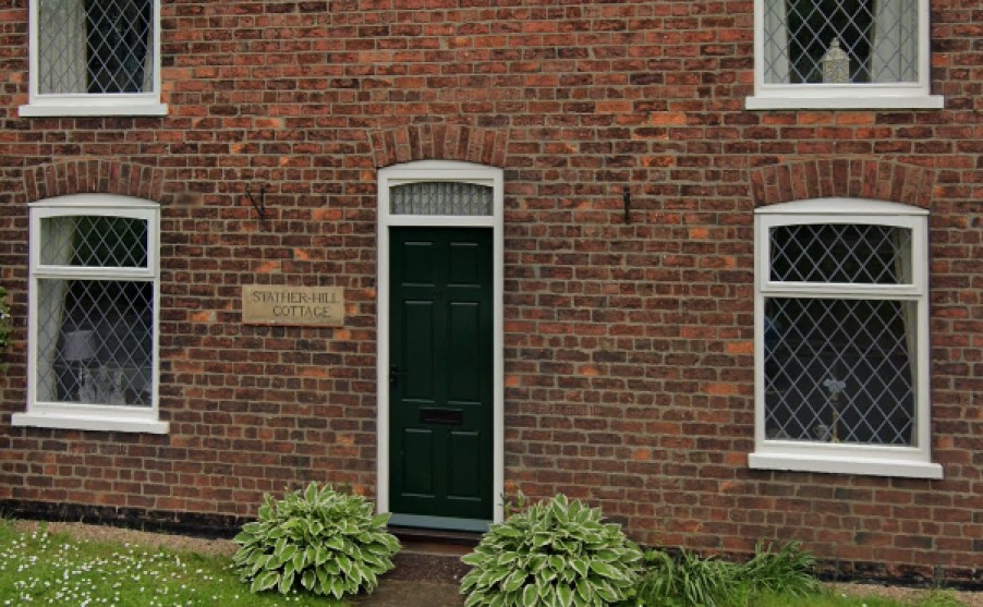
Stather Hill Cottage.
Well Stather Hill has been giving me quite the run round.
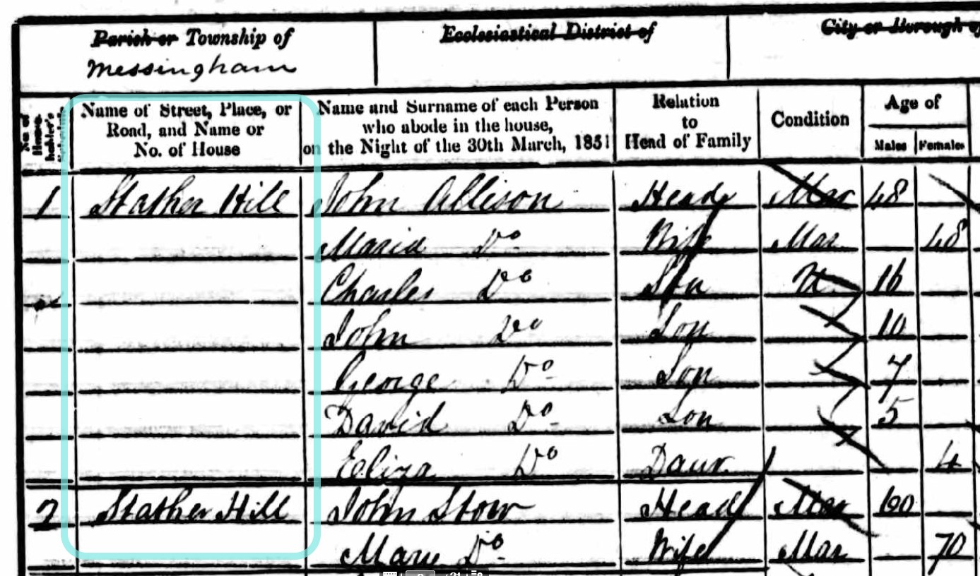
The first two entries for District 20b of the Parish of Messingham 1851 Census, it the Township of Messingham are for Stather Hill.
I should point out that the low lying fruit, the easy pickings, have already been picked. Places named in the Census readily identified on the maps and those locations associated with the records on the spreadsheet, but I will come back to that later.
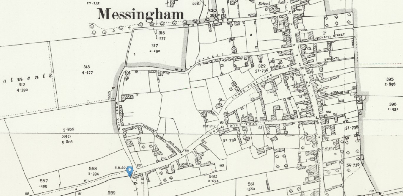 OS 25 Map Messingham Stather Hill Cottage - Lincolnshire XXVI.7, Revised: 1905, Published: 1907 and Lincolnshire XXVI.3, Revised: 1905, Published: 1907
Stather Hill Cottage is at the marker on this map, but I could not find a reference to Stather Hill on this map. Click on the map above to open the original on a new page and see if you can find a Stather Hill within the Parish of Messingham?
Going to an earlier time of 1885-1886, closer to the date of the 1851 Census.
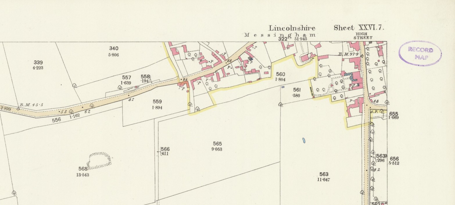 NLS Old OS 25 Map 1886 Messingham Stather Hill Cottage - Lincolnshire XXVI.7 Surveyed: 1885, Published: 1886
Still no mention of Stather Hill. These maps are still held by the National Library of Scotland but are as the original, single sheets, not merged together to form continuous mapping as is found in the Georeferenced Mapping.