England Jurisdictions 1851 - Collection
This is mainly a collection of snippets I have created for use elsewhere on this site.
I like to include information about places occupied by people as well as the people themselves. I think it creates a more rounded image of the story or person.
The parish snippet has the following note, in this case for Bramshaw.
England Jurisdictions 1851 - Bramshaw
Extract from FamilySearch England Jurisdictions 1851. This link may not work if you don't have a subscription to FamilySearch
Then search for Bramshaw, Wiltshire. Use the Key to select which boundaries you wish to see.
Generally within Articles, I use the subject matter, the parish, first, followed by a more general context level zoom out. However, within this article I will start wide, and zoom in.
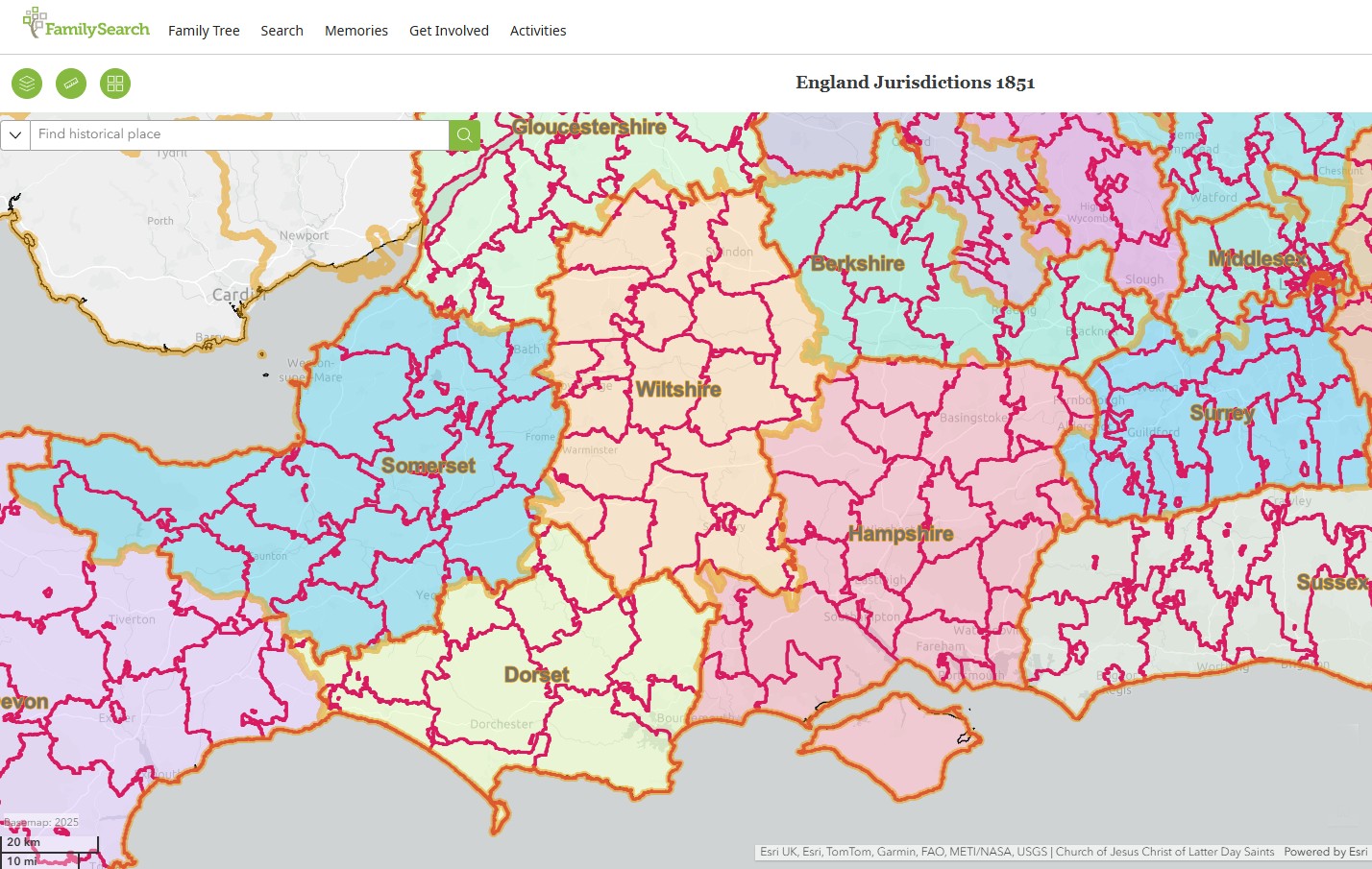
Counties and Civil Registration Districts of Southern Central England
Not all Parishes, not Civil Registration Districts, (CRD) are within solely one county. Generally I use majority rules in such cases.
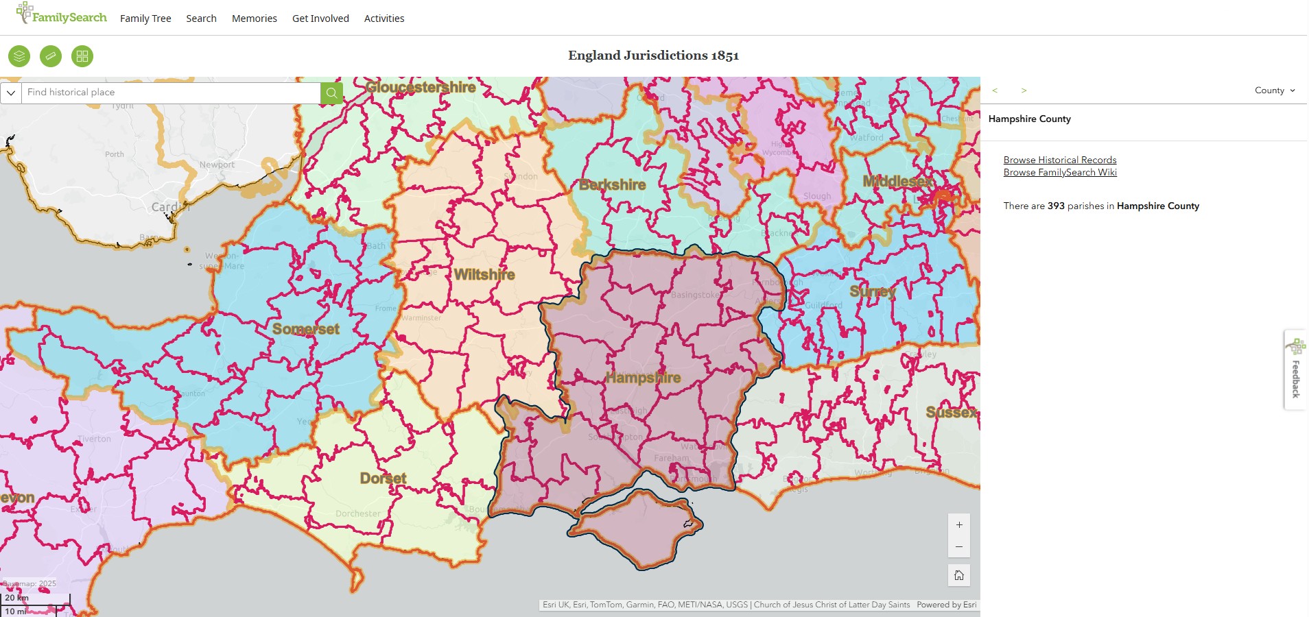
Hampshire
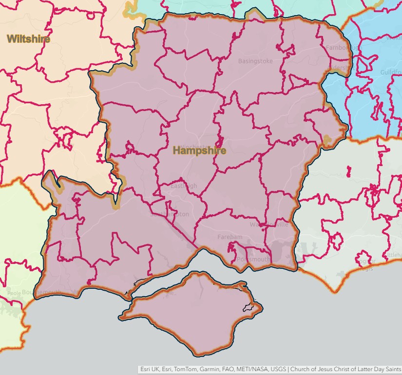
Hampshire
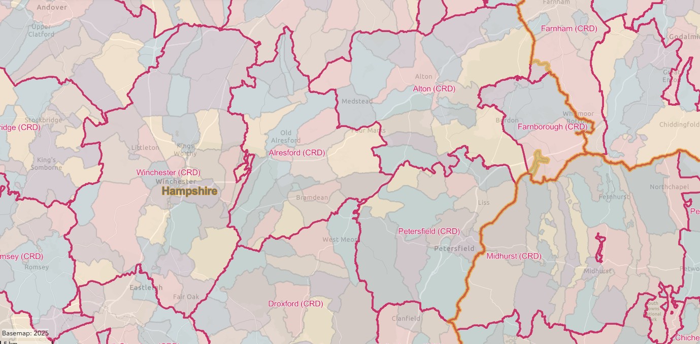
South Central England, Civil Registration Districts in Hampshire
England Jurisdictions 1851 - CRD SCE Hampshire North
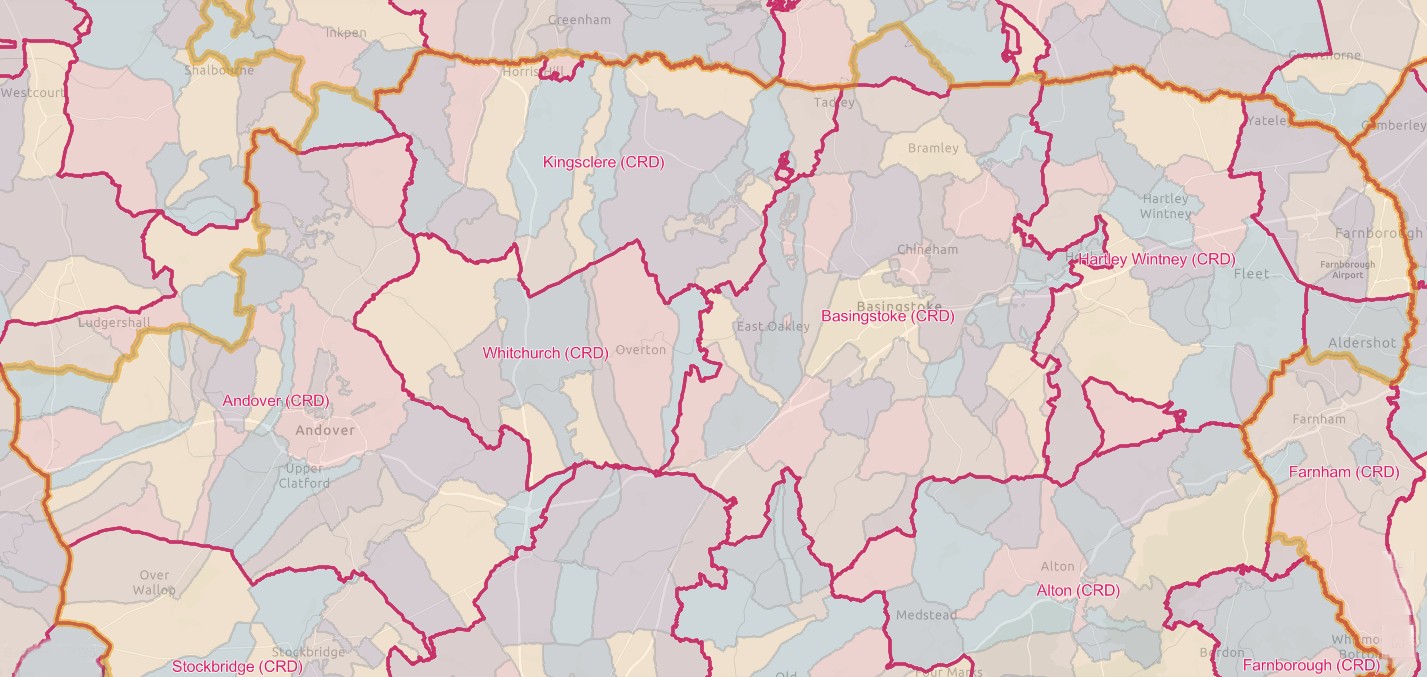
England Jurisdictions 1851 - CRD SCE Hampshire Centre
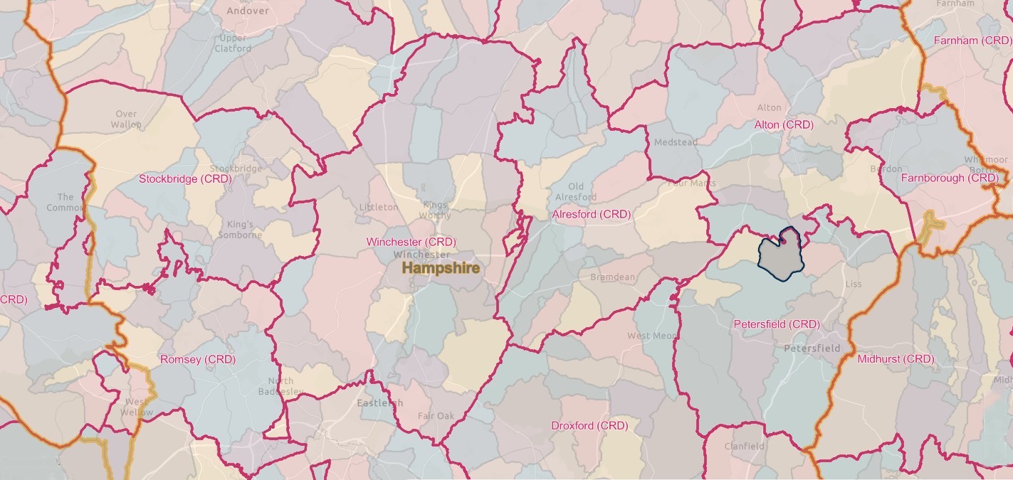
England Jurisdictions 1851 - CRD SCE Hampshire South
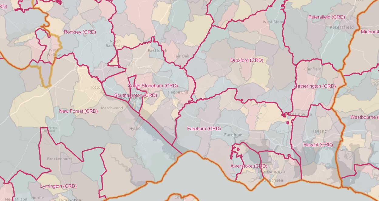
England Jurisdictions 1851 - CRD SCE Hampshire South West
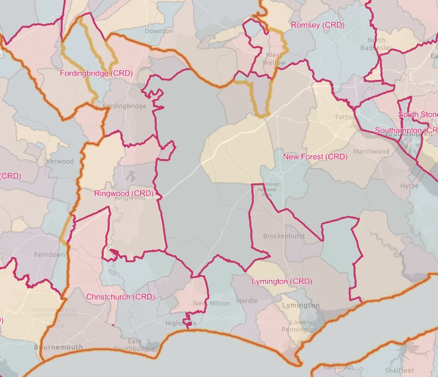
England Jurisdictions 1851 - CRD SCE Hampshire Isle of Wight
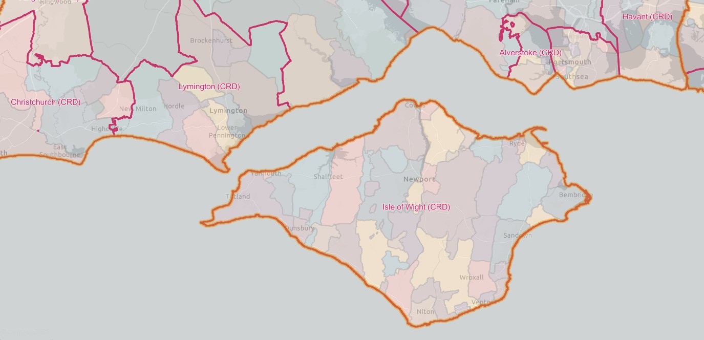
England Jurisdictions 1851 - CRD SCE Hampshire East
From another source, a list of Civil Registration Districts in text.
REGISTRATION DISTRICTS IN HAMPSHIRE
The list below shows the civil registration districts in Hampshire since 1837. The same districts were used to compile the census returns for the years 1851 to 1921.
For the purposes of these pages, "Hampshire" refers to:
- the ancient county of Hants (1837–89), including the county of the town of Southampton.
- the administrative counties of Southampton (1889–1959) and Hampshire (1959–74), with the county boroughs of Bournemouth (1900–74), Portsmouth (1889–1974 and Southampton (1889–1974).
- the non-metropolitan county of Hampshire (from 1974), including the unitary authority of Portsmouth (from 1997)
- the administrative county of the Isle of Wight (1890–1974), the non-metropolitan county of the Isle of Wight (1974–95) and the unitary authority of the Isle of Wight (from 1995).
Click on a district name in the table below to see the places and dates covered, or see the Index of Place Names for the whole of England and Wales.
|
Registration District |
Registration County |
From |
To |
Comments |
|
Hampshire |
1932 |
1974 |
Created 1.10.1932 out of Hartley Wintney, Farnham, Basingstoke and Alton registration districts. Abolished 1.4.1974 and added to North East Hampshire registration district. |
|
|
Hampshire |
1837 |
1932 |
Abolished 1.10.1932 and divided between Winchester, Alton, Basingstoke and Droxford registration districts. |
|
|
Hampshire |
1837 |
2008 |
Abolished 1.4.2008 and added to Hampshire registration district. |
|
|
Hampshire |
1837 |
1932 |
Abolished 1.10.1932 and added to Gosport registration district. |
|
|
Hampshire |
1837 |
2008 |
Abolished 1.4.2008 and added to Hampshire registration district. |
|
|
Hampshire |
1837 |
2000 |
Abolished 1.1.2001 and added to Hampshire North registration district. |
|
|
Hampshire |
1932 |
1974 |
Created 1.10.1932 out of Bournemouth & Christchurch and Poole registration districts. Transfererd to Dorset on 1.4.1974. |
|
|
Hampshire |
1925 |
1932 |
Created 1.7.1925 by renaming Christchurch registration district. Abolished 1.10.1932 and divided between Bournemouth and Christchurch registration districts. |
|
|
1837 |
1879 |
Partly in Hampshire until 1.11.1879. |
||
|
Hampshire |
1837 |
1932 |
Abolished 1.10.1932 and added to Gosport, Petersfield and Droxford registration districts. |
|
|
Hampshire |
1837 |
1925 |
Renamed 1.7.1925 to become Bournemouth & Christchurch registration district. |
|
|
Hampshire |
1932 |
1974 |
Created 1.10.1932 out of Bournemouth & Christchurch, Fordingbridge and Ringwood registration districts. Abolished 1.4.1974 and divided between Bournemouth, Ringwood & Fordingbridge and Poole registration districts. |
|
|
Hampshire |
1837 |
2008 |
Abolished 1.4.2008 and added to Hampshire registration district. |
|
|
Hampshire |
1927 |
1932 |
Created 1.4.1927 out of South Stoneham and Winchester registration districts. Abolished 1.10.1932 and divided between Winchester and Romsey & Stockbridge registration districts. |
|
|
Hampshire |
1837 |
1932 |
Abolished 1.10.1932 and divided between Gosport, Droxford and Portsmouth registration districts. |
|
|
Hampshire |
1846 |
1869 |
Created 28.5.1846 out of Farnham registration district. Abolished 1.7.1869 and divided between Hartley Wintney, Farnham, Alton, Petersfield and Guildford registration districts. |
|
|
1837 |
1932 |
Partly in Hampshire until 1.10.1932. |
||
|
Hampshire |
1837 |
1932 |
Abolished 1.10.1932 and added to Christchurch registration district. |
|
|
Hampshire |
1932 |
1974 |
Created 1.10.1932 out of Alverstoke, Fareham, Havant and Catherington registration districts. Renamed 1.4.1974 to become South East Hampshire registration district. |
|
|
Hampshire |
2008 |
Created 1.4.2008 from Alton andover, Droxford, Hampshire North, New Forest, North East Hampshire, Petersfield, Romsey, South East Hampshire and Winchester registration districts. |
||
|
Hampshire |
2001 |
2008 |
Created 1.1.2001 from Basingstoke and Kingsclere & Whitchurch registration districts. Abolished 1.4.2008 and added to Hampshire registration district. |
|
|
Hampshire |
1837 |
1932 |
Abolished 1.10.1932 and divided between Aldershot and Basingstoke registration districts. |
|
|
Hampshire |
1837 |
1932 |
Abolished 1.10.1932 and divided between Gosport, Portsmouth, Petersfield and Droxford registration districts. |
|
|
Hampshire |
1837 |
1838 |
Abolished 27.1.1838 and added to Winchester registration district. |
|
|
1837 |
1895 |
Partly in Hampshire until 30.9.1895. |
||
|
Hampshire |
1837 |
1932 |
||
|
Isle of Wight |
1932 |
|||
|
Hampshire |
1837 |
1932 |
Abolished 1.10.1932 and divided between Kingsclere & Whitchurch and Basingstoke registration districts. |
|
|
Hampshire |
1932 |
2000 |
Created 1.10.1932 out of Kingsclere, Whitchurch, Basingstoke and Andover registration districts. Abolished 1.1.2001 and added to Hampshire North registration district. |
|
|
Hampshire |
1837 |
1932 |
Abolished 1.10.1932 and added to New Forest registration district. |
|
|
1837 |
1844 |
Partly in Hampshire until 20.10.1844. |
||
|
1837 |
1895 |
Partly in Hampshire until 1.7.1895. |
||
|
Hampshire |
1837 |
2008 |
Abolished 1.4.2008 and added to Hampshire registration district. |
|
|
Hampshire |
1974 |
2008 |
Created 1.4.1974 out of Aldershot registration district. Abolished 1.4.2008 and added to Hampshire registration district. |
|
|
Hampshire |
1837 |
2008 |
Abolished 1.4.2008 and added to Hampshire registration district. |
|
|
Hampshire |
1837 |
1900 |
Renamed 1.7.1900 to become Portsmouth registration district. |
|
|
Hampshire |
1900 |
Created 1.7.1900 by renaming Portsea Island registration district. |
||
|
Hampshire |
1837 |
1932 |
Abolished 1.10.1932 and added to Christchurch registration district. |
|
|
Hampshire |
1974 |
1999 |
Created 1.4.1974 out of Christchurch registration district. Abolished 1.5.1999 and added to New Forest registration district. |
|
|
Hampshire |
1837 |
1932 |
Abolished 1.10.1932 and added to Romsey & Stockbridge registration district. |
|
|
Hampshire |
1974 |
2008 |
Created 1.4.1974 out of Romsey & Stockbridge registration district. Abolished 1.4.2008 and added to Hampshire registration district. |
|
|
Hampshire |
1932 |
1974 |
Created 1.10.1932 out of Romsey, Stockbridge, Eastleigh and Winchester registration districts. Abolished 1.4.1974 and divided between Romsey and Andover registration districts. |
|
|
Hampshire |
1837 |
|||
|
Hampshire |
1974 |
2008 |
Created 1.4.1974 by renaming Gosport registration district. Abolished 1.4.2008 and added to Hampshire registration district. |
|
|
Hampshire |
1837 |
1927 |
Abolished 1.4.1927 and added to Eastleigh registration district. |
|
|
Hampshire |
1837 |
1932 |
Abolished 1.10.1932 and added to Romsey & Stockbridge registration district. |
|
|
Hampshire |
1837 |
1932 |
Abolished 1.10.1932 and divided between Kingsclere & Whitchurch and Basingstoke registration districts. |
|
|
Hampshire |
1837 |
2008 |
Abolished 1.4.2008 and added to Hampshire registration district. |
Some of the above Civil Registration Districts, in more detail.
Alresford
England Jurisdictions 1851 - CRD Alresford
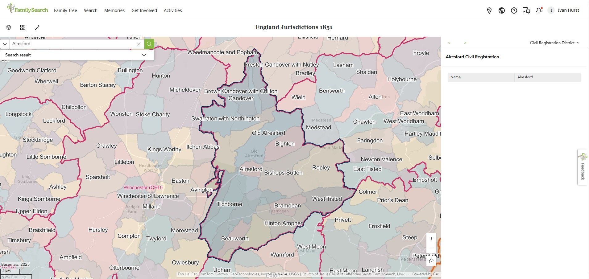
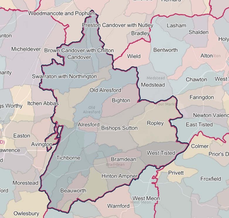
ALRESFORD REGISTRATION DISTRICT
- Registration County : Hampshire.
- Created : 1.7.1837.
- Abolished : 1.10.1932 (divided between Winchester, Alton, Basingstoke and Droxford registration districts).
- Sub-districts : Alresford (1837–1932); Ropley (1837–1920).
- GRO volumes : VII (1837–51); 2c (1852–1932).
- District number : 65a (1841–46); 113 (1847–69); 104 (1870–80); 105 (1881–1908); 107 (1909–32).
Table 1: List of Places in Alresford Registration District
|
Civil Parish |
County |
From |
To |
Comments |
|
Beauworth |
1837 |
1932 |
See Table 2, notes (d) and (e). |
|
|
Bighton |
1837 |
1932 |
See Table 2, note (e). |
|
|
Bishop's Sutton |
1837 |
1932 |
See Table 2, note (e). |
|
|
Bramdean |
1837 |
1932 |
See Table 2, note (e). |
|
|
Brown Candover |
1837 |
1932 |
Abolished 1.4.1932 and added to the parish of Candovers. |
|
|
Candovers |
1932 |
1932 |
Created 1.4.1932 from the parishes of Brown Candover and Chilton Candover. See also Table 2, note (c). |
|
|
Cheriton |
1837 |
1932 |
See Table 2, note (e). |
|
|
Chilton Candover |
1837 |
1932 |
Abolished 1.4.1932 and added to the parish of Candovers. |
|
|
Exton |
1932 |
1932 |
That part which until 1.4.1932 formed part of the parish of Beauworth. See also Table 2, note (d). |
|
|
Godsfield |
1837 |
1932 |
Abolished 1.4.1932 and added to the parish of Old Alresford. |
|
|
Hinton Ampner |
1837 |
1932 |
Abolished 1.4.1932 and added to the parish of Bramdean. |
|
|
Itchen Stoke |
1837 |
1932 |
Abolished 1.4.1932 and added to the parish of Itchen Stoke & Ovington. See also Table 2, note (a). |
|
|
Itchen Stoke & Ovington |
1932 |
1932 |
Created 1.4.1932 out of the separate parishes of Itchen Stoke and Ovington. See also Table 2, note (e). |
|
|
Kilmeston |
1837 |
1932 |
See Table 2, note (e). |
|
|
New Alresford |
1837 |
1932 |
See Table 2, note (e). |
|
|
Northington |
1837 |
1932 |
See Table 2, note (e). |
|
|
Old Alresford |
1837 |
1932 |
See Table 2, note (e). |
|
|
Ovington |
1837 |
1932 |
Abolished 1.4.1932 and added to the parish of Itchen Stoke & Ovington. |
|
|
Ropley |
1837 |
1932 |
See Table 2, note (b). |
|
|
Swarraton |
1837 |
1932 |
Abolished 1.4.1932 and added to the parish of Northington. |
|
|
Tichborne |
1837 |
1932 |
See Table 2, note (e). |
|
|
West Tisted |
1837 |
1932 |
See Table 2, note (b). |
Table 2: Boundary Changes affecting Alresford Registration District
|
Date of Change |
Note |
Description of Change |
Population transferred |
|
24.3.1889 |
(a) |
Lost a detached part of the parish of Itchen Stoke (which was added to the parish of Avington on 24.3.1889) from Winchester registration district. |
24 in 1891 |
|
1.10.1932 (abolished) |
(b) |
Lost the parishes of Ropley and West Tilsted to Alton registration district. |
1761 in 1931 |
|
(c) |
Lost the parish of Candovers to Basingstoke registration district. |
199 in 1931 |
|
|
(d) |
Lost the part in the parish of Exton (which until 1.4.1932 formed part of the parish of Beauworth) to Droxford registration district. |
6 in 1931 |
|
|
(e) |
Lost the remaining parishes of Beauworth, Bighton, Bishop's Sutton, Bramdean, Cheriton, Itchen Stoke & Ovington, Kilmeston, New Alresford, Northington, Old Alresford and Tichborne, to Winchester registration district. |
5155 in 1931 |
© Copyright and Database Right 1996–2023
The information on this page may not be reproduced without the consent of the copyright holder.
Hosted by UKBMD - Births, Marriages, Deaths & Censuses on the Internet
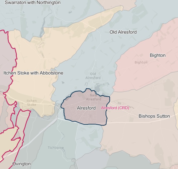
Alresford
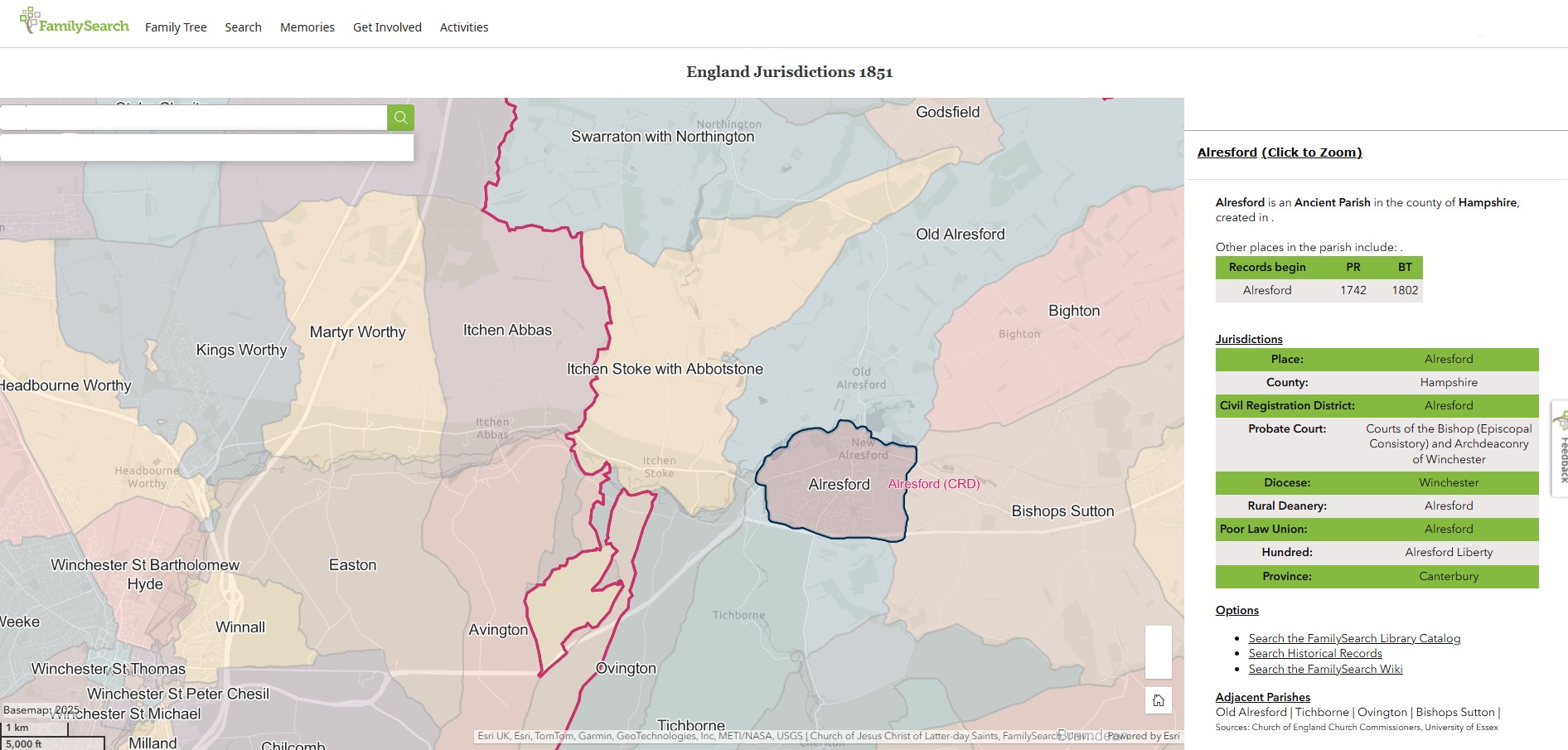
England Jurisdictions 1851 - Alresford
Extract from FamilySearch England Jurisdictions 1851. This link may not work if you don't have a subscription to FamilySearch
Then search for Alresford. Use the Key to select which boundaries you wish to see.
Beauworth
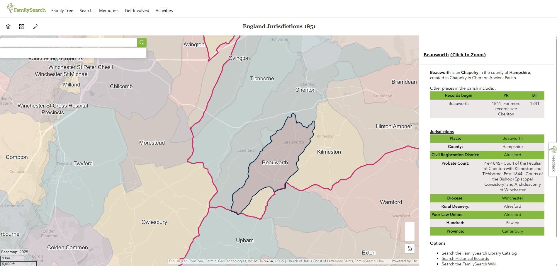
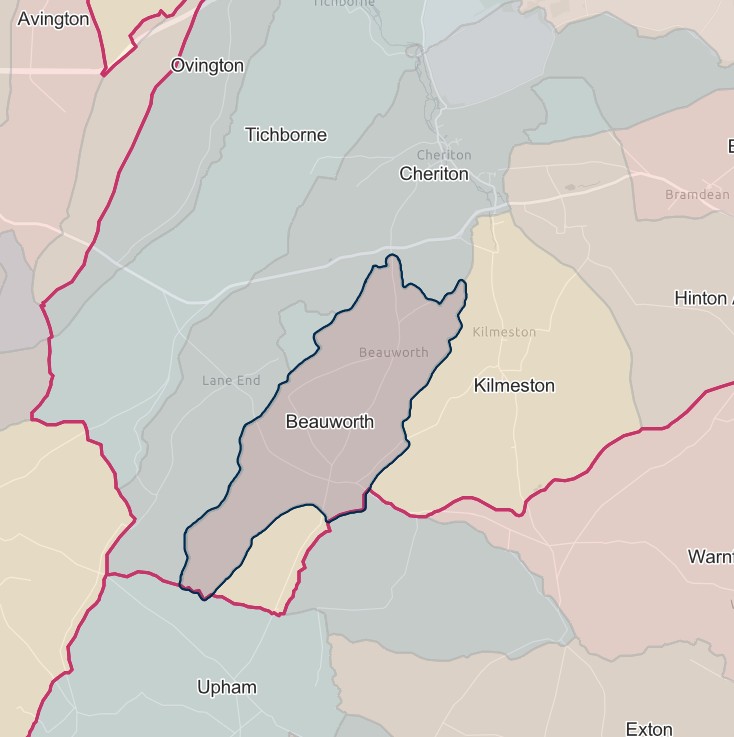
England Jurisdictions 1851 - Beauworth
Extract from FamilySearch England Jurisdictions 1851. This link may not work if you don't have a subscription to FamilySearch
Then search for Beauworth. Use the Key to select which boundaries you wish to see.
Bighton
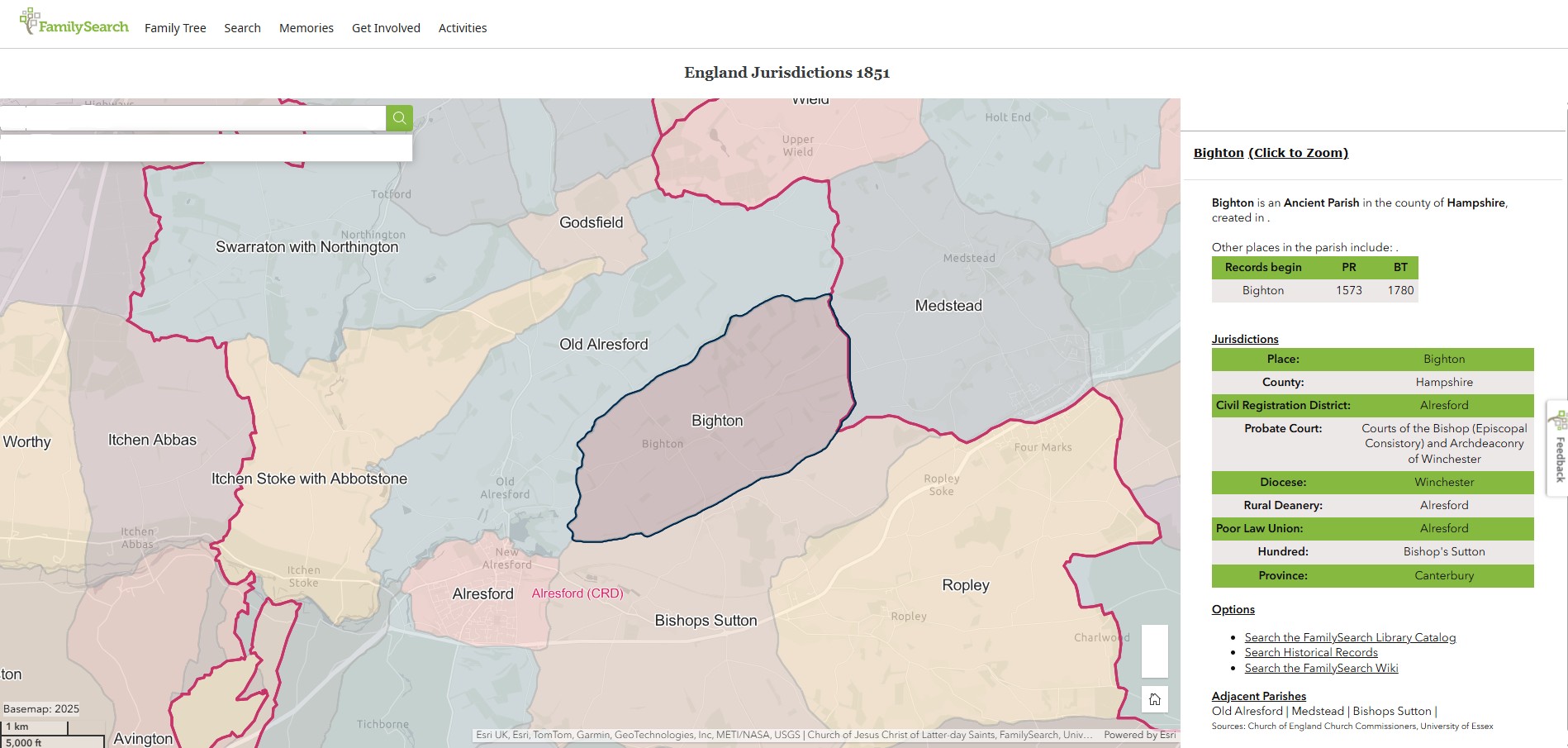
England Jurisdictions 1851 - Bighton
Extract from FamilySearch England Jurisdictions 1851. This link may not work if you don't have a subscription to FamilySearch
Then search for Bighton. Use the Key to select which boundaries you wish to see.
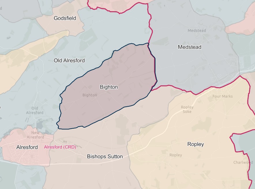
Bishop's Sutton
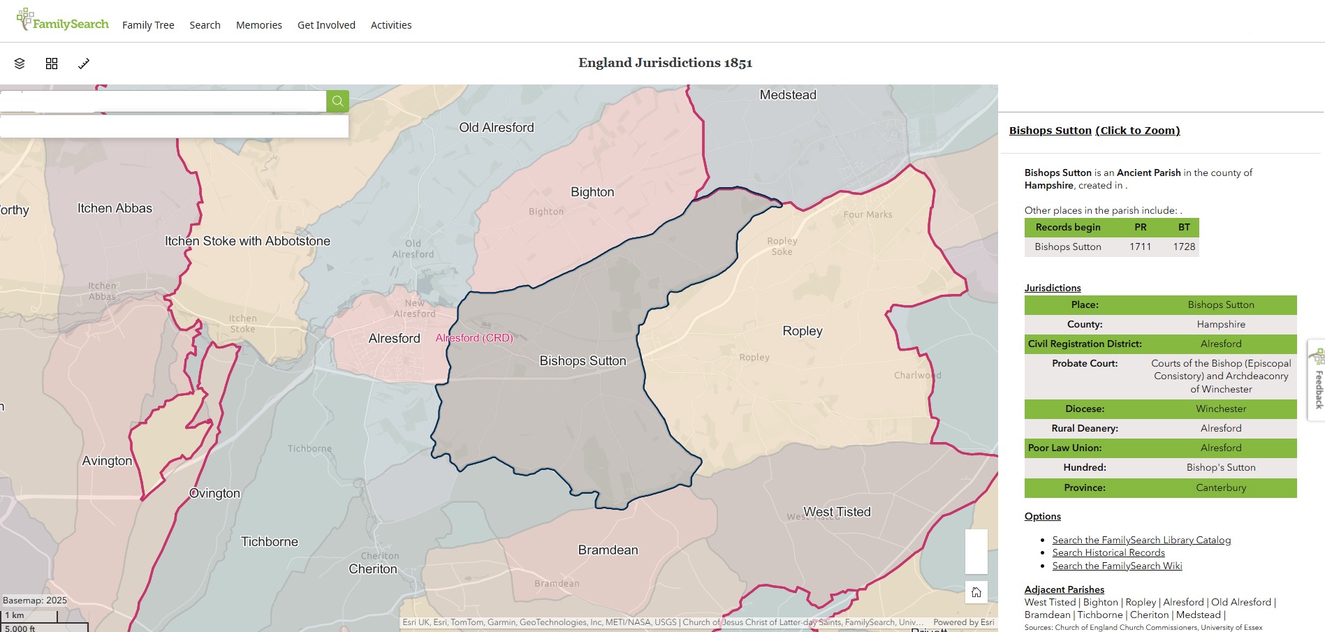
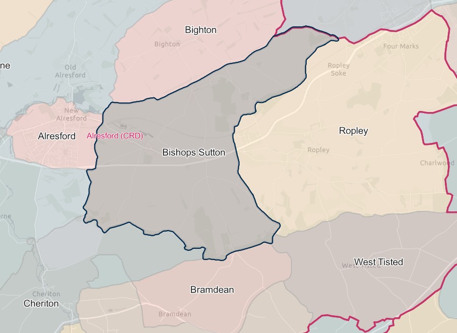
England Jurisdictions 1851 - Bishop's Sutton
Extract from FamilySearch England Jurisdictions 1851. This link may not work if you don't have a subscription to FamilySearch
Then search for Bishops Sutton. Use the Key to select which boundaries you wish to see.
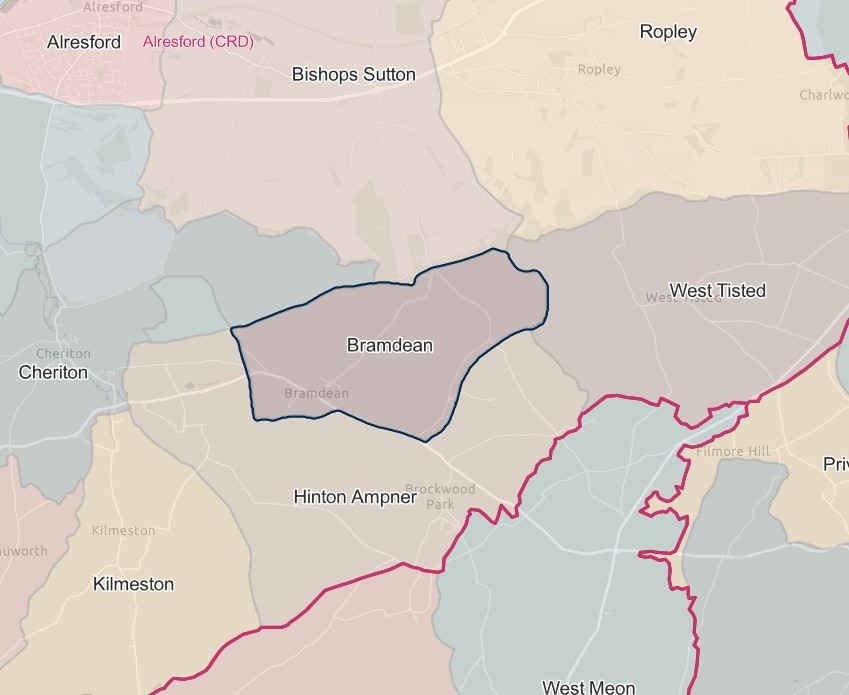
Bramdean
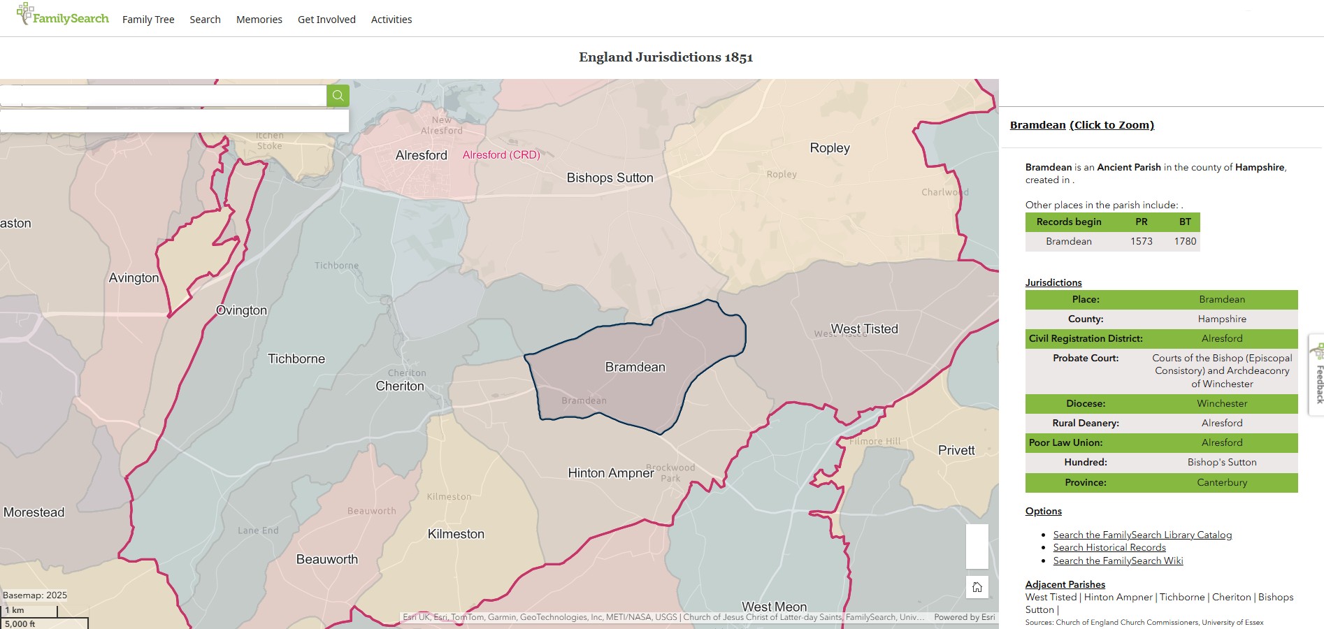
England Jurisdictions 1851 - Bramdean
Extract from FamilySearch England Jurisdictions 1851. This link may not work if you don't have a subscription to FamilySearch
Then search for Bramdean. Use the Key to select which boundaries you wish to see.
Brown Candover
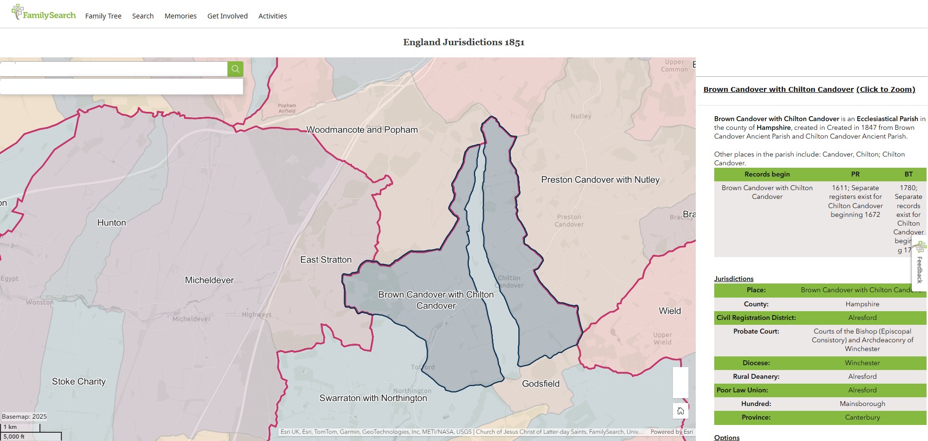
England Jurisdictions 1851 - Brown Candover with Chilton Candover
Extract from FamilySearch England Jurisdictions 1851. This link may not work if you don't have a subscription to FamilySearch
Then search for Brown Candover with Chilton Candover. Use the Key to select which boundaries you wish to see.
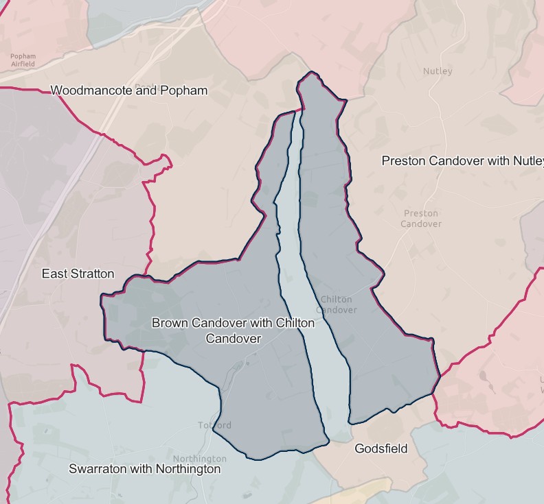
Brown Candover with Chilton Candover
Brown Candover with Chilton Candover is an Ecclesiastical Parish in the county of Hampshire, created in Created in 1847 from Brown Candover Ancient Parish and Chilton Candover Ancient Parish.
England Jurisdictions 1851 - Brown Candover with Chilton Candover
Extract from FamilySearch England Jurisdictions 1851. This link may not work if you don't have a subscription to FamilySearch
Then search for Brown Candover with Chilton Candover. Use the Key to select which boundaries you wish to see.


Candovers
Created 1.4.1932 from the parishes of Brown Candover and Chilton Candover.
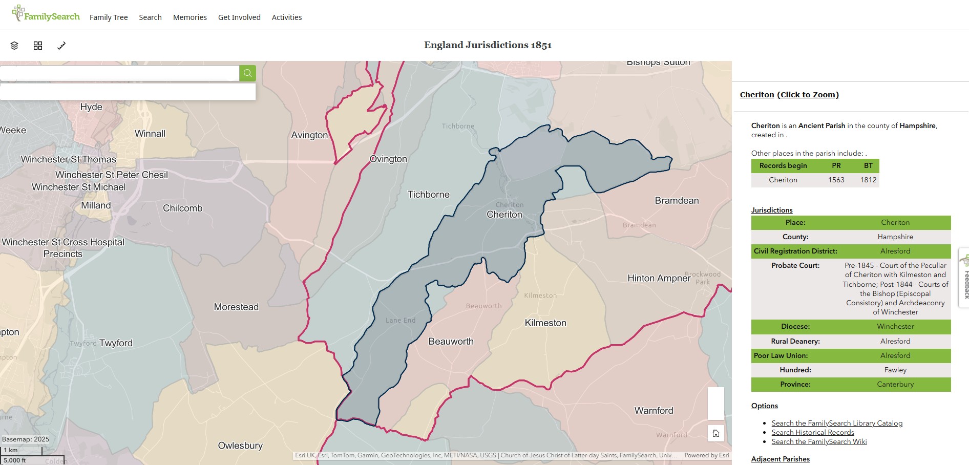
Cheriton
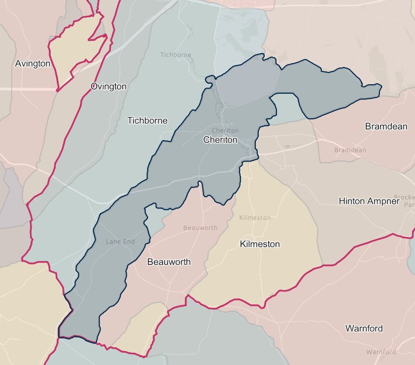
England Jurisdictions 1851 - Cheriton
Extract from FamilySearch England Jurisdictions 1851. This link may not work if you don't have a subscription to FamilySearch
Then search for Cheriton. Use the Key to select which boundaries you wish to see.
Chilton Candover
England Jurisdictions 1851 - Brown Candover with Chilton Candover
Extract from FamilySearch England Jurisdictions 1851. This link may not work if you don't have a subscription to FamilySearch
Then search for Brown Candover with Chilton Candover. Use the Key to select which boundaries you wish to see.


Exton
Until 1.4.1932 formed part of the parish of Beauworth.
Godsfield
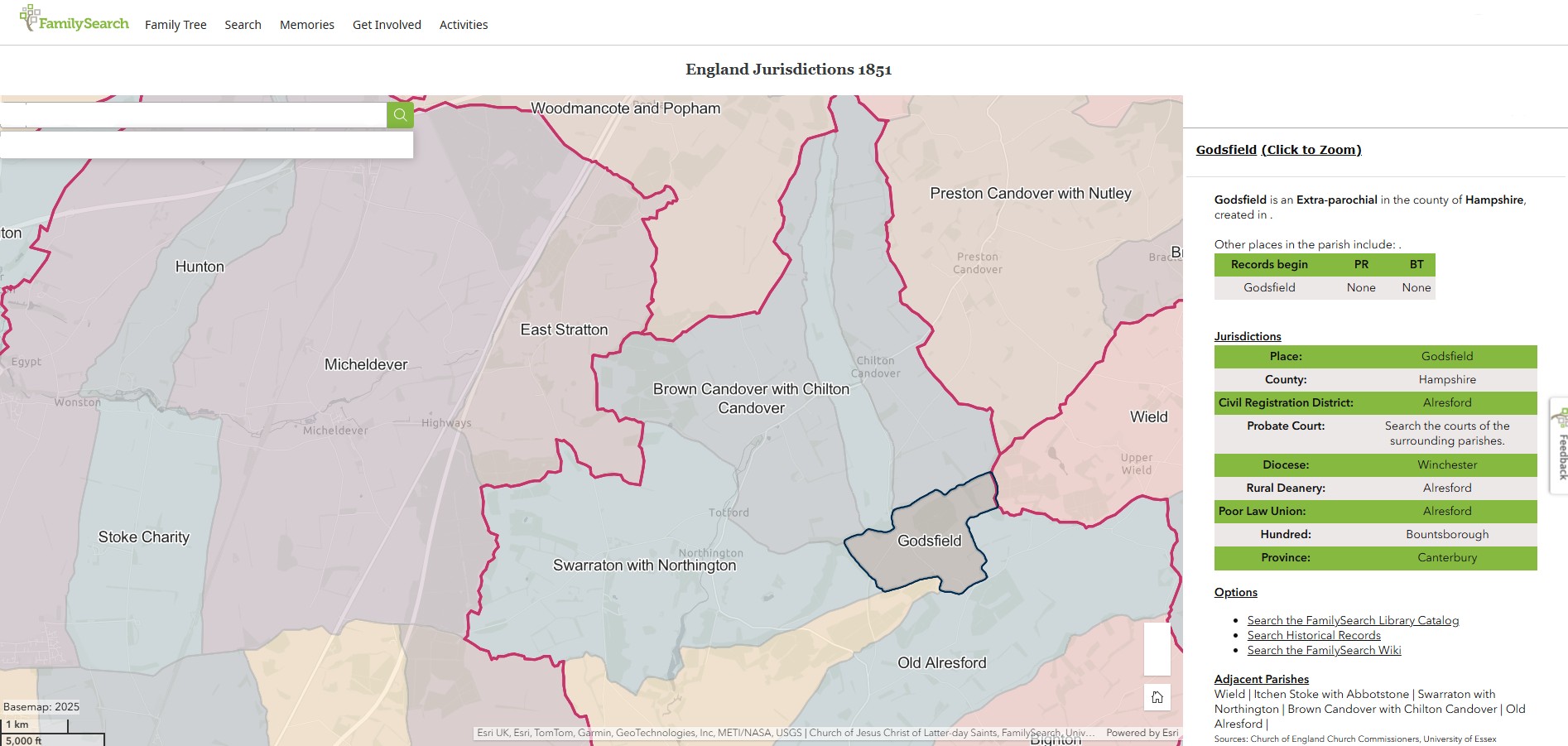
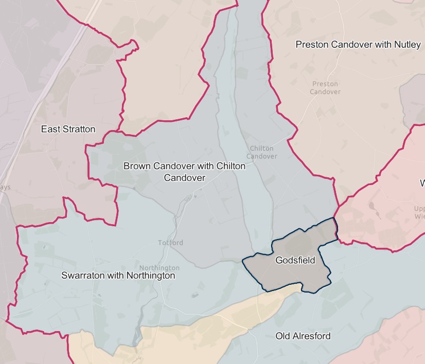
England Jurisdictions 1851 - Godsfield
Extract from FamilySearch England Jurisdictions 1851. This link may not work if you don't have a subscription to FamilySearch
Then search for Godsfield. Use the Key to select which boundaries you wish to see.
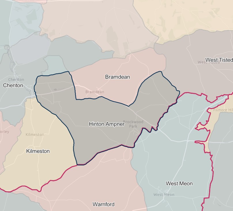
Hinton Ampner
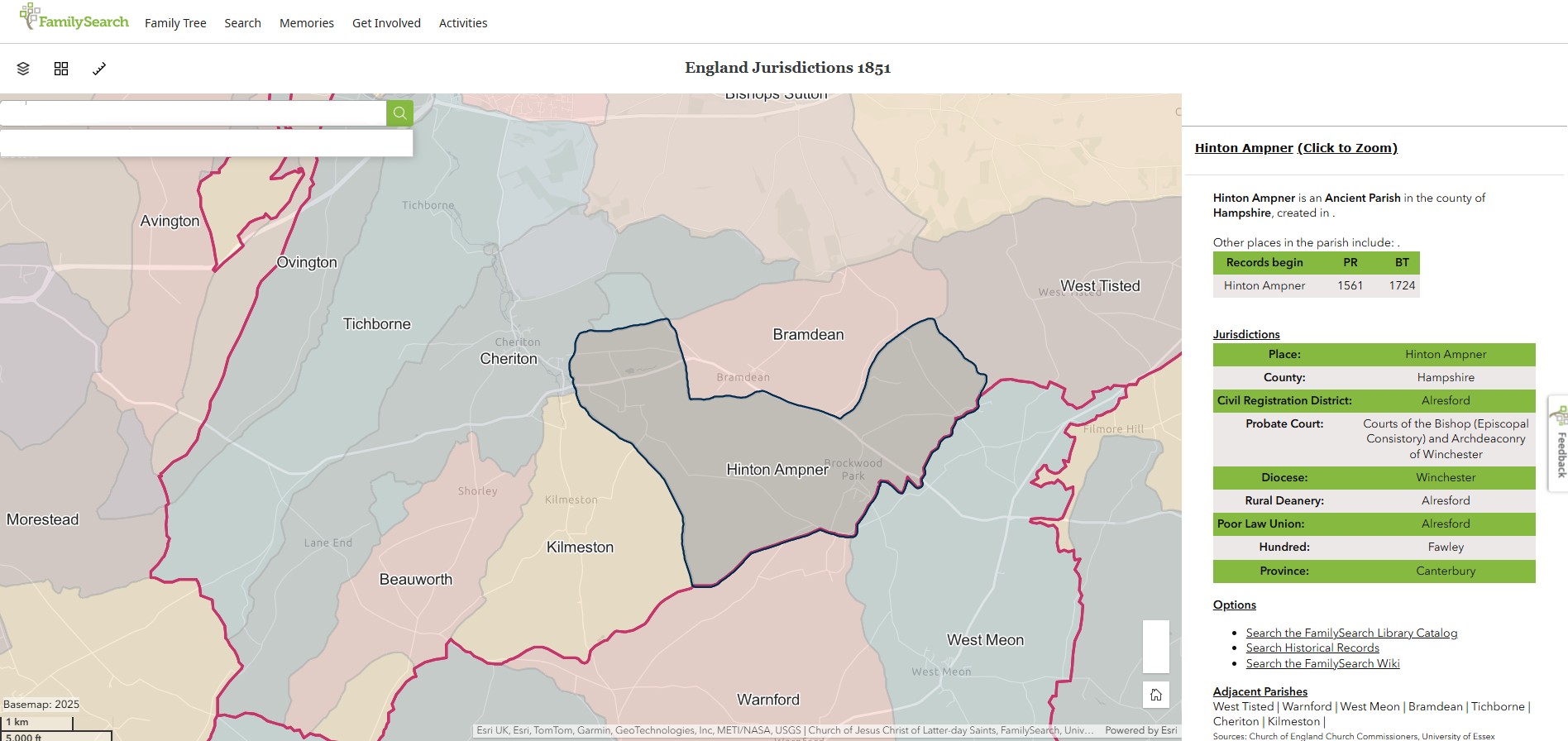
England Jurisdictions 1851 - Hinton Ampner
Extract from FamilySearch England Jurisdictions 1851. This link may not work if you don't have a subscription to FamilySearch
Then search for Hinton Ampner. Use the Key to select which boundaries you wish to see.
Itchen Stoke
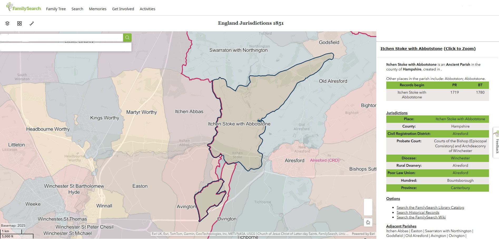
Itchen Stoke abolished 1.4.1932 and added to the parish of Itchen Stoke & Ovington.
England Jurisdictions 1851 - Itchen Stoke with Abbotstone
Extract from FamilySearch England Jurisdictions 1851. This link may not work if you don't have a subscription to FamilySearch
Then search for Itchen Stoke with Abbotstone. Use the Key to select which boundaries you wish to see.
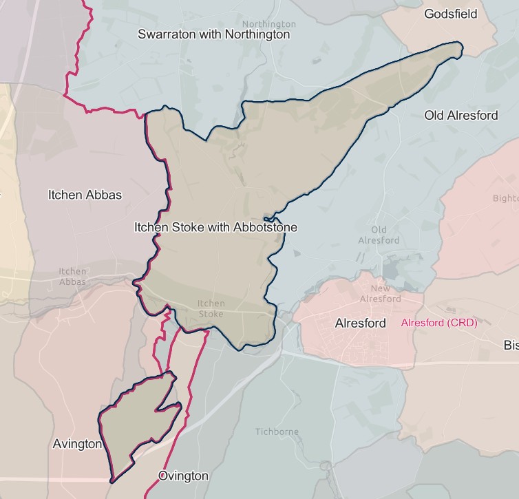
Itchen Stoke with Abbotstone
England Jurisdictions 1851 - Itchen Stoke with Abbotstone
Extract from FamilySearch England Jurisdictions 1851. This link may not work if you don't have a subscription to FamilySearch
Then search for Itchen Stoke with Abbotstone. Use the Key to select which boundaries you wish to see.


Itchen Stoke & Ovington
Formed in 1.4.1932 and by merging the parishes of Itchen Stoke & Ovington.
England Jurisdictions 1851 - Itchen Stoke with Abbotstone
Extract from FamilySearch England Jurisdictions 1851. This link may not work if you don't have a subscription to FamilySearch
Then search for Itchen Stoke with Abbotstone. Use the Key to select which boundaries you wish to see.


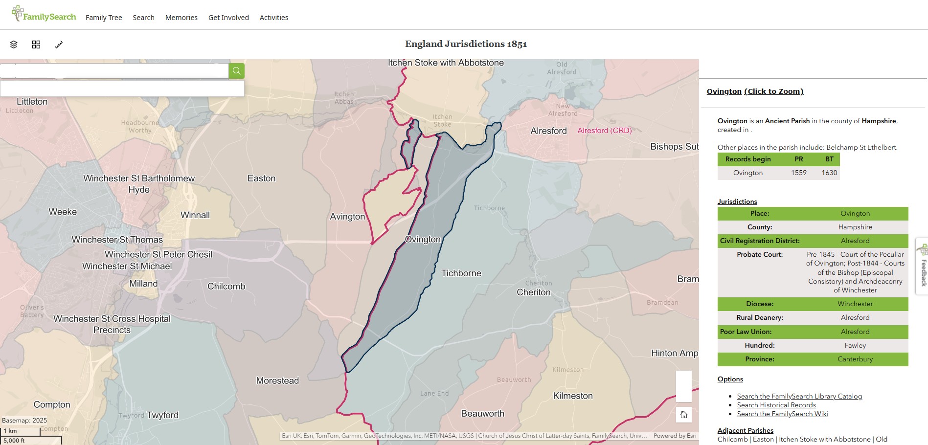
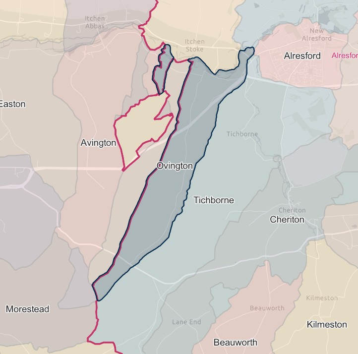
England Jurisdictions 1851 - Ovington
Extract from FamilySearch England Jurisdictions 1851. This link may not work if you don't have a subscription to FamilySearch
Then search for Ovington. Use the Key to select which boundaries you wish to see.
Kilmeston
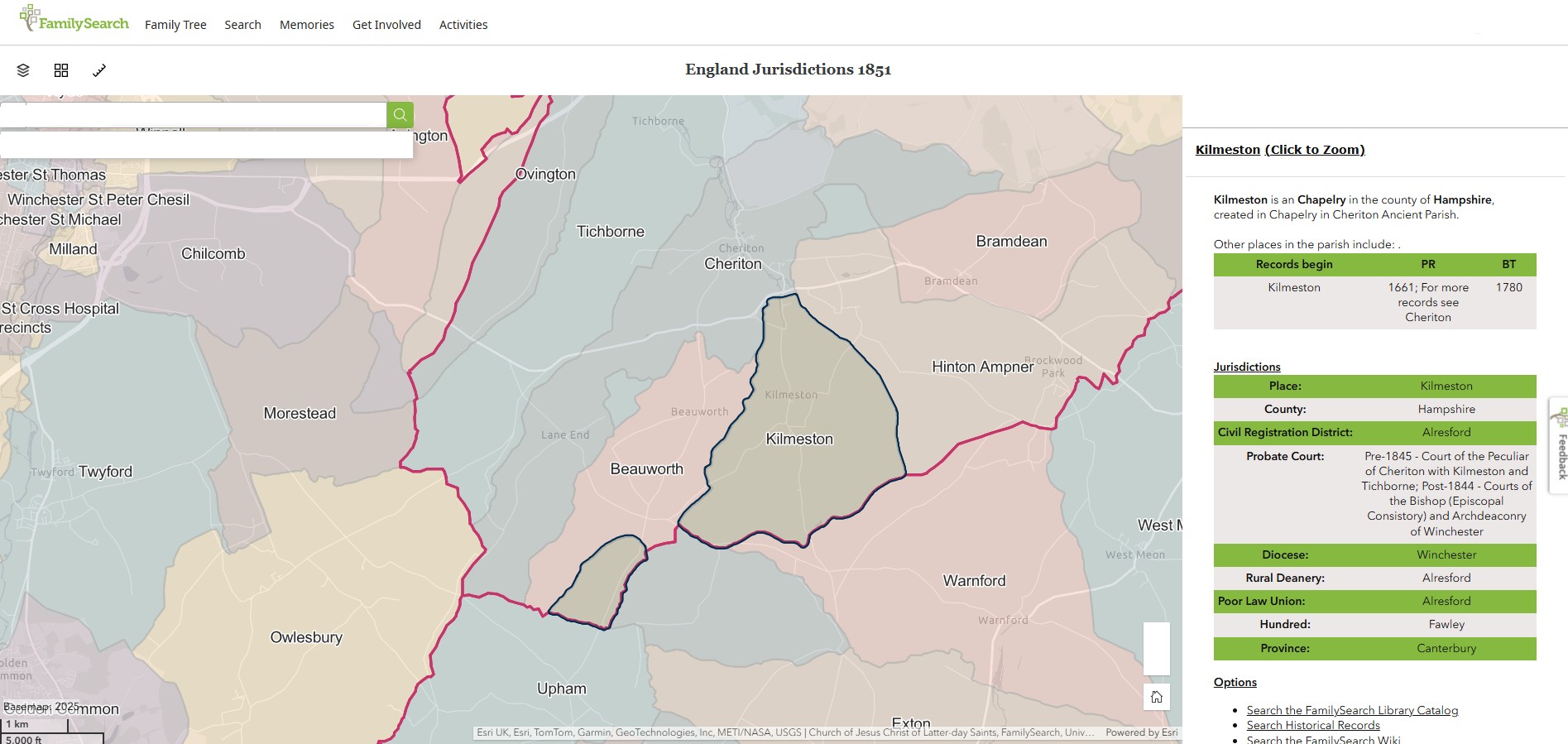
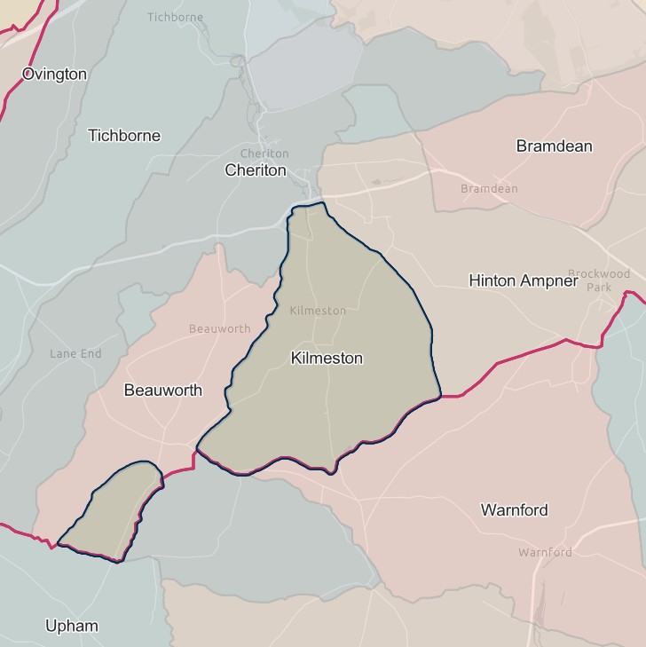
England Jurisdictions 1851 - Kilmeston
Extract from FamilySearch England Jurisdictions 1851. This link may not work if you don't have a subscription to FamilySearch
Then search for Kilmeston. Use the Key to select which boundaries you wish to see.
New Alresford
England Jurisdictions 1851 - Alresford
Extract from FamilySearch England Jurisdictions 1851. This link may not work if you don't have a subscription to FamilySearch
Then search for Alresford. Use the Key to select which boundaries you wish to see.


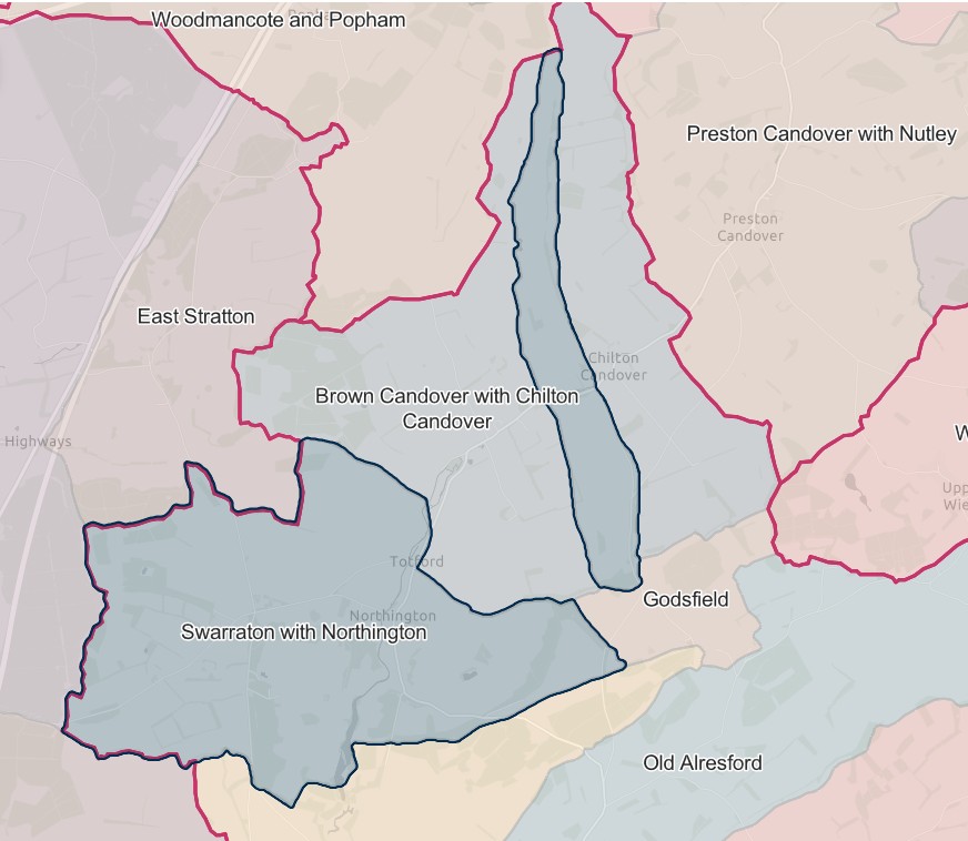
Northington
England Jurisdictions 1851 - Swarraton with Northington
Extract from FamilySearch England Jurisdictions 1851. This link may not work if you don't have a subscription to FamilySearch
Then search for Swarraton with Northington. Use the Key to select which boundaries you wish to see.
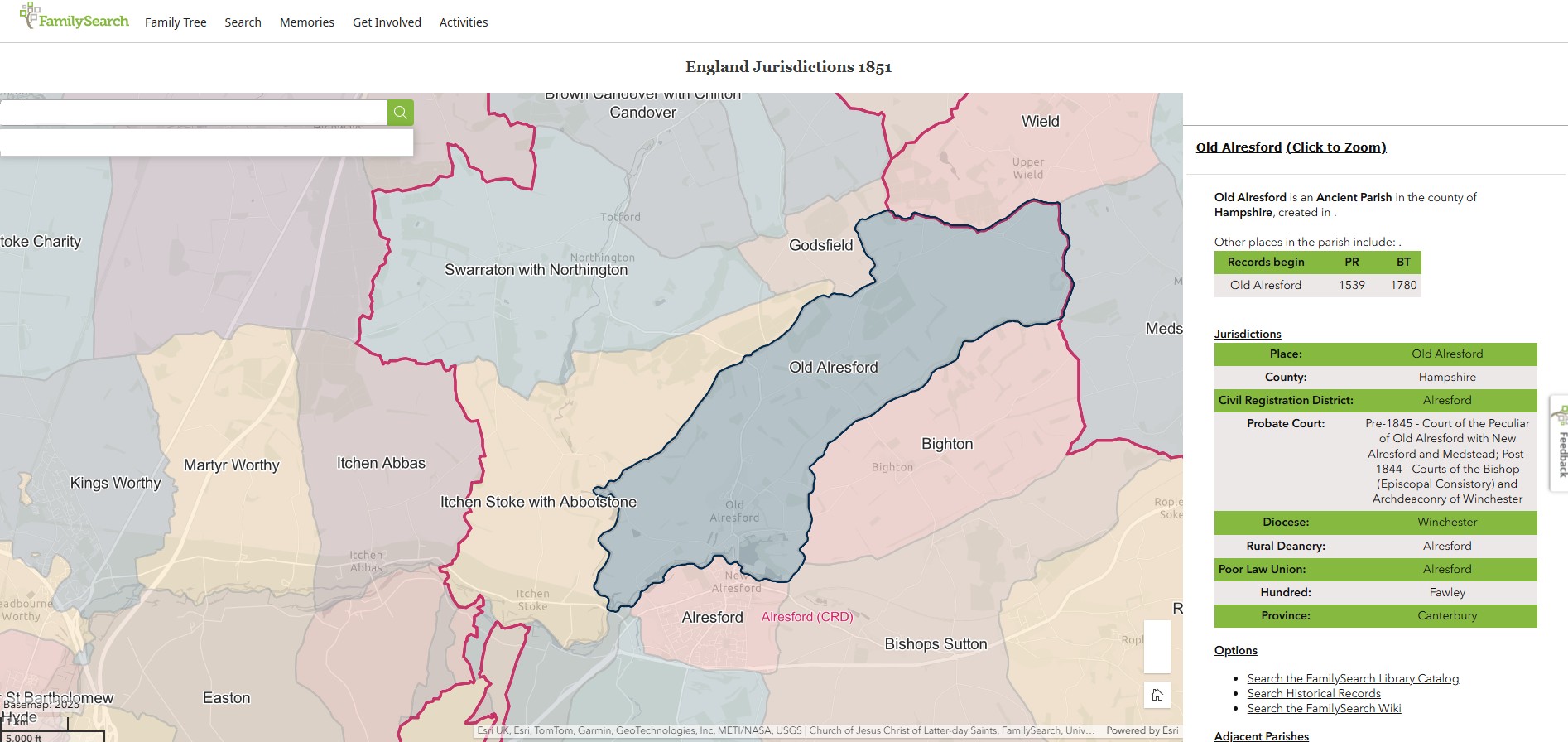
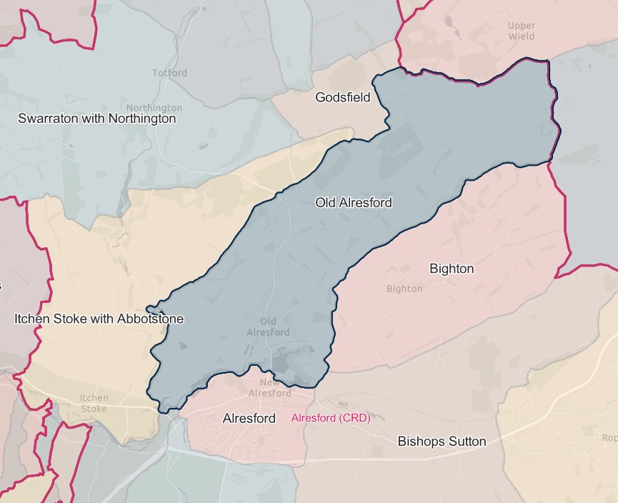
Old Alresford
England Jurisdictions 1851 - Old Alresford
Extract from FamilySearch England Jurisdictions 1851. This link may not work if you don't have a subscription to FamilySearch
Then search for Old Alresford. Use the Key to select which boundaries you wish to see.
Ovington
England Jurisdictions 1851 - Ovington
Extract from FamilySearch England Jurisdictions 1851. This link may not work if you don't have a subscription to FamilySearch
Then search for Ovington. Use the Key to select which boundaries you wish to see.


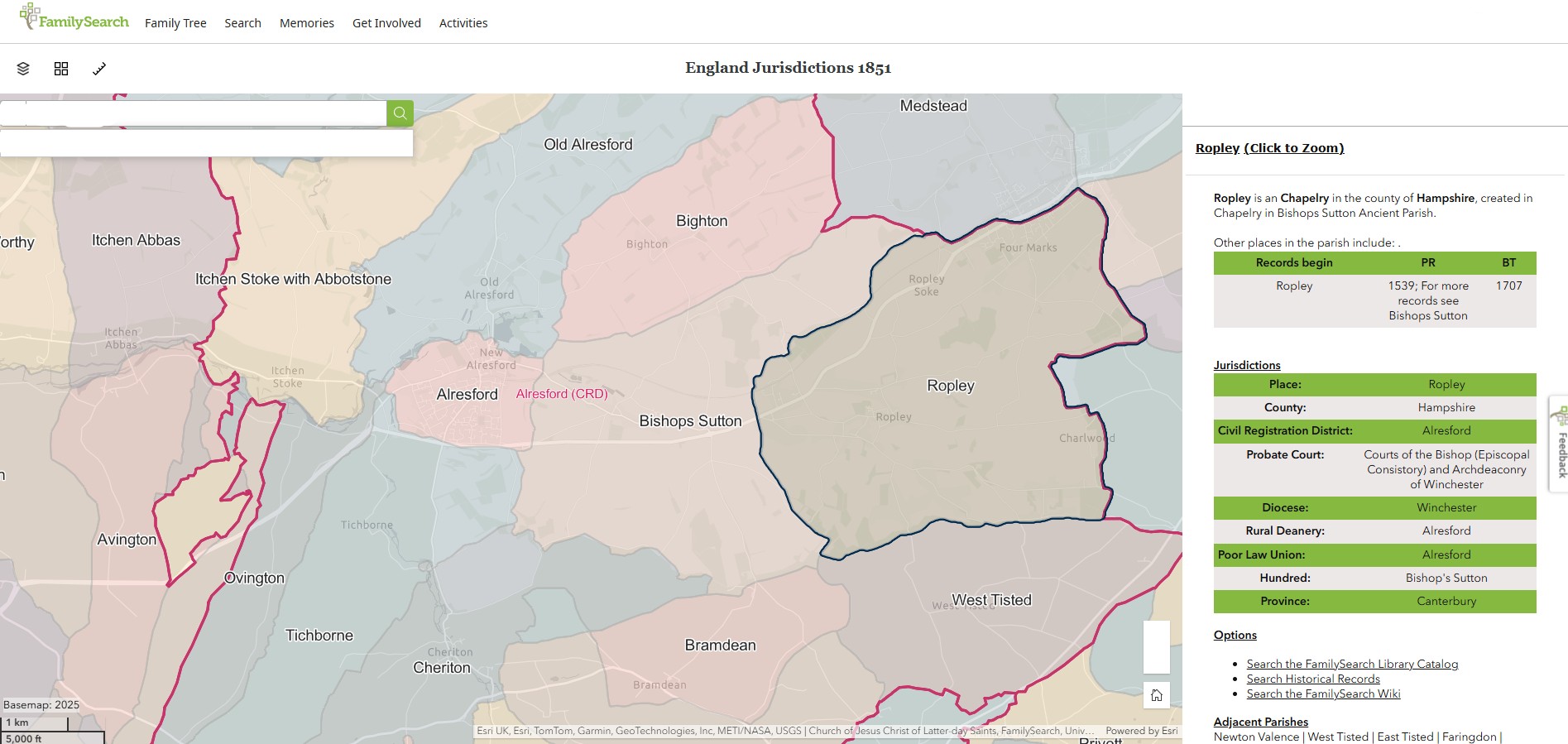
Ropley
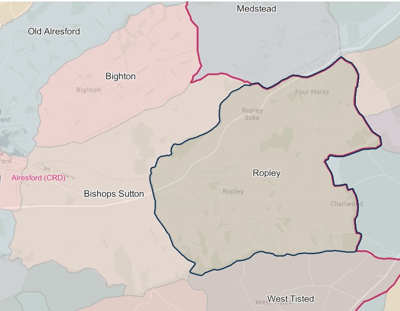
England Jurisdictions 1851 - Ropley
Extract from FamilySearch England Jurisdictions 1851. This link may not work if you don't have a subscription to FamilySearch
Then search for Ropley. Use the Key to select which boundaries you wish to see.
Swarraton
England Jurisdictions 1851 - Swarraton with Northington
Extract from FamilySearch England Jurisdictions 1851. This link may not work if you don't have a subscription to FamilySearch
Then search for Swarraton with Northington. Use the Key to select which boundaries you wish to see.


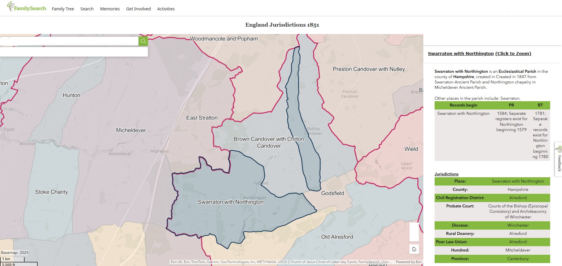
Swarraton with Northington
Swarraton with Northington is an Ecclesiastical Parish in the county of Hampshire, created in Created in 1847 from Swarraton Ancient Parish and Northington chapelry in Micheldever Ancient Parish.
England Jurisdictions 1851 - Swarraton with Northington
Extract from FamilySearch England Jurisdictions 1851. This link may not work if you don't have a subscription to FamilySearch
Then search for Swarraton with Northington. Use the Key to select which boundaries you wish to see.


Tichborne
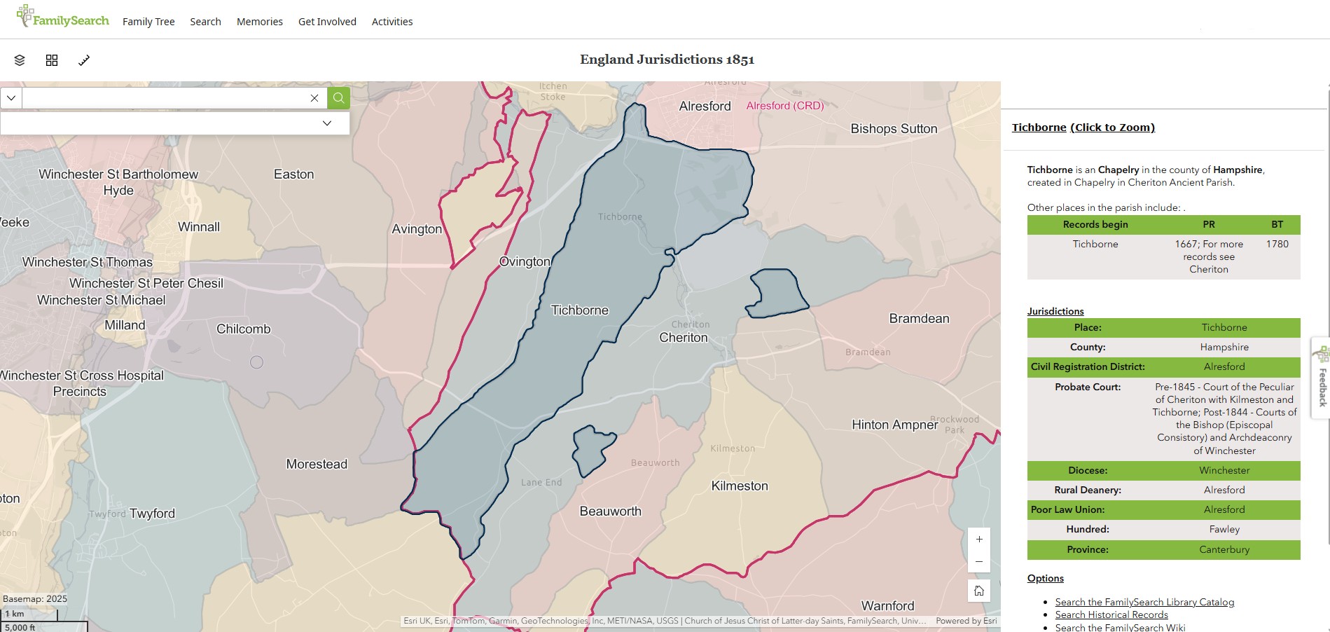
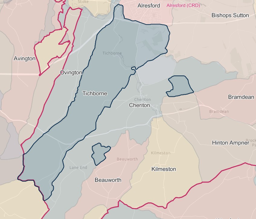
England Jurisdictions 1851 - Tichbourne
Extract from FamilySearch England Jurisdictions 1851. This link may not work if you don't have a subscription to FamilySearch
Then search for Tichbourne. Use the Key to select which boundaries you wish to see.
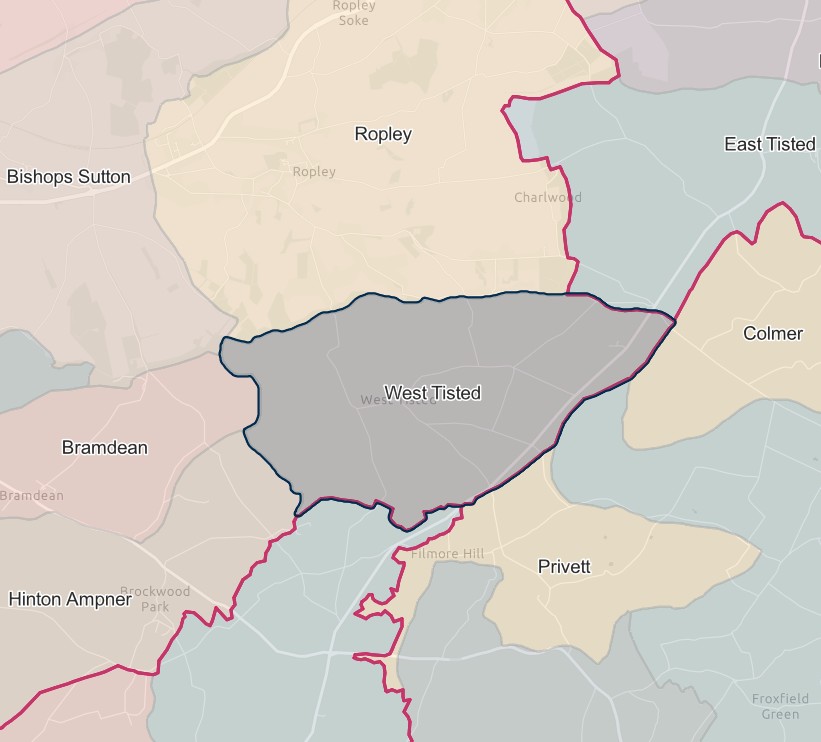
West Tisted
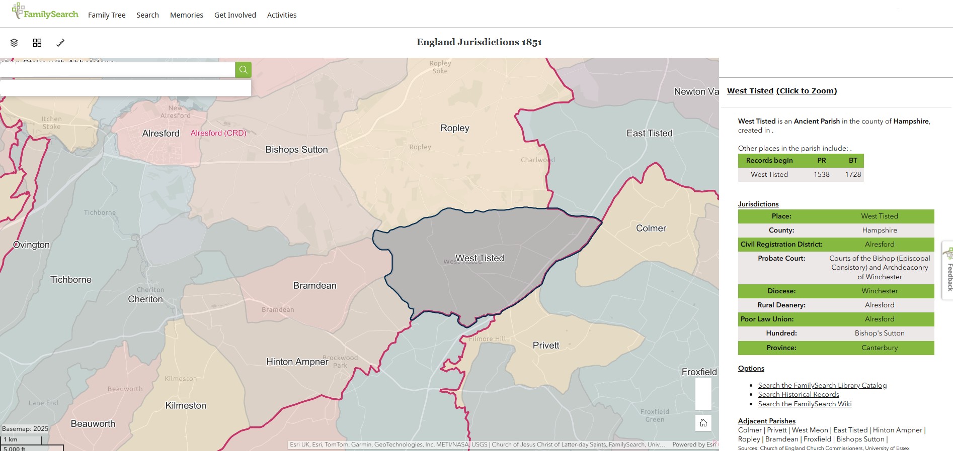
England Jurisdictions 1851 - West Tisted
Extract from FamilySearch England Jurisdictions 1851. This link may not work if you don't have a subscription to FamilySearch
Then search for West Tisted. Use the Key to select which boundaries you wish to see.
Andover
England Jurisdictions 1851 - CRD Andover
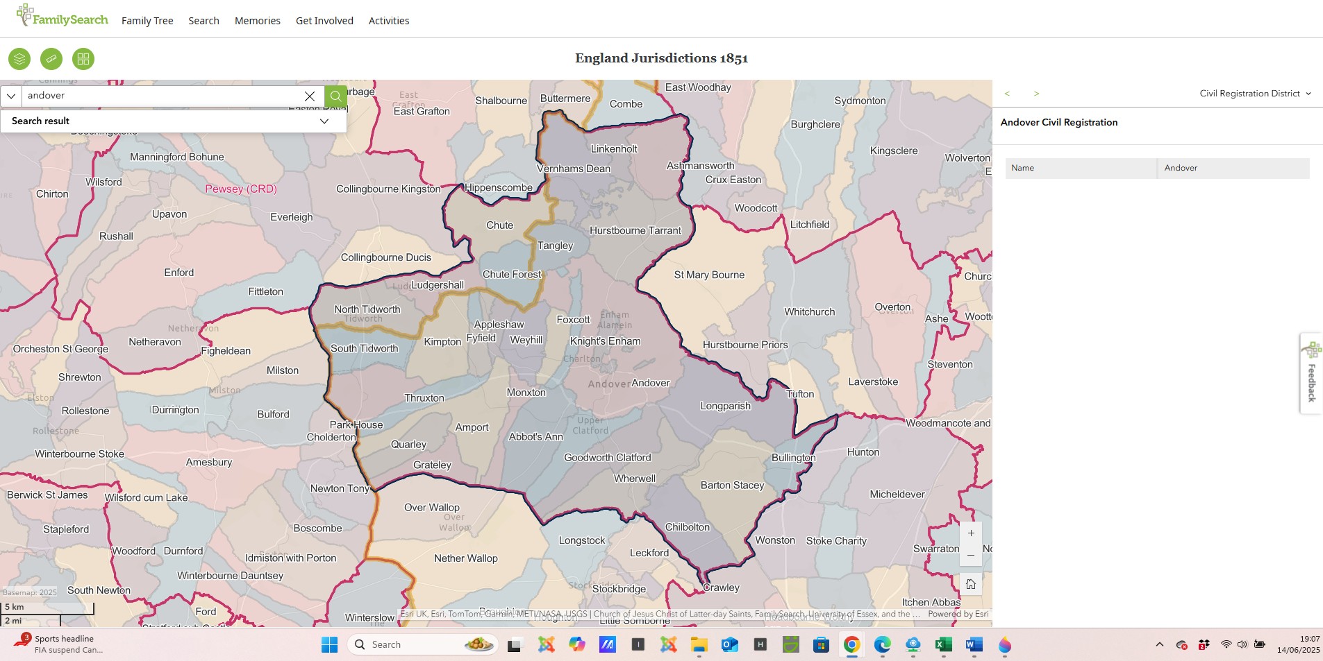
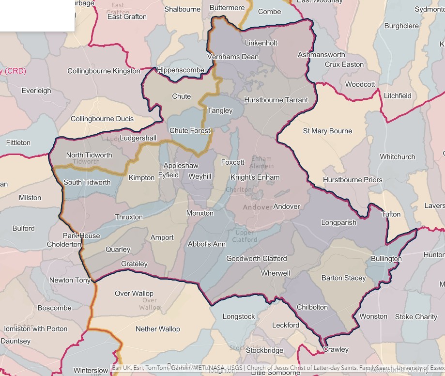
ANDOVER REGISTRATION DISTRICT
- Registration County : Hampshire.
- Created : 1.7.1837.
- Abolished : 1.4.2008 (added to Hampshire registration district).
- Sub-districts : Amport; Andover; Hurstbourne Tarrant; Longparish; Ludgershall
- GRO volumes : VII (1837–51); 2c (1852–1946); 6B (1946–74); 20 (1974–92).
- District number : 63b (1841–46); 118 (1847–69); 109 (1870–80); 110 (1881–1908); 112 (1909–46); 299 (1946–74); 490 (1974–2008).
Table 1: List of Places in Andover Registration District
|
Civil Parish |
County |
From |
To |
Comments |
|
Abbotts Ann |
1837 |
2008 |
See Table 2, note (e). |
|
|
Amport |
1837 |
2008 |
See Table 2, note (e). |
|
|
Andover |
1837 |
1974 |
Abolished 1.4.1974 to become the Test Valley unparished area. See also Table 2, note (b). |
|
|
Appleshaw |
1837 |
2008 |
See Table 2, note (e). |
|
|
Barton Stacey |
1837 |
2008 |
See Table 2, note (e). |
|
|
Bullington |
1837 |
2008 |
See Table 2, note (e). |
|
|
Charlton |
1984 |
2008 |
Created 1.4.1984 out of the Test Valley unparished area. See also Table 2, note (e). |
|
|
Chilbolton |
1837 |
2008 |
See Table 2, note (e). |
|
|
Chute |
1837 |
1880 |
See Table 2, note (a). |
|
|
Chute Forest |
1837 |
1880 |
See Table 2, note (a). |
|
|
Enham Alamein |
2007 |
2008 |
Created 1.4.2007 out of the Test Valley unparished area. See also Table 2, note (e). |
|
|
Faccombe |
1837 |
2008 |
See Table 2, note (e). |
|
|
Foxcott |
1837 |
1932 |
Abolished 1.4.1932 and divided between the parishes of Andover and Tangley. |
|
|
Fyfield |
1837 |
2008 |
See Table 2, note (e). |
|
|
Goodworth Clatford |
1837 |
2008 |
See Table 2, note (e). |
|
|
Grately |
1837 |
2008 |
See Table 2, note (e). |
|
|
Hurstbourne Tarrant |
1837 |
2008 |
See Table 2, note (e). |
|
|
Kimpton |
1837 |
2008 |
See Table 2, note (e). |
|
|
Knights Enham |
1837 |
1883 |
Abolished 25.3.1883 and added to the parish of Andover. |
|
|
Knights Enham |
1894 |
1932 |
Created 1894 out of the rural part of the parish of Andover. Abolished 1.4.1932 and added to the parish of Andover. |
|
|
Leckford |
1974 |
2008 |
See Table 2, notes (c) and (e). |
|
|
Linkenholt |
1837 |
2008 |
See Table 2, note (e). |
|
|
Longparish |
1837 |
2008 |
See Table 2, note (e). |
|
|
Longstock |
1974 |
2008 |
See Table 2, notes (c) and (e). |
|
|
Ludgershall |
1837 |
1880 |
See Table 2, note (a). |
|
|
Monxton |
1837 |
2008 |
See Table 2, note (e). |
|
|
Nether Wallop |
1974 |
2008 |
See Table 2, notes (c) and (e). |
|
|
North Tidworth |
1837 |
1880 |
See Table 2, note (a). |
|
|
Over Wallop |
1974 |
2008 |
See Table 2, notes (c) and (e). |
|
|
Park House |
1837 |
1866 |
Abolished 25.3.1866 and added to the parish of Shipton Bellinger. |
|
|
Penton Grafton |
1837 |
2008 |
See Table 2, note (e). |
|
|
Penton Mewsey |
1837 |
2008 |
See Table 2, note (e). |
|
|
Quarley |
1837 |
2008 |
See Table 2, note (e). |
|
|
St. Mary Bourne |
1932 |
1932 |
That part which until 1.4.1932 formed part of the parish of Andover. See also Table 2, note (b). |
|
|
Shipton Bellinger |
1837 |
2008 |
See Table 2, note (e). |
|
|
Smannell |
1932 |
2008 |
Created 1.4.1932 out of the parish of Andover. See also Table 2, note (e). |
|
|
South Tedworth |
1837 |
1992 |
See Table 2, note (d). |
|
|
Stockbridge |
1974 |
2008 |
See Table 2, notes (c) and (e). |
|
|
Tangley |
1837 |
2008 |
See Table 2, note (e). |
|
|
Test Valley* |
1974 |
2008 |
Unparished area which until 1.4.1974 formed the parish of Andover. See also Table 2, note (e). |
|
|
Thruxton |
1837 |
2008 |
See Table 2, note (e). |
|
|
Upper Clatford |
1837 |
2008 |
See Table 2, note (e). |
|
|
Vernhams Dean |
1837 |
2008 |
See Table 2, note (e). |
|
|
Wherwell |
1837 |
2008 |
See Table 2, note (e). |
Table 2: Boundary Changes affecting Andover Registration District
|
Date of Change |
Note |
Description of Change |
Population transferred |
|
1.4.1880 |
(a) |
Lost the parishes of Chute, Chute Forest, Ludgershall and North TIdworth, to Pewsey registration district. |
1469 in 1871 |
|
1.10.1932 |
(b) |
Lost the part in the parish of St. Mary Bourne (which until 1.4.1932 formed part of the parish of Andover) to Kingsclere & Whitchurch registration district. |
4 in 1931 |
|
1.4.1974 |
(c) |
Gained the parishes of Leckford, Longstock, Nether Wallop, Over Wallop and Stockbridge, from Romsey & Stockbridge registration district. |
4249 in 1971 |
|
1.4.1992 |
(d) |
Lost the parish of South Tedworth to Devizes registration district. |
n/a |
|
1.4.2008 (abolished) |
(e) |
Lost the Test Valley unparished area and the parishes of Abbotts Ann, Amport, Appleshaw, Barton Stacey, Bullington, Charlton, Chilbolton, Enham Alamein, Faccombe, Fyfield, Goodworth Clatford, Grately, Hurstbourne Tarrant, Kimpton, Leckford, Linkenholt, Longparish, Longstock, Monxton, Nether Wallop, Over Wallop, Penton Grafton, Penton Mewsey, Quarley, Shipton Bellinger, Smannell, Stockbridge, Tangley, Thruxton, Upper Clatford, Vernhams Dean and Wherwell, to Hampshire registration district. |
59928 in 2001 |
The Parishes within the Civil Registration District as at 1851 (generally the same as the 1837 entries above)
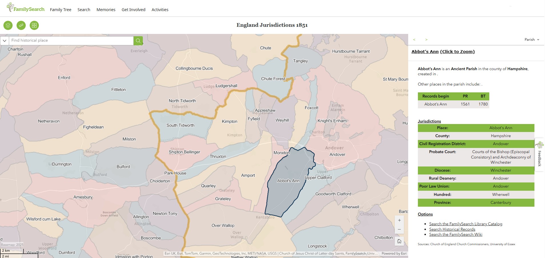
Abbot's Ann
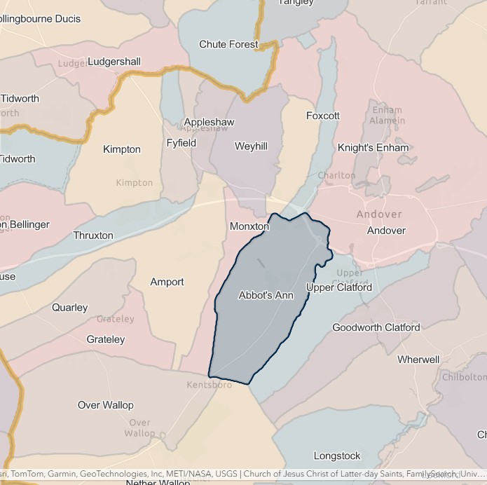
England Jurisdictions 1851 - Abbot's Ann
Extract from FamilySearch England Jurisdictions 1851. This link may not work if you don't have a subscription to FamilySearch
Then search for Abbot's Ann. Use the Key to select which boundaries you wish to see.
Amport
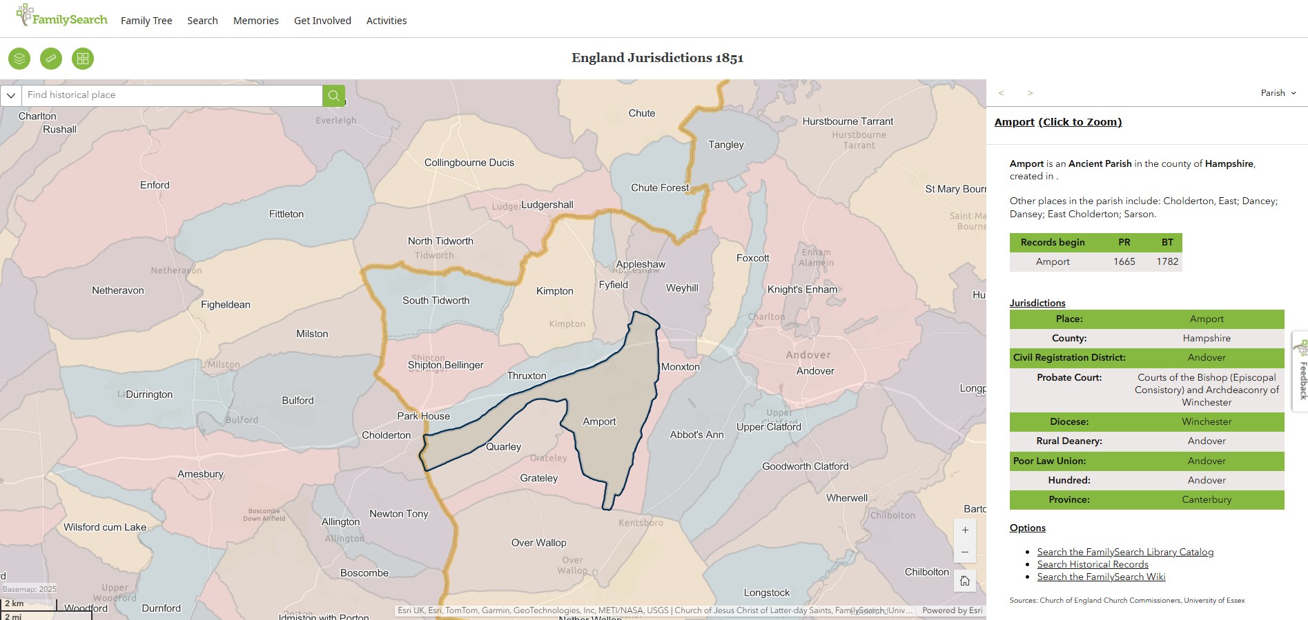
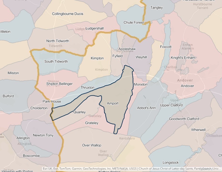
England Jurisdictions 1851 - Amport
Extract from FamilySearch England Jurisdictions 1851. This link may not work if you don't have a subscription to FamilySearch
Then search for Amport. Use the Key to select which boundaries you wish to see.
Andover
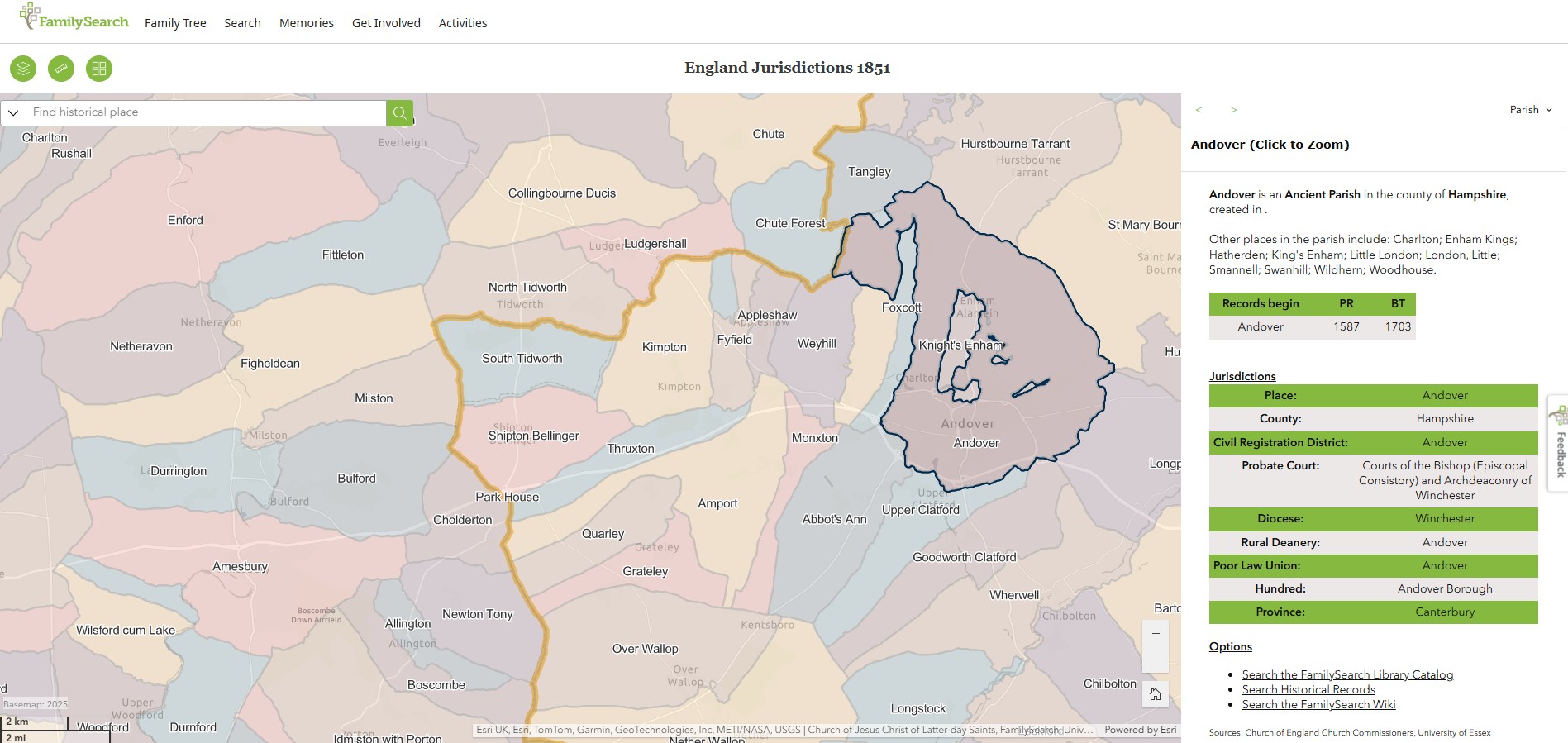
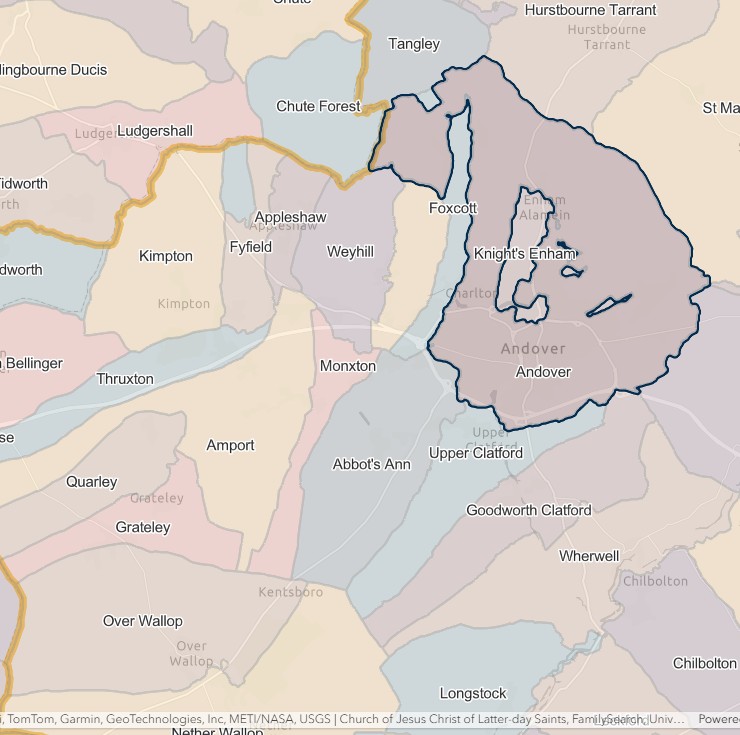
England Jurisdictions 1851 - Andover
Extract from FamilySearch England Jurisdictions 1851. This link may not work if you don't have a subscription to FamilySearch
Then search for Andover. Use the Key to select which boundaries you wish to see.
Appleshaw
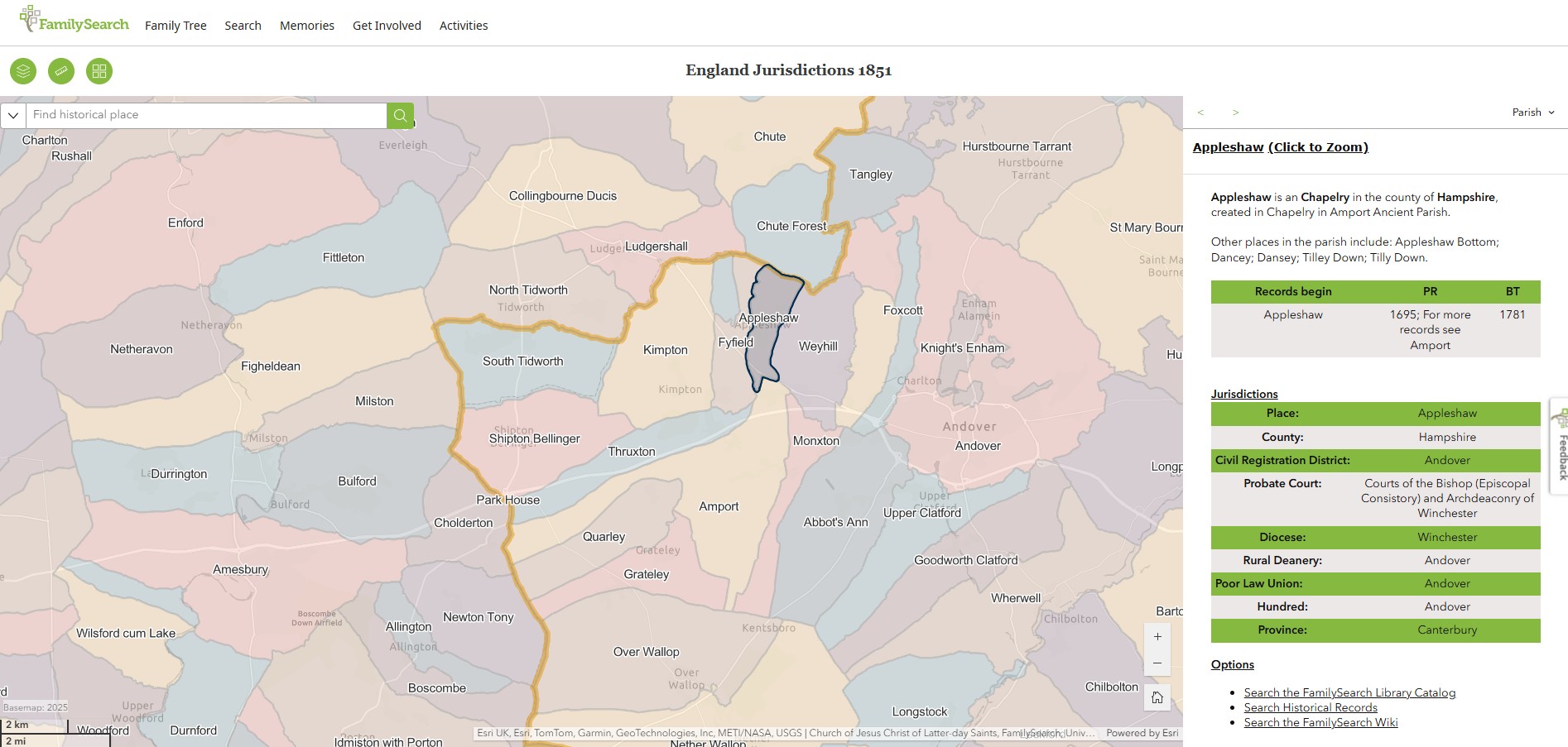
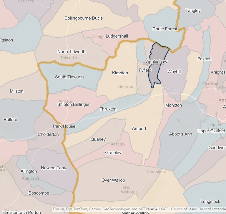
England Jurisdictions 1851 - Appleshaw
Extract from FamilySearch England Jurisdictions 1851. This link may not work if you don't have a subscription to FamilySearch
Then search for Appleshaw. Use the Key to select which boundaries you wish to see.
Barton Stacey
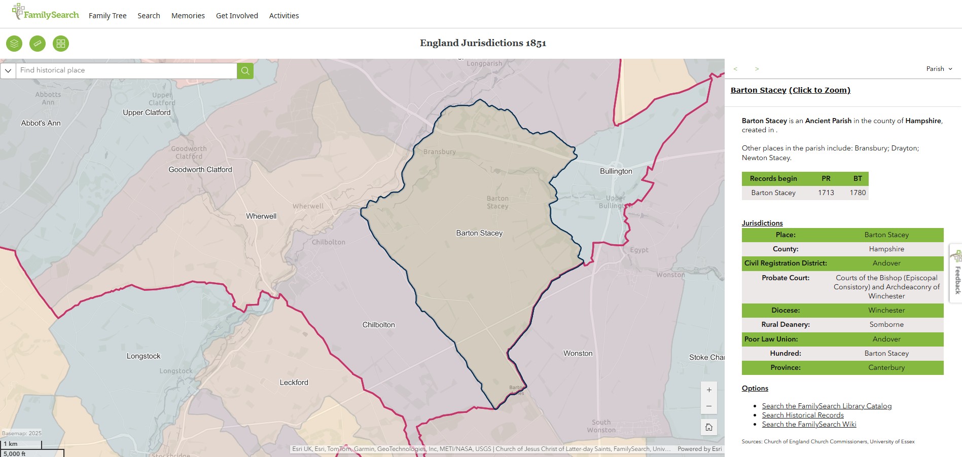
England Jurisdictions 1851 - Barton Stacey
Extract from FamilySearch England Jurisdictions 1851. This link may not work if you don't have a subscription to FamilySearch
Then search for Barton Stacey. Use the Key to select which boundaries you wish to see.

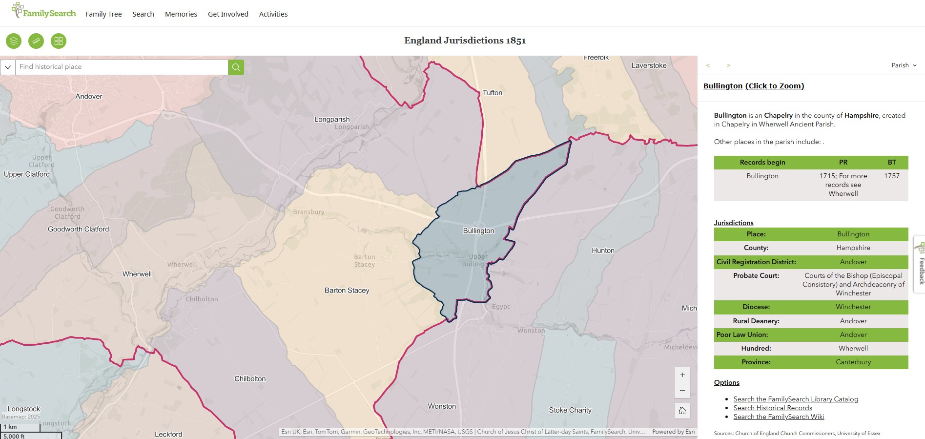
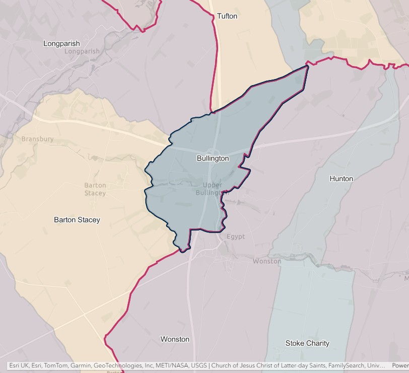
Bullington
England Jurisdictions 1851 - Bullington
Extract from FamilySearch England Jurisdictions 1851. This link may not work if you don't have a subscription to FamilySearch
Then search for Bullington. Use the Key to select which boundaries you wish to see.
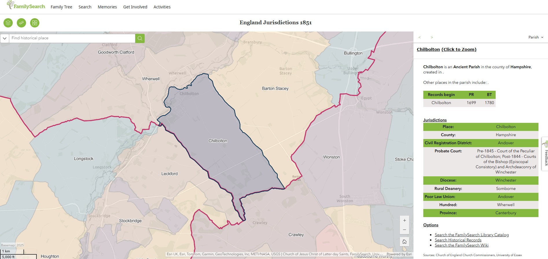
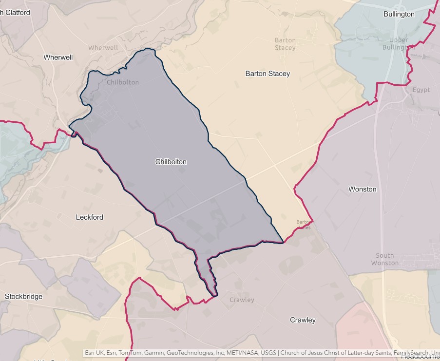
Chilbolton
England Jurisdictions 1851 - Chilbolton
Extract from FamilySearch England Jurisdictions 1851. This link may not work if you don't have a subscription to FamilySearch
Then search for Chilbolton. Use the Key to select which boundaries you wish to see.
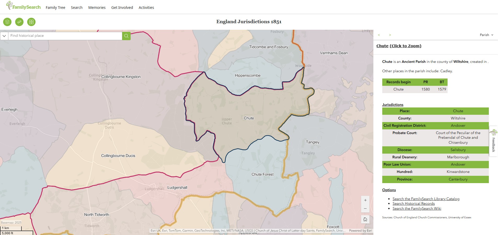
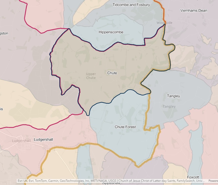
Chute
England Jurisdictions 1851 - Chute
Extract from FamilySearch England Jurisdictions 1851. This link may not work if you don't have a subscription to FamilySearch
Then search for Chute. Use the Key to select which boundaries you wish to see.
Chute Forest
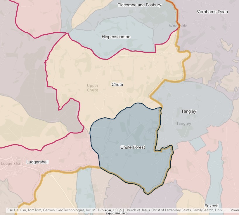
England Jurisdictions 1851 - Chute Forest
Extract from FamilySearch England Jurisdictions 1851. This link may not work if you don't have a subscription to FamilySearch
Then search for Chute Forest. Use the Key to select which boundaries you wish to see.

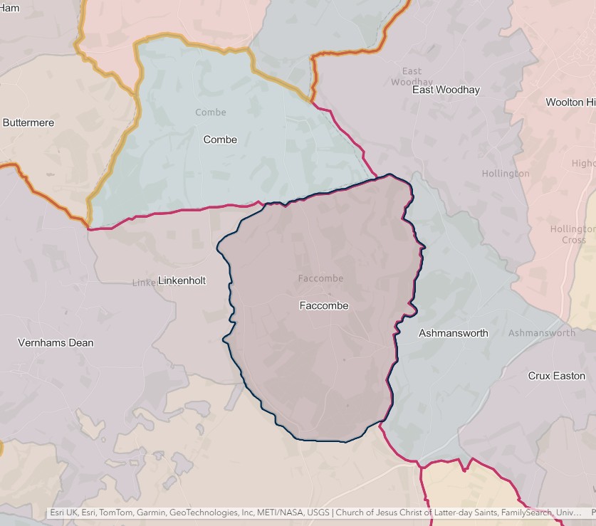
Faccombe
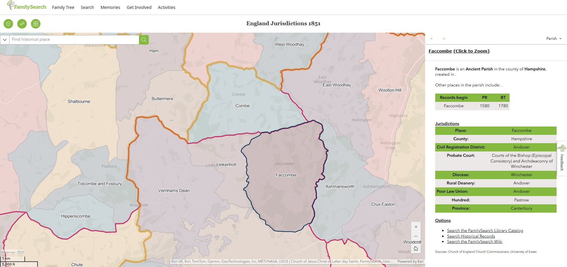
England Jurisdictions 1851 - Faccombe
Extract from FamilySearch England Jurisdictions 1851. This link may not work if you don't have a subscription to FamilySearch
Then search for Faccombe. Use the Key to select which boundaries you wish to see.
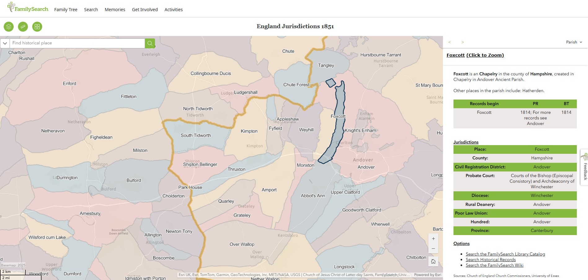
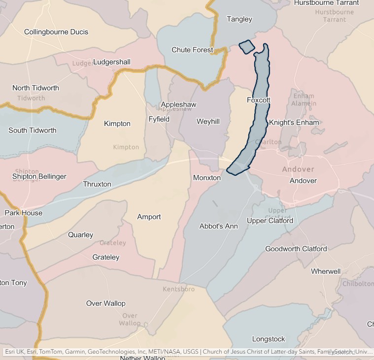
Foxcott
England Jurisdictions 1851 - Foxcott
Extract from FamilySearch England Jurisdictions 1851. This link may not work if you don't have a subscription to FamilySearch
Then search for Foxcott. Use the Key to select which boundaries you wish to see.
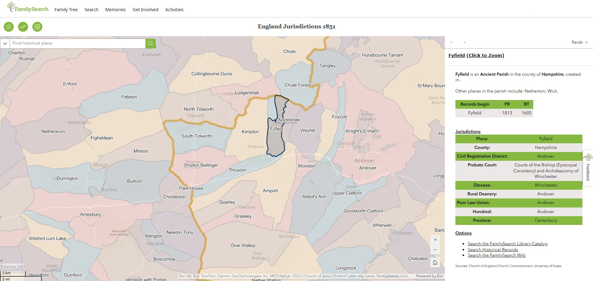
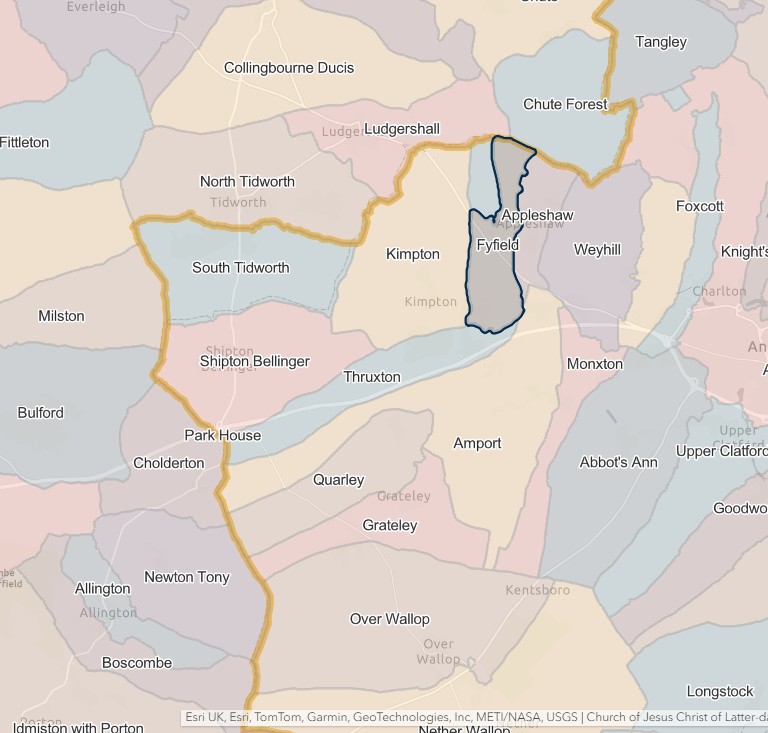
Fyfield
England Jurisdictions 1851 - Fyfield
Extract from FamilySearch England Jurisdictions 1851. This link may not work if you don't have a subscription to FamilySearch
Then search for Fyfield. Use the Key to select which boundaries you wish to see.
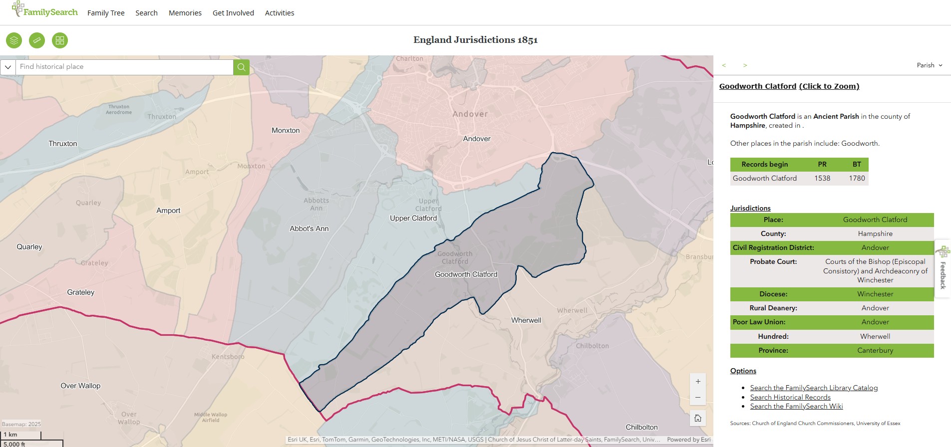
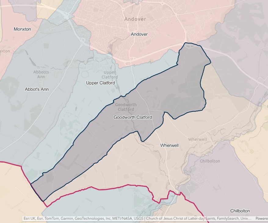
Goodworth Clatford
England Jurisdictions 1851 - Goodworth Clatford
Extract from FamilySearch England Jurisdictions 1851. This link may not work if you don't have a subscription to FamilySearch
Then search for Goodworth Clatford. Use the Key to select which boundaries you wish to see.
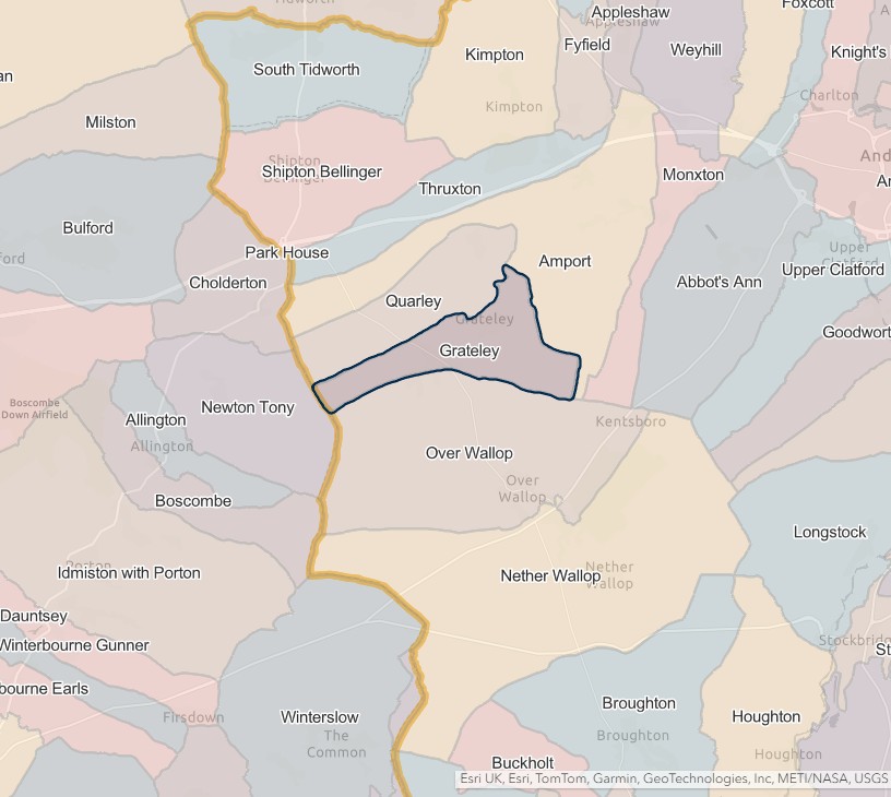
Grately
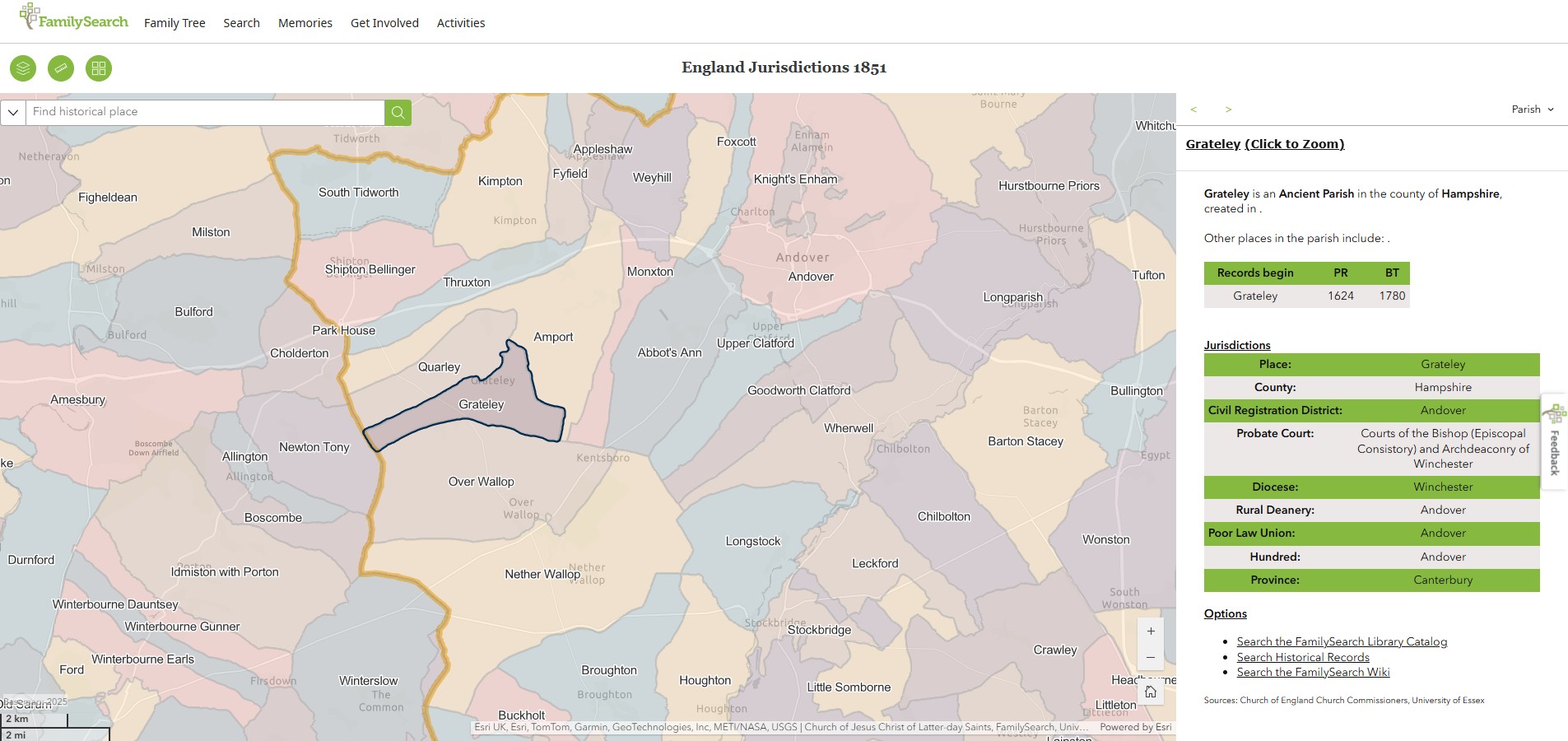
Grately or Grateley
England Jurisdictions 1851 - Grateley
Extract from FamilySearch England Jurisdictions 1851. This link may not work if you don't have a subscription to FamilySearch
Then search for Grateley. Use the Key to select which boundaries you wish to see.
Hurstbourne Tarrant
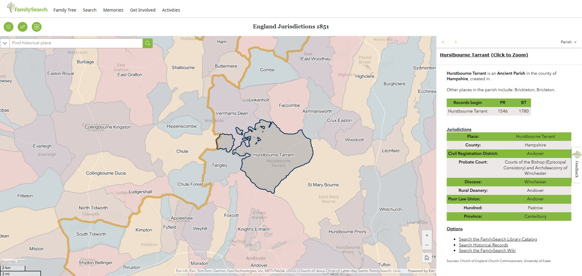
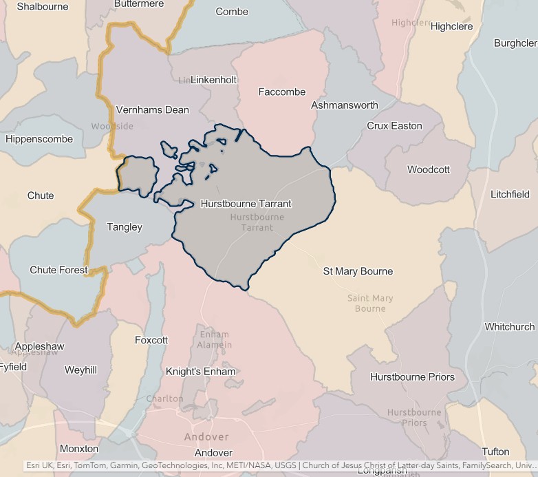
England Jurisdictions 1851 - Hurstbourne Tarrant
Extract from FamilySearch England Jurisdictions 1851. This link may not work if you don't have a subscription to FamilySearch
Then search for Hurstbourne Tarrant. Use the Key to select which boundaries you wish to see.
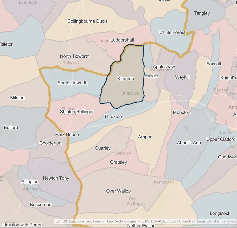
Kimpton
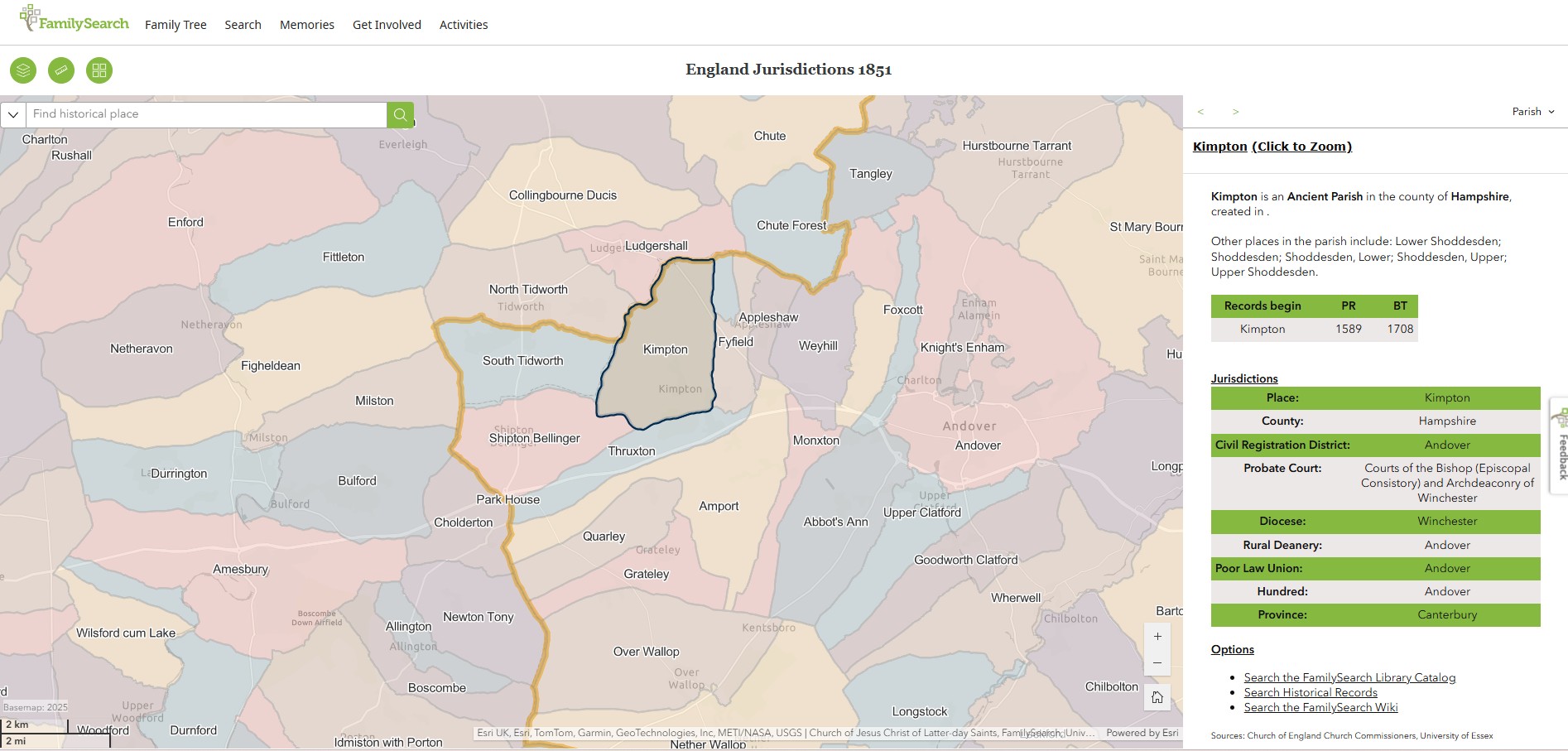
England Jurisdictions 1851 - Kimpton
Extract from FamilySearch England Jurisdictions 1851. This link may not work if you don't have a subscription to FamilySearch
Then search for Kimpton. Use the Key to select which boundaries you wish to see.
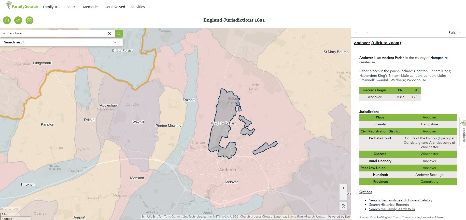
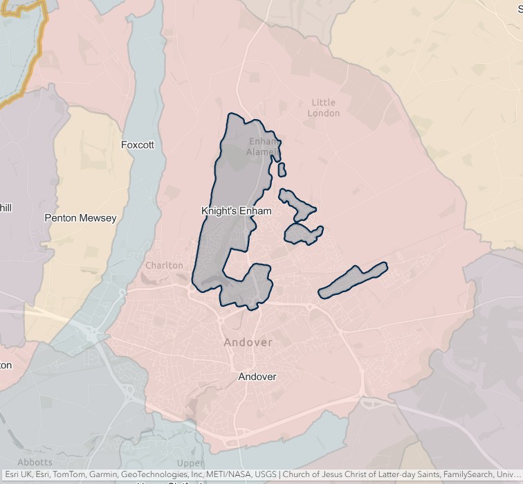
Knight's Enham
England Jurisdictions 1851 - Knight's Enham
Extract from FamilySearch England Jurisdictions 1851. This link may not work if you don't have a subscription to FamilySearch
Then search for Knight's Enham. Use the Key to select which boundaries you wish to see.
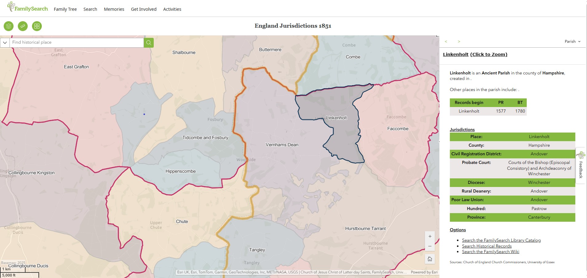
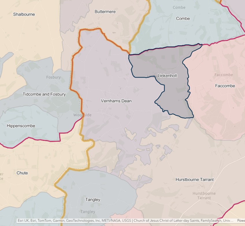
Linkenholt
England Jurisdictions 1851 - Linkenholt
Extract from FamilySearch England Jurisdictions 1851. This link may not work if you don't have a subscription to FamilySearch
Then search for Linkenholt. Use the Key to select which boundaries you wish to see.
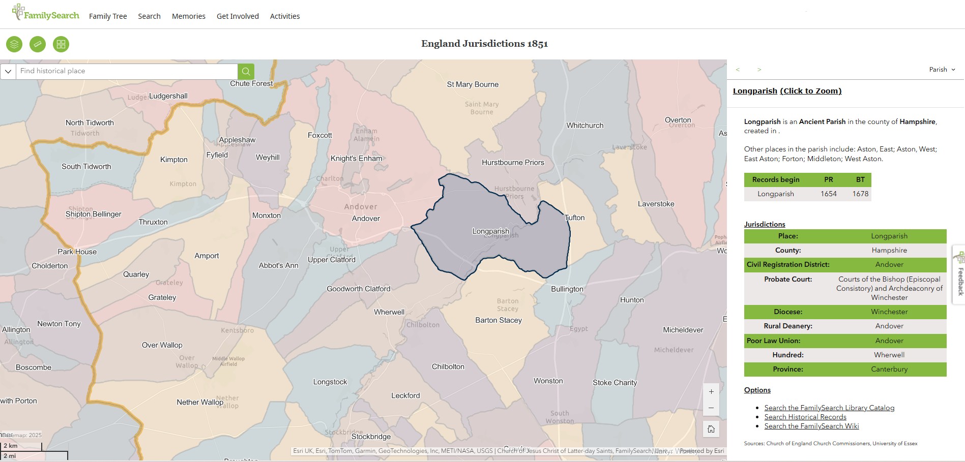
Longparish
England Jurisdictions 1851 - Longparish
Extract from FamilySearch England Jurisdictions 1851. This link may not work if you don't have a subscription to FamilySearch
Then search for Longparish. Use the Key to select which boundaries you wish to see.

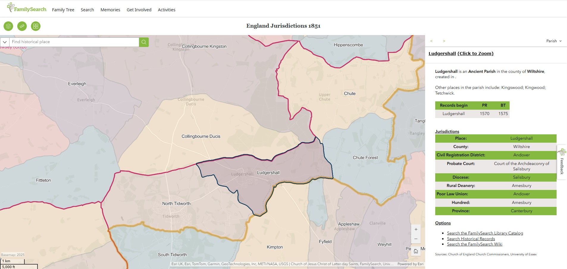
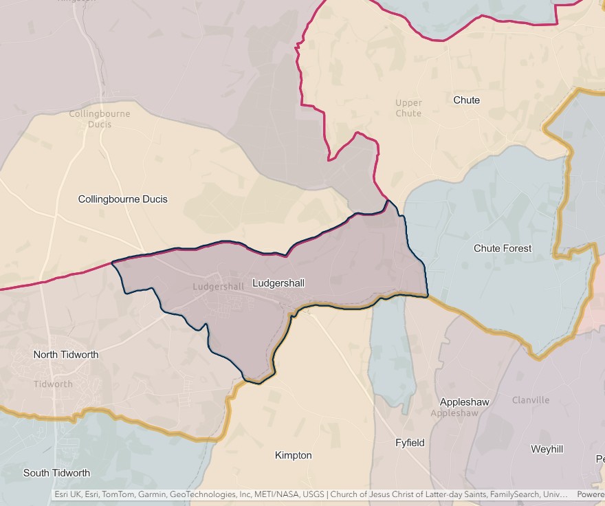
Ludgershall
England Jurisdictions 1851 - Ludgershall
Extract from FamilySearch England Jurisdictions 1851. This link may not work if you don't have a subscription to FamilySearch
Then search for Ludgershall. Use the Key to select which boundaries you wish to see.
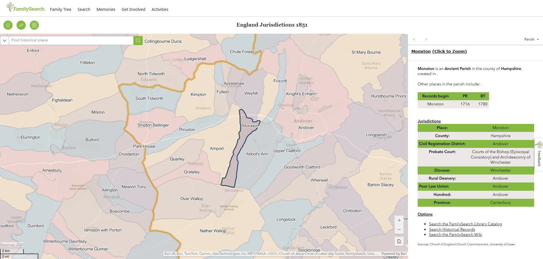
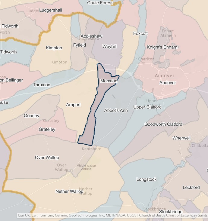
Monxton
England Jurisdictions 1851 - Monxton
Extract from FamilySearch England Jurisdictions 1851. This link may not work if you don't have a subscription to FamilySearch
Then search for Monxton. Use the Key to select which boundaries you wish to see.
North Tidworth
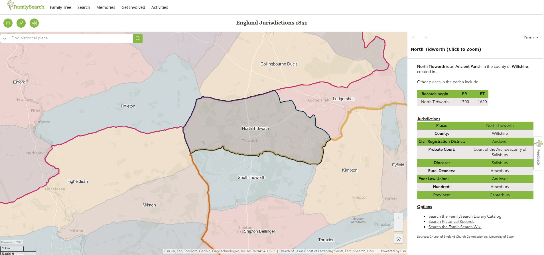
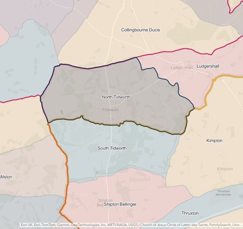
England Jurisdictions 1851 - North Tidworth
Extract from FamilySearch England Jurisdictions 1851. This link may not work if you don't have a subscription to FamilySearch
Then search for North Tidworth. Use the Key to select which boundaries you wish to see.
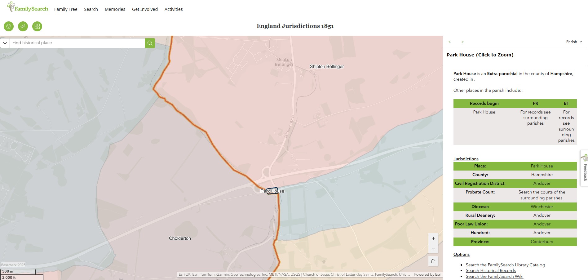
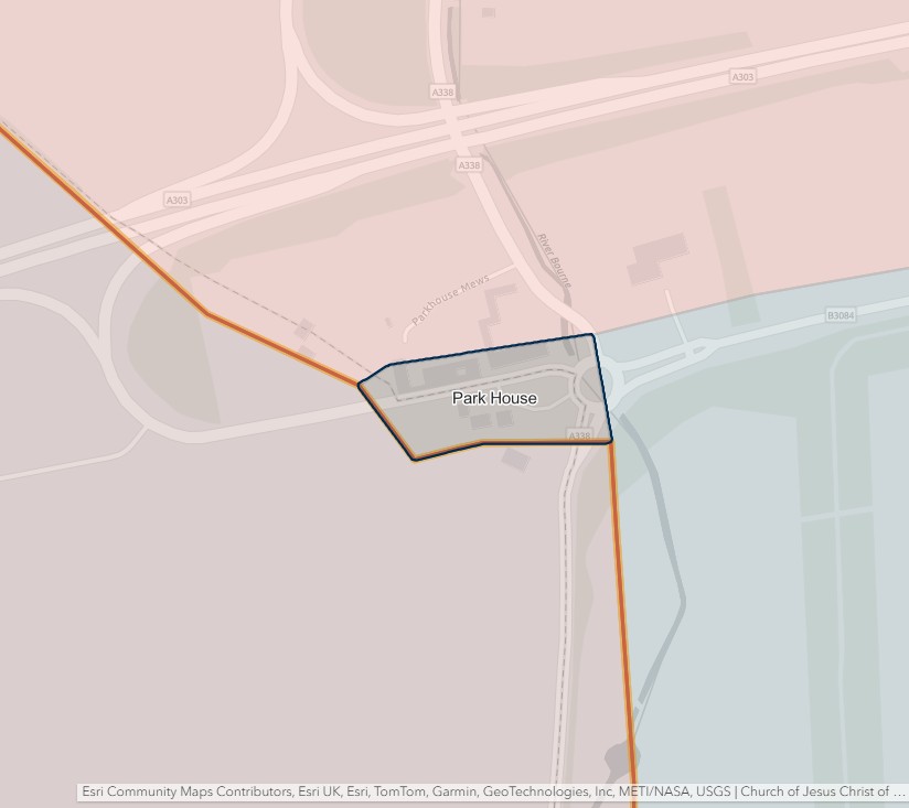
Park House
England Jurisdictions 1851 - Park House
Extract from FamilySearch England Jurisdictions 1851. This link may not work if you don't have a subscription to FamilySearch
Then search for Park House. Use the Key to select which boundaries you wish to see.
Penton Grafton
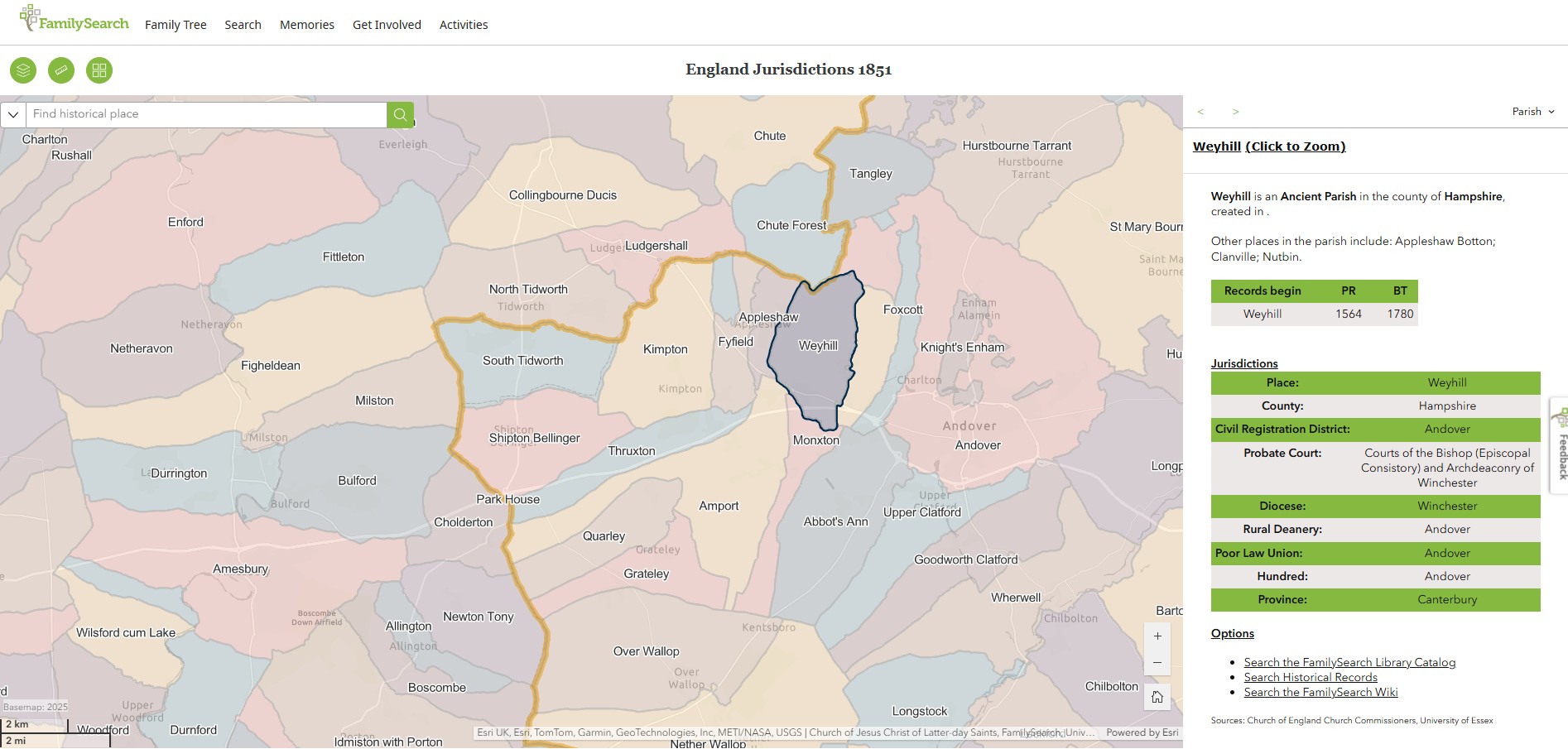
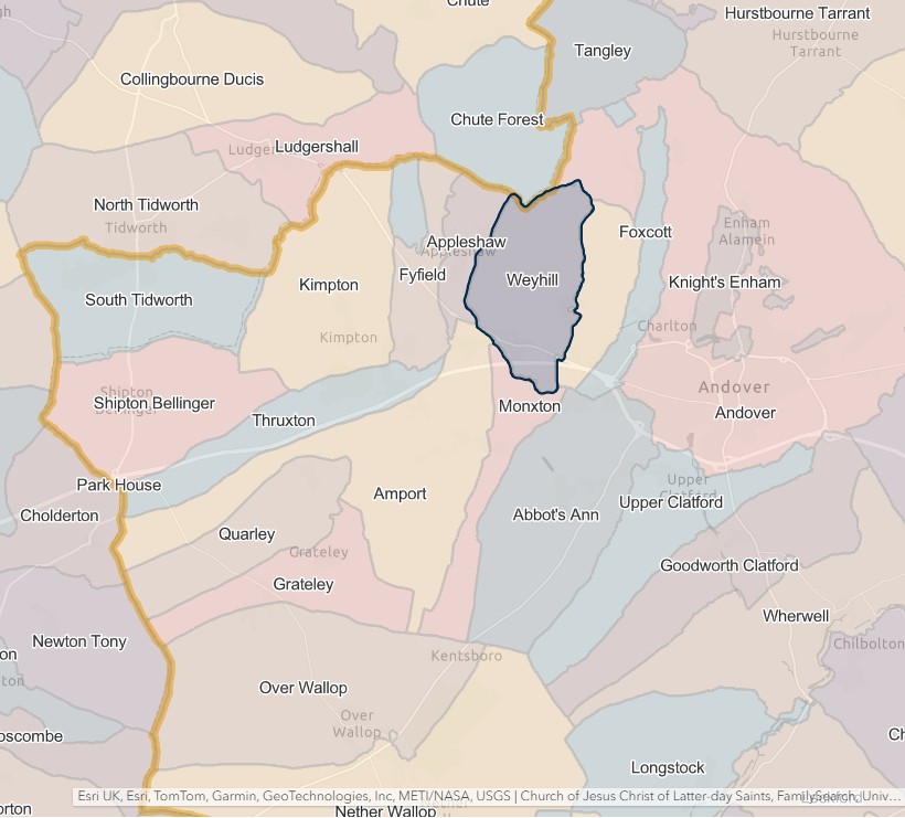
England Jurisdictions 1851 - Penton Grafton
Extract from FamilySearch England Jurisdictions 1851. This link may not work if you don't have a subscription to FamilySearch
Then search for Penton Grafton or Weyhill. Use the Key to select which boundaries you wish to see.
Currently only Weyhill will give a result in England Jurisdictions 1851.
However of Penton Grafton Parish Council site it states that 'Weyhill parish should correctly be called Penton Grafton but both names have been used since the nineteenth century.'
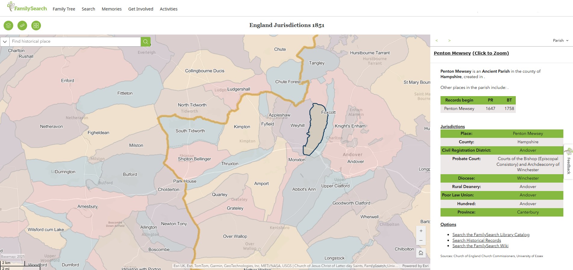
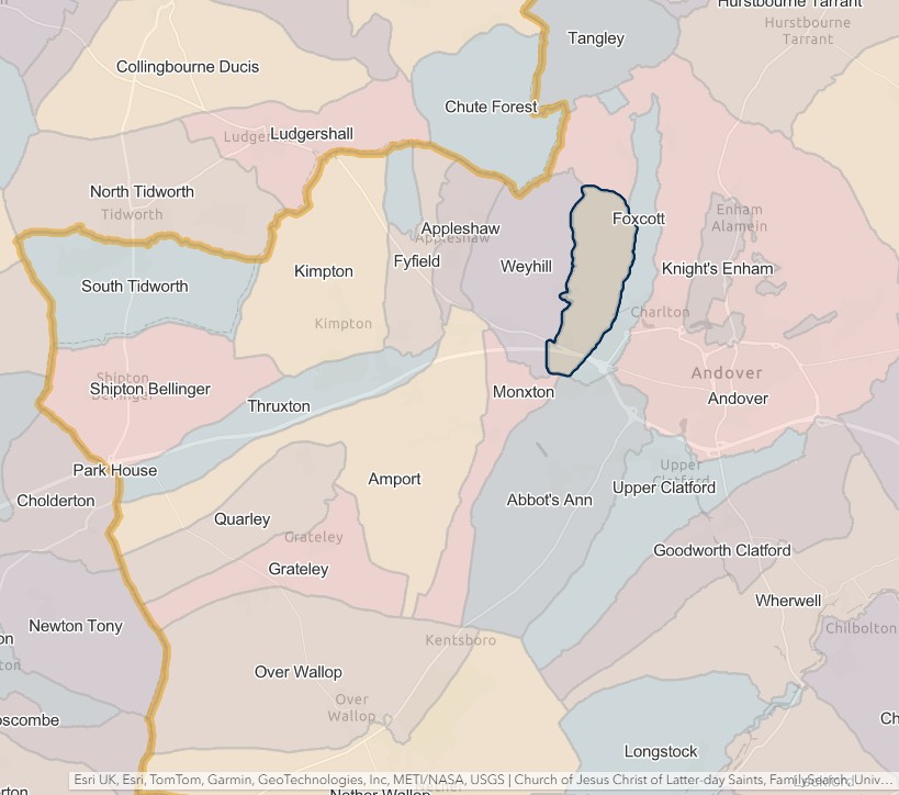
Penton Mewsey
England Jurisdictions 1851 - Penton Mewsey
Extract from FamilySearch England Jurisdictions 1851. This link may not work if you don't have a subscription to FamilySearch
Then search for Penton Mewsey. Use the Key to select which boundaries you wish to see.
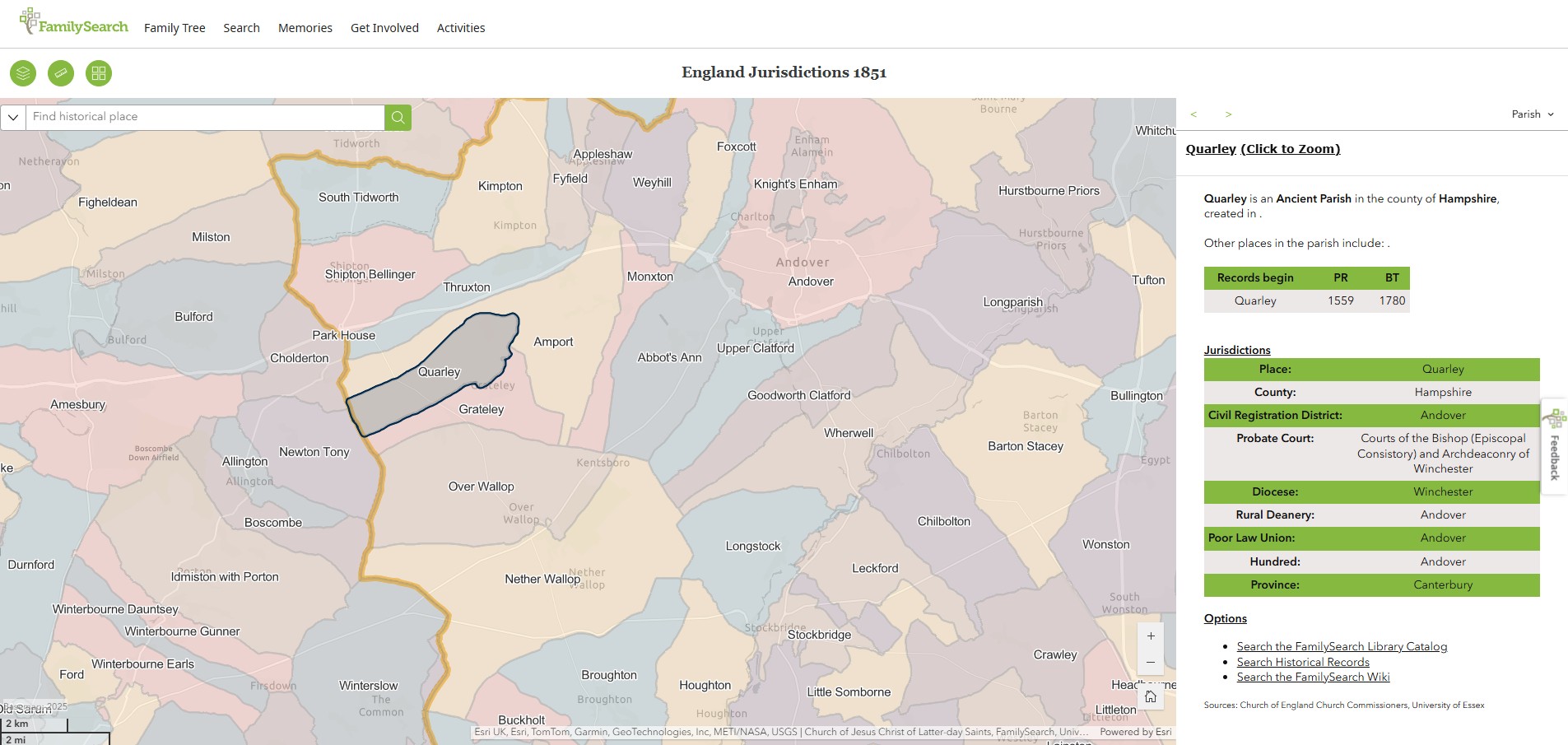
Quarley
England Jurisdictions 1851 - Quarley
Extract from FamilySearch England Jurisdictions 1851. This link may not work if you don't have a subscription to FamilySearch
Then search for Quarley. Use the Key to select which boundaries you wish to see.

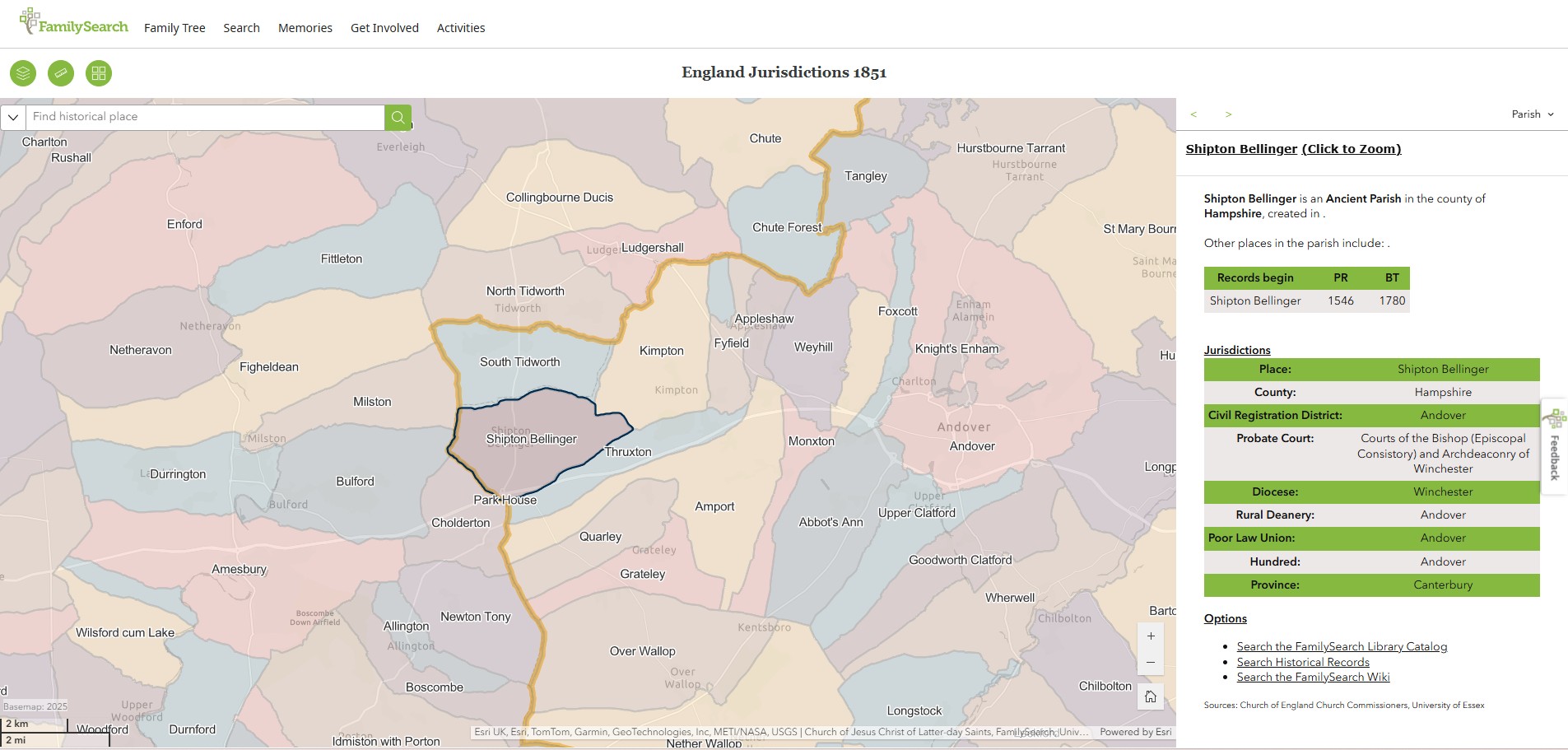
Shipton Bellinger
England Jurisdictions 1851 - Shipton Bellinger
Extract from FamilySearch England Jurisdictions 1851. This link may not work if you don't have a subscription to FamilySearch
Then search for Shipton Bellinger. Use the Key to select which boundaries you wish to see.
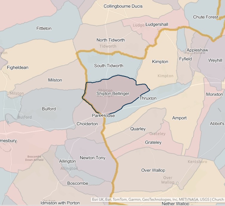
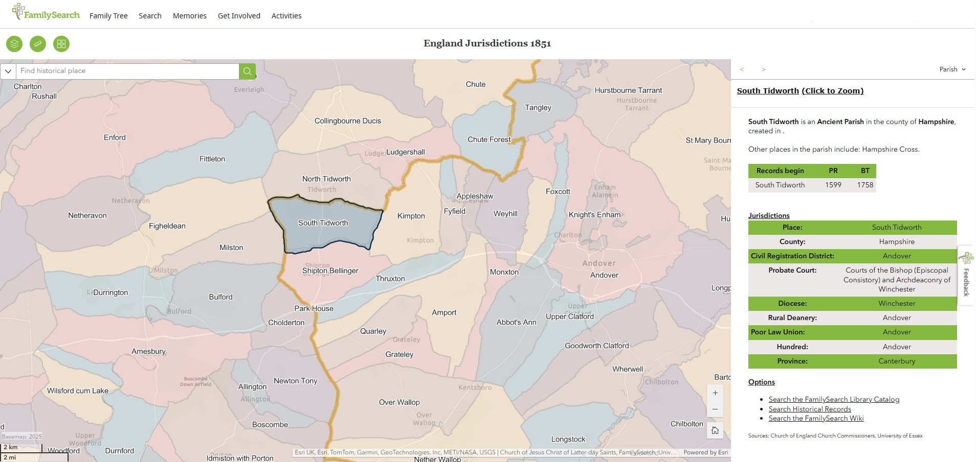
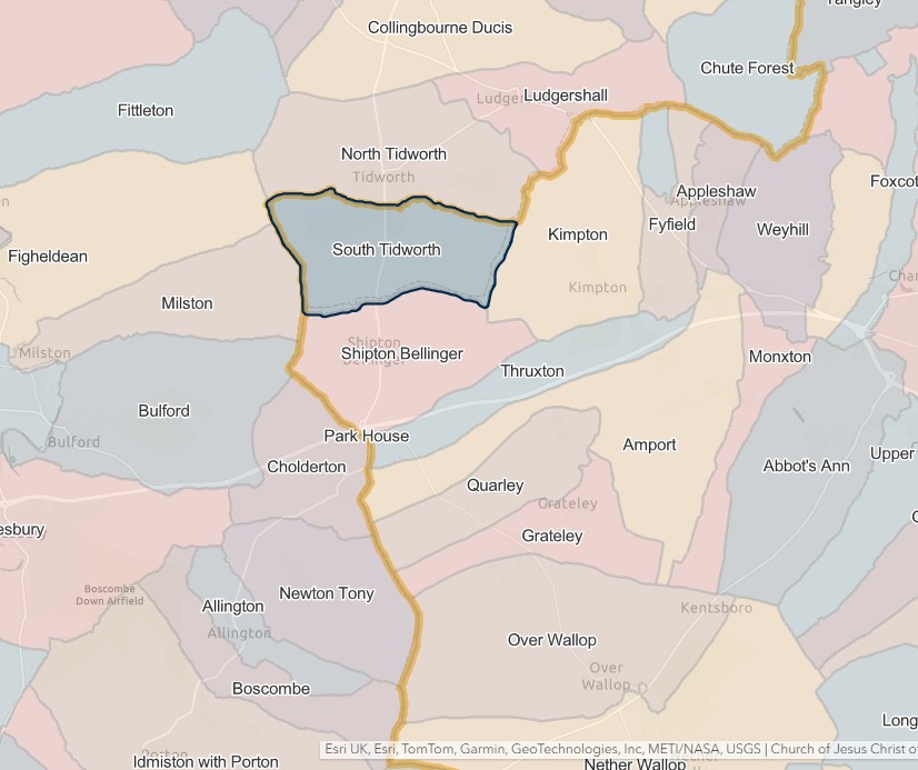
South Tidworth
England Jurisdictions 1851 - South Tidworth
Extract from FamilySearch England Jurisdictions 1851. This link may not work if you don't have a subscription to FamilySearch
Then search for South Tidworth. Use the Key to select which boundaries you wish to see.
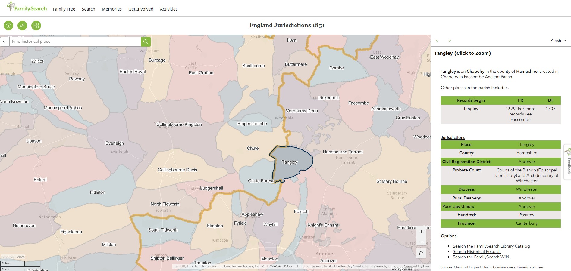
Tangley
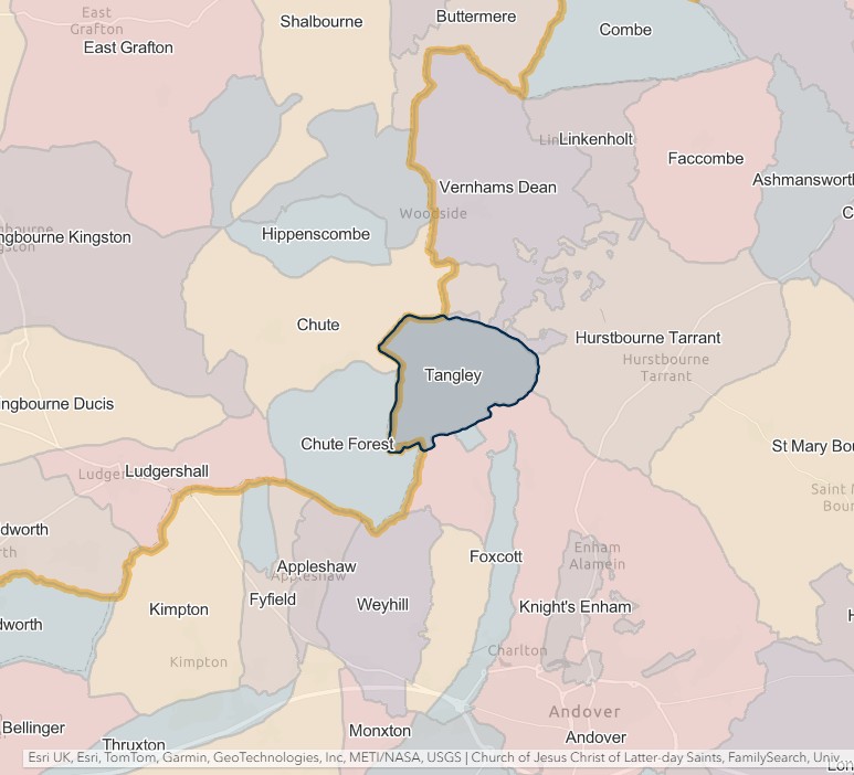
England Jurisdictions 1851 - Tangley
Extract from FamilySearch England Jurisdictions 1851. This link may not work if you don't have a subscription to FamilySearch
Then search for Tangley. Use the Key to select which boundaries you wish to see.
Thruxton
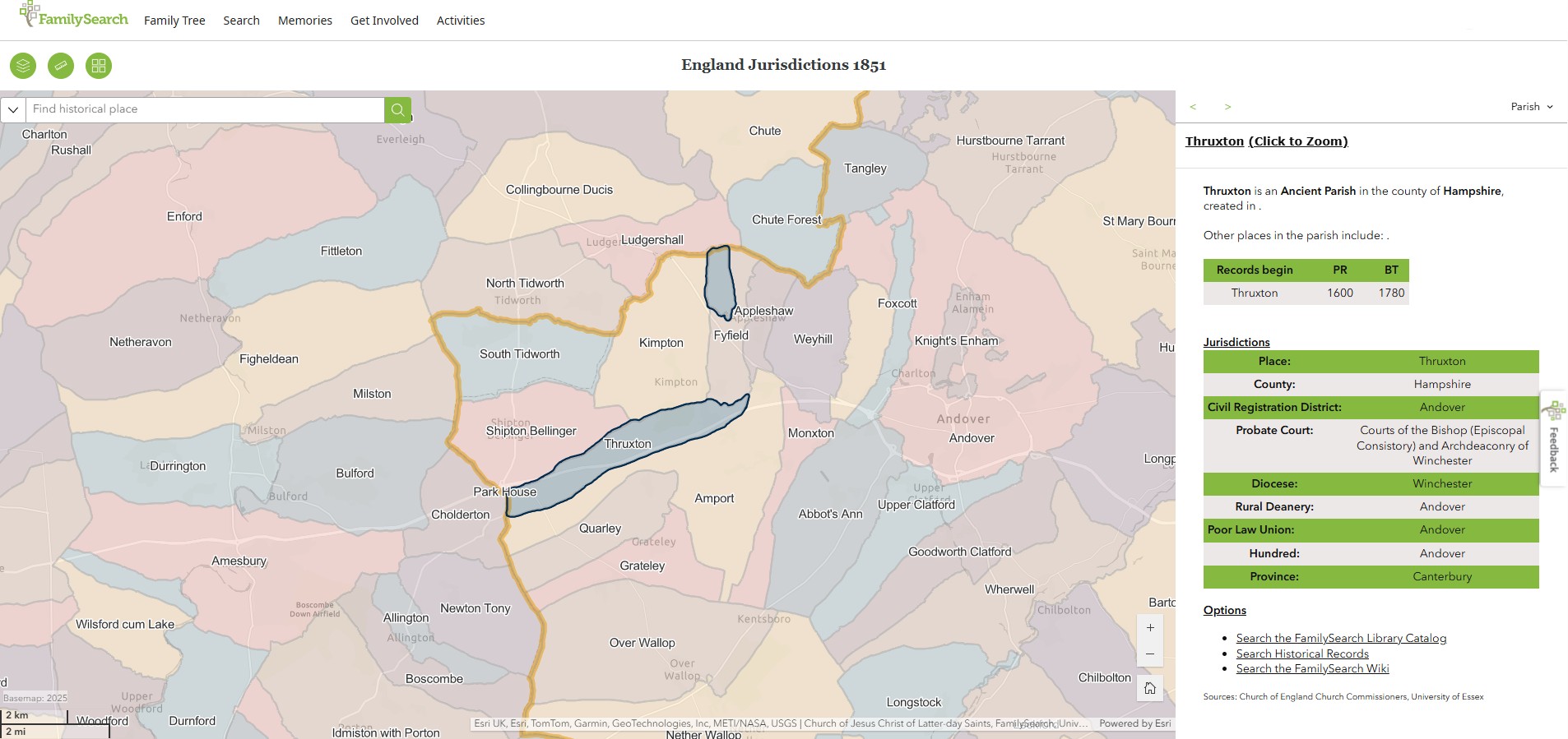
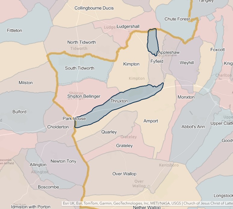
England Jurisdictions 1851 - Thruxton
Extract from FamilySearch England Jurisdictions 1851. This link may not work if you don't have a subscription to FamilySearch
Then search for Thruxton. Use the Key to select which boundaries you wish to see.
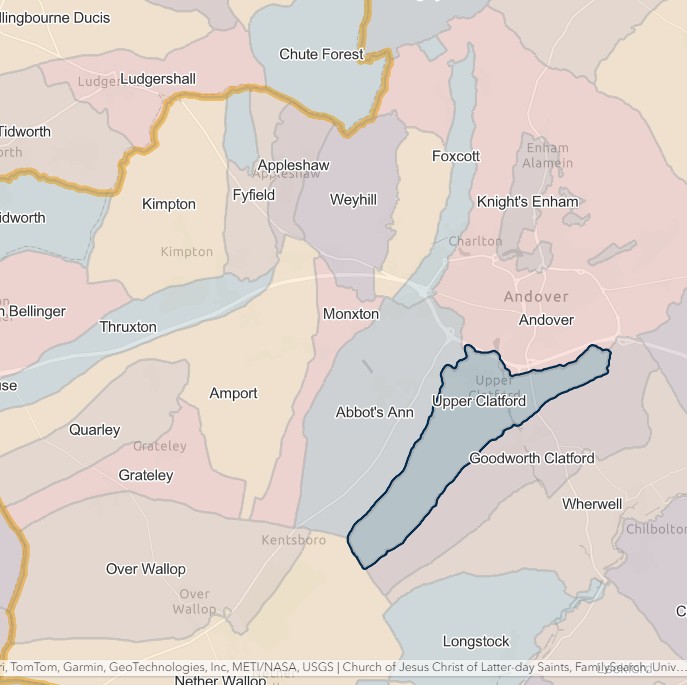
Upper Clatford
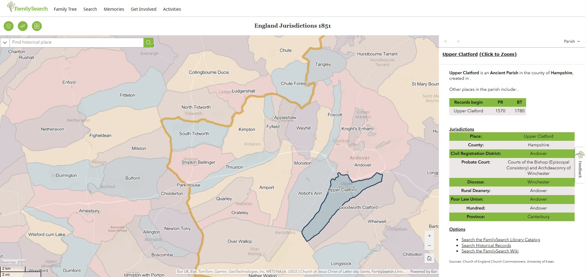
England Jurisdictions 1851 - Upper Clatford
Extract from FamilySearch England Jurisdictions 1851. This link may not work if you don't have a subscription to FamilySearch
Then search for Upper Clatford. Use the Key to select which boundaries you wish to see.
Vernhams Dean
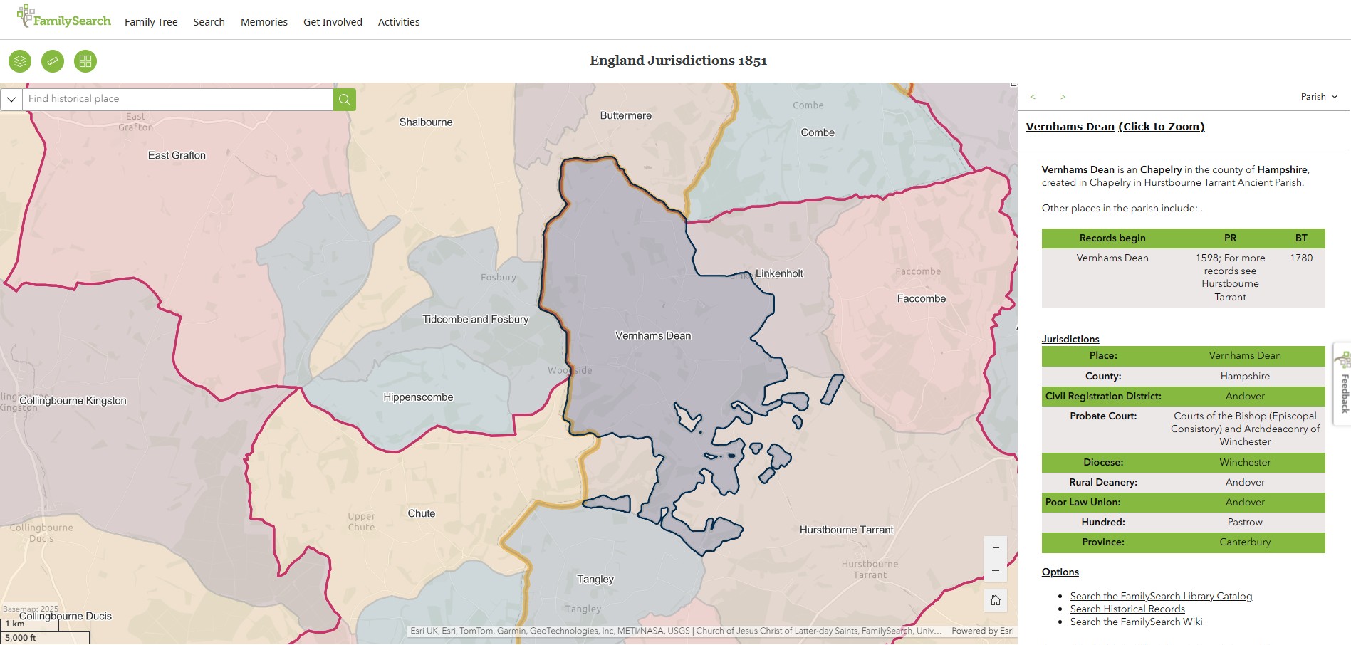
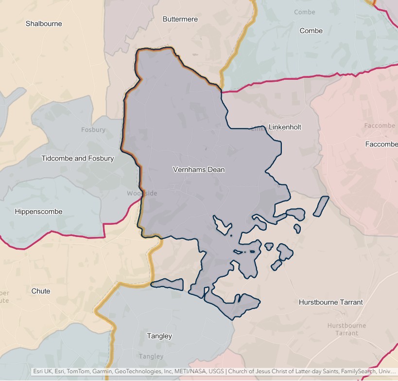
England Jurisdictions 1851 - Vernhams Dean
Extract from FamilySearch England Jurisdictions 1851. This link may not work if you don't have a subscription to FamilySearch
Then search for Vernhams Dean. Use the Key to select which boundaries you wish to see.
Weyhill
England Jurisdictions 1851 - Weyhill
Extract from FamilySearch England Jurisdictions 1851. This link may not work if you don't have a subscription to FamilySearch
Then search for Penton Grafton or Weyhill. Use the Key to select which boundaries you wish to see.
Currently only Weyhill will give a result in England Jurisdictions 1851.
However of Penton Grafton Parish Council site it states that 'Weyhill parish should correctly be called Penton Grafton but both names have been used since the nineteenth century.'


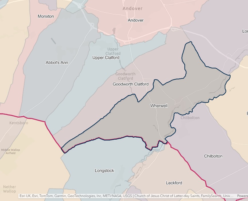
Wherwell
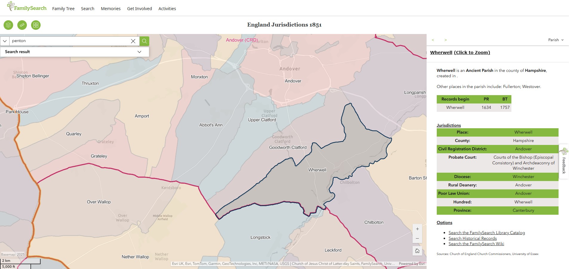
England Jurisdictions 1851 - Wherwell
Extract from FamilySearch England Jurisdictions 1851. This link may not work if you don't have a subscription to FamilySearch
Then search for Wherwell. Use the Key to select which boundaries you wish to see.
Christchurch
England Jurisdictions 1851 - CRD Christchurch
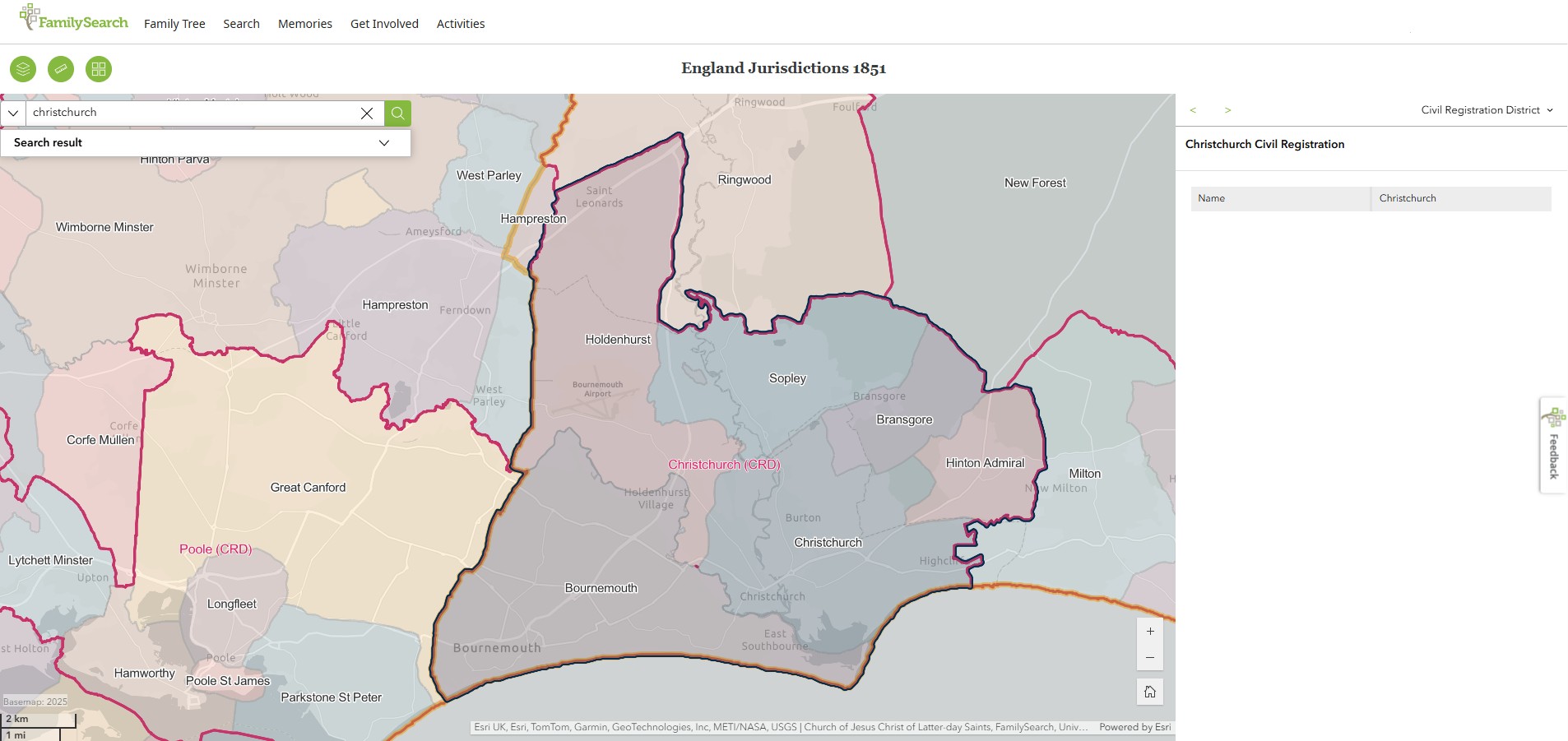
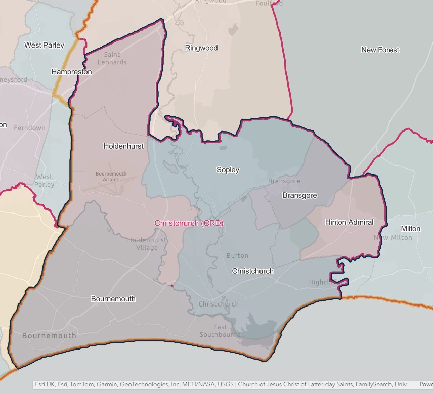
CHRISTCHURCH REGISTRATION DISTRICT
- Registration County : Hampshire.
- Created : 1.7.1837.
- Abolished : 1.7.1925 (renamed to become Bournemouth & Christchurch registration district).
- Re-created : 1.10.1932 (out of Bournemouth & Christchurch, Fordingbridge and Ringwood registration districts).
- Abolished : 1.4.1974 (divided between Bournemouth, Ringwood & Fordingbridge and Poole registration districts).
- Sub-districts : Bournemouth; Christchurch; Christchurch & Ringwood.
- GRO volumes : VIII (1837–51); 2b (1852–1925); 2b (1932–46); 6B (1946–74).
- District number : 62d (1841–46); 101 (1847–69); 92 (1870–80); 93 (1881–1908); 95 (1909–25 & 1932–46); 302 (1946–74).
Table 1A: List of Places in Christchurch Registration District (1837–1925)
|
Civil Parish |
County |
From |
To |
Comments |
|
Bournemouth |
1894 |
1925 |
Created 1894 out of the parishes of Holdenhurst and Christchurch. See also Table 2, note (c). |
|
|
Christchurch |
1837 |
1925 |
See Table 2, notes (a) and (c). |
|
|
Christchurch East |
1894 |
1925 |
Created 1894 out of the parishes of Christchurch and Milton. See also Table 2, notes (b) and (c). |
|
|
Highcliffe |
1897 |
1925 |
Created 1.10.1897 out of the parish of Christchurch East. See also Table 2, note (c). |
|
|
Holdenhurst |
1837 |
1925 |
See Table 2, note (c). |
|
|
Hurn |
1894 |
1925 |
Created 1894 out of the parish of Christchurch. See also Table 2, note (c). |
|
|
Pokesdown |
1894 |
1902 |
Created 1894 out of the parish of Christchurch. Abolished 30.9.1902 and added to the parish of Bournemouth. |
|
|
Sopley |
1837 |
1925 |
See Table 2, note (c). |
|
|
Southbourne |
1894 |
1902 |
Created 1894 out of the parish of Christchurch. Abolished 30.9.1902 and added to the parish of Bournemouth. |
|
|
Winton |
1894 |
1902 |
Created 1894 out of the parish of Holdenhurst. Abolished 30.9.1902 and added to the parish of Bournemouth. |
Table 1B: List of Places in Christchurch Registration District (1932–74)
|
Civil Parish |
County |
From |
To |
Comments |
|
Breamore |
1932 |
1974 |
See Table 2, notes (e) and (k). |
|
|
Burley |
1932 |
1974 |
See Table 2, notes (f) and (k). |
|
|
Christchurch |
1932 |
1974 |
Abolished 1.4.1974 to become an unparished area. See also Table 2, notes (d) and (i). |
|
|
Christchurch East |
1932 |
1974 |
Abolished 1.4.1974 and divided between the parishes of Burton and Bransgore. See also Table 2, notes (d), (i) and (k). |
|
|
Damerham |
1932 |
1974 |
See Table 2, notes (e) and (k). |
|
|
Ellingham |
1932 |
1974 |
See Table 2, notes (f) and (k). |
|
|
Fordingbridge |
1932 |
1974 |
See Table 2, notes (e) and (k). |
|
|
Hale |
1932 |
1974 |
See Table 2, notes (e) and (k). |
|
|
Harbridge & Ibsley |
1932 |
1974 |
See Table 2, notes (f) and (k). |
|
|
Hurn |
1932 |
1974 |
See Table 2, notes (d) and (i). |
|
|
Martin |
1932 |
1974 |
See Table 2, notes (e) and (k). |
|
|
Ringwood |
1932 |
1974 |
See Table 2, notes (f) and (k). |
|
|
Rockbourne |
1932 |
1974 |
See Table 2, notes (e) and (k). |
|
|
Sopley |
1932 |
1974 |
See Table 2, notes (d), (i) and (k). |
|
|
St. Leonards & St. Ives |
1932 |
1974 |
See Table 2, notes (f), (g), (h) and (j). |
|
|
Whitsbury |
1932 |
1974 |
See Table 2, notes (e) and (k). |
|
|
Woodgreen |
1932 |
1974 |
See Table 2, notes (e) and (k). |
Table 2: Boundary Changes affecting Christchurch Registration District
|
Date of Change |
Note |
Description of Change |
Population transferred |
|
1.1.1893 |
(a) |
Lost part of the parish of Christchurch (which was added to the parish of Ringwood on 29.9.1892) to Ringwood registration district. |
91 in 1891 |
|
1.6.1895 |
(b) |
Gained part of the parish of Christchurch East (which until 1894 formed part of the parish of Milton) from Lymington registration district. |
403 in 1891 |
|
1.7.1925 (abolished) |
(c) |
Lost the parishes of Bournemouth, Christchurch, Christchurch East, Highcliffe, Holdenhurst, Hurn and Sopley, to Bournemouth & Christchurch registration district. |
104068 in 1921 |
|
1.10.1932 |
(d) |
Gained the parishes of Christchurch, Christchurch East, Hurn and Sopley, from Bournemouth & Christchurch registration district. |
14657 in 1931 |
|
(e) |
Gained the parishes of Breamore, Damerham, Fordingbridge, Hale, Martin, Rockbourne, Whitsbury and Woodgreen, from Fordingbridge registration district. |
6468 in 1931 |
|
|
(f) |
Gained the parishes of Burley, Ellingham, Harbridge & Ibsley, Ringwood and St. Leonards & St. Ives, from Ringwood registration district. |
8536 in 1931 |
|
|
15.8.1947 |
(g) |
Lost part of the parish of St. Leonards & St. Ives (which was added to the parish of West Parley on 15.8.1947) to Blandford registration district. |
0 in 1931 |
|
(h) |
Gained part of the parish of St. Leonards & St. Ives (which until 15.8.1947 formed part of the parish of West Parley) from Blandford registration district. |
0 in 1931 |
|
|
1.4.1974 (abolished) |
(i) |
Lost the parish of Christchurch (which became an unparished area on 1.4.1974), parts of the parishes of Christchurch East and Sopley (which became parts of the parishes of Burton and Hurn on 1.4.1974) and the parish of Hurn, to Bournemouth registration district. |
33648 in 1971 |
|
(j) |
Lost the parish of St. Leonards & St. Ives to Poole registration district. |
4517 in 1971 |
|
|
(k) |
Lost part of the parish of Christchurch East (which became the parish of Bransgore on 1.4.1974) and the parishes of Breamore, Burley, Damerham, Ellingham, Fordingbridge, Hale, Harbridge & Ibsley, Martin, Ringwood, Rockbourne, Whitsbury and Woodgreen and the remaining part of the parish of Sopley, to Ringwood & Fordingbridge registration district. |
32986 in 1971 |
The Parishes within the Civil Registration District as at 1851 (generally the same as the 1837 entries above)
There appears to be a conflict of information regarding the extent of the Christchurch CRD at 1837 from the list above and from the 1851 map.
Accordingly, those parishes not included in the list as at 1837 but on the map have been added as three additional tabs.
Christchurch
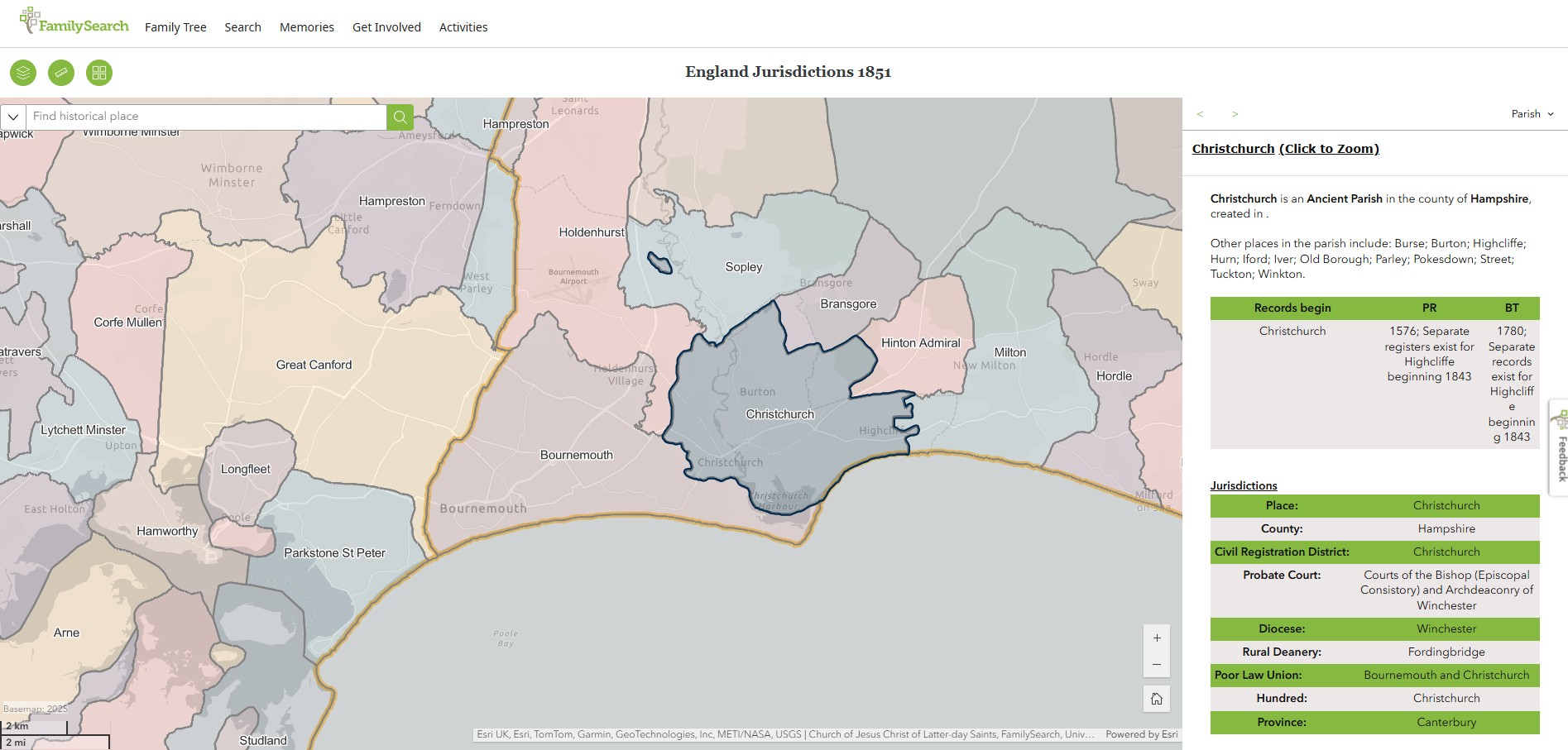
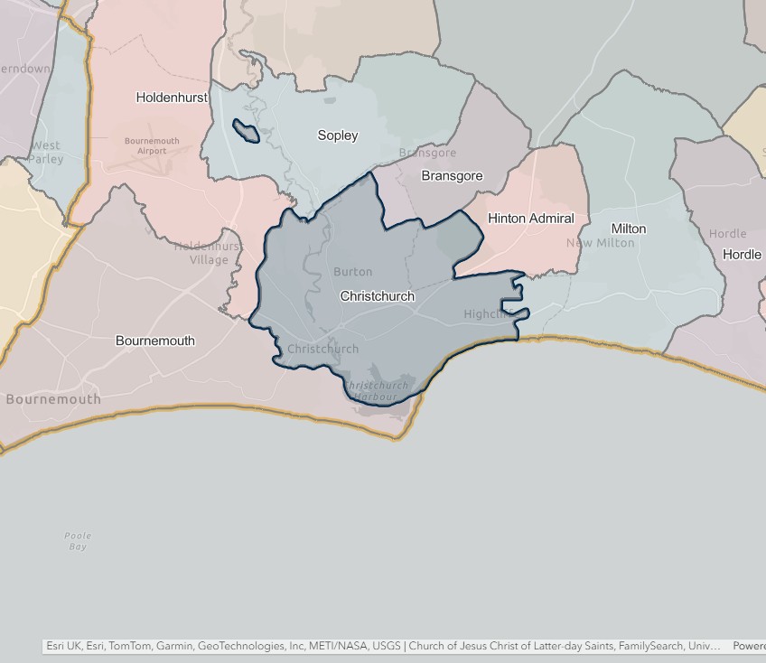
England Jurisdictions 1851 - Christchurch
Extract from FamilySearch England Jurisdictions 1851. This link may not work if you don't have a subscription to FamilySearch
Then search for Christchurch. Use the Key to select which boundaries you wish to see.
Holdenhurst
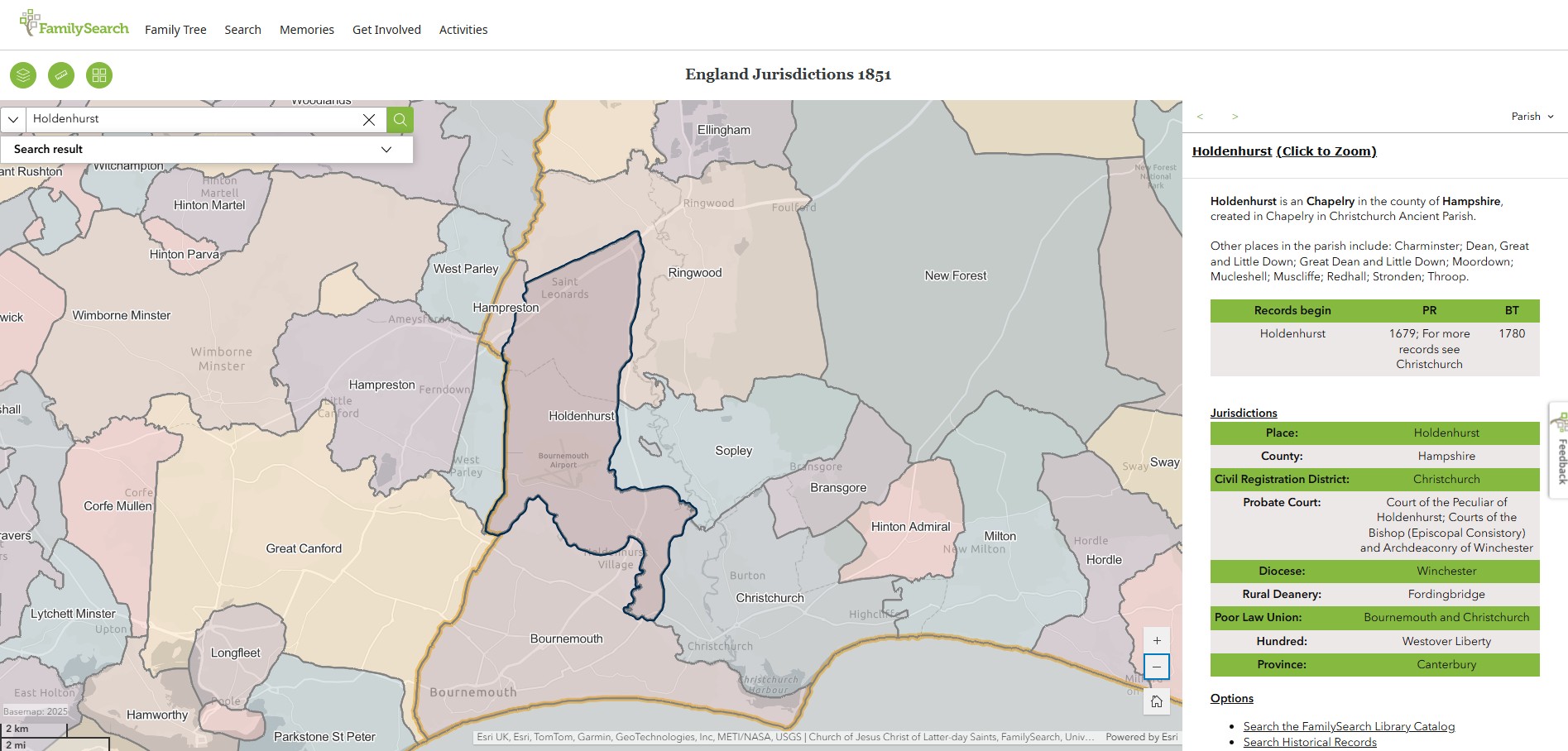
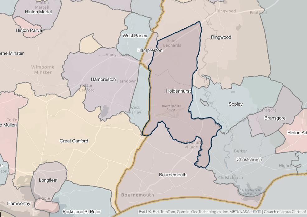
England Jurisdictions 1851 - Holdenhurst
Extract from FamilySearch England Jurisdictions 1851. This link may not work if you don't have a subscription to FamilySearch
Then search for Holdenhurst. Use the Key to select which boundaries you wish to see.
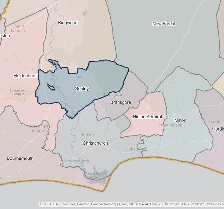
Sopley
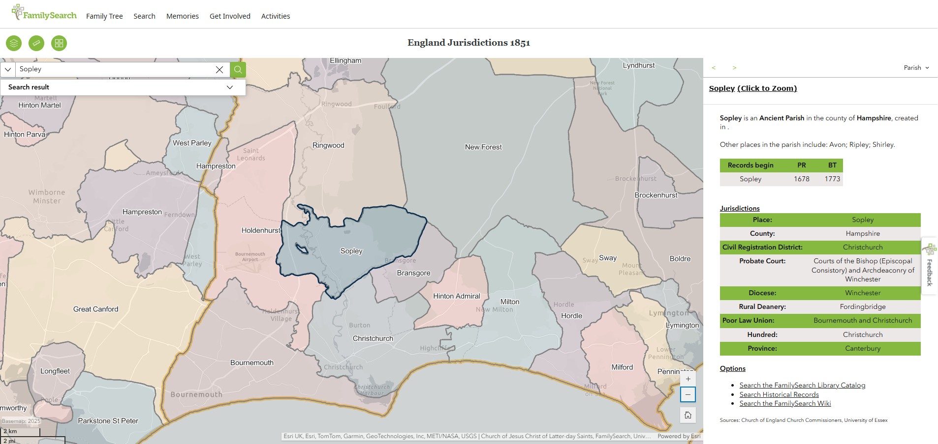
England Jurisdictions 1851 - Sopley
Extract from FamilySearch England Jurisdictions 1851. This link may not work if you don't have a subscription to FamilySearch
Then search for Sopley. Use the Key to select which boundaries you wish to see.
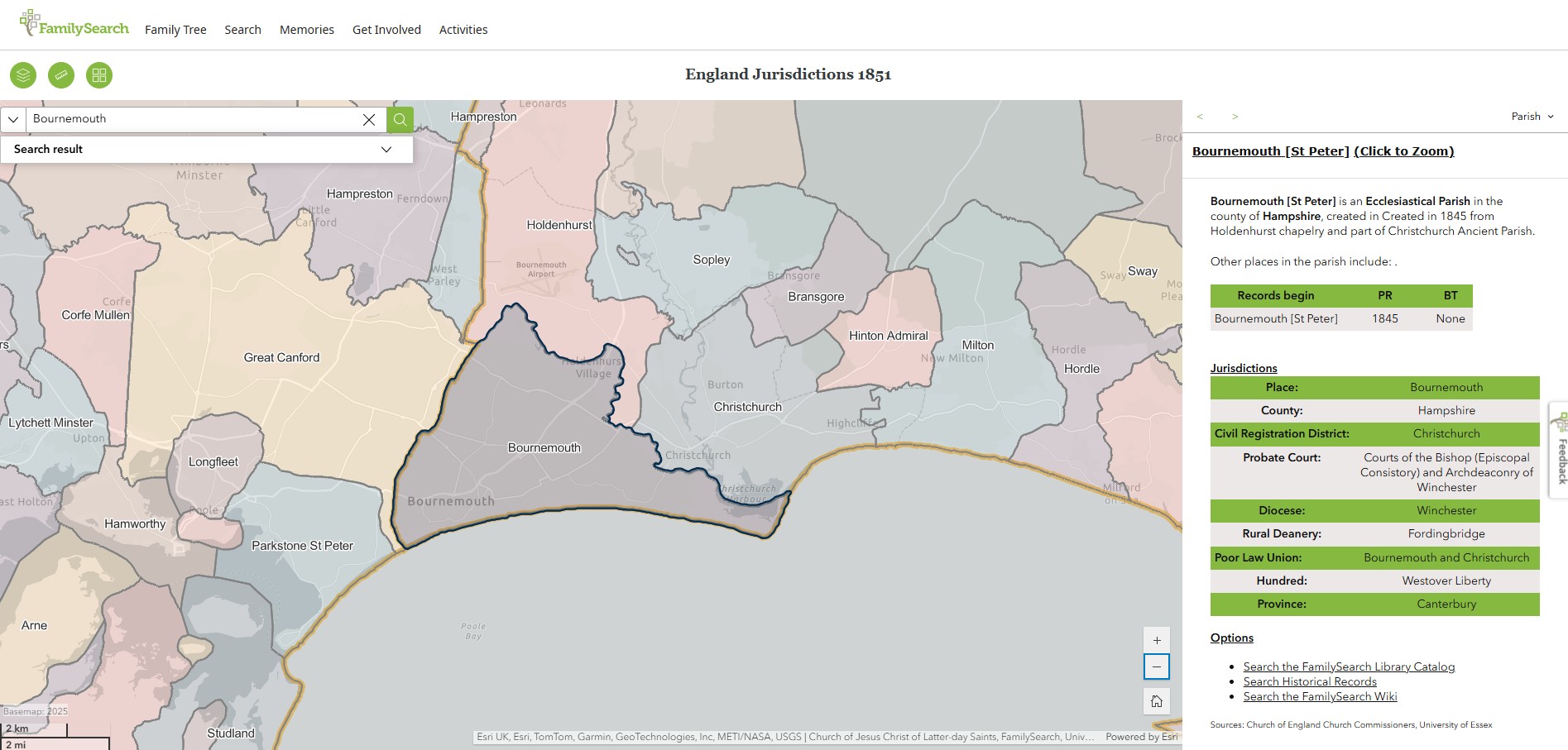
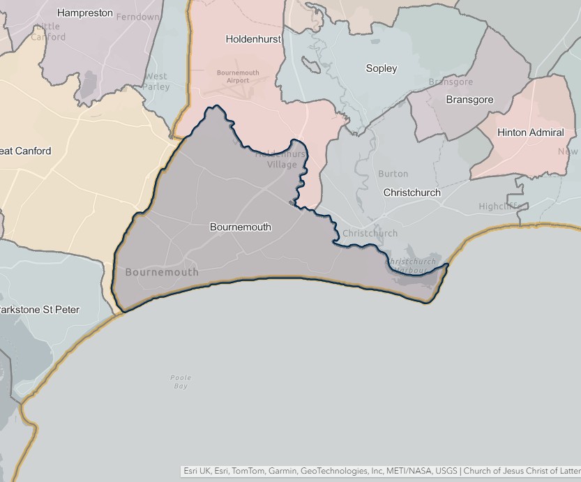
Bournemouth
England Jurisdictions 1851 - Bournemouth
Extract from FamilySearch England Jurisdictions 1851. This link may not work if you don't have a subscription to FamilySearch
Then search for Bournemouth. Use the Key to select which boundaries you wish to see.
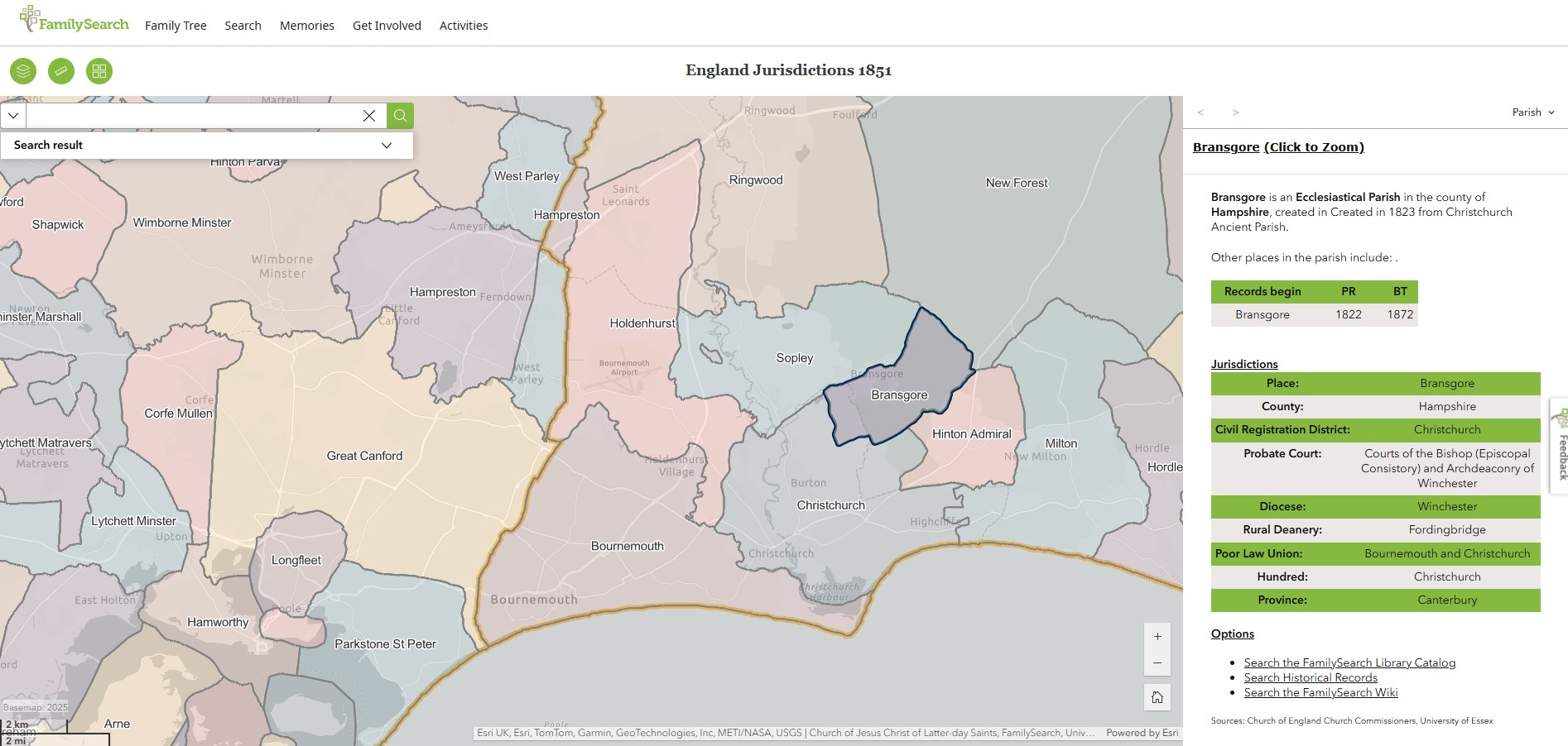
Bransgore
England Jurisdictions 1851 - Bransgore
Extract from FamilySearch England Jurisdictions 1851. This link may not work if you don't have a subscription to FamilySearch
Then search for Bransgore. Use the Key to select which boundaries you wish to see.

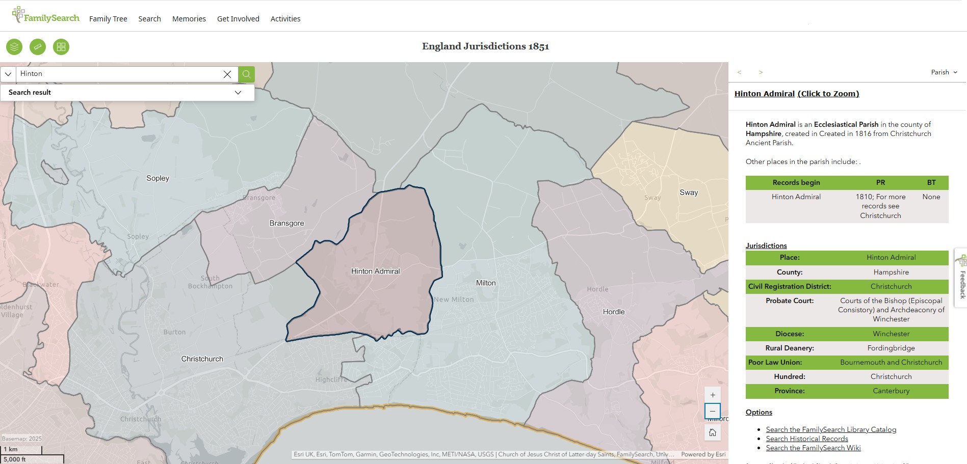
Hinton Admiral
England Jurisdictions 1851 - Hinton Admiral
Extract from FamilySearch England Jurisdictions 1851. This link may not work if you don't have a subscription to FamilySearch
Then search for Hinton Admiral. Use the Key to select which boundaries you wish to see.

Fordingbridge
England Jurisdictions 1851 - CRD Fordingbridge
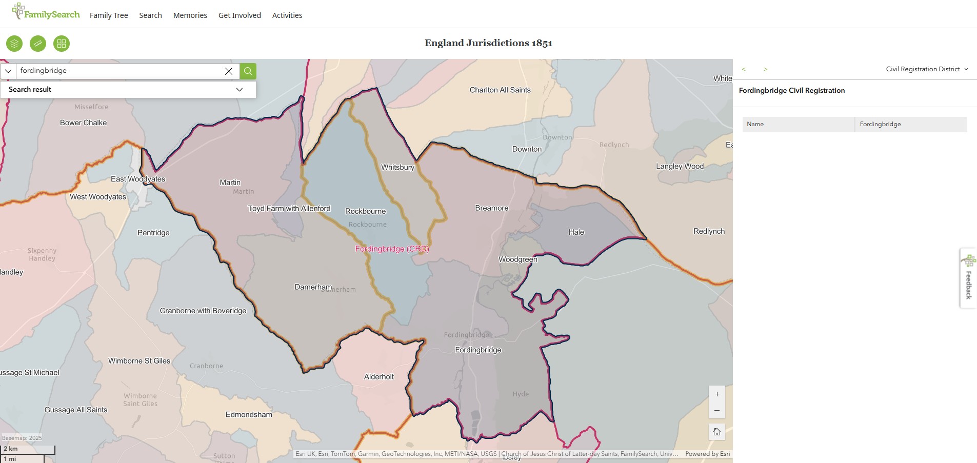
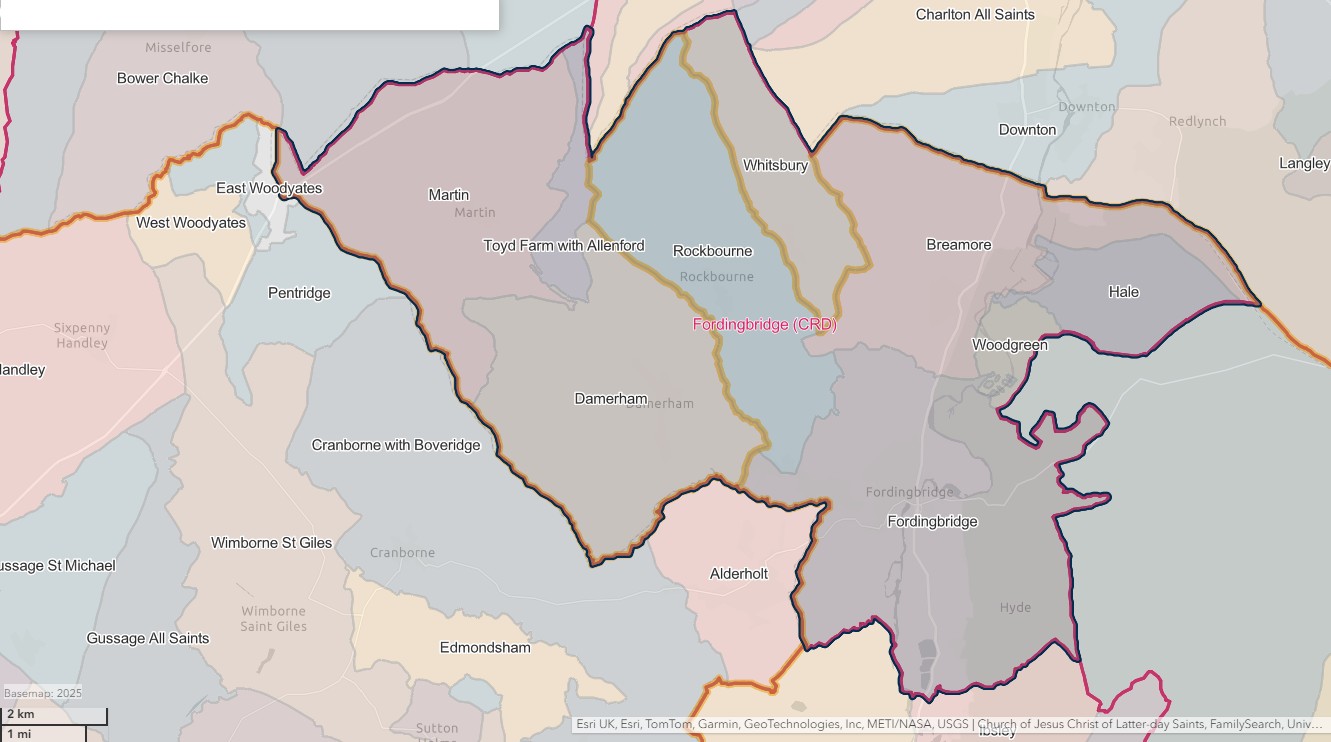
FORDINGBRIDGE REGISTRATION DISTRICT
- Registration County : Hampshire.
- Created : 1.7.1837.
- Abolished : 1.10.1932 (added to Christchurch registration district).
- Sub-districts : Fordingbridge
- GRO volumes : VIII (1837–51); 2b (1852–1932).
- District number : 62f (1841–46); 103 (1847–69); 94 (1870–80); 95 (1881–1908); 97 (1909–32).
Table 1: List of Places in Fordingbridge Registration District
|
Civil Parish |
County |
From |
To |
Comments |
|
Ashley Walk |
1837 |
1932 |
Abolished 1.4.1932 and added to the parish of Fordingbrdge. |
|
|
Breamore |
1837 |
1932 |
See Table 2, note (a). |
|
|
Damerham |
1837 |
1895 |
Transferred from Wiltshire to Hampshire on 30.9.1895. See also Table 2, note (a). |
|
|
1895 |
1932 |
|||
|
Fordingbridge |
1837 |
1932 |
See Table 2, note (a). |
|
|
Hale |
1837 |
1932 |
See Table 2, note (a). |
|
|
Martin |
1837 |
1895 |
Transferred from Wiltshire to Hampshire on 30.9.1895. See also Table 2, note (a). |
|
|
1895 |
1932 |
|||
|
North Charford |
1837 |
1932 |
Abolished 1.4.1932 and divided between the parishes of Hale and Breamore. |
|
|
Rockbourne |
1837 |
1932 |
See Table 2, note (a). |
|
|
South Charford |
1837 |
1932 |
Abolished 1.4.1932 and divided between the parishes of Breamore and Hale. |
|
|
Toyd Farm & Allenford |
1837 |
1895 |
Transferred from Wiltshire to Hampshire on 30.9.1895. Abolished 1.4.1932 and added to the parish of Martin. |
|
|
1895 |
1932 |
|||
|
Whitsbury |
1837 |
1895 |
Transferred from Wiltshire to Hampshire on 30.9.1895. See also Table 2, note (a). |
|
|
1895 |
1932 |
|||
|
Woodgreen |
1837 |
1932 |
See Table 2, note (a). |
Table 2: Boundary Changes affecting Fordingbridge Registration District
|
Date of Change |
Note |
Description of Change |
Population transferred |
|
1.10.1932 (abolished) |
(a) |
Lost the parishes of Breamore, Damerham, Fordingbridge, Hale, Martin, Rockbourne, Whitsbury and Woodgreen, to Christchurch registration district. |
6468 in 1931 |
The Parishes within the Civil Registration District as at 1851 (generally the same as the 1837 entries above)
Ashley Walk
England Jurisdictions 1851 - Ashley Walk
Extract from FamilySearch England Jurisdictions 1851. This link may not work if you don't have a subscription to FamilySearch
Then search for Ashley Walk. Use the Key to select which boundaries you wish to see.
However, to date I have not found Ashley Walk on the England Jurisdictions 1851 Mapping,
Ashley Walk reference in New Forest National Park
In 1868 a new civil parish called Ashley Walk was created, which incorporated much of what is now the eastern half of the current parishes of Godshill and Hyde; the new parish did not include Godshill village, which remained part of Fordingbridge. The civil parish of Ashley Walk lasted until 1932.
GB Historical GIS / University of Portsmouth, Ashley Walk CP through time | Boundaries of Parish-level Unit, A Vision of Britain through Time.
URL: https://www.visionofbritain.org.uk/unit/10203867/boundary
Date accessed: 26th June 2025
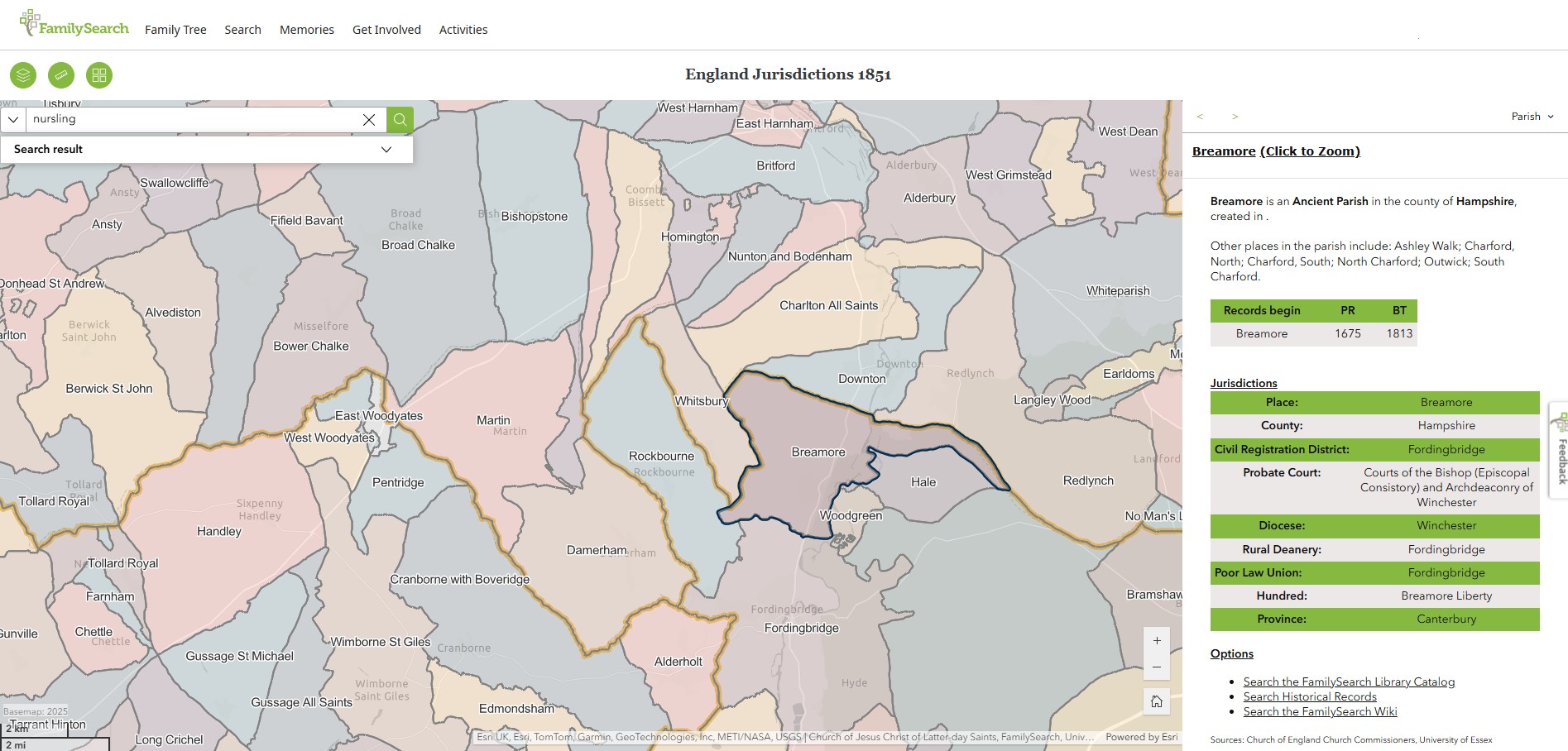
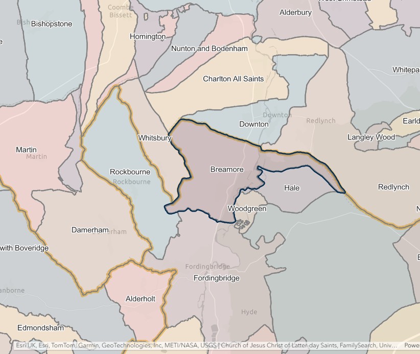
Breamore
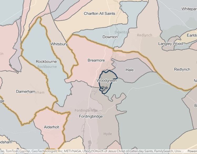
England Jurisdictions 1851 - Breamore
Extract from FamilySearch England Jurisdictions 1851. This link may not work if you don't have a subscription to FamilySearch
Then search for Breamore. Use the Key to select which boundaries you wish to see.
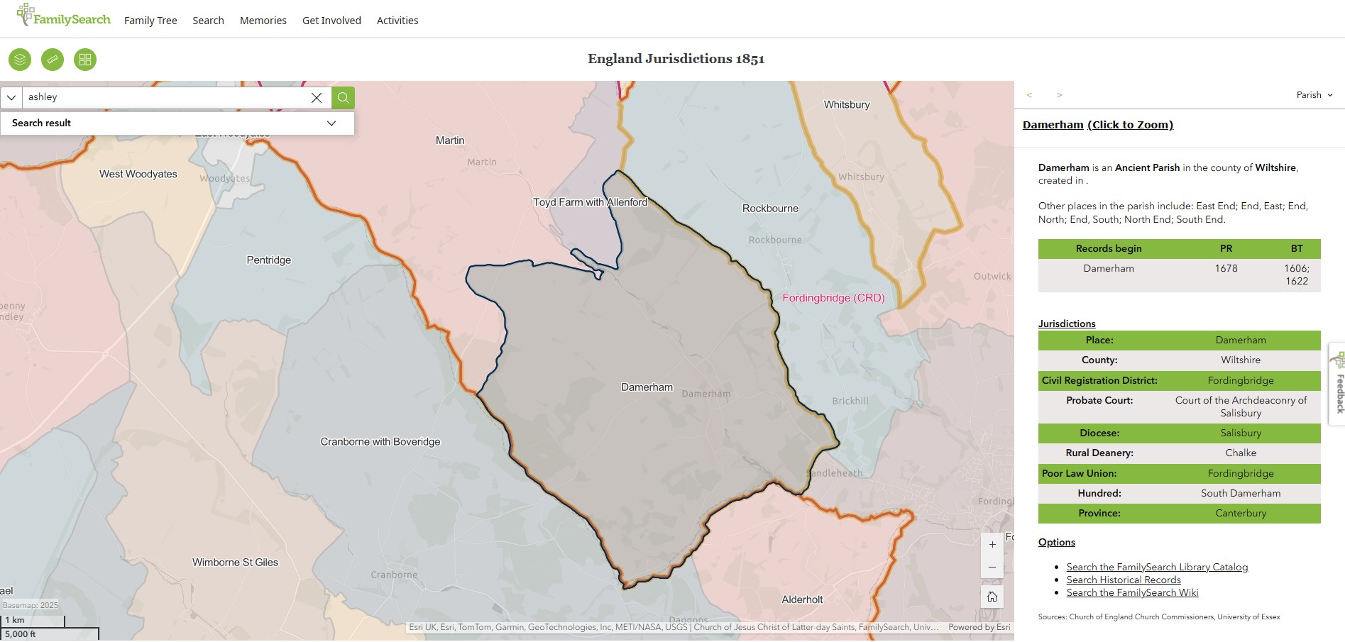
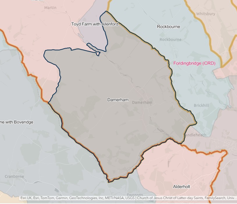
Damerham
England Jurisdictions 1851 - Damerham
Extract from FamilySearch England Jurisdictions 1851. This link may not work if you don't have a subscription to FamilySearch
Then search for Damerham. Use the Key to select which boundaries you wish to see.
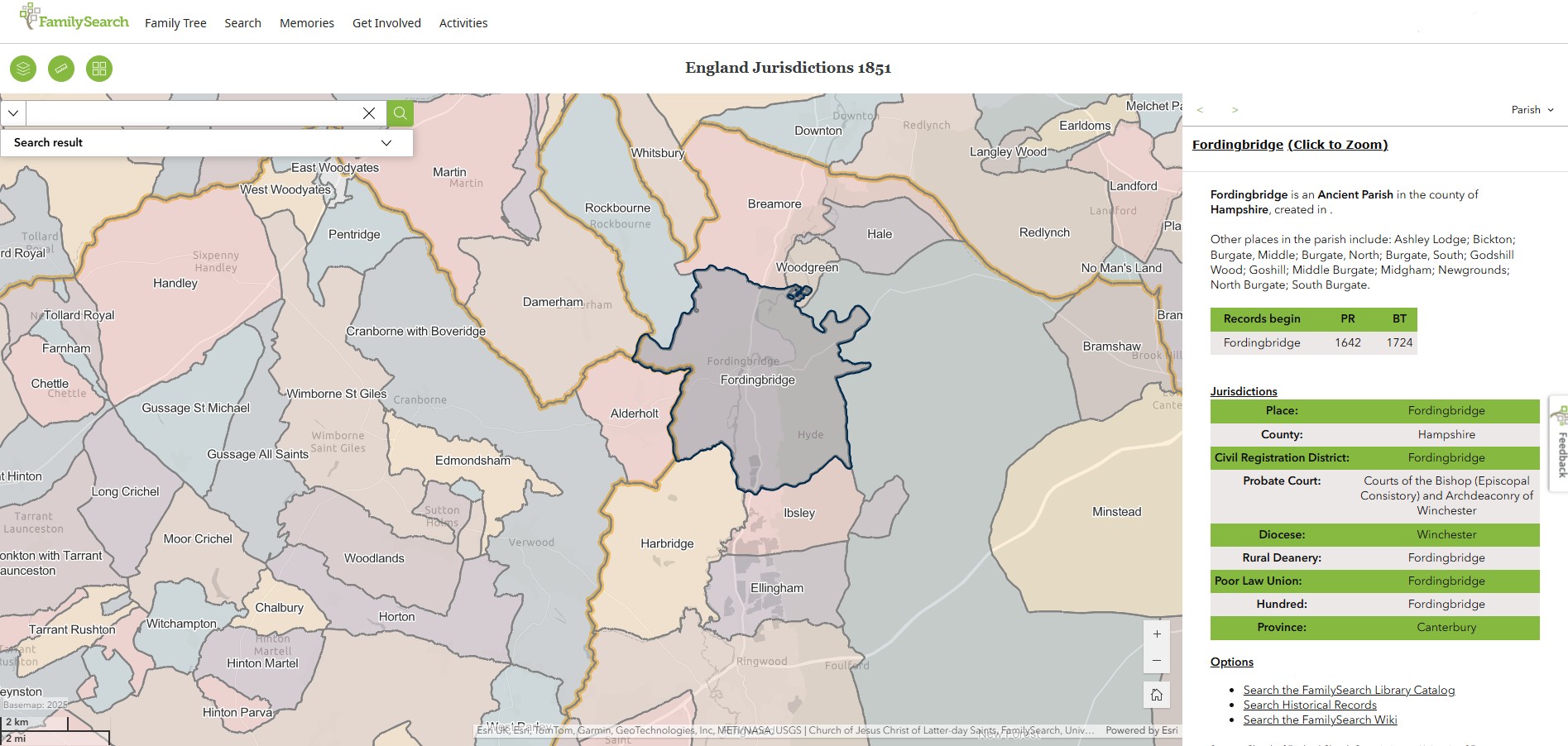
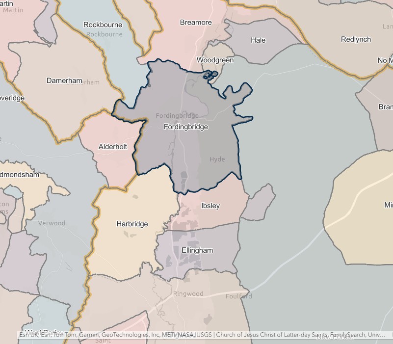
Fordingbridge
England Jurisdictions 1851 - Fordingbridge
Extract from FamilySearch England Jurisdictions 1851. This link may not work if you don't have a subscription to FamilySearch
Then search for Fordingbridge. Use the Key to select which boundaries you wish to see.
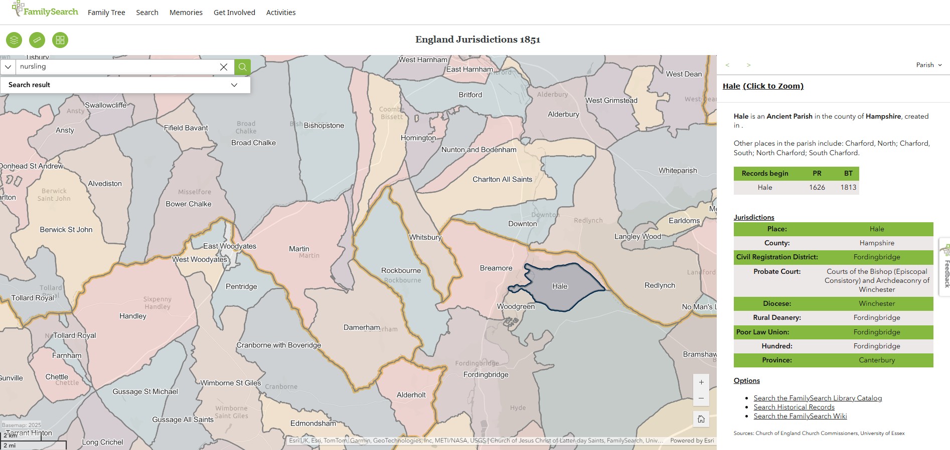
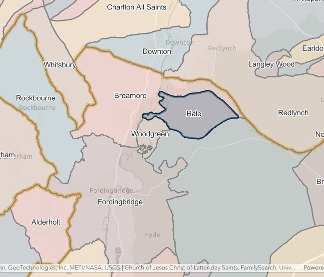
Hale
England Jurisdictions 1851 - Hale
Extract from FamilySearch England Jurisdictions 1851. This link may not work if you don't have a subscription to FamilySearch
Then search for Hale. Use the Key to select which boundaries you wish to see.
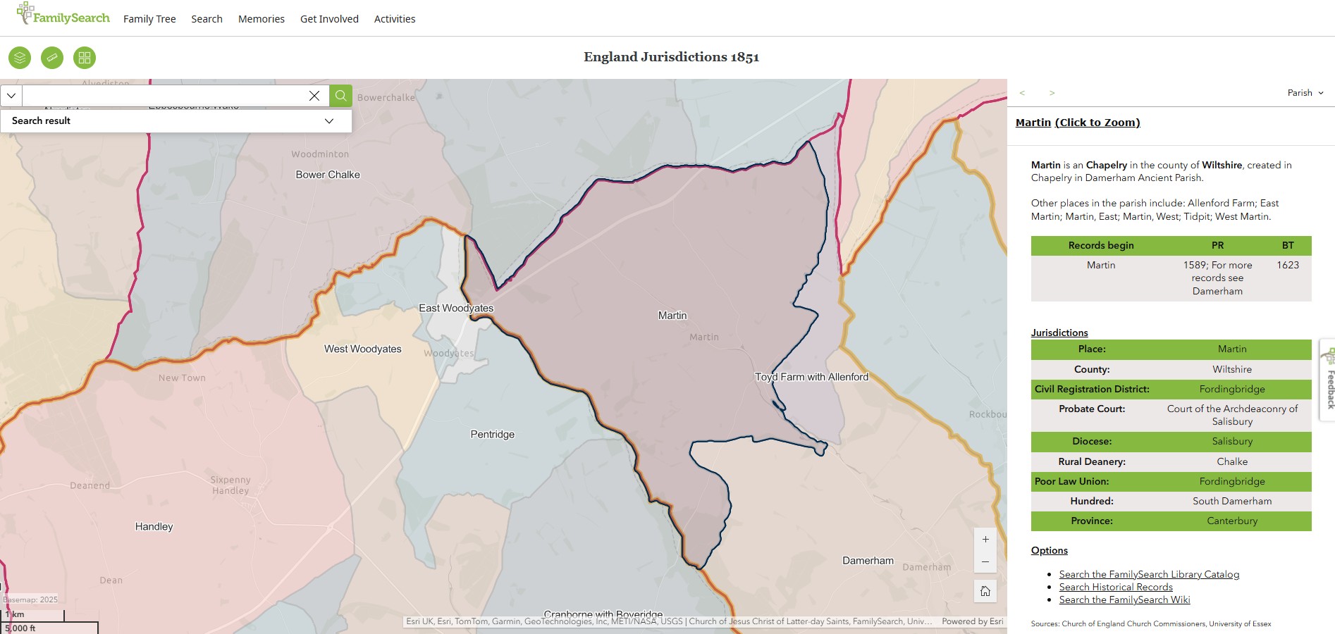
Martin
England Jurisdictions 1851 - Martin
Extract from FamilySearch England Jurisdictions 1851. This link may not work if you don't have a subscription to FamilySearch
Then search for Martin. Use the Key to select which boundaries you wish to see.
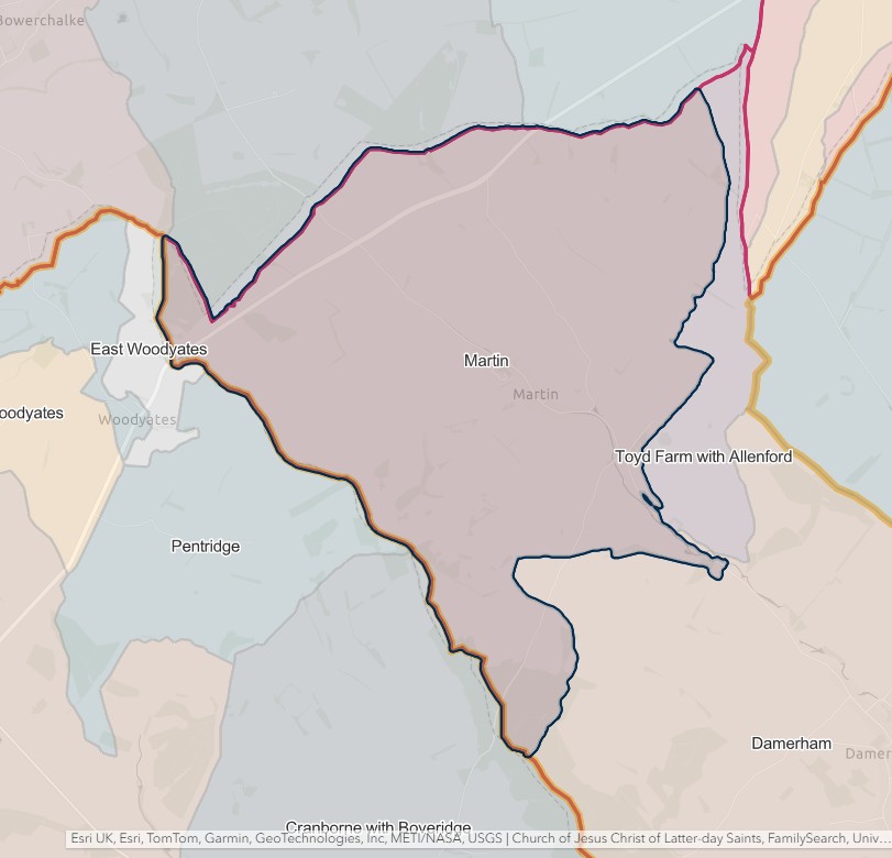
North Charford
England Jurisdictions 1851 - North Charford
Extract from FamilySearch England Jurisdictions 1851. This link may not work if you don't have a subscription to FamilySearch
Then search for North Charford. Use the Key to select which boundaries you wish to see.
However, North and South Charford are shown as being part of Breamore on the England Jurisdictions 1851 Mapping.
'Parishes: North Charford with South Charford', in A History of the County of Hampshire: Volume 4, ed. William Page (London, 1911), British History Online https://www.british-history.ac.uk/vch/hants/vol4/pp560-563 [accessed 26 June 2025].
In 1831 the parish of North Charford included 'the tithing of South Charford,' but both were originally and are now separate, though small and decayed parishes, South Charford possessing no village and North Charford only a few scattered houses and the old manor-house, converted in 1880 by Professor Wrightson into an agricultural college. North Charford contains 874½ acres, of which about two-thirds are arable land, and the remainder is permanent grass and woodland. South Charford contains 862½ acres, of which 350 acres are arable, about 400 permanent grass and 100 woodland. The Avon flows through both parishes from north to south and the land on the banks of the river is flat, but from the valley there is a gradual rise east and west respectively to 392 ft. and 383 ft. above the ordnance datum.
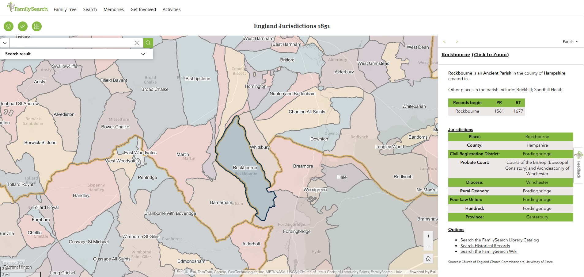
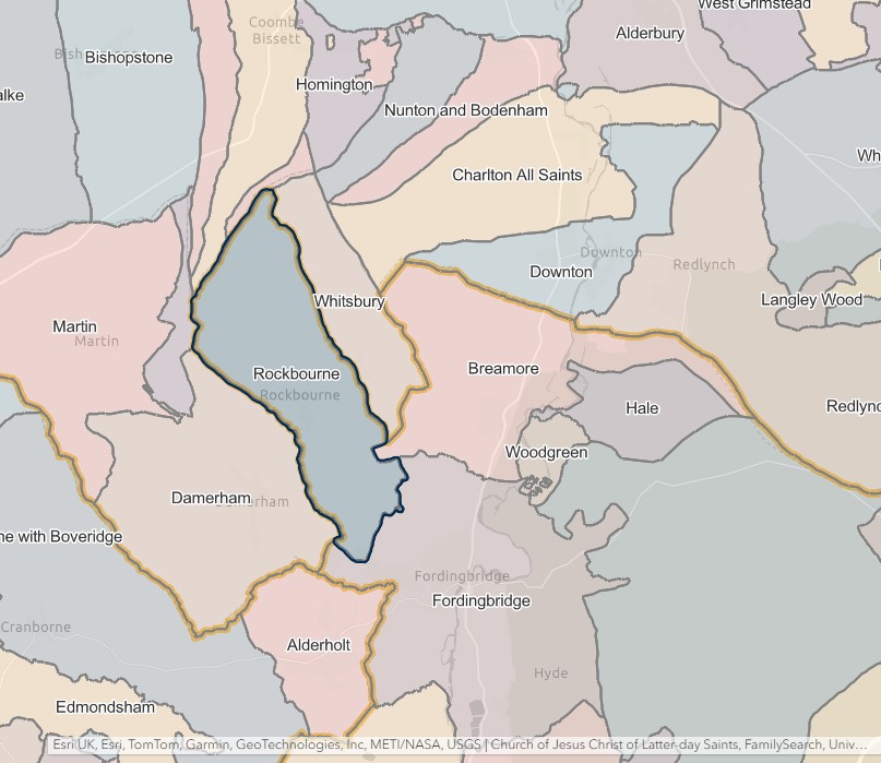
Rockbourne
England Jurisdictions 1851 - Rockbourne
Extract from FamilySearch England Jurisdictions 1851. This link may not work if you don't have a subscription to FamilySearch
Then search for Rockbourne. Use the Key to select which boundaries you wish to see.
South Charford
England Jurisdictions 1851 - South Charford
Extract from FamilySearch England Jurisdictions 1851. This link may not work if you don't have a subscription to FamilySearch
Then search for South Charford. Use the Key to select which boundaries you wish to see.
However, North and South Charford are shown as being part of Breamore on the England Jurisdictions 1851 Mapping.
'Parishes: North Charford with South Charford', in A History of the County of Hampshire: Volume 4, ed. William Page (London, 1911), British History Online https://www.british-history.ac.uk/vch/hants/vol4/pp560-563 [accessed 26 June 2025].
In 1831 the parish of North Charford included 'the tithing of South Charford,' but both were originally and are now separate, though small and decayed parishes, South Charford possessing no village and North Charford only a few scattered houses and the old manor-house, converted in 1880 by Professor Wrightson into an agricultural college. North Charford contains 874½ acres, of which about two-thirds are arable land, and the remainder is permanent grass and woodland. South Charford contains 862½ acres, of which 350 acres are arable, about 400 permanent grass and 100 woodland. The Avon flows through both parishes from north to south and the land on the banks of the river is flat, but from the valley there is a gradual rise east and west respectively to 392 ft. and 383 ft. above the ordnance datum.
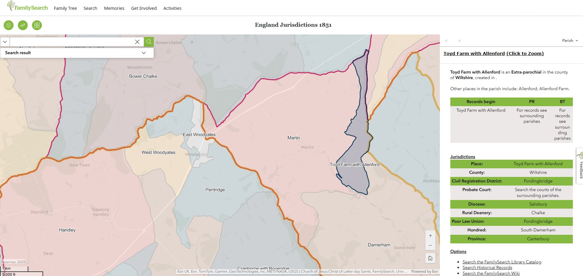
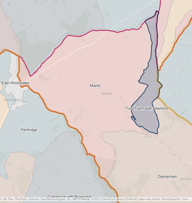
Toyd Farm & Allenford
England Jurisdictions 1851 - Toyd Farm with Allenford
Extract from FamilySearch England Jurisdictions 1851. This link may not work if you don't have a subscription to FamilySearch
Then search for Toyd Farm with Allenford. Use the Key to select which boundaries you wish to see.
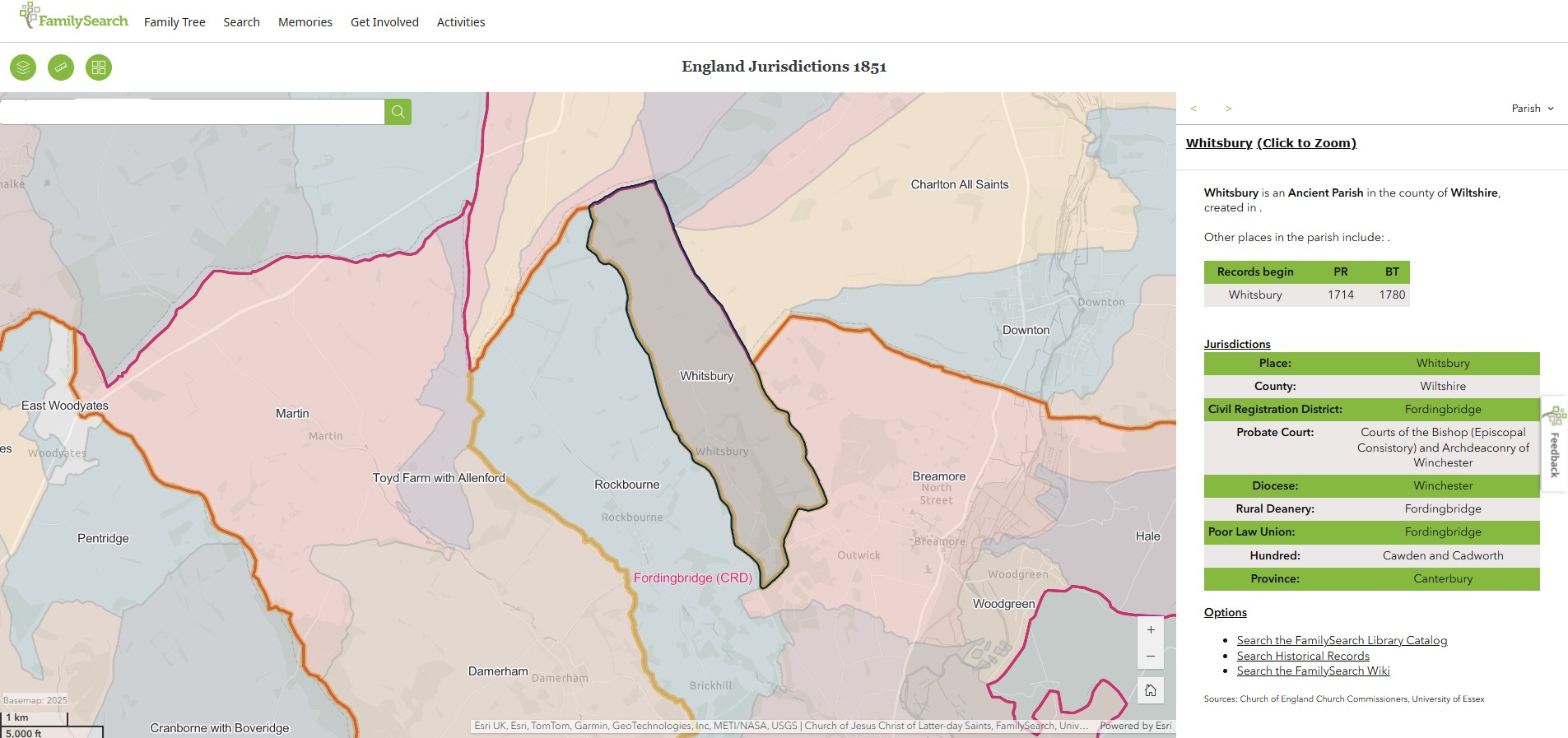
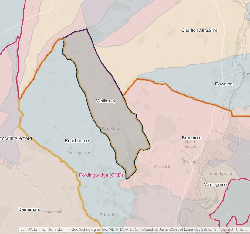
Whitsbury
England Jurisdictions 1851 - Whitsbury
Extract from FamilySearch England Jurisdictions 1851. This link may not work if you don't have a subscription to FamilySearch
Then search for Whitsbury. Use the Key to select which boundaries you wish to see.
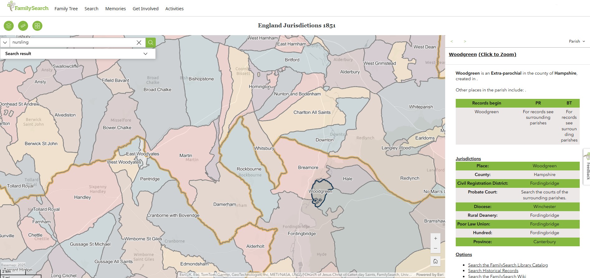
Woodgreen
England Jurisdictions 1851 - Woodgreen
Extract from FamilySearch England Jurisdictions 1851. This link may not work if you don't have a subscription to FamilySearch
Then search for Woodgreen. Use the Key to select which boundaries you wish to see.
Lymington
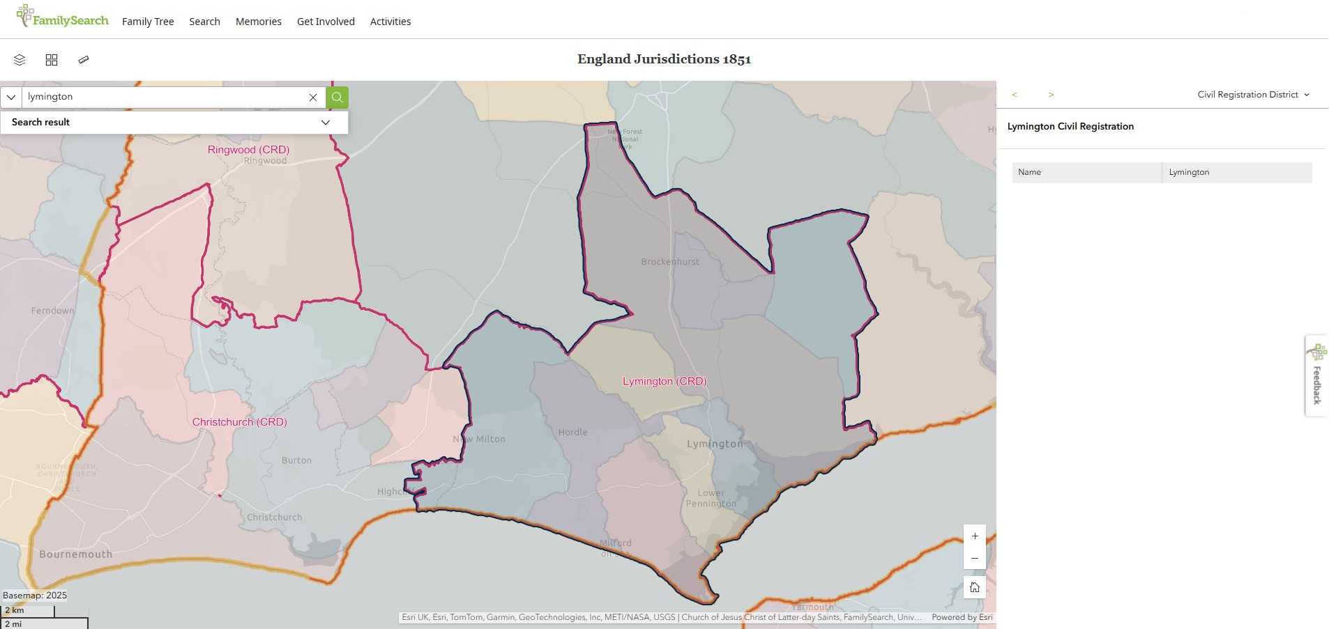
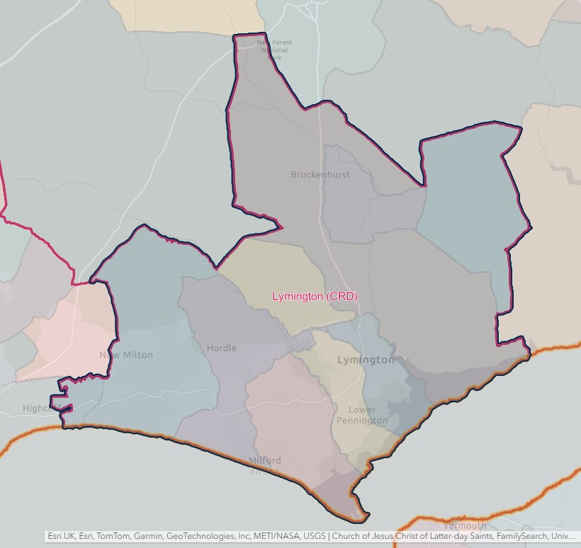
England Jurisdictions 1851 - CRD Lymington
LYMINGTON REGISTRATION DISTRICT
- Registration County : Hampshire.
- Created : 1.7.1837.
- Abolished : 1.10.1932 (added to New Forest registration district).
- Sub-districts : Lymington; Milford.
- GRO volumes : VIII (1837–51); 2b (1852–1932).
- District number : 62c (1841–46); 100 (1847–69); 91 (1870–80); 92 (1881–1908); 94 (1909–32).
Table 1: List of Places in Lymington Registration District
|
Civil Parish |
County |
From |
To |
Comments |
|
Boldre |
1837 |
1932 |
See Table 2, note (b). |
|
|
Brockenhurst |
1837 |
1932 |
See Table 2, note (b). |
|
|
Christchurch East |
1894 |
1895 |
That part which until 1894 formed part of the parish of Milton. See also Table 2, note (a). |
|
|
East Boldre |
1929 |
1932 |
Created 1.4.1929 out of the parish of Boldre. See also Table 2, note (b). |
|
|
Hordle |
1837 |
1932 |
Abolished 1.4.1932 and divided between the parishes of Lymington and Sway. |
|
|
Lymington |
1837 |
1932 |
See Table 2, note (b). |
|
|
Milford |
1837 |
1911 |
Abolished 1.4.1911 to become the separate parishes of Milford on Sea and Pennington. |
|
|
Milford on Sea |
1911 |
1932 |
Created 1.4.1911 out of the parish of Milford. Abolished 1.4.1932 and added to the parish of Lymington. |
|
|
Milton |
1837 |
1932 |
Abolished 1.4.1932 and added to the parish of Lymington. See also Table 2, note (a). |
|
|
Pennington |
1911 |
1932 |
Created 1.4.1911 out of the parish of Milford. Abolished 1.4.1932 and added to the parish of Lymington. |
|
|
Rhinefield |
1837 |
1932 |
See Table 2, note (b). |
|
|
Sway |
1878 |
1932 |
Created 29.9.1878 out of the parish of Boldre. See also Table 2, note (b). |
Table 2: Boundary Changes affecting Lymington Registration District
|
Date of Change |
Note |
Description of Change |
Population transferred |
|
1.6.1895 |
(a) |
Lost the part in the parish of Christchurch East (which until 1894 formed part of the parish of Milton) to Christchurch registration district. |
403 in 1891 |
|
1.10.1932 (abolished) |
(b) |
Lost the parishes of Boldre, Brockenhurst, East Boldre, Lymington, Rhinefield and Sway, to New Forest registration district. |
22386 in 1931 |
The Parishes within the Civil Registration District as at 1851 (generally the same as the 1837 entries above)
Boldre
England Jurisdictions 1851 - Boldre
Extract from FamilySearch England Jurisdictions 1851. This link may not work if you don't have a subscription to FamilySearch
Then search for Boldre. Use the Key to select which boundaries you wish to see.

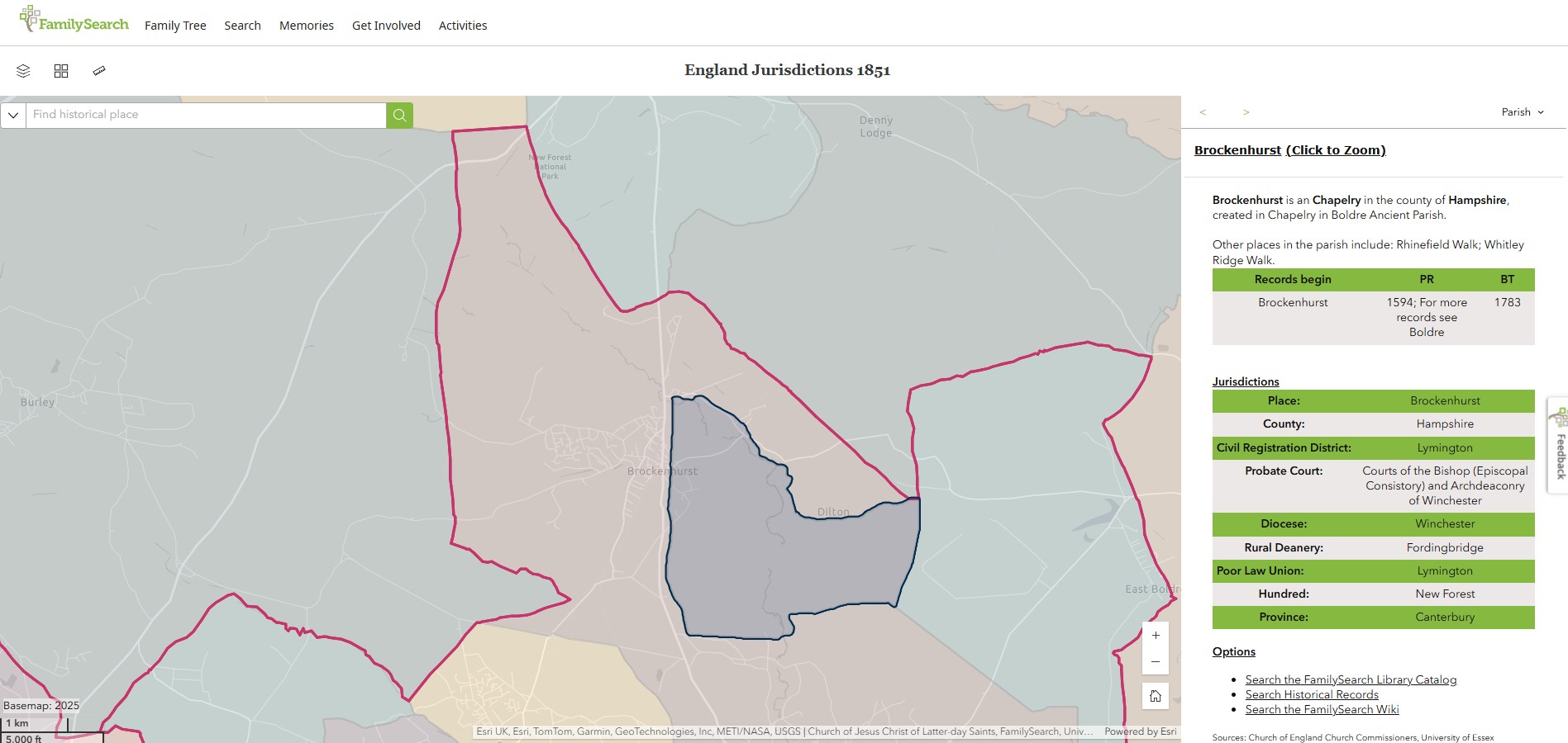
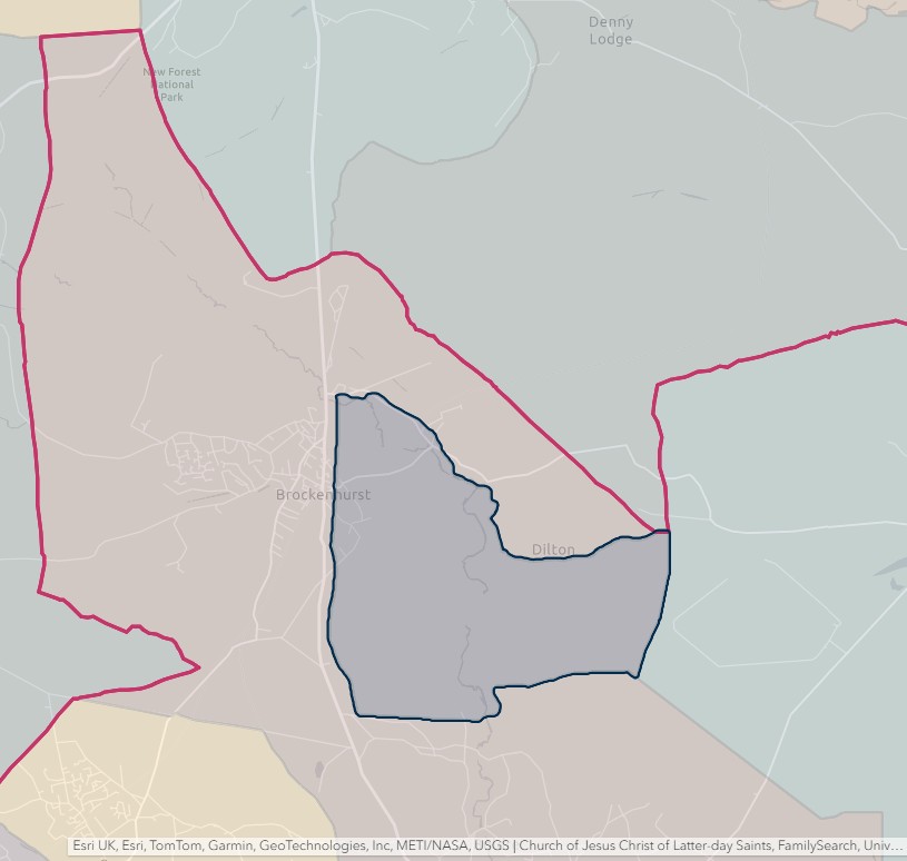
Brockenhurst
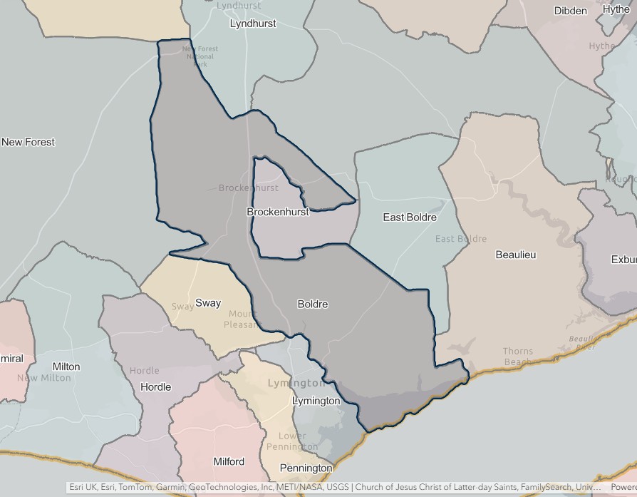
England Jurisdictions 1851 - Brockenhurst
Extract from FamilySearch England Jurisdictions 1851. This link may not work if you don't have a subscription to FamilySearch
Then search for Brockenhurst. Use the Key to select which boundaries you wish to see.
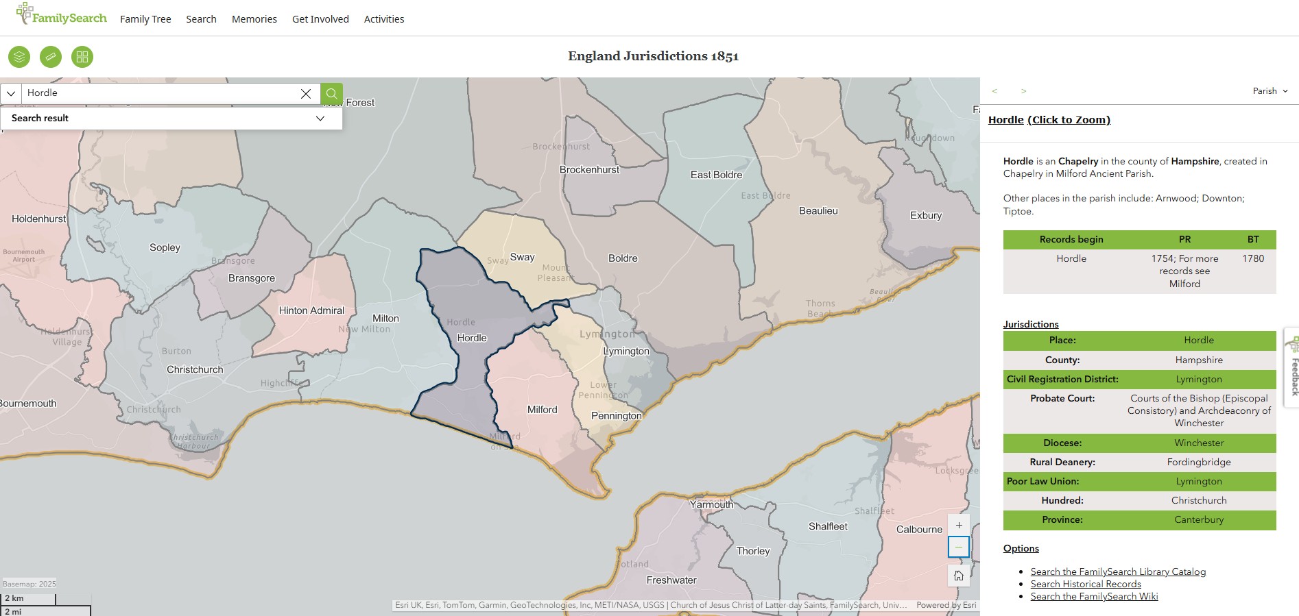
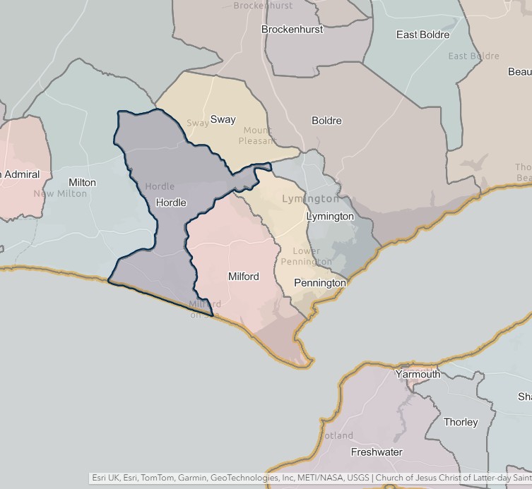
Hordle
England Jurisdictions 1851 - Hordle
Extract from FamilySearch England Jurisdictions 1851. This link may not work if you don't have a subscription to FamilySearch
Then search for Hordle. Use the Key to select which boundaries you wish to see.
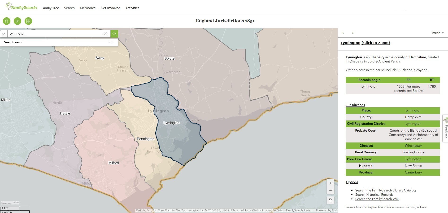
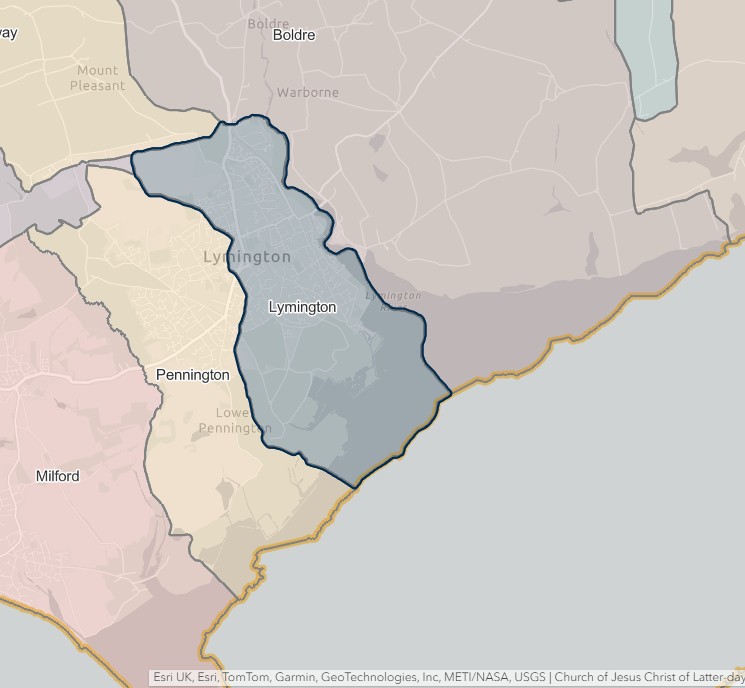
Lymington
England Jurisdictions 1851 - Lymington
Extract from FamilySearch England Jurisdictions 1851. This link may not work if you don't have a subscription to FamilySearch
Then search for Lymington. Use the Key to select which boundaries you wish to see.
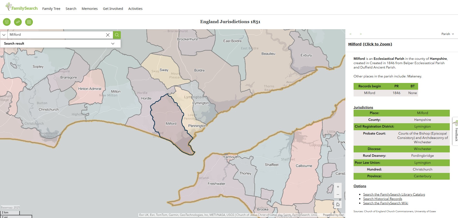
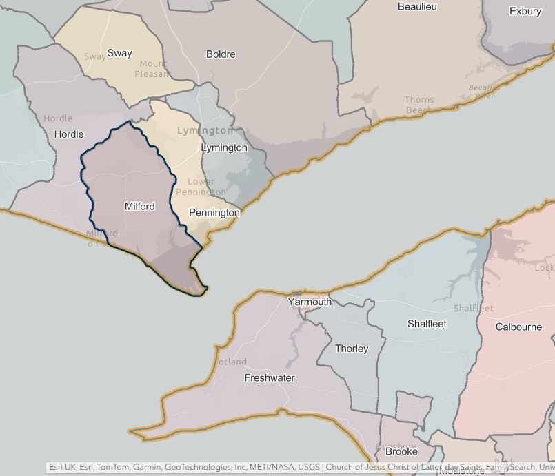
Milford
England Jurisdictions 1851 - Milford
Extract from FamilySearch England Jurisdictions 1851. This link may not work if you don't have a subscription to FamilySearch
Then search for Milford. Use the Key to select which boundaries you wish to see.
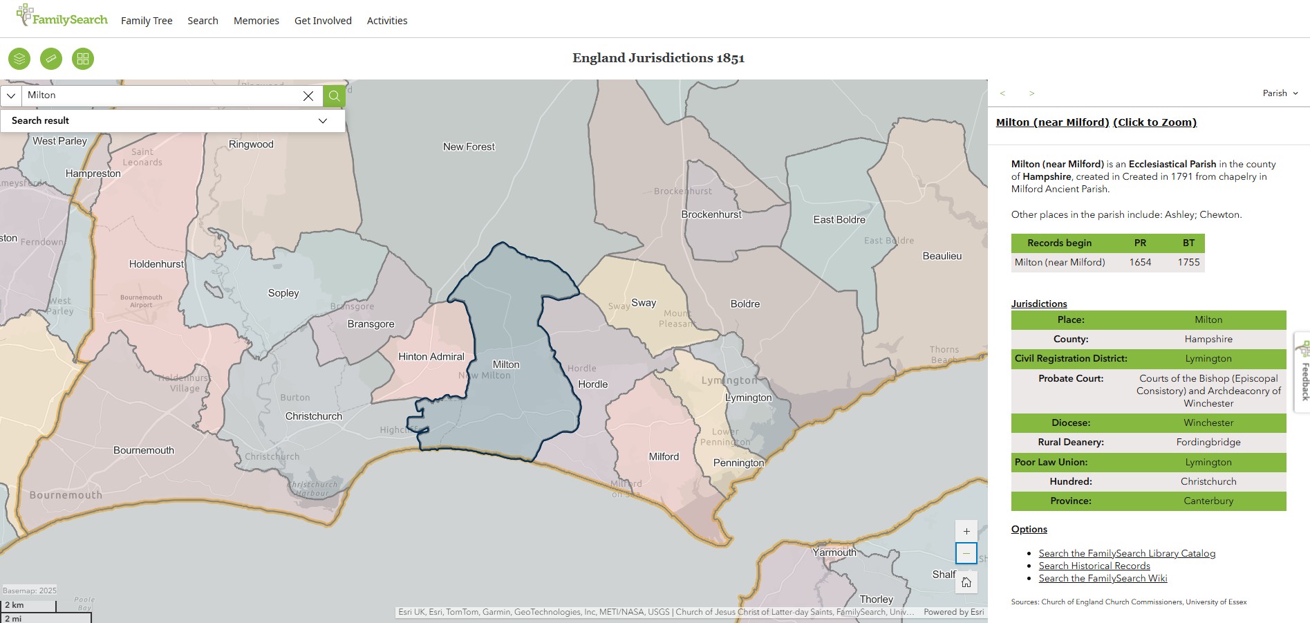
Milton
England Jurisdictions 1851 - Milton
Extract from FamilySearch England Jurisdictions 1851. This link may not work if you don't have a subscription to FamilySearch
Then search for Milton. Use the Key to select which boundaries you wish to see.

Rhinefield
England Jurisdictions 1851 - Rhinefield
Extract from FamilySearch England Jurisdictions 1851. This link may not work if you don't have a subscription to FamilySearch
Then search for Rhinefield. Use the Key to select which boundaries you wish to see.
However, Rhinefield is not listed in the England Jurisdictions 1851 Mapping.
'Parishes: Brockenhurst', in A History of the County of Hampshire: Volume 4, ed. William Page (London, 1911), British History Online https://www.british-history.ac.uk/vch/hants/vol4/pp626-629 [accessed 26 June 2025].
BROCKENHURST
The parish of Brockenhurst (Broceste, xi cent.; Brokenst, xiii cent.; Brokehurst, xiv cent.; Brocknes, xvi cent.; Brocknest, xvii cent.) contains 6,903 acres of land, of which 37 are covered with water. The village is situated on high ground on the main road from Lyndhurst to Lymington, and owing to its situation is extremely picturesque. The parish contains large patches of wood and moorland and the timber is exceptionally fine. There is a station on the London and South Western Railway. The Boldre or Lymington River after flowing through the parish in a south-easterly direction passes out into Boldre and thence to the Solent.
Brockenhurst Church, one of the only two churches in the New Forest mentioned in the Domesday Survey, is built on rising ground on the western edge of Beaulieu Heath, a short distance out of the village. It is picturesquely surrounded by trees, and in the churchyard is a remarkably fine yew tree, and to the south-west near the church is the hollow stump of a still older yew.
Brockenhurst Park, containing 425 acres of land the property of Mr. E. J. H. Morant, the lord of the manor, descends eastwards from the village to the Boldre River. Rhinefield is the residence of Mr. Edward Lionel Walker-Munro, R.N.; Lady Cross Lodge of the Hon. Sir Charles John Darling, Justice of the High Court. New Park, which is Crown property, is mentioned as early as 1484, when 'the custody of the king's park called New Park' was granted to John Hoton alias Huton. In a survey of 1615 it is described as 'divided with pales, lodges and ditches into several meadows and pastures and containing 416 acres and 12 perches, with lodge stables and appurtenances worth yearly £100: the timber trees and beech trees in the park being in number 498. The park and lodge are in the tenure and occupation of Sir George Carye, who hath fully stocked the same with cattle and horses. The oak and beech trees within the park marked out for the use of the navy are in number 270.' In 1670 it was added to by Charles II for the reception of red deer from France and subsequently granted as a farm to the Duke of Bedford, the Lord Warden. Carys, the residence and property of the Rev. Frederick Hermann Bowden-Smith, probably takes its name from John Cary, who held the office of riding forester to Charles II.
There are 530 acres of woodland, 1,421 of grass and 548 of arable land. The soil is marl and loam, the subsoil gravel and in some parts clay.
Rhinefield is a township consisting of 7,360 acres 2 miles south-west from Brockenhurst station, constituted by an Order of the Poor Law Board 23 November 1868, and consisting of parts of Rhinefield and Wilverley Walks in the New Forest, which were extra-parochial before the passing of the New Forest Poor Law Act of 1866.
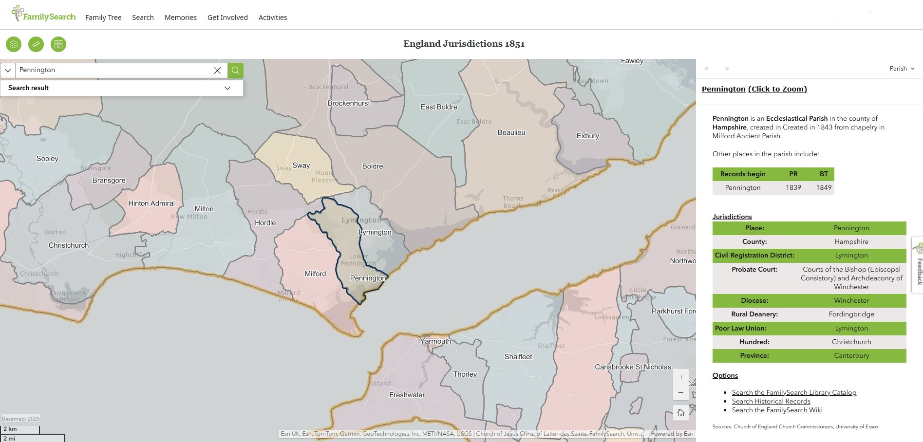
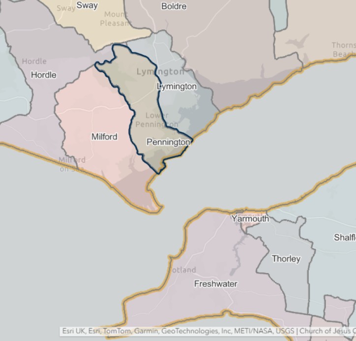
Pennington
England Jurisdictions 1851 - Pennington
Extract from FamilySearch England Jurisdictions 1851. This link may not work if you don't have a subscription to FamilySearch
Then search for Pennington. Use the Key to select which boundaries you wish to see.
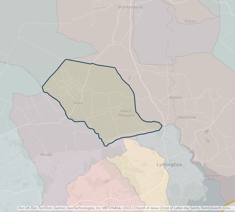
Sway
England Jurisdictions 1851 - Sway
Extract from FamilySearch England Jurisdictions 1851. This link may not work if you don't have a subscription to FamilySearch
Then search for Sway. Use the Key to select which boundaries you wish to see.

New Forest
England Jurisdictions 1851 - CRD New Forest
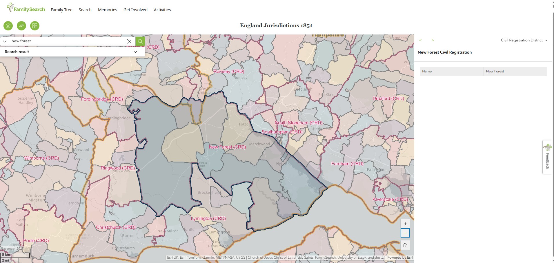
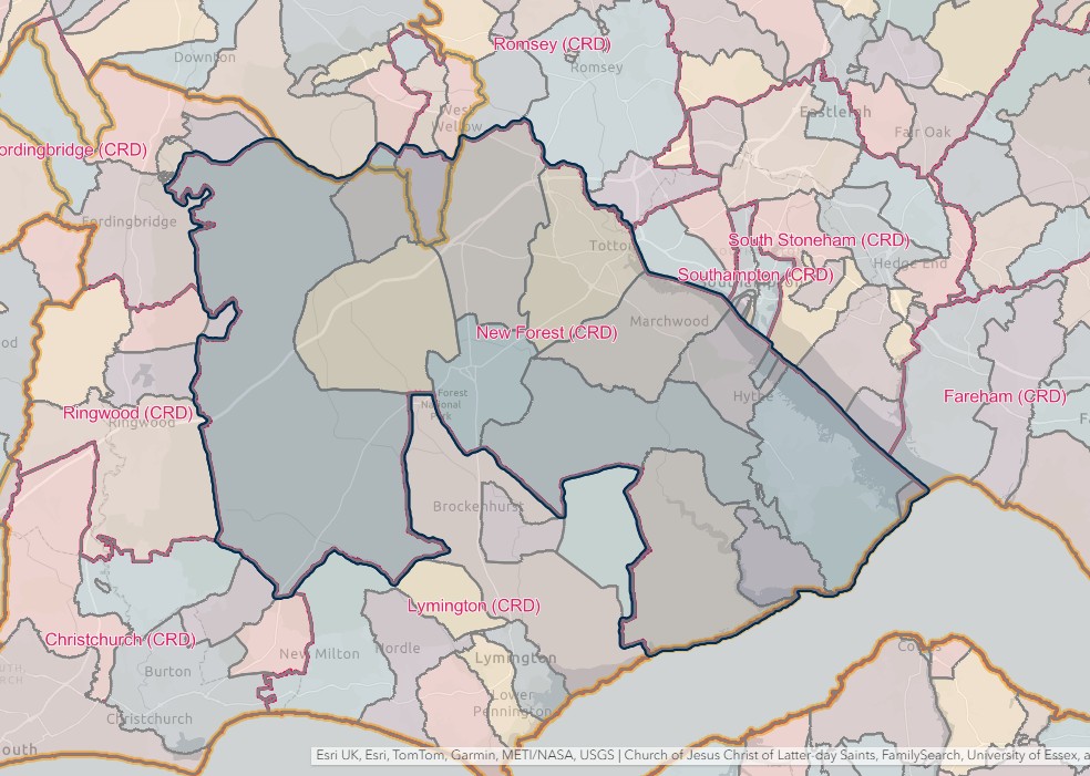
NEW FOREST REGISTRATION DISTRICT
- Registration County : Hampshire.
- Created : 1.7.1837.
- Abolished : 1.4.2008 (added to Hampshire registration district).
- Sub-districts : Eling; Fawley; Lyndhurst; Lymington; New Forest.
- GRO volumes : VIII (1837–51); 2b (1852–1946); 6B (1946–74); 20 (1974–92).
- District number : 62b (1841–46); 104 (1847–69); 95 (1870–80); 96 (1881–1908); 98 (1909–46); 306 (1946–74); 494 (1974–2008).
Table 1: List of Places in New Forest Registration District
|
Civil Parish |
County |
From |
To |
Comments |
|
Ashurst & Colbury |
1985 |
2008 |
Created 1.4.1985 out of the parish of Toton & Eling. See also Table 2, note (h). |
|
|
Beaulieu |
1837 |
2008 |
See Table 2, note (h). |
|
|
Boldre |
1932 |
2008 |
See Table 2, notes (b) and (h). |
|
|
Bramshaw |
1837 |
2008 |
On 30.9.1895 the part in Wiltshire became the separate parish of East Bramshaw, so that thereafer Bramshaw was entirely in Hampshire. See also Table 2, notes (e) and (h). |
|
|
1895 |
1895 |
|||
|
Breamore |
1999 |
2008 |
See Table 2, notes (g) and (h). |
|
|
Brockenhurst |
1932 |
2008 |
See also Table 2, notes (b) and (h). |
|
|
Burley |
1999 |
2008 |
See Table 2, notes (g) and (h). |
|
|
Bransgore |
1999 |
2008 |
See Table 2, notes (g) and (h). |
|
|
Colbury |
1894 |
1934 |
Created 30.9.1894 out of the parish of Eling. Abolished 1.10.1934 and divided between the parishes of Denny Lodge and Eling. |
|
|
Copythorne |
1894 |
2008 |
Created 30.9.1894 out of the parish of Eling. See also Table 2, note (h). |
|
|
Damerham |
1999 |
2008 |
See Table 2, notes (g) and (h). |
|
|
Denny Lodge |
1837 |
2008 |
See Table 2, note (h). |
|
|
Dibden |
1837 |
1984 |
Renamed 1.8.1984 to become the parish of Hythe & Dibden. See also Table 2, note (d). |
|
|
East Boldre |
1932 |
2008 |
See Table 2, notes (b) and (h). |
|
|
East Bramshaw |
1895 |
1932 |
Created 30.9.1895 from the Wiltshire part of the parish of Bramshaw. Abolished 1.4.1932 and added to the parish of Bramshaw. |
|
|
Eling |
1837 |
1974 |
Renamed 1.4.1974 to become the parish of Totton & Eling. See also Table 2, note (c). |
|
|
Ellingham, Harbridge & Ibsley |
1999 |
2008 |
See Table 2, notes (g) and (h). |
|
|
Exbury & Lepe |
1837 |
2008 |
See Table 2, note (h). |
|
|
Fawley |
1837 |
2008 |
See Table 2, note (h). |
|
|
Fordingbridge |
1999 |
2008 |
See Table 2, notes (g) and (h). |
|
|
Godshill |
1999 |
2008 |
See Table 2, notes (g) and (h). |
|
|
Hale |
1999 |
2008 |
See Table 2, notes (g) and (h). |
|
|
Hordle |
1979 |
2008 |
Created 1.4.1979 out of the New Forest unparished area. See also Table 2, note (h). |
|
|
Hyde |
1999 |
2008 |
See Table 2, notes (g) and (h). |
|
|
Hythe & Dibden |
1984 |
2008 |
Created 1.8.1984 by renaming the parish of Dibden. See also Table 2, note (h). |
|
|
Lymington |
1932 |
1974 |
Abolished 1.4.1974 to become the New Forest unparished area. See also Table 2, note (b). |
|
|
Lymington & Pennington |
1979 |
2008 |
Created 1.4.1979 out of the New Forest unparished area. See also Table 2, note (h). |
|
|
Lyndhurst |
1837 |
2008 |
See Table 2, note (h). |
|
|
Marchwood |
1894 |
2008 |
Created 30.9.1894 out of the parish of Eling. See also Table 2, notes (d) and (h). |
|
|
Martin |
1999 |
2008 |
See Table 2, notes (g) and (h). |
|
|
Milford on Sea |
1979 |
2008 |
Created 1.4.1979 out of the New Forest unparished area. See also Table 2, note (h). |
|
|
Minstead |
1837 |
2008 |
See Table 2, note (h). |
|
|
Netley Marsh |
1894 |
2008 |
Created 30.9.1894 out of the parish of Eling. See also Table 2, note (h). |
|
|
New Forest* |
1974 |
1979 |
Unparished area which until 1.4.1974 formed the parish of Lymington. Abolished 1.4.1979 and divided between the parishes of Hordle, Lymington & Pennington, Milford on Sea and New Milton. |
|
|
New Milton |
1979 |
2008 |
Created 1.4.1979 out of the New Forest unparished area. See also Table 2, note (h). |
|
|
No Man's Land |
1837 |
1869 |
See Table 2, note (a). |
|
|
Rhinefield |
1932 |
2008 |
See Table 2, notes (b), (f) and (h). |
|
|
Ringwood |
1999 |
2008 |
See Table 2, notes (g) and (h). |
|
|
Rockbourne |
1999 |
2008 |
See Table 2, notes (g) and (h). |
|
|
Sandleheath |
1999 |
2008 |
See Table 2, notes (g) and (h). |
|
|
Sopley |
1999 |
2008 |
See Table 2, notes (g) and (h). |
|
|
Sway |
1932 |
2008 |
See Table 2, notes (b) and (h). |
|
|
Totton & Eling |
1974 |
2008 |
Created 1.4.1974 by renaming the parish of Eling. See also Table 2, notes (d) and (h). |
|
|
Whitsbury |
1999 |
2008 |
See Table 2, notes (g) and (h). |
|
|
Woodgreen |
1999 |
2008 |
See Table 2, notes (g) and (h). |
Table 2: Boundary Changes affecting New Forest Registration District
|
Date of Change |
Note |
Description of Change |
Population transferred |
|
15.12.1869 |
(a) |
Lost the parish of No Man's Land to Alderbury registration district. |
149 in 1861 |
|
1.10.1932 |
(b) |
Gained the parishes of Boldre, Brockenhurst, East Boldre, Lymington, Rhinefield and Sway, from Lymington registration district. |
22386 in 1931 |
|
1.4.1954 |
(c) |
Gained part of the parish of Eling (which until 1.4.1954 formed part of the parish of Millbrook) from Romsey & Stockbridge registration district. |
0 in 1951 |
|
1.4.1978 |
(d) |
Lost parts of the parishes of Dibden, Marchwood and Totton & Eling (which was added to the Southampton unparished area on 1.4.1978) to Southampton registration district. |
0 in 1978 |
|
1.4.1979 |
(e) |
Gained part of the parish of Bramshaw (which until 1.4.1979 formed part of the parish of Fordingbridge) from Ringwood & Fordingbridge registration district. |
n/a |
|
(f) |
Lost part of the parish of Rhinefield (which was added to the parish of Burley on 1.4.1979) to Ringwood & Fordingbridge registration district. |
n/a |
|
|
1.5.1999 |
(g) |
Gained the parishes of Breamore, Burley, Bransgore, Damerham; Ellingham, Harbridge & Ibsley; Fordingbridge, Godshill, Hale, Hyde, Martin, Ringwood, Rockbourne, Sandleheath, Sopley, Whitsbury and Woodgreen, from Ringwood & Fordingbridge registration district. |
n/a |
|
1.4.2008 (abolished) |
(h) |
Lost the parishes of Ashurst & Colbury, Beaulieu, Boldre, Bramshaw, Bransgore, Breamore, Brockenhurst, Burley, Copythorne, Damerham, Denny Lodge, East Boldre, Ellingham, Harbridge & Ibsley; Exbury & Lepe, Fawley, Fordingbridge, Godshill, Hale, Hordle, Hyde, Hythe & Dibden, Lymington & Pennington, Lyndhurst, Marchwood, Martin, Milford on Sea, Minstead, Netley Marsh, New Milton, Ringwood, Rockbourne, Sandleheath, Sopley, Sway, Totton & Eling, Whitsbury and Woodgreen, to Hampshire registration district. |
169331 in 2001 |
The Parishes within the Civil Registration District as at 1851 (generally the same as the 1837 entries above)
Beaulieu
England Jurisdictions 1851 - Beaulieu
Extract from FamilySearch England Jurisdictions 1851. This link may not work if you don't have a subscription to FamilySearch
Then search for Beaulieu. Use the Key to select which boundaries you wish to see.
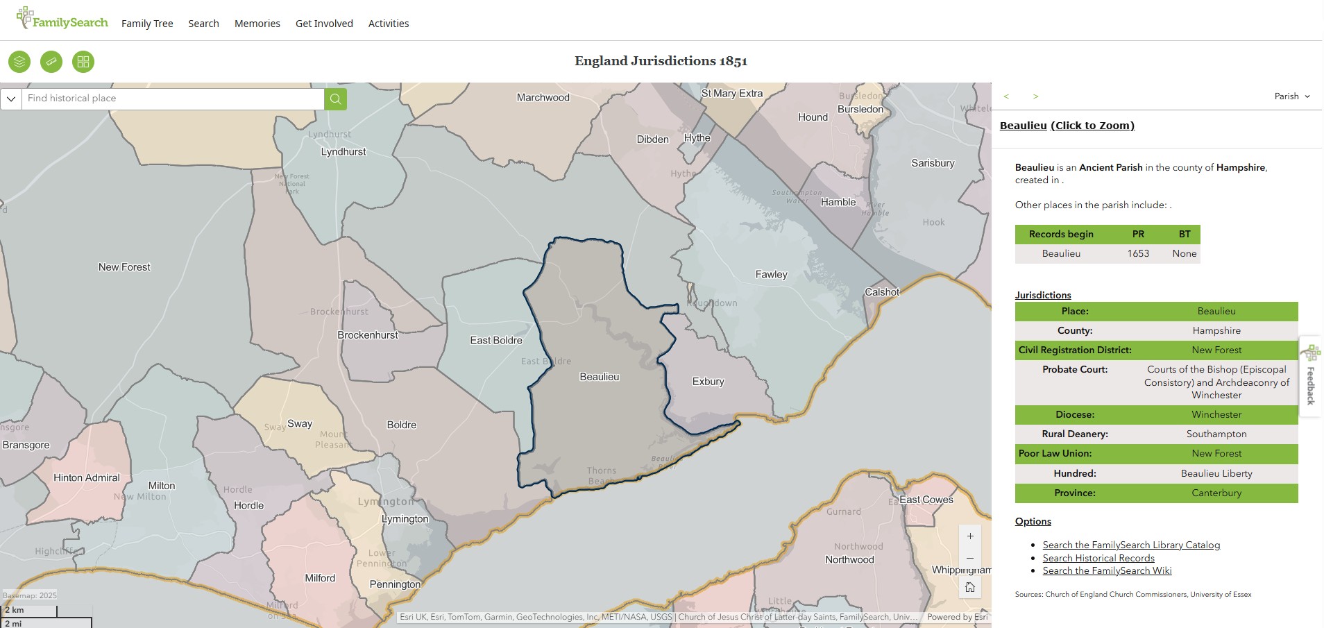
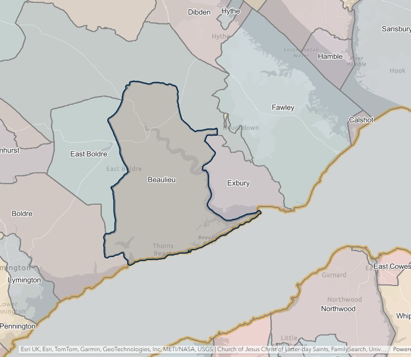
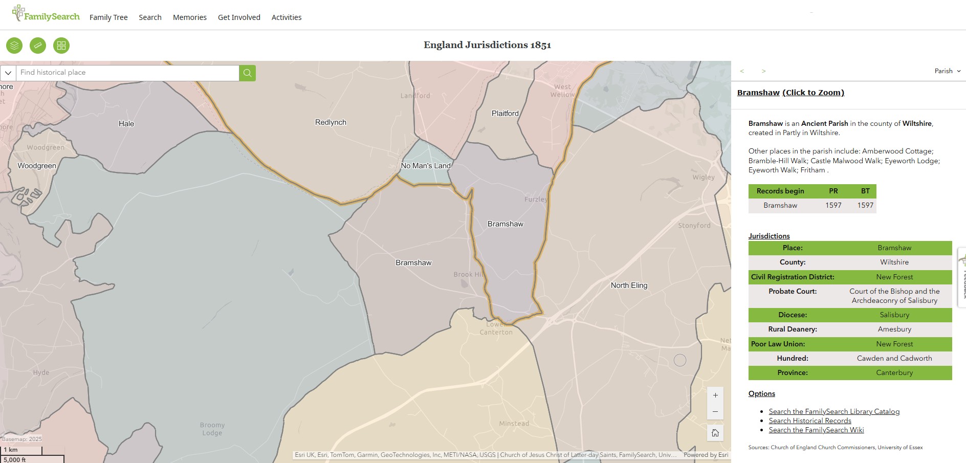
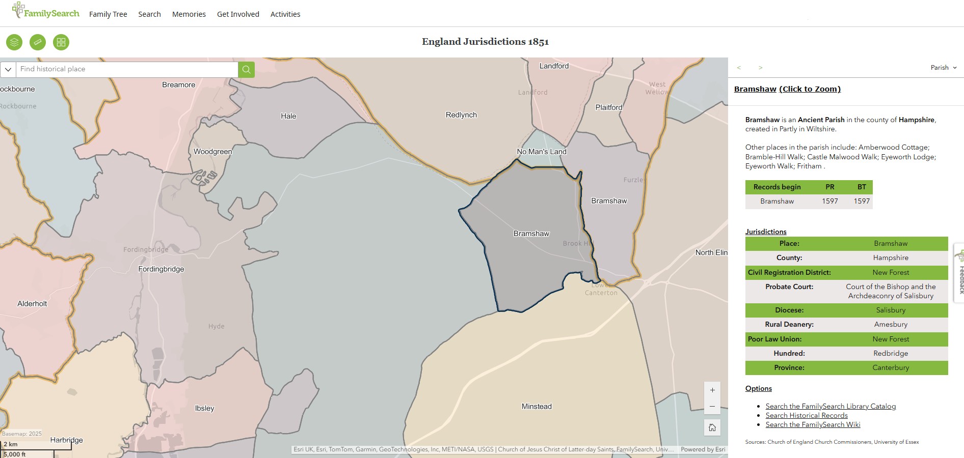
Bramshaw
England Jurisdictions 1851 - Bramshaw
Extract from FamilySearch England Jurisdictions 1851. This link may not work if you don't have a subscription to FamilySearch
Then search for Bramshaw, Wiltshire. Use the Key to select which boundaries you wish to see.
Bramshaw, Wiltshire
Bramshaw, Hampshire
Bramshaw, just the map

Denny Lodge
England Jurisdictions 1851 - Denny Lodge
Extract from FamilySearch England Jurisdictions 1851. This link may not work if you don't have a subscription to FamilySearch
Then search for Denny Lodge. Use the Key to select which boundaries you wish to see.
However, Denny Lodge does not show up on the England Jurisdictions 1851 Mapping.
The civil parish of Denny Lodge was created in 1868 from extra-parochial parts of the New Forest. It was enlarged in 1934 with the addition of 862 acres from Brockenhurst parish, and 4722 acres from Colbury parish which was abolished in that year.
Also, Extract from the New Forest entry in England Jurisdictions 1851
New Forest is an Extra-parochial in the county of Hampshire, created in .
Other places in the parish include: Amberworth Cottage; Ashley Walk; Ashurst Walk; Broomy Lodge; Broomy Walk; Bramble Hill Walk with No Man's Land; Burley Walk; Decoy Pond; Denny Lodge Walk; Eyeworth Lodge; Eyeworth Walk; Holmsley Walk; Irons Hill Walk; Lady Cross Walk; Rhinefield Walk; Whitley Ridge Walk; Wilverley Walk.
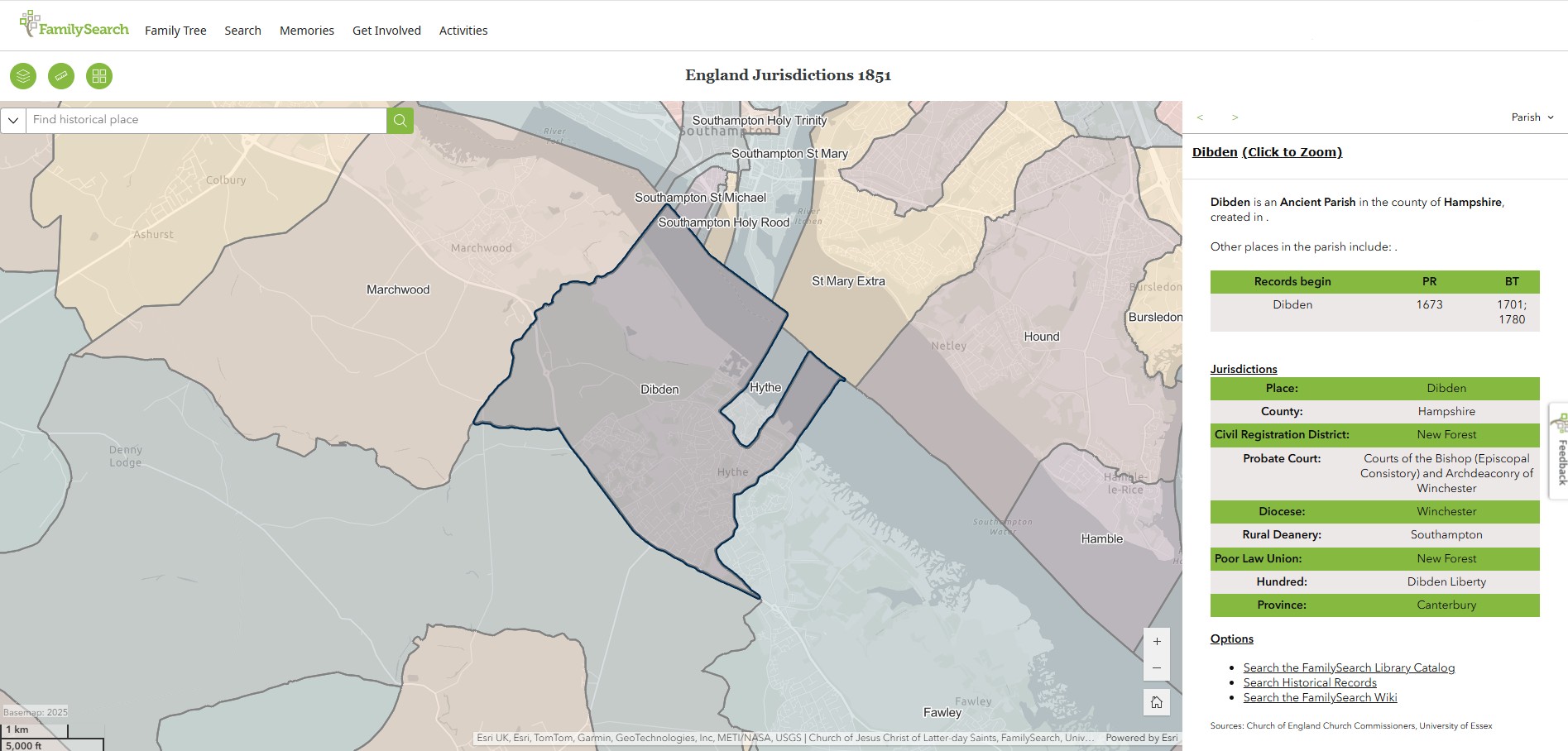
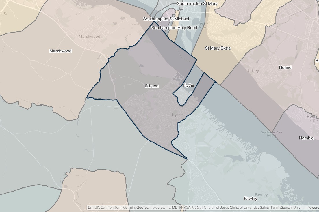
Dibden
England Jurisdictions 1851 - Dibden
Extract from FamilySearch England Jurisdictions 1851. This link may not work if you don't have a subscription to FamilySearch
Then search for Dibden. Use the Key to select which boundaries you wish to see.
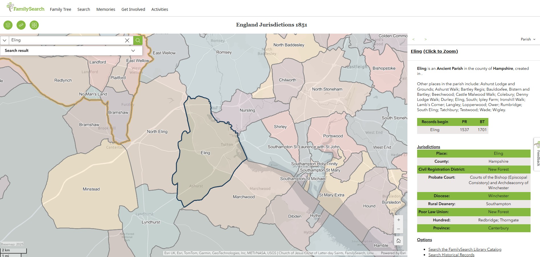
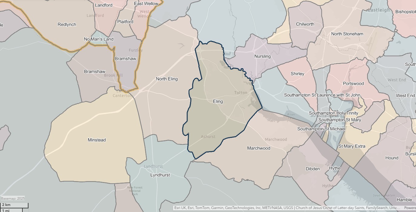
Eling
England Jurisdictions 1851 - Eling
Extract from FamilySearch England Jurisdictions 1851. This link may not work if you don't have a subscription to FamilySearch
Then search for Eling. Use the Key to select which boundaries you wish to see.
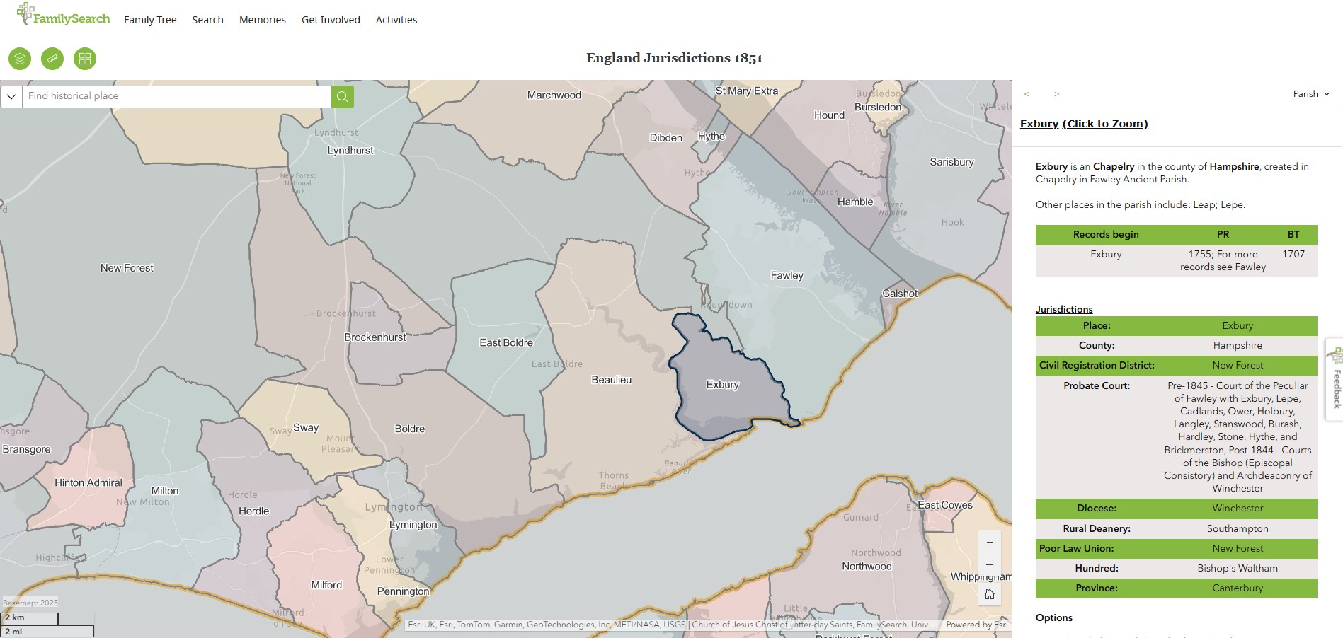
Exbury & Lepe
England Jurisdictions 1851 - Exbury
Extract from FamilySearch England Jurisdictions 1851. This link may not work if you don't have a subscription to FamilySearch
Then search for Exbury. Use the Key to select which boundaries you wish to see.

Fawley
England Jurisdictions 1851 - Fawley
Extract from FamilySearch England Jurisdictions 1851. This link may not work if you don't have a subscription to FamilySearch
Then search for Fawley. Use the Key to select which boundaries you wish to see.
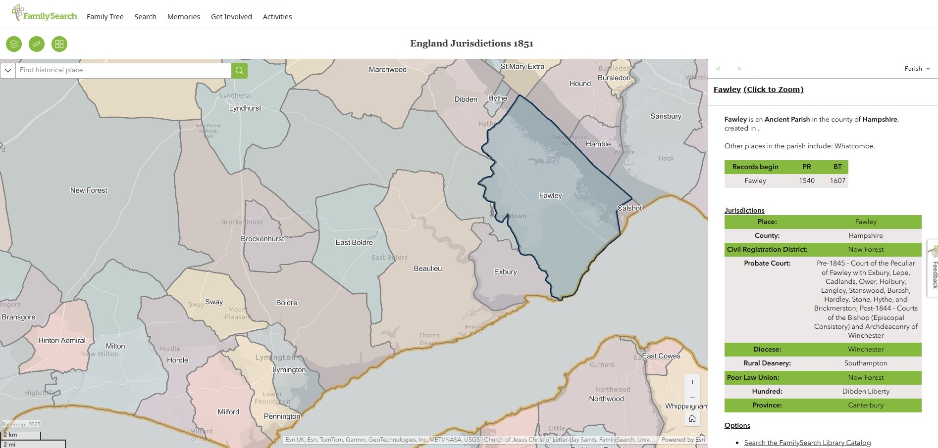
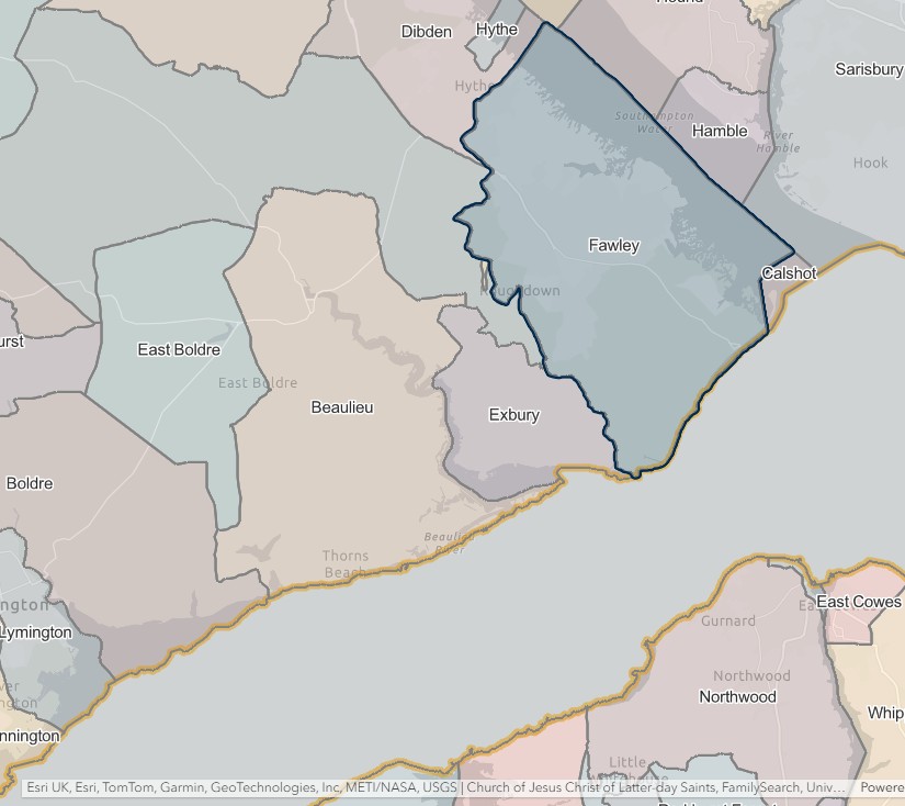
Lyndhurst
England Jurisdictions 1851 - Lyndhurst
Extract from FamilySearch England Jurisdictions 1851. This link may not work if you don't have a subscription to FamilySearch
Then search for Lyndhurst. Use the Key to select which boundaries you wish to see.
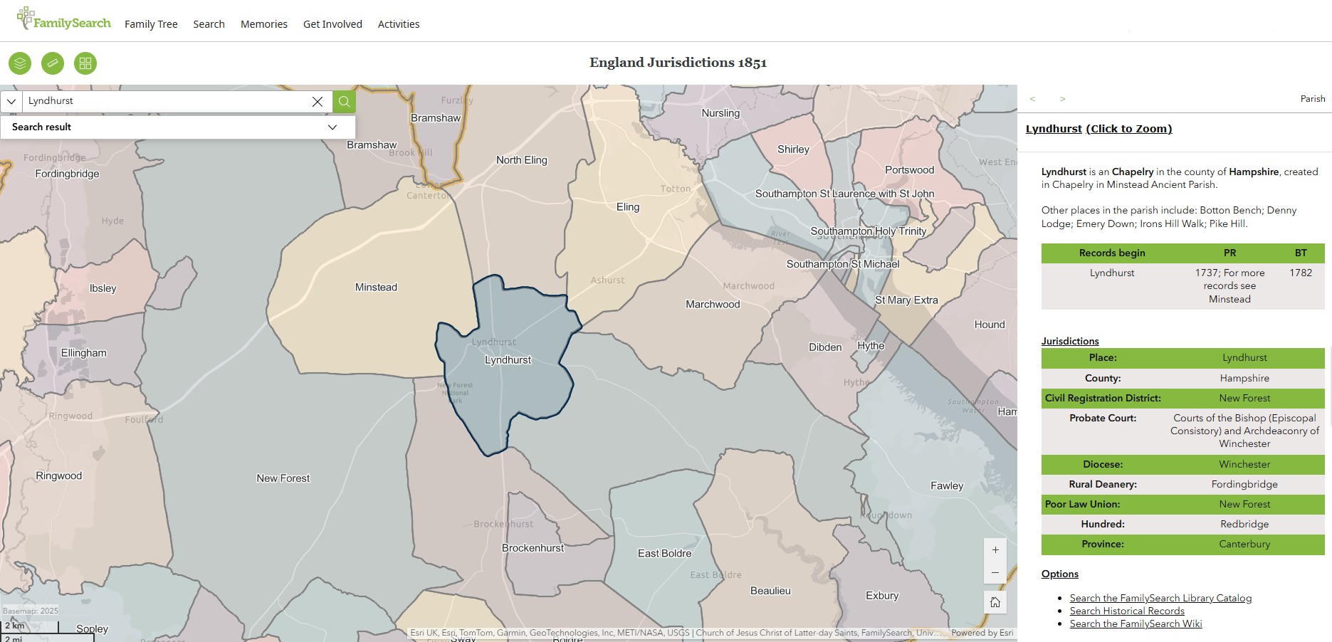
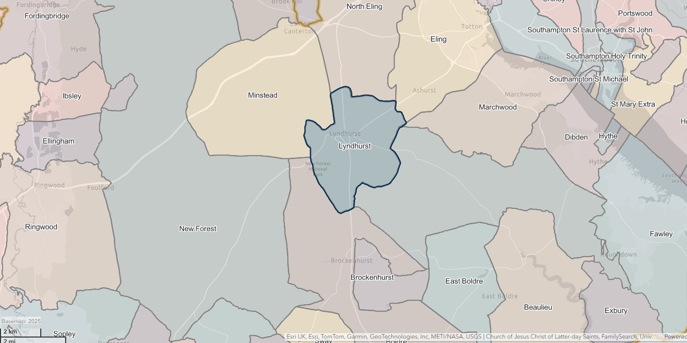
Minstead
England Jurisdictions 1851 - Minstead
Extract from FamilySearch England Jurisdictions 1851. This link may not work if you don't have a subscription to FamilySearch
Then search for Minstead. Use the Key to select which boundaries you wish to see.
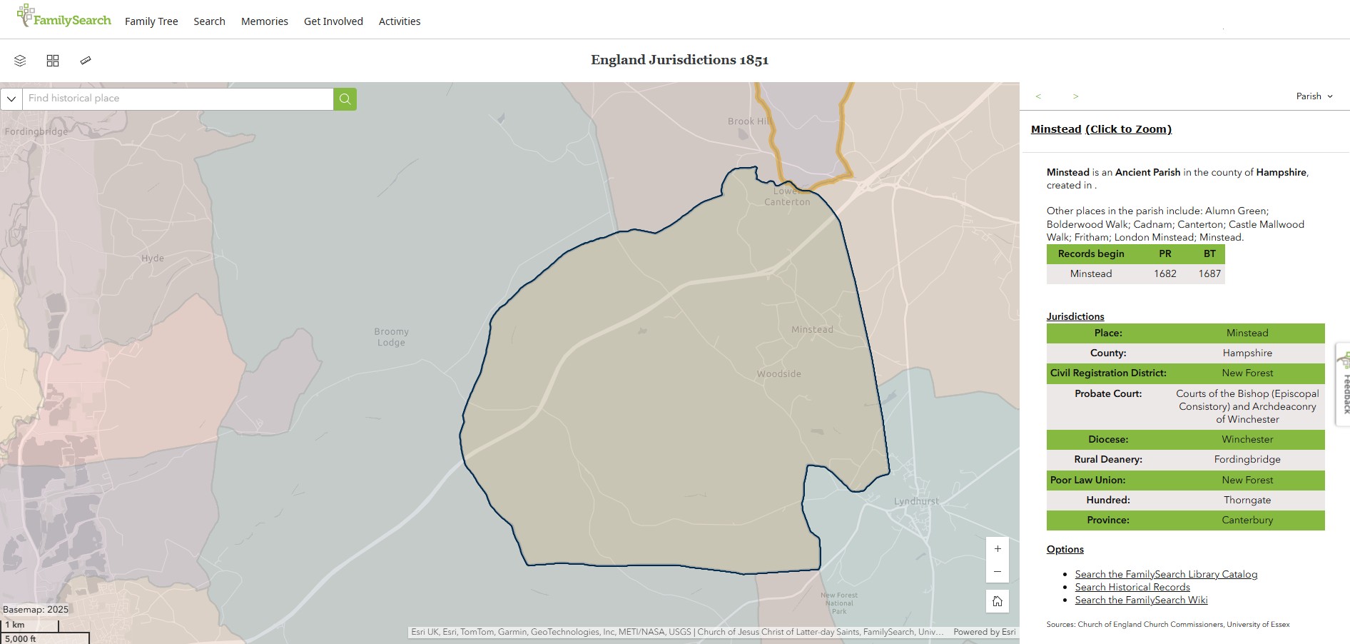
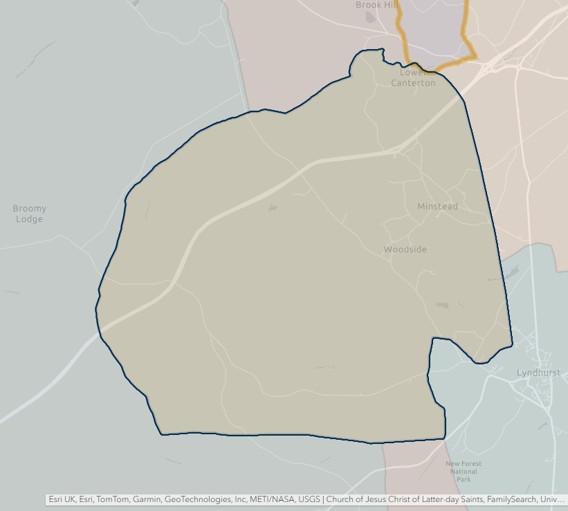
No Man's Land
England Jurisdictions 1851 - No Man's Land
Extract from FamilySearch England Jurisdictions 1851. This link may not work if you don't have a subscription to FamilySearch
Then search for No Man's Land. Use the Key to select which boundaries you wish to see.
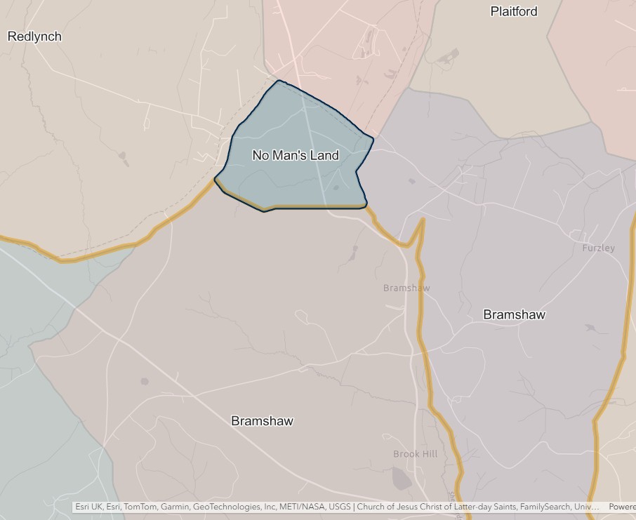
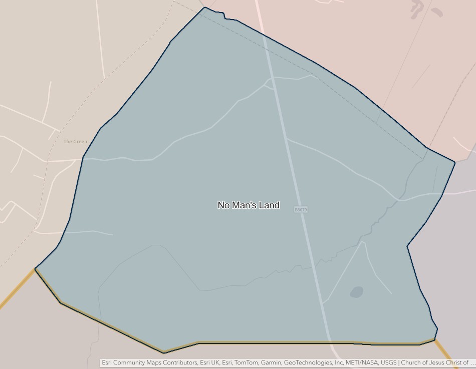
New Forest
England Jurisdictions 1851 - New Forest
Extract from FamilySearch England Jurisdictions 1851. This link may not work if you don't have a subscription to FamilySearch
Then search for New Forest. Use the Key to select which boundaries you wish to see.
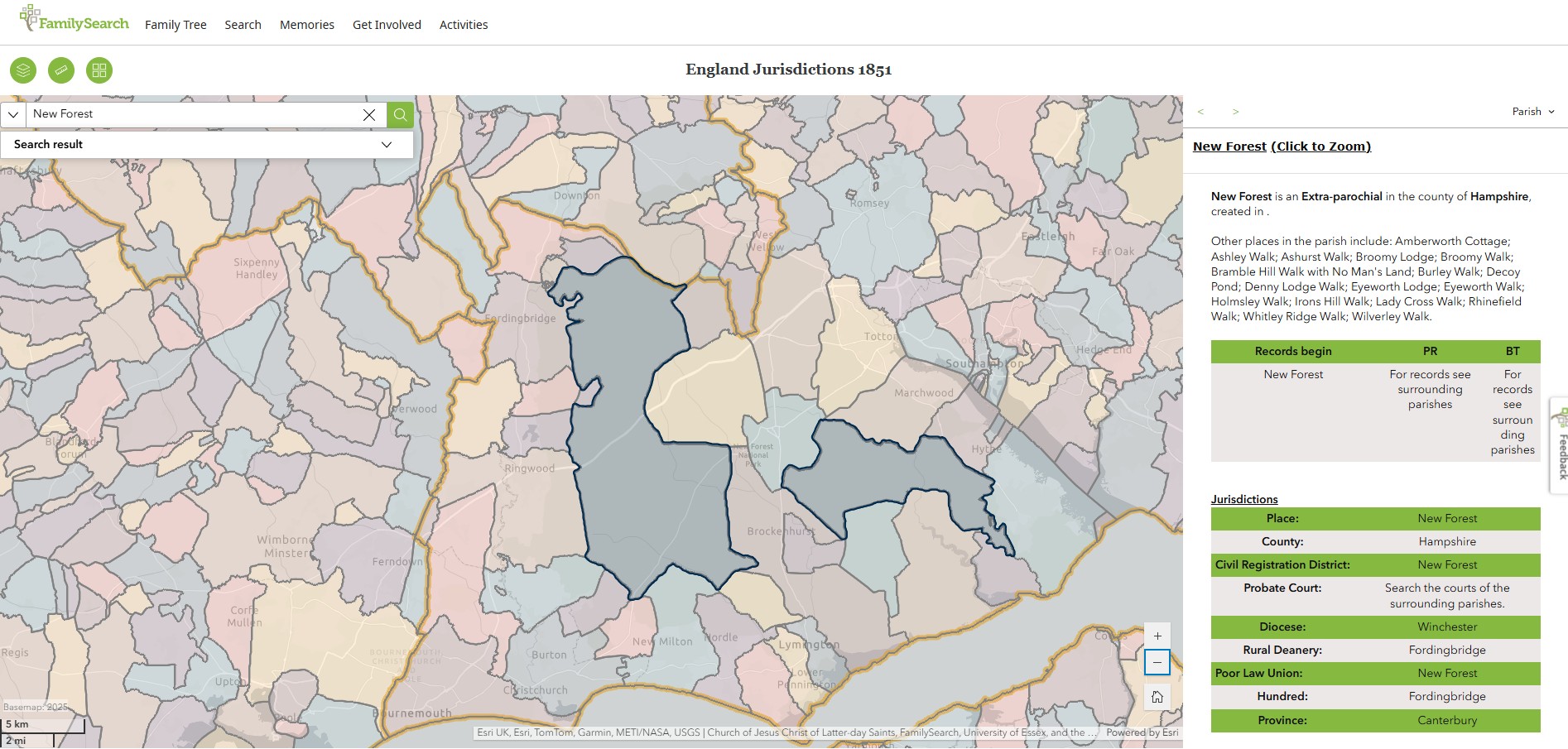
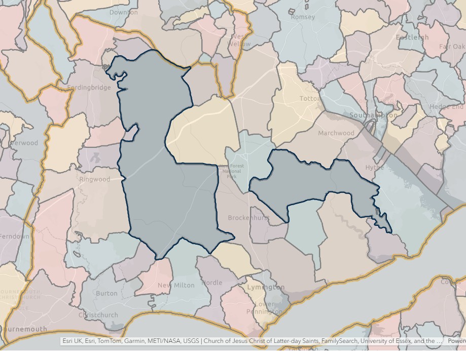
Petersfield
England Jurisdictions 1851 - CRD Petersfield
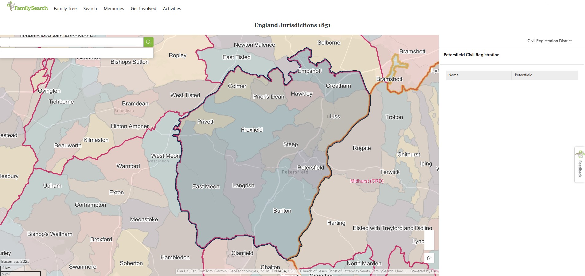
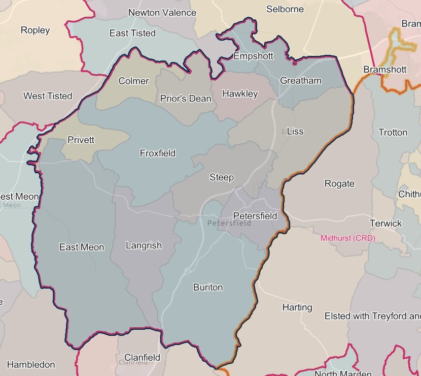
PETERSFIELD REGISTRATION DISTRICT
- Registration County : Hampshire.
- Created : 1.7.1837.
- Abolished : 1.4.2008 (added to Hampshire registration district).
- Sub-districts : East Meon; Petersfield.
- GRO volumes : VII (1837–51); 2c (1852–1946); 6B (1946–74); 20 (1974–92).
- District number : 65b (1841–46); 112 (1847–69); 103 (1870–80); 104 (1881–1908); 106 (1909–46); 307 (1946–74); 496 (1974–2008).
Table 1: List of Places in Petersfield Registration District
|
Civil Parish |
County |
From |
To |
Comments |
|
Bramshott |
1869 |
1974 |
In 1894 the part in West Sussex (which until 1.4.1889 had been part of Sussex) became part of the parish of Rogate, so that thereafter Bramshott was entirely in Hampshire. Renamed 24.4.1974 to become the parish of Bramshott & Liphook. See also Table 2, notes (a), (c) and (e). |
|
|
1869 |
1889 |
|||
|
1889 |
1894 |
|||
|
Bramshott & Liphook |
1974 |
2008 |
Created 24.4.1974 by renaming the parish of Bramshott. See also Table 2, notes (i), (j) and (k). |
|
|
Buriton |
1837 |
2008 |
See Table 2, note (k). |
|
|
Clanfield |
1932 |
2008 |
See Table 2, notes (f) and (k). |
|
|
Colemore |
1837 |
1932 |
Abolished 1.4.1932 and added to the parish of Colemore & Priors Dean. |
|
|
Colemore & Priors Dean |
1932 |
2008 |
Created 1.4.1932 out of the parishes of Priors Dean and Colemore. See also Table 2, note (k). |
|
|
East Meon |
1974 |
2008 |
Created 24.4.1974 by renaming the parish of Eastmeon. See also Table 2, note (k). |
|
|
Eastmeon |
1837 |
1974 |
Renamed 24.4.1974 to become the parish of East Meon. |
|
|
Empshott |
1837 |
1932 |
Abolished 1.4.1932 and added to the parish of Hawkley. |
|
|
Froxfield |
1837 |
2008 |
See Table 2, note (k). |
|
|
Grayshott |
1932 |
1932 |
That part which until 1.4.1932 formed part of the parish of Bramshott. See also Table 2, note (e). |
|
|
Greatham |
1837 |
2008 |
See Table 2, notes (d), (j) and (k). |
|
|
Hawkley |
1837 |
2008 |
See Table 2, notes (i) and (k). |
|
|
Horndean |
1932 |
2008 |
See Table 2, notes (f) and (k). |
|
|
Langrish |
1894 |
2008 |
Created 1894 out of the parish of East Meon. See also Table 2, note (k). |
|
|
Liss |
1837 |
2008 |
See Table 2, note (k). |
|
|
Petersfield |
1837 |
2008 |
See Table 2, note (k). |
|
|
Priors Dean |
1837 |
1932 |
Abolished 1.4.1932 and added to the parish of Colemore & Priors Dean. |
|
|
Privett |
1837 |
1932 |
Abolished 1.4.1932 and added to the parish of Froxfield. |
|
|
Rogate |
1894 |
1895 |
That part which until 1894 formed the West Sussex part of the parish of Bramshott. See also Table 2, note (c). |
|
|
Rowlands Castle |
1932 |
2008 |
Created 1.4.1932 out of the parishes of Norh Havant, Idsworth, Warblington, Blendworth, Bedhampton and Chalton. See also Table 2, notes (f). (g), (h) and (k). |
|
|
Sheet |
1837 |
1932 |
Abolished 1.4.1932 and divided between the parishes of Petersfield, Steep and Burton. |
|
|
Steep |
1837 |
2008 |
See Table 2, notes (b) and (k). |
|
|
Stroud |
1994 |
2008 |
Created 1.4.1994 out of the parishes of Langrish and Petersfield. See also Table 2, note (k). |
Table 2: Boundary Changes affecting Petersfield Registration District
|
Date of Change |
Note |
Description of Change |
Population transferred |
|
1.7.1869 |
(a) |
Gained the parish of Bramshott from Farnborough registration district. |
1367 in 1861 |
|
25.3.1883 |
(b) |
Lost a detached part of the parish of Steep (which was added to the parish of Chithurst on 25.3.1883) to Midhurst registration district. |
0 in 1891 |
|
1.6.1895 |
(c) |
Lost the part in the parish of Rogate (which until 1894 formed the West Sussex part of the parish of Bramshott) to Midhurst registration district. |
11 in 1891 |
|
1.4.1929 |
(d) |
Lost part of the parish of Greatham (which was added to the parish of Whitehill on 1.4.1929) to Alton registration district. |
567 in 1921 |
|
1.10.1932 |
(e) |
Lost the part in the parish of Grayshott (which until 1.4.1932 formed part of the parish of Bramshott) to Alton registration district. |
20 in 1931 |
|
(f) |
Gained part of the parish of Rowlands Castle (which until 1.4.1932 formed the parish of Idsworth and parts of the parishes of Blendworth and Chalton) and the parishes of Clanfield and Horndean, from Catherington registration district. |
3374 in 1931 |
|
|
(g) |
Gained part of the parish of Rowlands Castle (which until 1.4.1932 formed parts of the parishes of Bedhampton, North Havant and Warblington) from Havant registration district. |
883 in 1931 |
|
|
1.4.1952 |
(h) |
Lost part of the parish of Rowlands Castle (which was added to the parish of Havant on 1.4.1952) to Gosport registration district. |
2745 in 1951 |
|
1.4.1982 |
(i) |
Lost parts of the parishes of Bramshott & Liphook and Hawkley (which became parts of the parishes of Grayshott, Headley and Selborne on 1.4.1982) to Alton registration district. |
n/a |
|
(j) |
Gained parts of the parishes of Bramshott & Liphook and Greatham (which until 1.4.1982 formed parts of the parish of Whitehill) from Alton registration district. |
n/a | |
|
1.4.2008 (abolished) |
(k) |
Lost the parishes of Bramshott & Liphook, Buriton, Clanfield, Colemore & Priors Dean, East Meon, Froxfield, Greatham, Hawkley, Horndean, Langrish, Liss, Petersfield, Rowlands Castle, Steep and Stroud, to Hampshire registration district. |
53324 in 2001 |
© Copyright and Database Right 1996–2023
The information on this page may not be reproduced without the consent of the copyright holder.
Hosted by UKBMD - Births, Marriages, Deaths & Censuses on the Internet
The Parishes within the Civil Registration District as at 1851 (generally the same as the 1837 entries above)
Bramshott
In 1851 Bramshott was in the Farnborough CRD
1.7.1869 Gained the parish of Bramshott from Farnborough registration district.
Bramshott & Liphook
Created 24.4.1974 by renaming the parish of Bramshott.
Buriton
England Jurisdictions 1851 - Buriton
Extract from FamilySearch England Jurisdictions 1851. This link may not work if you don't have a subscription to FamilySearch
Then search for Buriton. Use the Key to select which boundaries you wish to see.
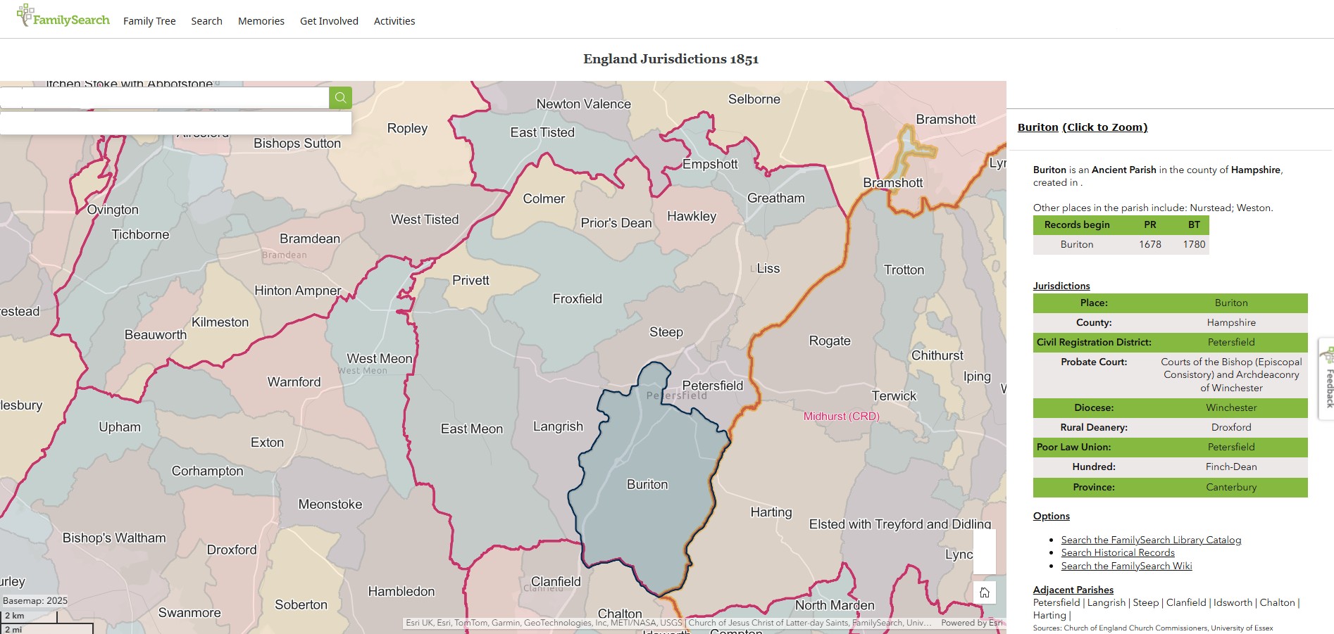
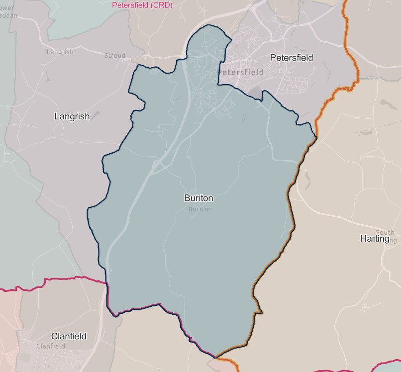
Clanfield
1.10.1932 Gained part of the parish of Rowlands Castle (which until 1.4.1932 formed the parish of Idsworth and parts of the parishes of Blendworth and Chalton) and the parishes of Clanfield and Horndean, from Catherington registration district.
Colmar/Colemore
England Jurisdictions 1851 - Colmer / Colmar / Colemore
Extract from FamilySearch England Jurisdictions 1851. This link may not work if you don't have a subscription to FamilySearch
Then search for Comer. Use the Key to select which boundaries you wish to see.
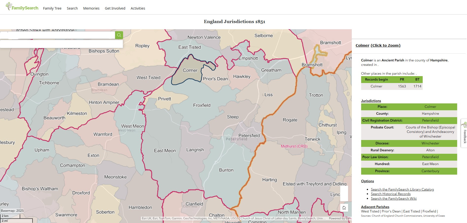
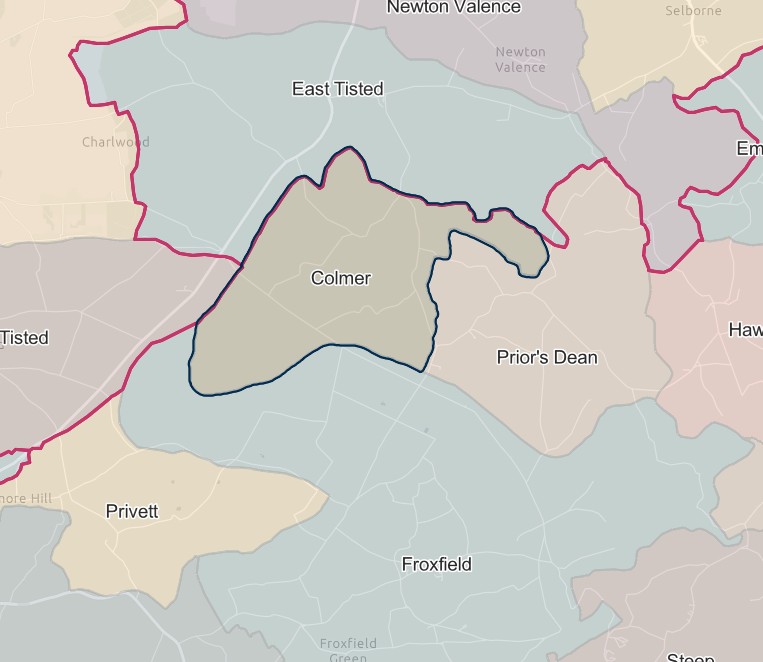
Colemore & Priors Dean
England Jurisdictions 1851 - Colmer / Colmar / Colemore
Extract from FamilySearch England Jurisdictions 1851. This link may not work if you don't have a subscription to FamilySearch
Then search for Comer. Use the Key to select which boundaries you wish to see.


England Jurisdictions 1851 - Prior's Dean
Extract from FamilySearch England Jurisdictions 1851. This link may not work if you don't have a subscription to FamilySearch
Then search for Prior's Dean. Use the Key to select which boundaries you wish to see.
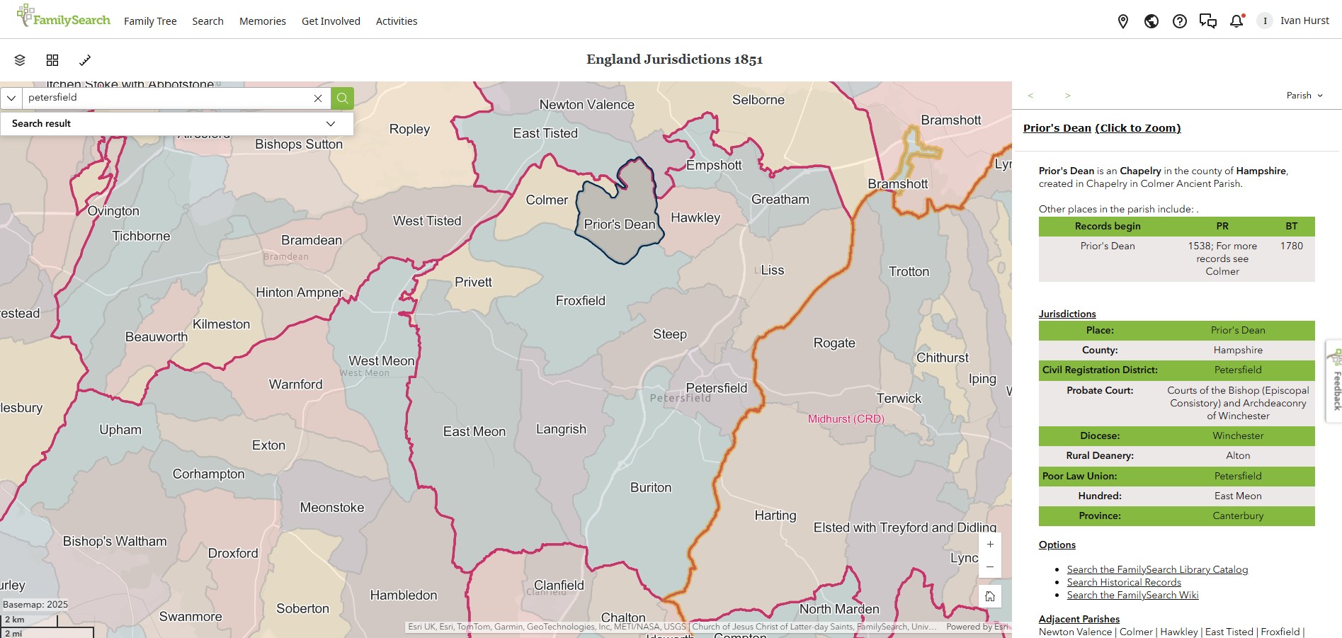
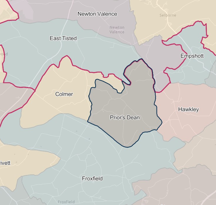
East Meon
England Jurisdictions 1851 - East Meon
Extract from FamilySearch England Jurisdictions 1851. This link may not work if you don't have a subscription to FamilySearch
Then search for East Meon. Use the Key to select which boundaries you wish to see.
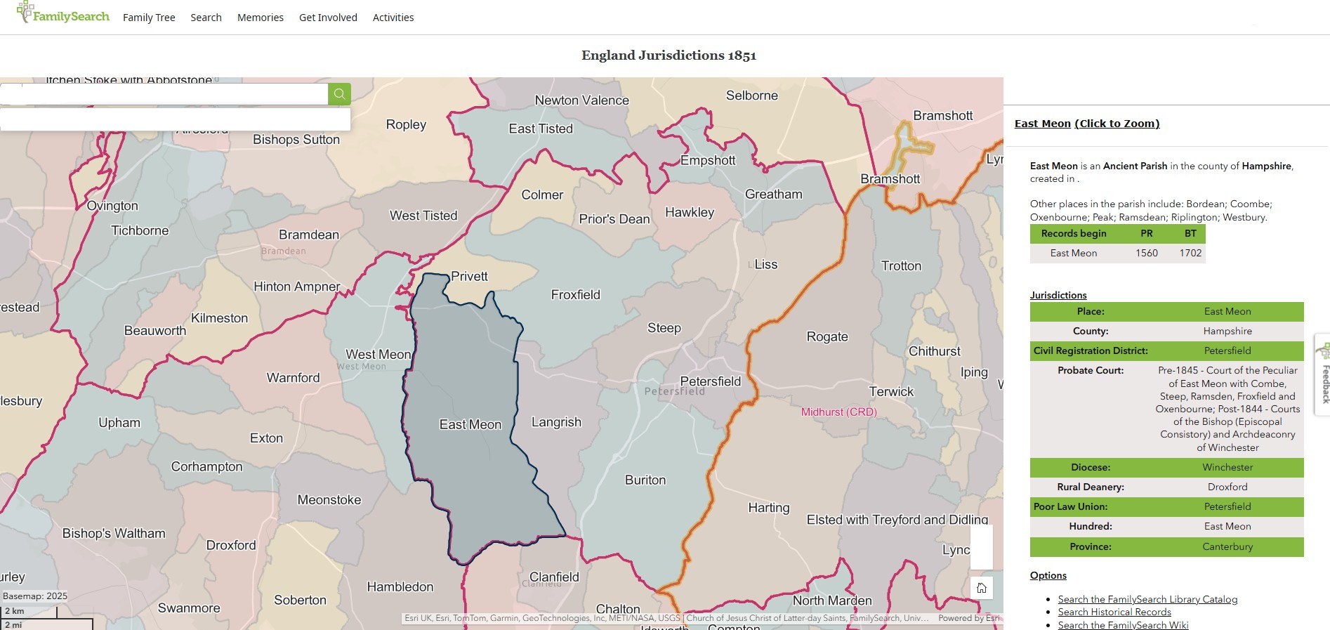
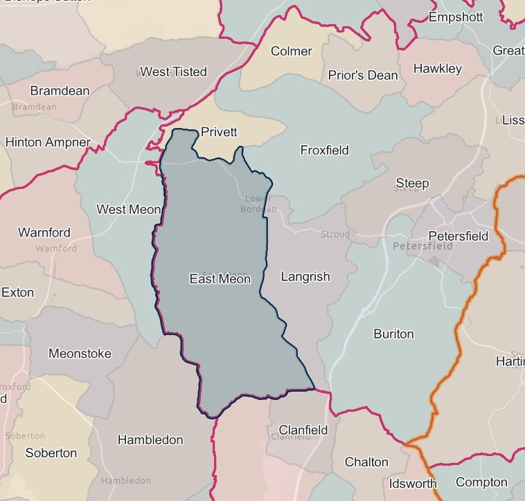
Eastmeon
Renamed 24.4.1974 to become the parish of East Meon.
Or was it the other way around. 1851 Map shows East Meon.
Empshott
England Jurisdictions 1851 - Empshott
Extract from FamilySearch England Jurisdictions 1851. This link may not work if you don't have a subscription to FamilySearch
Then search for Empshott. Use the Key to select which boundaries you wish to see.
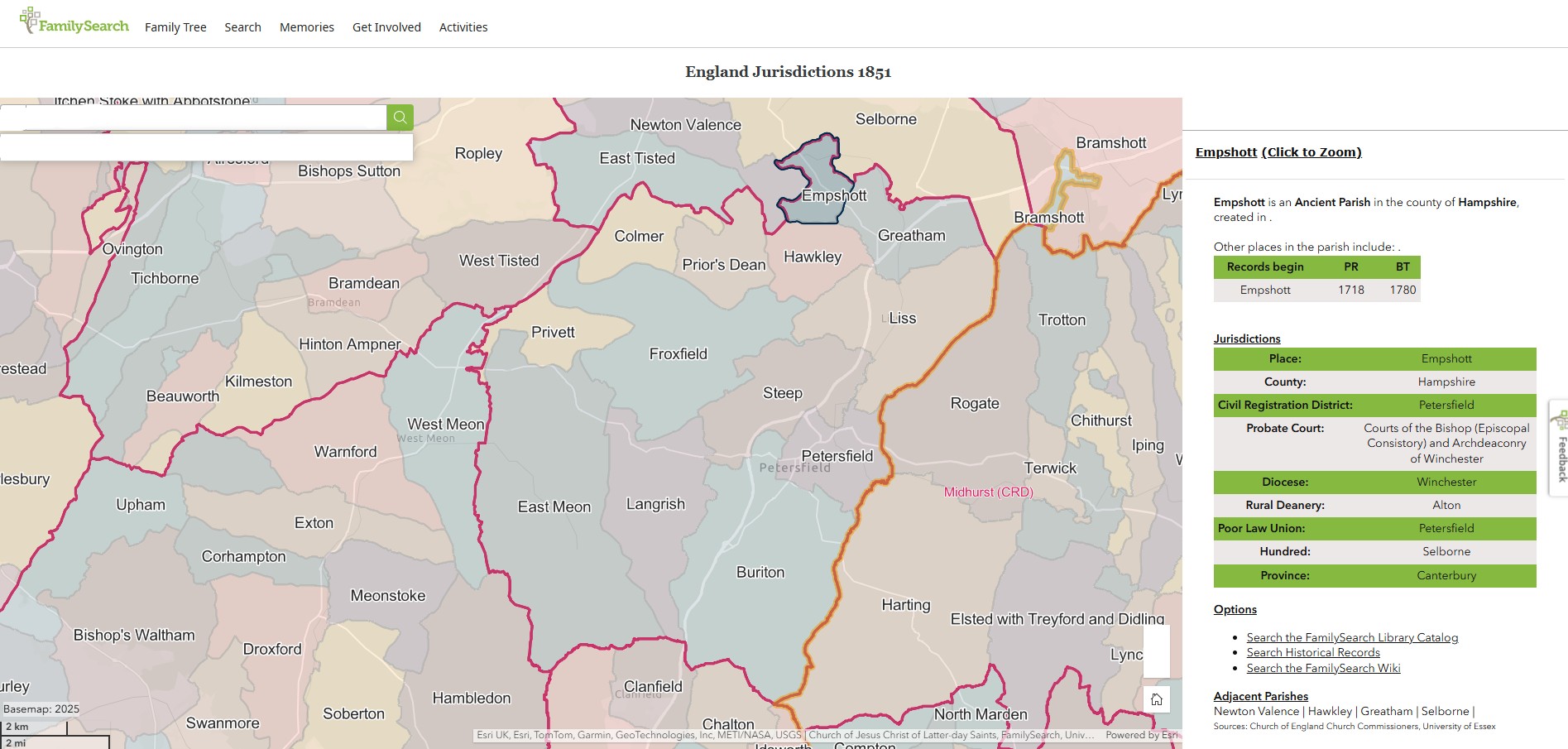
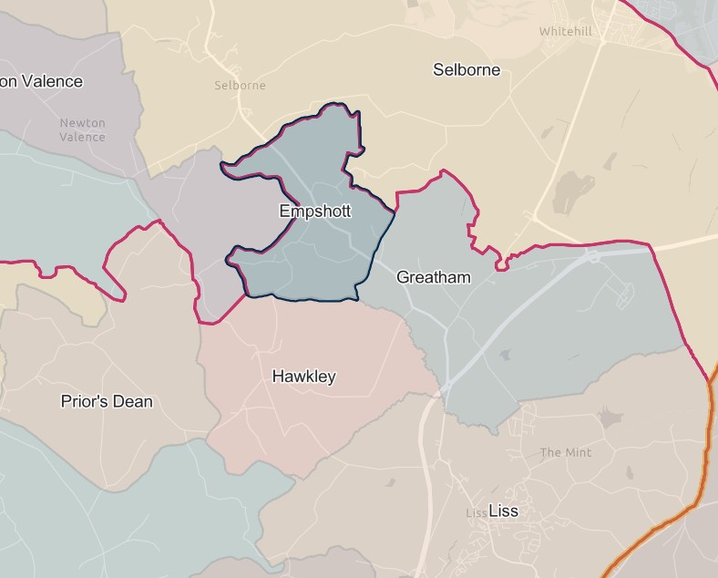
Froxfield
England Jurisdictions 1851 - Froxfield
Extract from FamilySearch England Jurisdictions 1851. This link may not work if you don't have a subscription to FamilySearch
Then search for Froxfield. Use the Key to select which boundaries you wish to see.
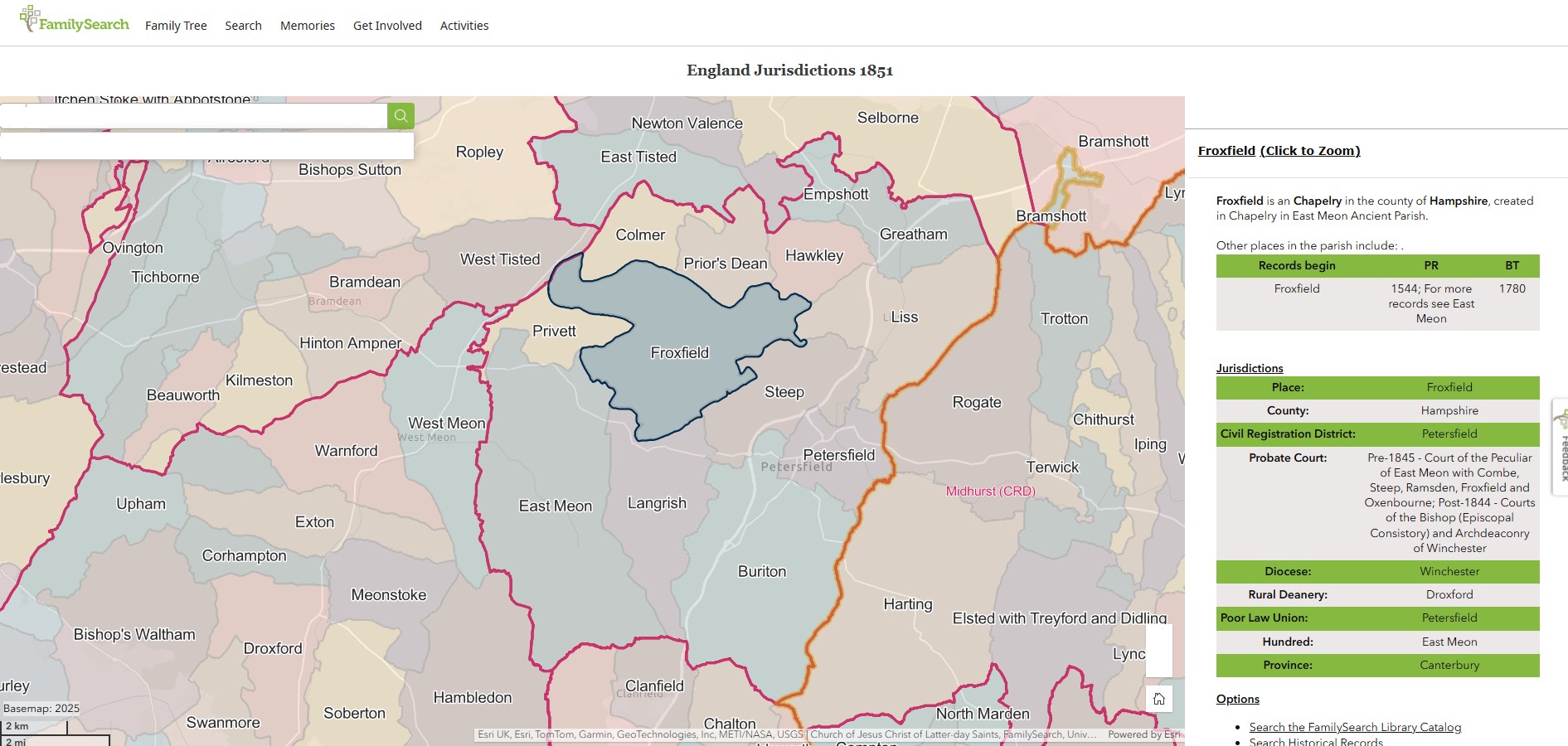
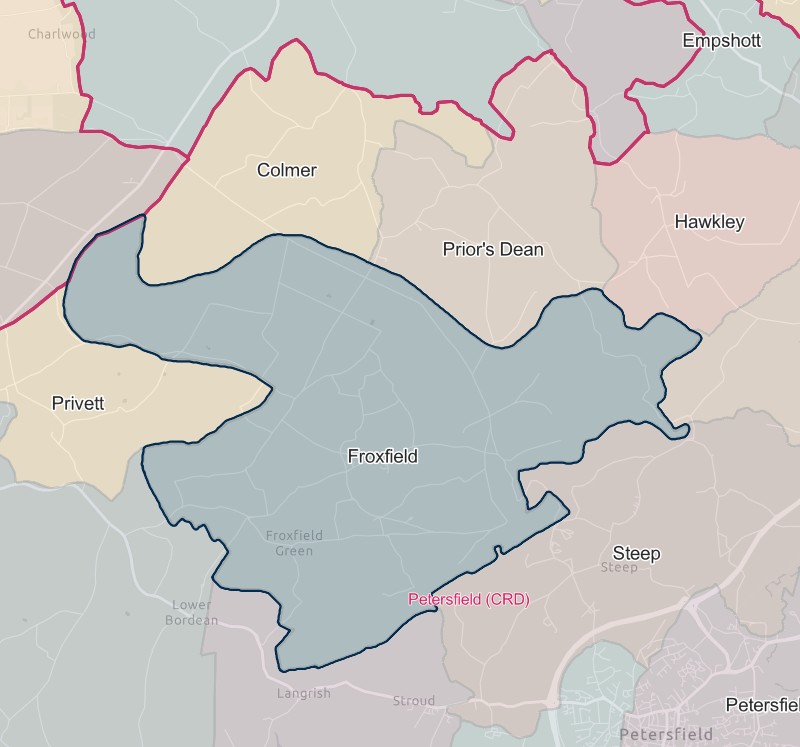
Grayshott
That part which until 1.4.1932 formed part of the parish of Bramshott.
1.10.1932 Lost the part in the parish of Grayshott (which until 1.4.1932 formed part of the parish of Bramshott) to Alton registration district.
Greatham
England Jurisdictions 1851 - Greatham
Extract from FamilySearch England Jurisdictions 1851. This link may not work if you don't have a subscription to FamilySearch
Then search for Greatham. Use the Key to select which boundaries you wish to see.
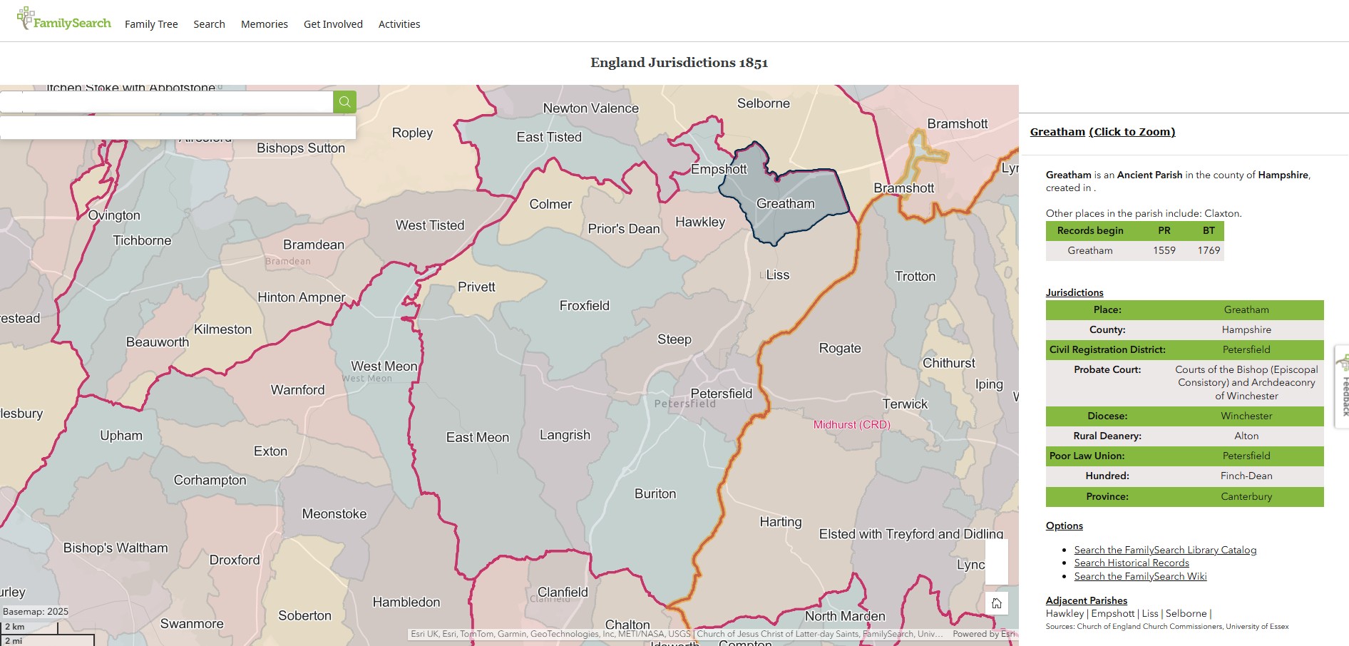
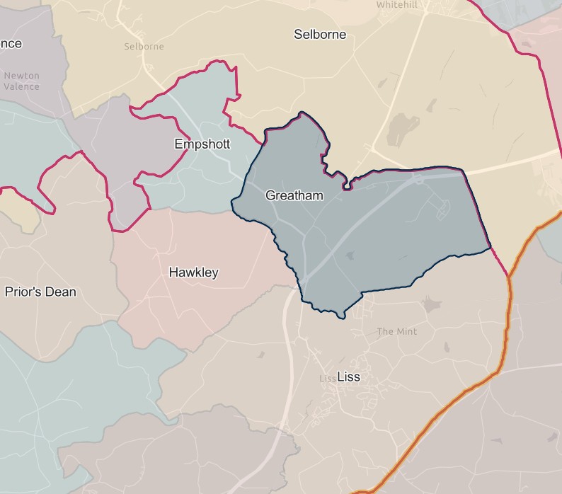
Hawkley
England Jurisdictions 1851 - Hawkley
Extract from FamilySearch England Jurisdictions 1851. This link may not work if you don't have a subscription to FamilySearch
Then search for Hawkley. Use the Key to select which boundaries you wish to see.
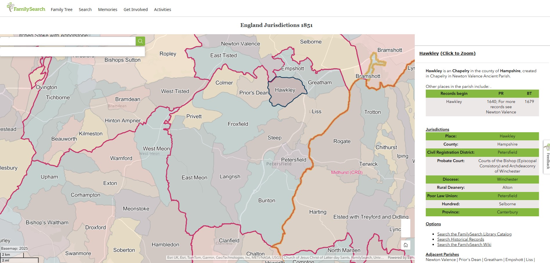
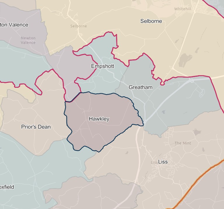
Horndean
1.10.1932 Gained part of the parish of Rowlands Castle (which until 1.4.1932 formed the parish of Idsworth and parts of the parishes of Blendworth and Chalton) and the parishes of Clanfield and Horndean, from Catherington registration district.
Langrish
England Jurisdictions 1851 - Langrish
Extract from FamilySearch England Jurisdictions 1851. This link may not work if you don't have a subscription to FamilySearch
Then search for Langrish. Use the Key to select which boundaries you wish to see.
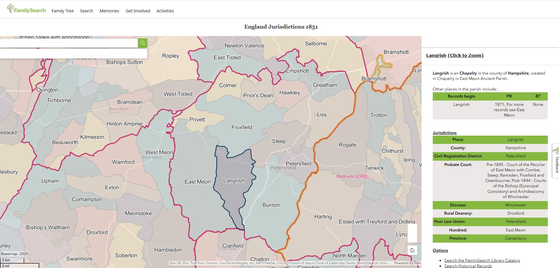
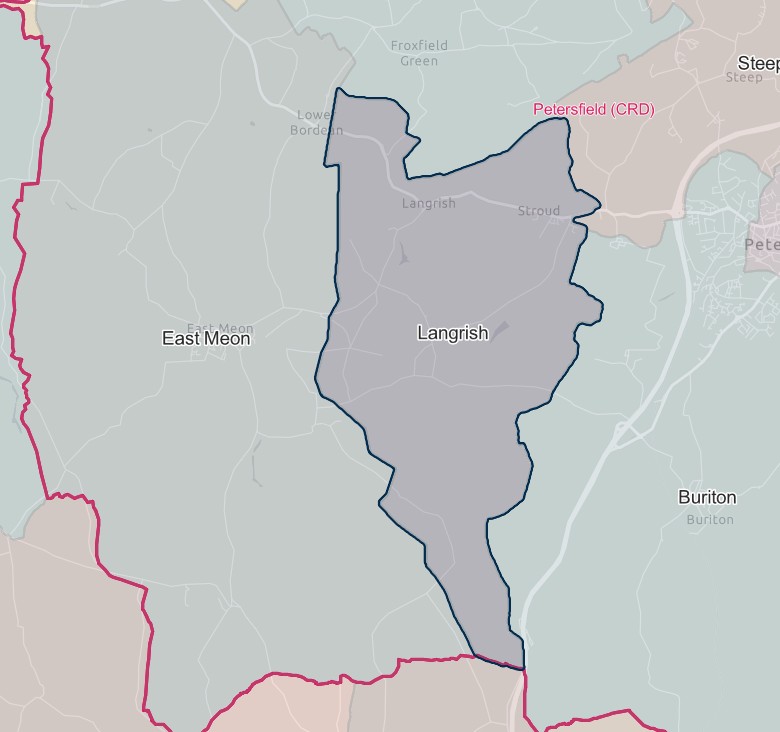
Liss
England Jurisdictions 1851 - Liss
Extract from FamilySearch England Jurisdictions 1851. This link may not work if you don't have a subscription to FamilySearch
Then search for Liss. Use the Key to select which boundaries you wish to see.
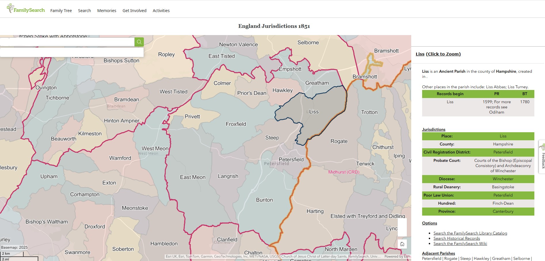
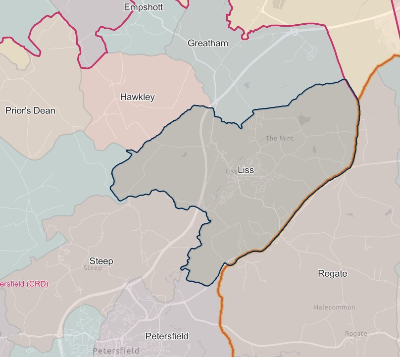
Petersfield
England Jurisdictions 1851 - Petersfield
Extract from FamilySearch England Jurisdictions 1851. This link may not work if you don't have a subscription to FamilySearch
Then search for Petersfield. Use the Key to select which boundaries you wish to see.
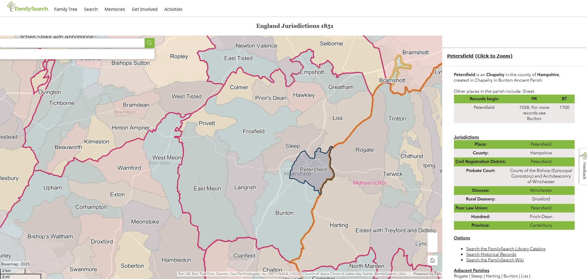
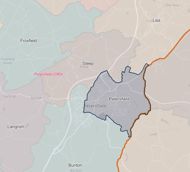
Priors Dean
England Jurisdictions 1851 - Prior's Dean
Extract from FamilySearch England Jurisdictions 1851. This link may not work if you don't have a subscription to FamilySearch
Then search for Prior's Dean. Use the Key to select which boundaries you wish to see.


Privett
England Jurisdictions 1851 - Privett
Extract from FamilySearch England Jurisdictions 1851. This link may not work if you don't have a subscription to FamilySearch
Then search for Privett. Use the Key to select which boundaries you wish to see.
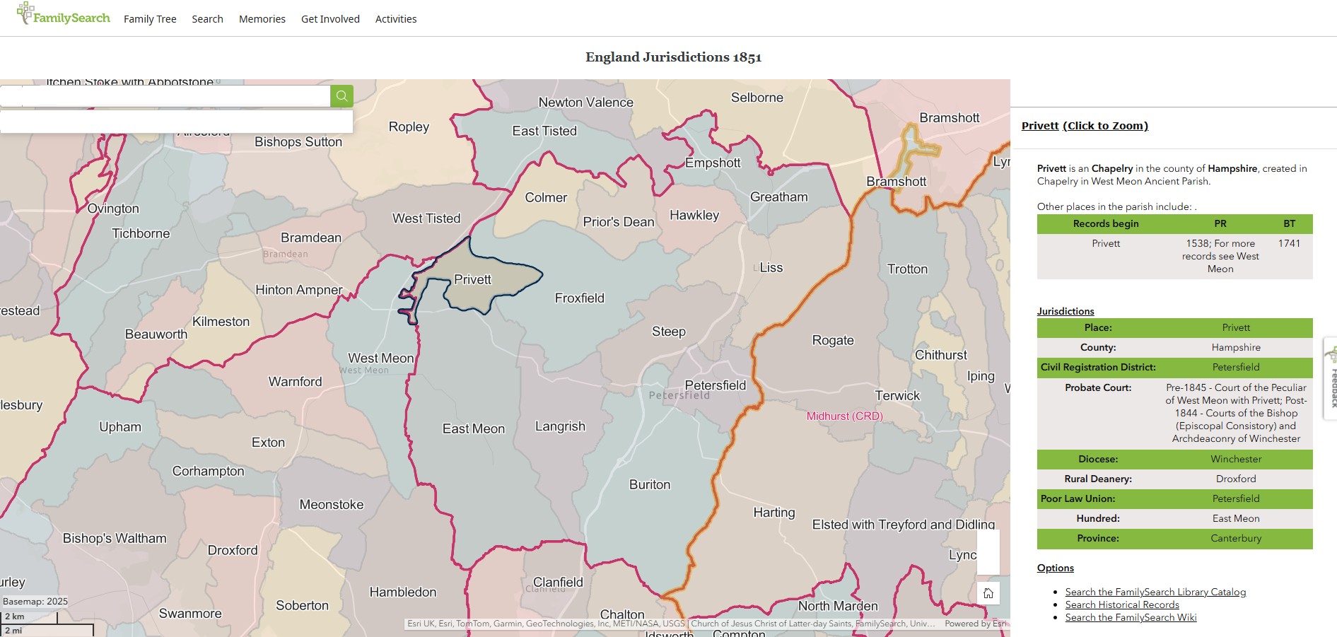
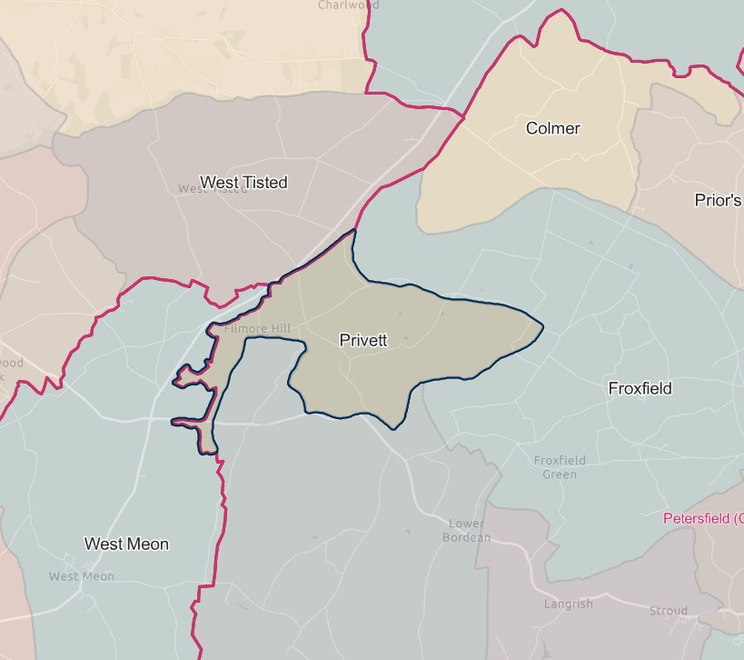
Rogate
That part which until 1894 formed the West Sussex part of the parish of Bramshott.
1.6.1895 Lost the part in the parish of Rogate (which until 1894 formed the West Sussex part of the parish of Bramshott) to Midhurst registration district.
Rowlands Castle
1.10.1932 Gained part of the parish of Rowlands Castle (which until 1.4.1932 formed the parish of Idsworth and parts of the parishes of Blendworth and Chalton) and the parishes of Clanfield and Horndean, from Catherington registration district.
Sheet
Abolished 1.4.1932 and divided between the parishes of Petersfield, Steep and Burton.
Should therefore show on the map.
Steep
England Jurisdictions 1851 - Steep
Extract from FamilySearch England Jurisdictions 1851. This link may not work if you don't have a subscription to FamilySearch
Then search for Steep. Use the Key to select which boundaries you wish to see.
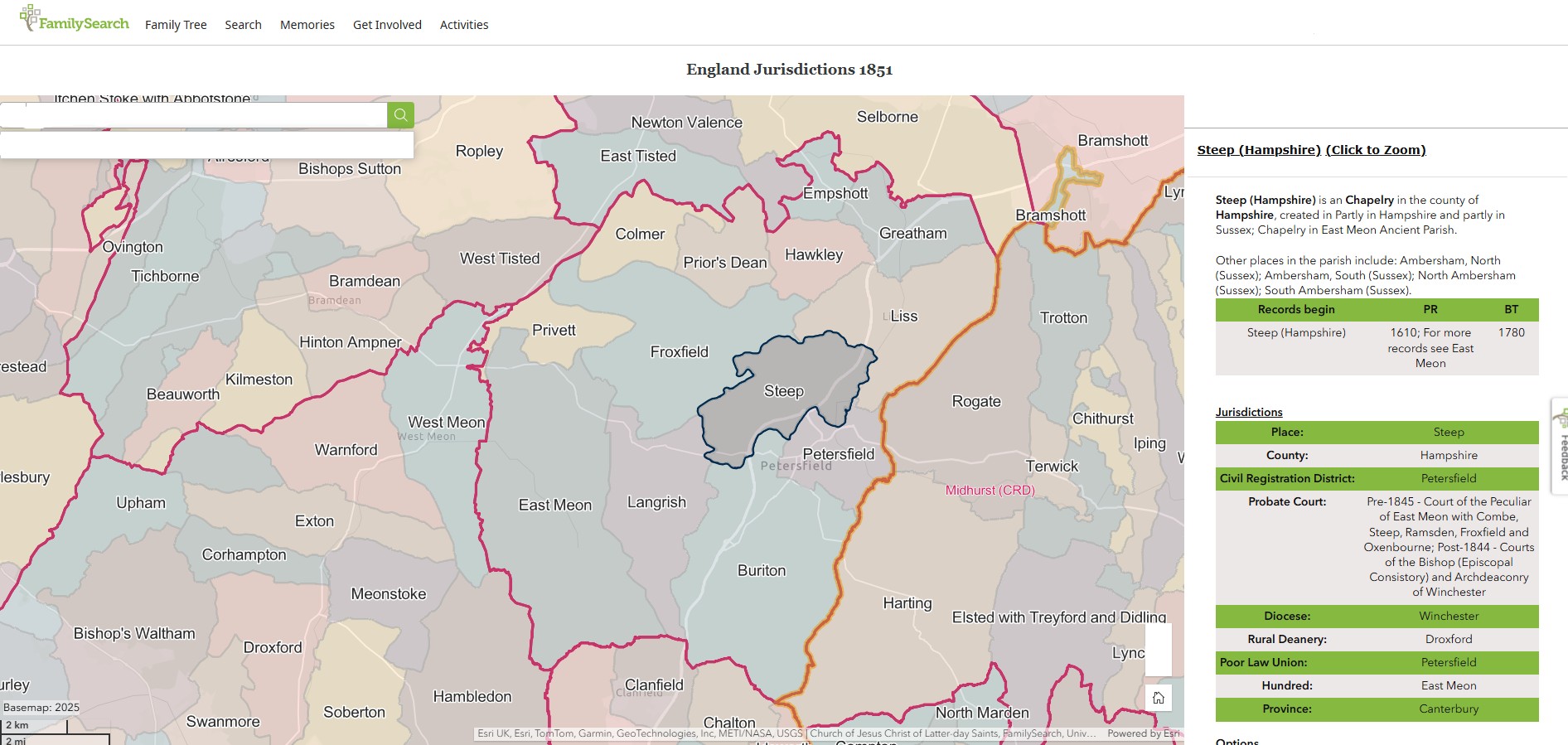
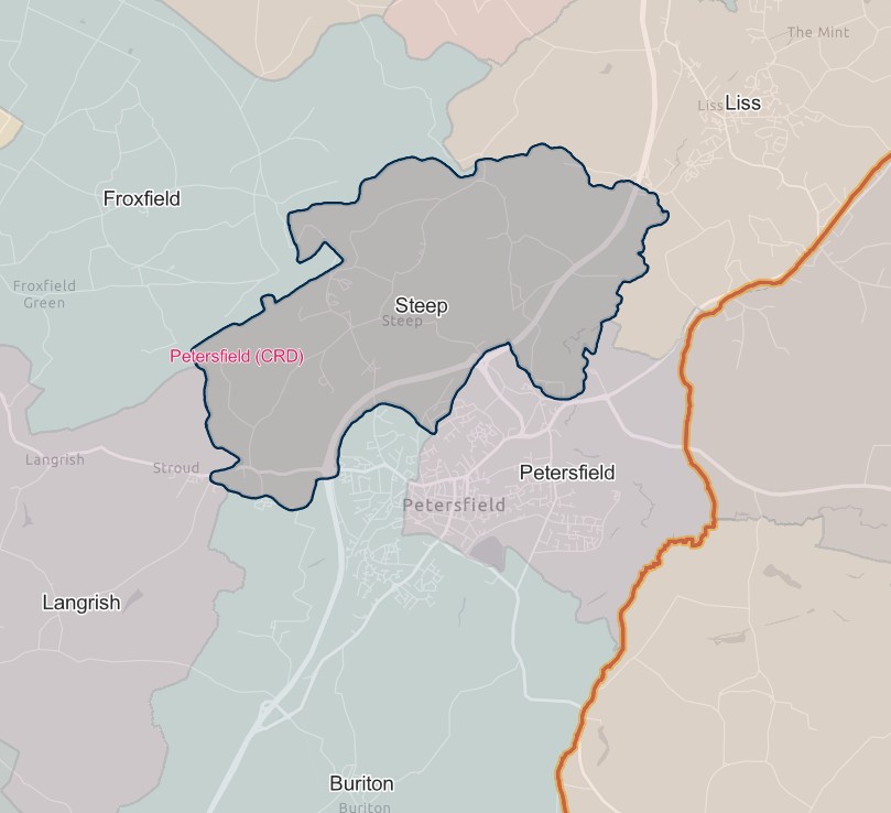
Stroud
Created 1.4.1994 out of the parishes of Langrish and Petersfield.
Ringwood
England Jurisdictions 1851 - CRD Ringwood

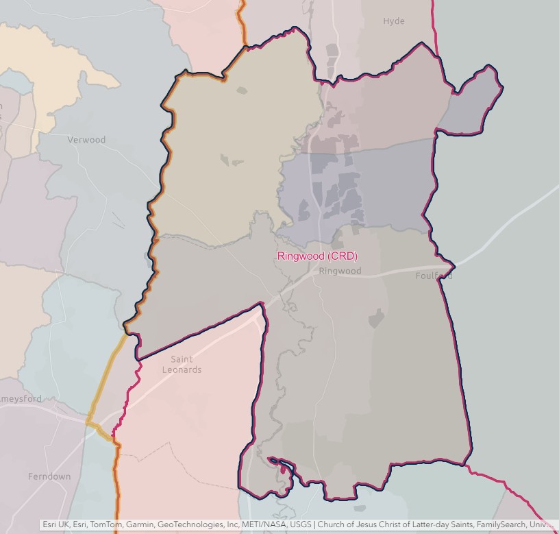
RINGWOOD REGISTRATION DISTRICT
- Registration County : Hampshire.
- Created : 1.7.1837.
- Abolished : 1.10.1932 (added to Christchurch registration district).
- Sub-districts : Ringwood
- GRO volumes : VIII (1837–51); 2b (1852–1932).
- District number : 62e (1841–46); 102 (1847–69); 93 (1870–80); 94 (1881–1908); 96 (1909–32).
Table 1: List of Places in Ringwood Registration District
|
Civil Parish |
County |
From |
To |
Comments |
|
Broomy |
1837 |
1932 |
Abolished 1.4.1932 and added to the parish of Ellingham. |
|
|
Burley |
1837 |
1932 |
See Table 2, note (b). |
|
|
Ellingham |
1837 |
1932 |
See Table 2, note (b). |
|
|
Harbridge |
1837 |
1932 |
Abolished 1.4.1932 and added to the parish of Harbridge & Ibsley. |
|
|
Harbridge & Ibsley |
1932 |
1932 |
Created 1.4.1932 from the separate parishes of Harbridge and Ibsley. See also Table 2, note (b). |
|
|
Ibsley |
1837 |
1932 |
Abolished 1.4.1932 and added to the parish of Harbridge & Ibsley. |
|
|
Ringwood |
1837 |
1932 |
See Table 2, notes (a) and (b). |
|
|
St. Leonards & St. Ives |
1932 |
1932 |
Created 1.4.1932 out of the parishes of Ringwood and Hurn. See also Table 2, note (b). |
Table 2: Boundary Changes affecting Ringwood Registration District
|
Date of Change |
Note |
Description of Change |
Population transferred |
|
1.1.1893 |
(a) |
Gained part of the parish of Ringwood (which until 29.9.1892 formed part of the parish of Christchurch) from Christchurch registration district. |
91 in 1891 |
|
1.10.1932 (abolished) |
(b) |
Lost the parishes of Burley, Ellingham, Harbridge & Ibsley, Ringwood and St. Leonards & St. Ives, to Christchurch registration district. |
8536 in 1931 |
The Parishes within the Civil Registration District as at 1851 (generally the same as the 1837 entries above)
Broomy
England Jurisdictions 1851 - Broomy
Extract from FamilySearch England Jurisdictions 1851. This link may not work if you don't have a subscription to FamilySearch
Then search for Broomy. Use the Key to select which boundaries you wish to see.
However, Broomy does not appear to be included in England Jurisdictions 1851 Mapping.
According to Parishmouse Broomy Walk was in the Parish of Ellingham. Broomy Lodge was in Linwood, also in Ellingham (on this site).
See also, The National Archives.
Below an extract of the 1901 Census which shows Broomy as a Civil Parish.
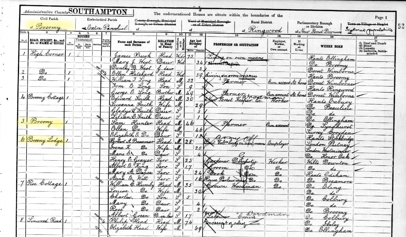
Burley
England Jurisdictions 1851 - Burley
Extract from FamilySearch England Jurisdictions 1851. This link may not work if you don't have a subscription to FamilySearch
Then search for Burley. Use the Key to select which boundaries you wish to see.
However, Burley, Hampshire, does not appear to be included in England Jurisdictions 1851 Mapping.
A map of Burley Parish can be found here
From the England Jurisdictions 1851 Mapping.
Ringwood is an Ancient Parish in the county of Hampshire, created in .
Other places in the parish include: Ashley, North; Bisterne and Crow; Burley; Burley Walk; Holmsley Walk; Kingston; North Ashley.
However, by inspection, Burley appears to be in The New Forest (on this site).
Ellingham
England Jurisdictions 1851 - Ellingham
Extract from FamilySearch England Jurisdictions 1851. This link may not work if you don't have a subscription to FamilySearch
Then search for Ellingham. Use the Key to select which boundaries you wish to see.
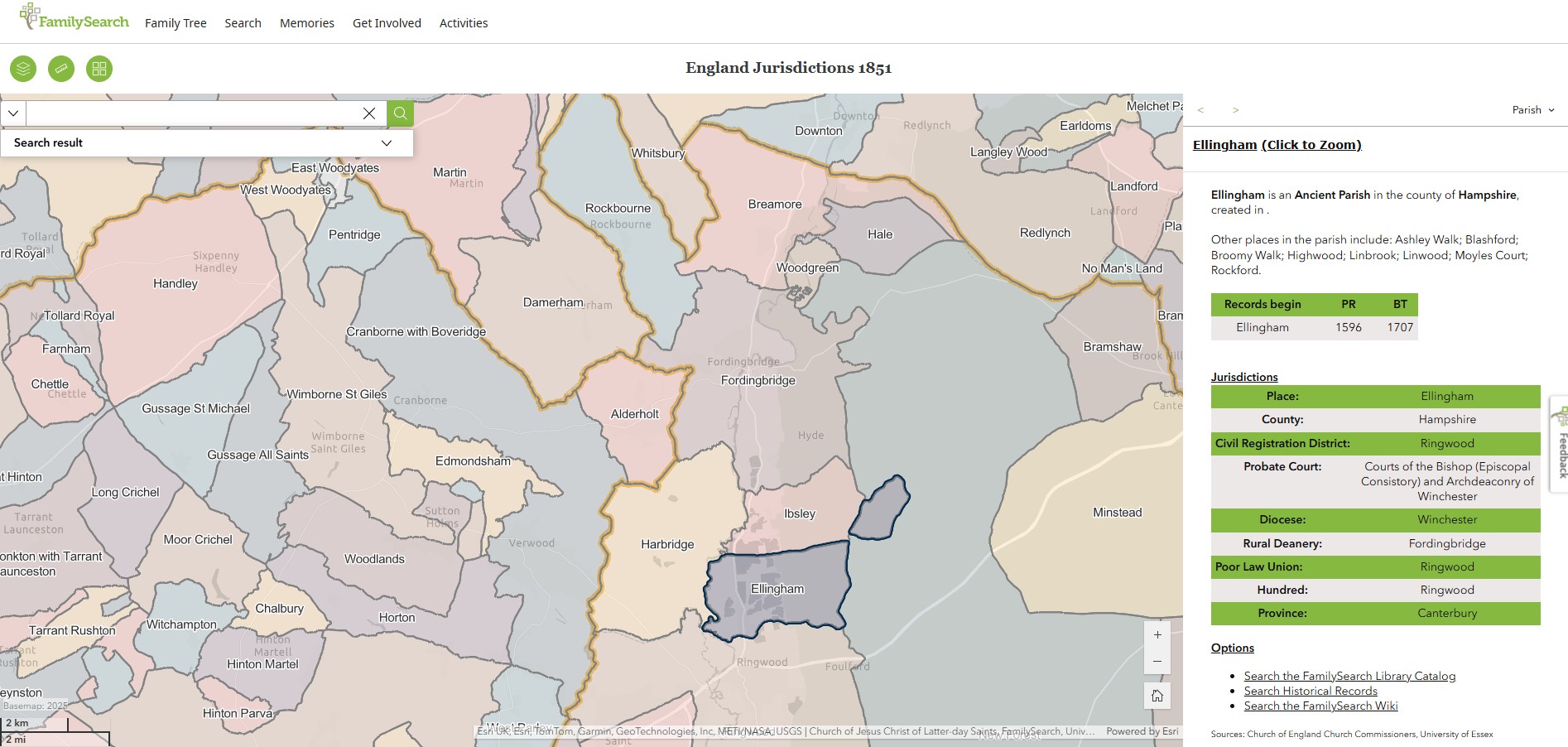
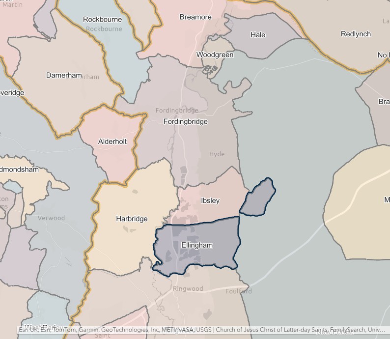
Harbridge
England Jurisdictions 1851 - Harbridge
Extract from FamilySearch England Jurisdictions 1851. This link may not work if you don't have a subscription to FamilySearch
Then search for Harbridge. Use the Key to select which boundaries you wish to see.
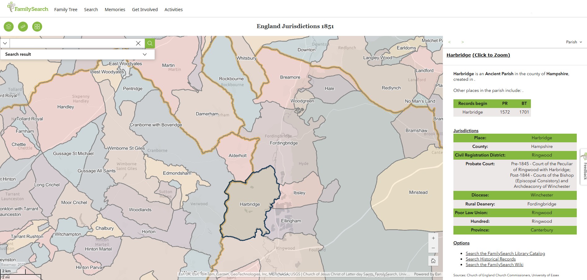
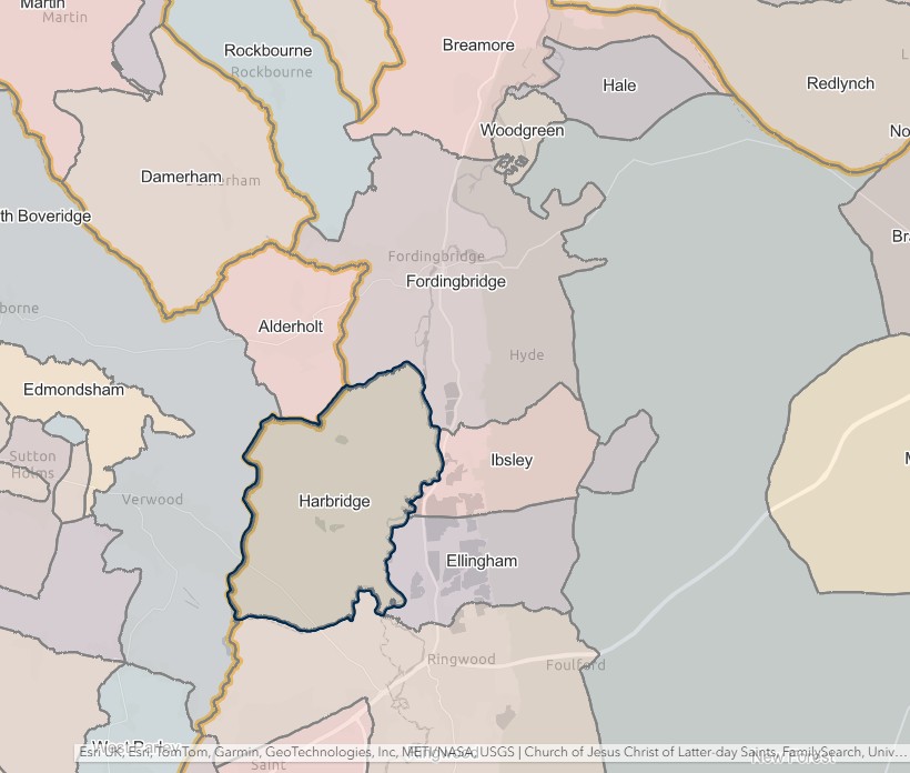
Ibsley
England Jurisdictions 1851 - Ibsley
Extract from FamilySearch England Jurisdictions 1851. This link may not work if you don't have a subscription to FamilySearch
Then search for Ibsley. Use the Key to select which boundaries you wish to see.
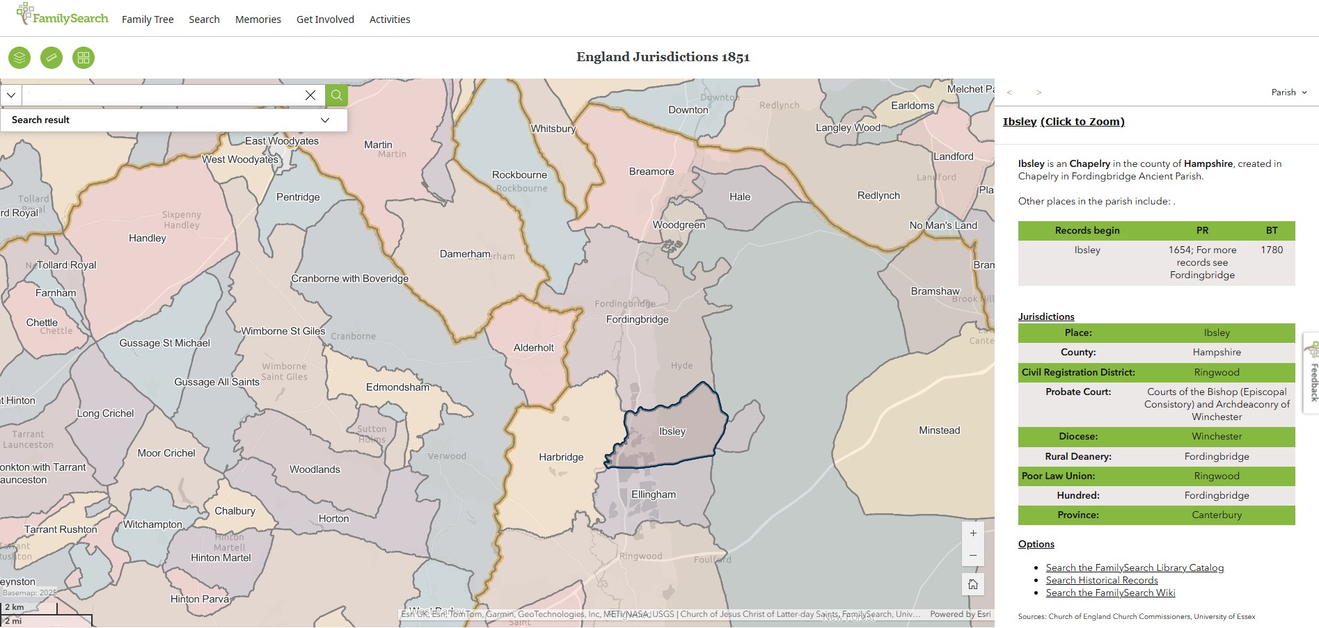
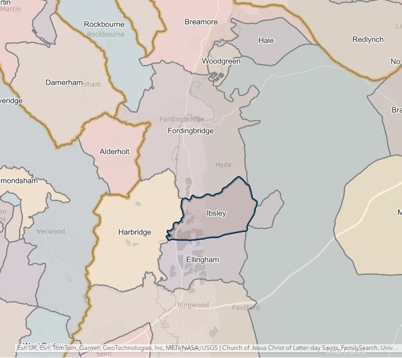
Ringwood
England Jurisdictions 1851 - Ringwood
Extract from FamilySearch England Jurisdictions 1851. This link may not work if you don't have a subscription to FamilySearch
Then search for Ringwood. Use the Key to select which boundaries you wish to see.
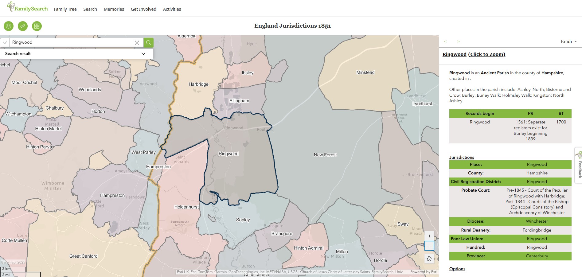
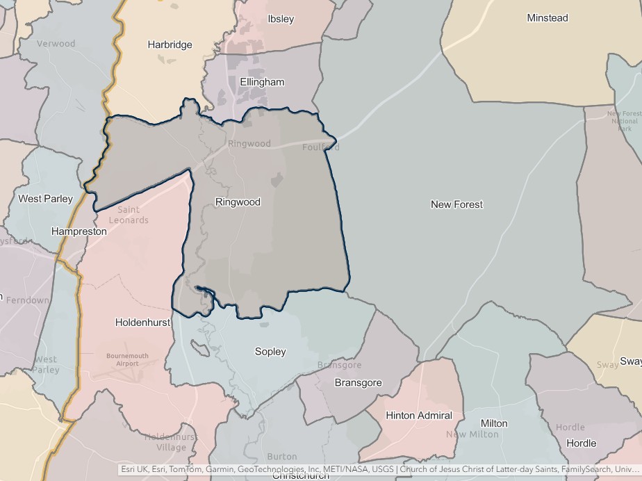
Romsey
England Jurisdictions 1851 - CRD Romsey
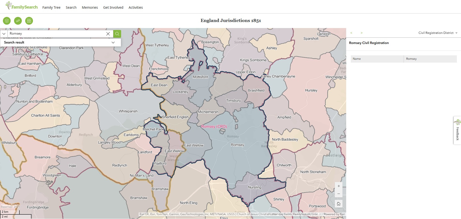
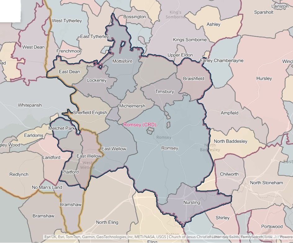
ROMSEY REGISTRATION DISTRICT
- Registration County : Hampshire.
- Created : 1.7.1837 (originally "Romsey & Mitchelmersh")
- Abolished : 1.10.1932 (added to Romsey & Stockbridge registration district).
- Re-created : 1.4.1974 (out of Romsey & Stockbridge registration district).
- Abolished : 1.4.2008 (added to Hampshire registration district).
- Sub-districts : Michelmersh; Romsey
- GRO volumes : VII (1837–51); 2c (1852–1932); 20 (1974–92).
- District number : 62g (1841–46); 107 (1847–69); 98 (1870–80); 99 (1881–1908); 101 (1909–32); 499 (1974–2008).
Table 1A: List of Places in Romsey Registration District (1837–1932)
|
Civil Parish |
County |
From |
To |
Comments |
|
Dunwood |
1837 |
1932 |
Abolished 1.4.1932 and added to the parish of Sherfield English. |
|
|
East Dean |
1837 |
1932 |
See Table 2, note (f). |
|
|
East Wellow |
1837 |
1932 |
Abolished 1.4.1932 and added to the parish of Wellow. |
|
|
Lockerley |
1837 |
1932 |
See Table 2, notes (d) and (f). |
|
|
Melchet Park |
1859 |
1895 |
Transferred from Wiltshire to Hampshire on 30.9.1895. Abolished 1.4.1932 and added to the parish of Melchet Park & Plaitford. See also Table 2, note (a). |
|
|
1895 |
1932 |
|||
|
Melchet Park & Plaitford |
1932 |
1932 |
Created 1.4.1932 from the separate parishes of Plaitford and Melchet Park. See also Table 2, note (f). |
|
|
Michelmersh |
1837 |
1932 |
See Table 2, note (f). |
|
|
Mottisfont |
1837 |
1932 |
See Table 2, notes (b) and (f). |
|
|
Nursling |
1837 |
1932 |
Abolished 1.4.1932 and added to the parish of Nursling & Rownhams. |
|
|
Nursling & Rownhams |
1932 |
1932 |
Created 1.4.1932 from the separate parishes of Nursling and Rownhams. See also Table 2, note (f). |
|
|
Plaitford |
1837 |
1895 |
Transferred from Wiltshire to Hampshire on 30.9.1895. Abolished 1.4.1932 and added to the parish of Melchet Park & Plaitford. See also Table 2, note (c). |
|
|
1895 |
1932 |
|||
|
Romsey Extra |
1837 |
1932 |
See Table 2, note (f). |
|
|
Romsey Intra |
1837 |
1932 |
See Table 2, note (f). |
|
|
Rownhams |
1897 |
1932 |
Created 1.10.1897 out of the parishes of Nursling, North Baddesley and Romsey Extra. Abolished 1.4.1932 and added to the parish of Nursling & Rownhams. See also Table 2, note (e). |
|
|
Sherfield English |
1837 |
1932 |
See Table 2, note (f). |
|
|
Timsbury |
1837 |
1932 |
Abolished 1.4.1932 and added to the parish of Michelmersh. |
|
|
Wellow |
1932 |
1932 |
Created 1.4.1932 from the parishes of West Wellow and East Wellow. See also Table 2, note (f). |
|
|
West Wellow |
1837 |
1895 |
Transferred from Wiltshire to Hampshire on 30.9.1895. Abolished 1.4.1932 and added to the parish of Wellow. |
|
|
1895 |
1932 |
Table 1B: List of Places in Romsey Registration District (1974–2008)
|
Civil Parish |
County |
From |
To |
Comments |
|
Ampfield |
1974 |
2008 |
See Table 2, notes (g) and (h). |
|
|
Ashley |
1974 |
2008 |
See Table 2, notes (g) and (h). |
|
|
Awbridge |
1984 |
2008 |
Created 1.4.1984 out of the parishes of Lockerley, Mottisfont and Sherfield English. See also Table 2, note (h). |
|
|
Bossington |
1974 |
2008 |
See Table 2, notes (g) and (h). |
|
|
Braishfield |
1974 |
2008 |
See Table 2, notes (g) and (h). |
|
|
Broughton |
1974 |
2008 |
See Table 2, notes (g) and (h). |
|
|
Buckholt |
1974 |
2008 |
See Table 2, notes (g) and (h). |
|
|
Chilworth |
1974 |
2008 |
See Table 2, notes (g) and (h). |
|
|
East Dean |
1974 |
2008 |
See Table 2, notes (g) and (h). |
|
|
East Tytherley |
1974 |
2008 |
See Table 2, notes (g) and (h). |
|
|
Frenchmoor |
1974 |
2008 |
See Table 2, notes (g) and (h). |
|
|
Houghton |
1974 |
2008 |
See Table 2, notes (g) and (h). |
|
|
King's Somborne |
1974 |
2008 |
See Table 2, notes (g) and (h). |
|
|
Little Somborne |
1974 |
2008 |
See Table 2, notes (g) and (h). |
|
|
Lockerley |
1974 |
2008 |
See Table 2, notes (g) and (h). |
|
|
Melchet Park & Plaitford |
1974 |
2008 |
See Table 2, notes (g) and (h). |
|
|
Michelmersh |
1974 |
2003 |
Renamed 19.11.2003 to become the parish of Michelmersh & Timsbury. See also Table 2, note (g). |
|
|
Michelmersh & Timsbury |
2003 |
2008 |
Created 19.11.2003 by renaming the parish of Michelmersh. See also Table 2, note (h). |
|
|
Mottisfont |
1974 |
2008 |
See Table 2, notes (g) and (h). |
|
|
North Baddesley |
1974 |
2008 |
See Table 2, notes (g) and (h). |
|
|
Nursling & Rownhams |
1974 |
2008 |
See Table 2, notes (g) and (h). |
|
|
Romsey |
1974 |
2008 |
Created 1.4.1974 by renaming the parish of Romsey Intra. See also Table 2, notes (g) and (h). |
|
|
Romsey Extra |
1974 |
2008 |
See Table 2, notes (g) and (h). |
|
|
Sherfield English |
1974 |
2008 |
See Table 2, notes (g) and (h). |
|
|
Valley Park |
2007 |
2008 |
Created 1.4.2007 out of the parishes of Chilworth and North Baddesley. See also Table 2, note (h). |
|
|
Wellow |
1974 |
2008 |
See Table 2, notes (g) and (h). |
|
|
West Tytherley |
1974 |
2008 |
See Table 2, notes (g) and (h). |
Table 2: Boundary Changes affecting Romsey Registration District
|
Date of Change |
Note |
Description of Change |
Population transferred |
|
24.1.1859 |
(a) |
Gained the parish of Melchet Park from Alderbury registration district. |
30 in 1851 |
|
25.3.1883 |
(b) |
Gained part of the parish of Mottisfont (which until 25.3.1883 formed a detached part of the parish of Broughton) from Stockbridge registration district. |
18 in 1891 |
|
25.3.1885 |
(c) |
Gained part of the parish of Plaitford (which until 25.3.1885 formed a detached part of the parish of Whiteparish) from Alderbury registration district. |
0 in 1891 |
|
24.3.1888 |
(d) |
Lost a detached part of the parish of Lockerley (which was added to the parish of East Tytherley on 24.3.1888) from Stockbridge registration district. |
0 in 1891 |
|
1.12.1897 |
(e) |
Gained part of the parish of Rownhams (which until 1.10.1897 formed part of the parish of North Baddesley) from Winchester registration district. |
140 in 1891 |
|
1.10.1932 (abolished) |
(f) |
Lost the parishes of East Dean, Lockerley, Melchet Park & Plaitford, Michelmersh, Mottisfont, Nursling & Rownhams, Romsey Extra, Romsey Intra, Sherfield English and Wellow, to Romsey & Stockbridge registration district. |
12703 in 1931 |
|
1.4.1974 |
(g) |
Gained the parishes of Ampfield, Ashley, Bossington, Braishfield, Broughton, Buckholt, Chilworth, East Dean, East Tytherley, Frenchmoor, Houghton, King's Somborne, Little Somborne, Lockerley, Melchet Park & Plaitford, Michelmersh, Mottisfont, North Baddesley, Nursling & Rownhams, Romsey, Romsey Extra, Sherfield English, Wellow and West Tytherley, from Romsey & Stockbridge registration district. |
71296 in 1971 |
|
1.4.2008 (abolished) |
(h) |
Lost the parishes of Ampfield, Ashley, Awbridge, Bossington, Braishfield, Broughton, Buckholt, Chilworth, East Dean, East Tytherley, Frenchmoor, Houghton, King's Somborne, Little Somborne, Lockerley, Melchet Park & Plaitford, Michelmersh & Timsbury, Mottisfont, North Baddesley, Nursling & Rownhams, Romsey, Romsey Extra, Sherfield English, Valley Park, Wellow and West Tytherley, to Hampshire registration district. |
49873 in 2001 |
The Parishes within the Civil Registration District as at 1851 (generally the same as the 1837 entries above)
Dunwood
England Jurisdictions 1851 - Dunwood
Extract from FamilySearch England Jurisdictions 1851. This link may not work if you don't have a subscription to FamilySearch
Then search for Dunwood. Use the Key to select which boundaries you wish to see.
DUNWOOD, an extra-parochial liberty, adjacent to the parish of East Wellow, and in the union of Romsey, hundred of Thorngate, Romsey and S. divisions of the county of Southampton. (Hampshire)
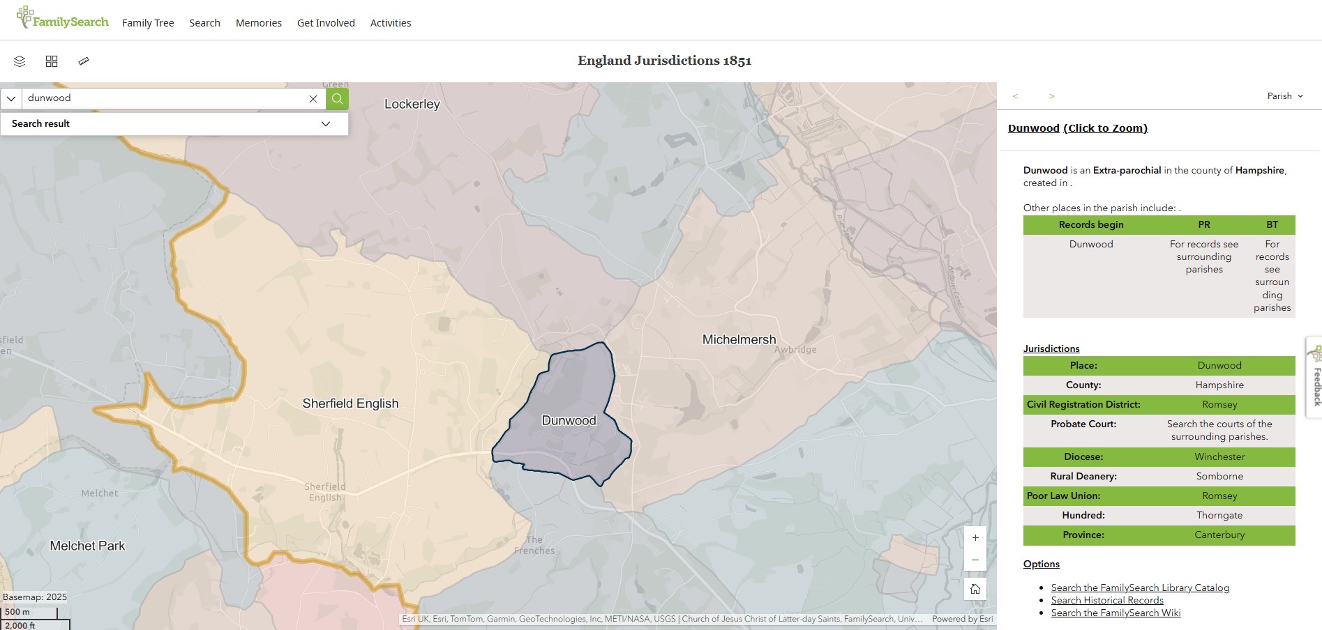
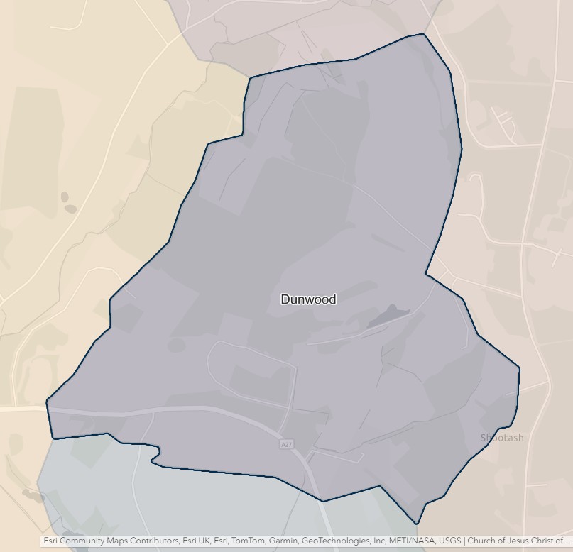
East Dean
England Jurisdictions 1851 - East Dean
Extract from FamilySearch England Jurisdictions 1851. This link may not work if you don't have a subscription to FamilySearch
Then search for East Dean. Use the Key to select which boundaries you wish to see.
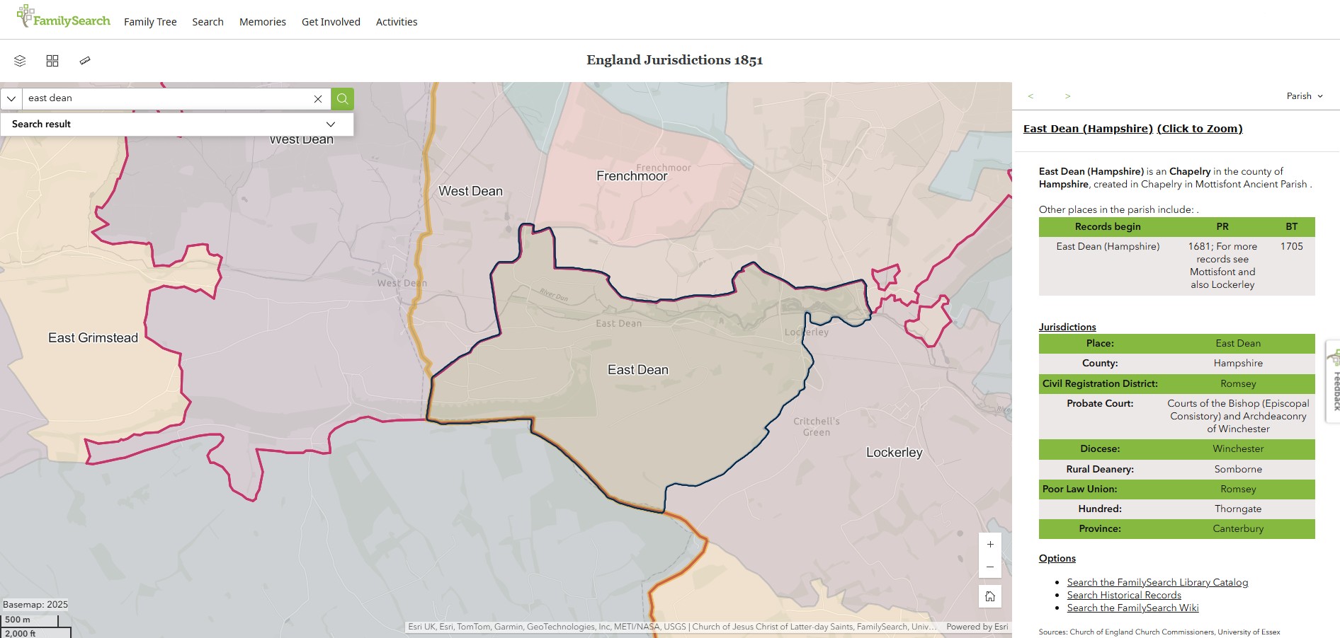
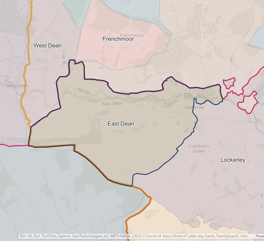
East Wellow
England Jurisdictions 1851 - East Wellow
Extract from FamilySearch England Jurisdictions 1851. This link may not work if you don't have a subscription to FamilySearch
Then search for East Wellow, Wiltshire. Use the Key to select which boundaries you wish to see.
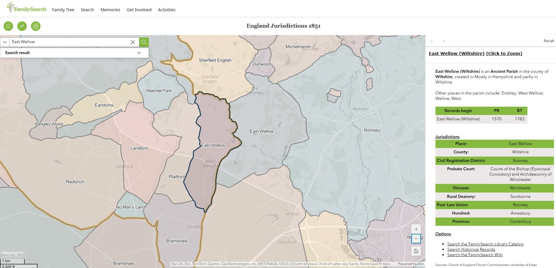
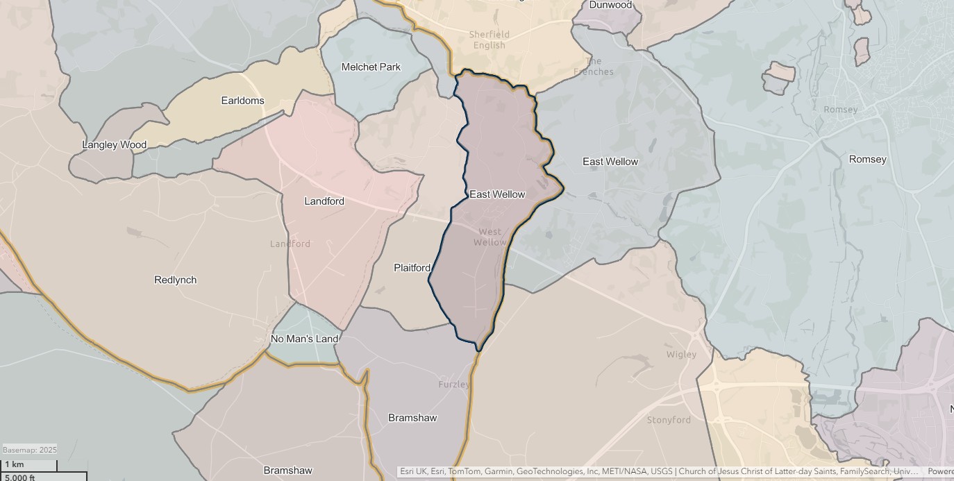
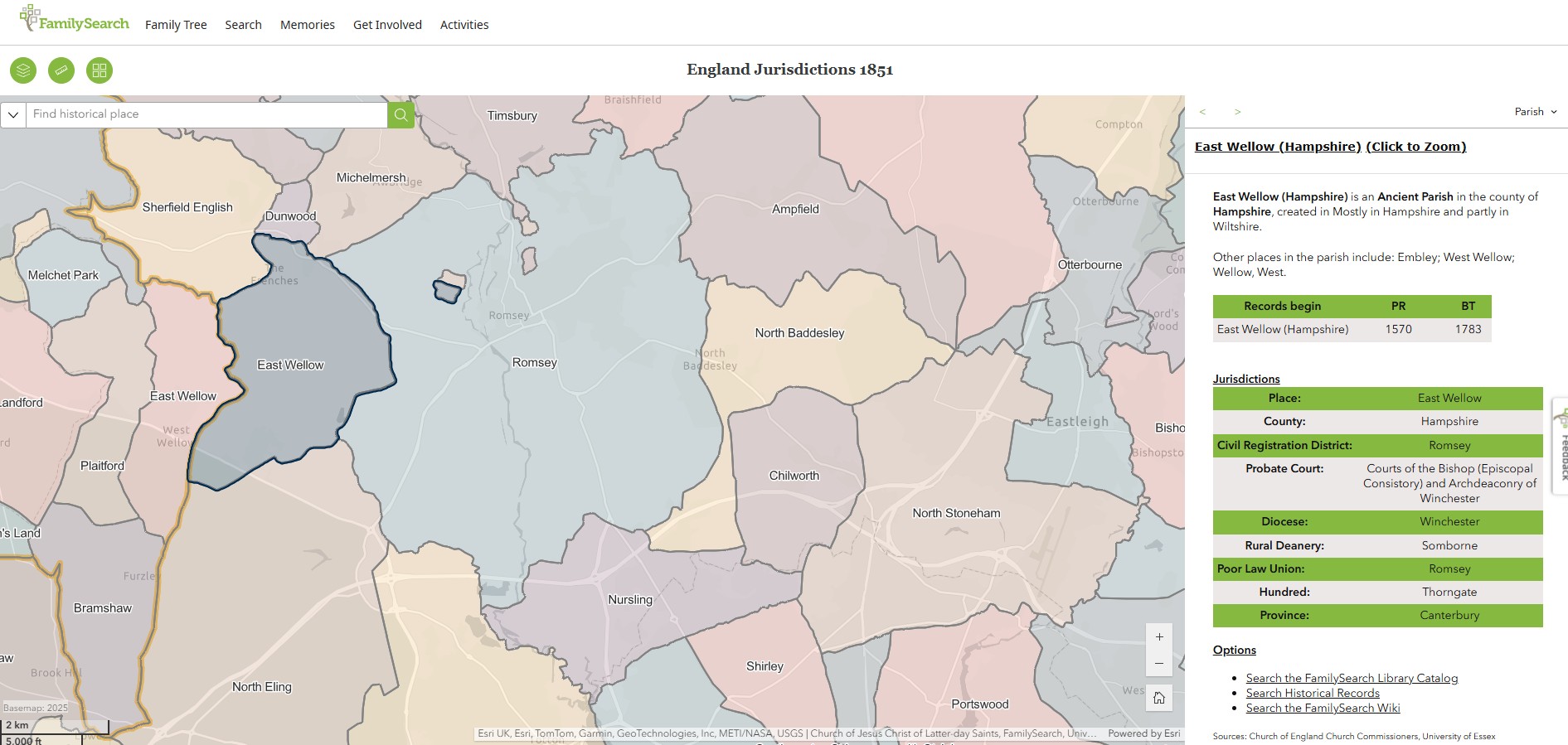
Lockerley
England Jurisdictions 1851 - Lockerley
Extract from FamilySearch England Jurisdictions 1851. This link may not work if you don't have a subscription to FamilySearch
Then search for Lockerly. Use the Key to select which boundaries you wish to see.
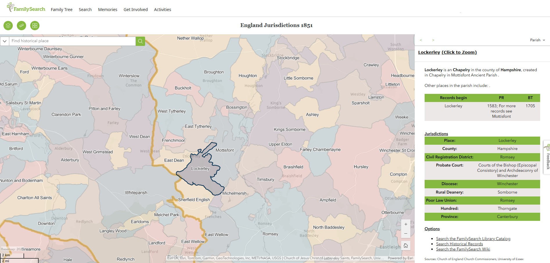
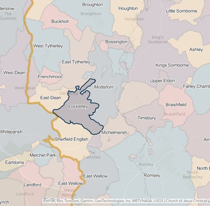
Melchet Park
England Jurisdictions 1851 - Melchet Park
Extract from FamilySearch England Jurisdictions 1851. This link may not work if you don't have a subscription to FamilySearch
Then search for Melchet Park. Use the Key to select which boundaries you wish to see.
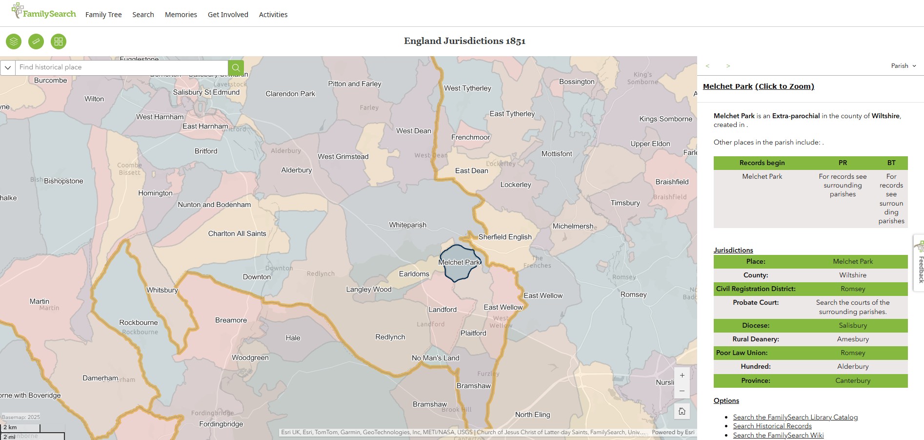
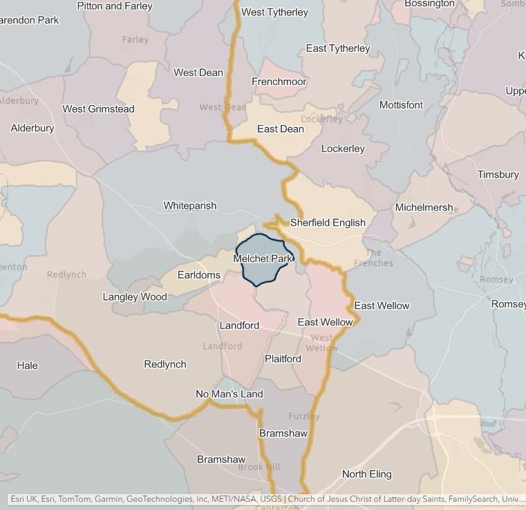
Michelmersh
England Jurisdictions 1851 - Michelmersh
Extract from FamilySearch England Jurisdictions 1851. This link may not work if you don't have a subscription to FamilySearch
Then search for Michelmersh. Use the Key to select which boundaries you wish to see.
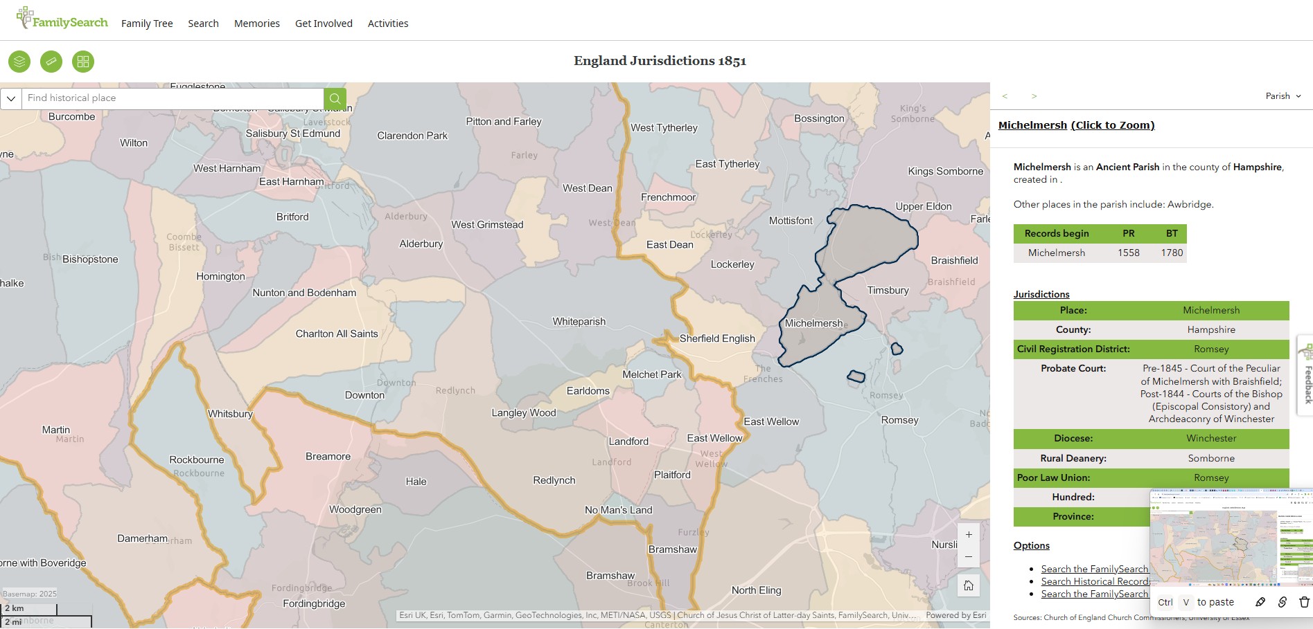
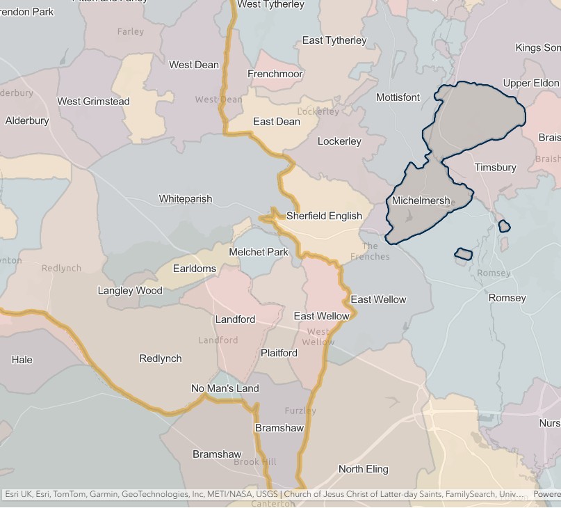
Mottisfont
England Jurisdictions 1851 - Mottisfont
Extract from FamilySearch England Jurisdictions 1851. This link may not work if you don't have a subscription to FamilySearch
Then search for Mottisfont. Use the Key to select which boundaries you wish to see.
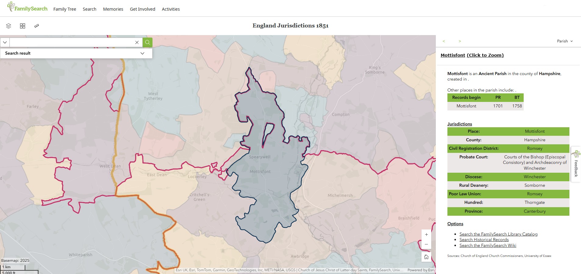
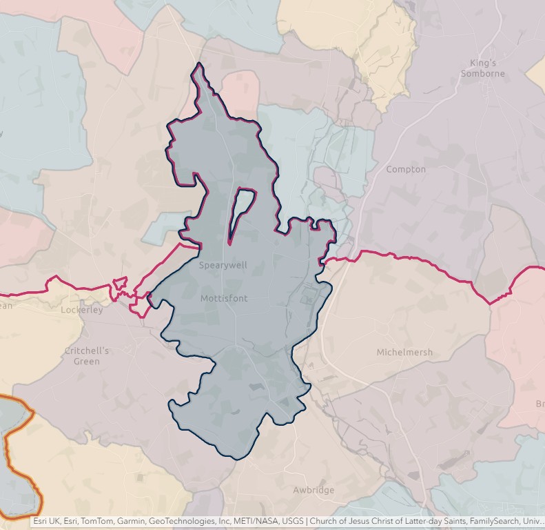
Nursling
England Jurisdictions 1851 - Nursling
Extract from FamilySearch England Jurisdictions 1851. This link may not work if you don't have a subscription to FamilySearch
Then search for Nursling. Use the Key to select which boundaries you wish to see.
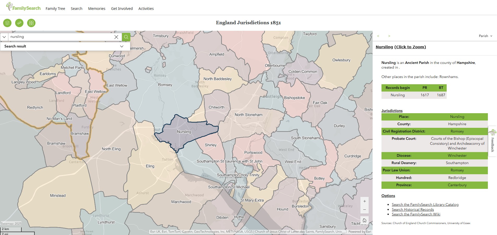
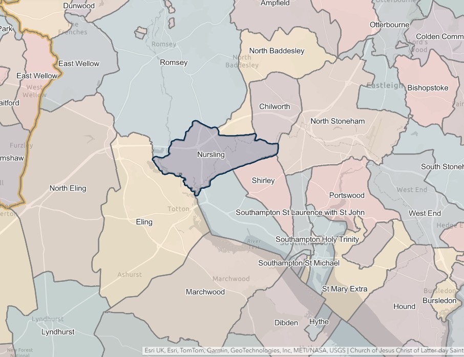
Romsey Extra
England Jurisdictions 1851 - Romsey Extra
Extract from FamilySearch England Jurisdictions 1851. This link may not work if you don't have a subscription to FamilySearch
Then search for Romsey Extra. Use the Key to select which boundaries you wish to see.
However, Romsey Extra does not appear to be included in England Jurisdictions 1851 Mapping.
Romsey Extra surrounds Romsey.
Romsey Extra civil parish was formed in 1866 from the area of Romsey parish outside the municipal borough. Its council was formed in 1894. On 1 April 2023 the parish council was abolished and most of its area transferred to Romsey parish; the Stanbridge Earls area became part of Awbridge parish.
Romsey (Intra)
England Jurisdictions 1851 - Romsey or Romsey Intra
Extract from FamilySearch England Jurisdictions 1851. This link may not work if you don't have a subscription to FamilySearch
Then search for Romsey or Romsey Intra. Use the Key to select which boundaries you wish to see.
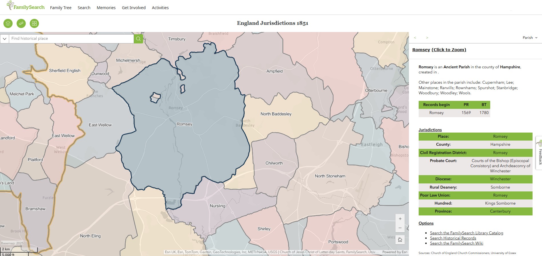

Sherfield English
England Jurisdictions 1851 - Sherfield English
Extract from FamilySearch England Jurisdictions 1851. This link may not work if you don't have a subscription to FamilySearch
Then search for Sherfield English. Use the Key to select which boundaries you wish to see.
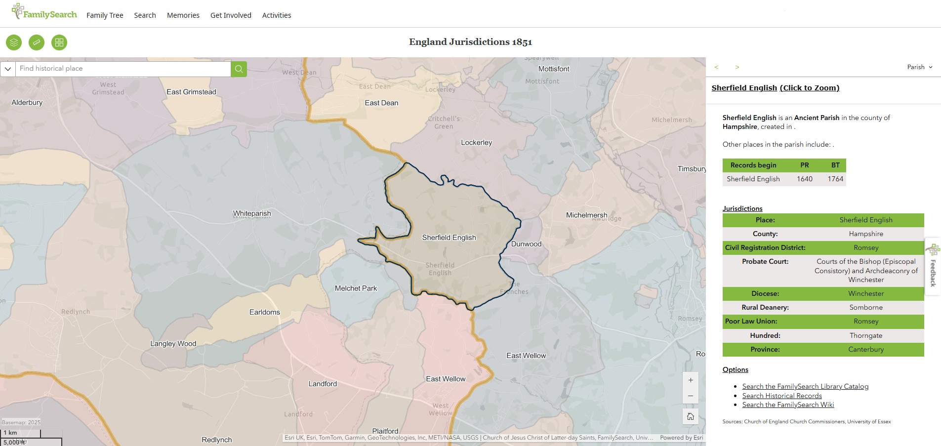
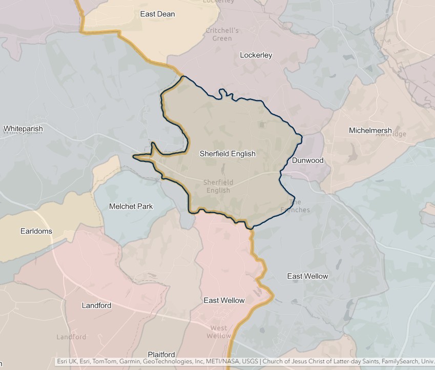
Timsbury
England Jurisdictions 1851 - Timsbury
Extract from FamilySearch England Jurisdictions 1851. This link may not work if you don't have a subscription to FamilySearch
Then search for Timsbury. Use the Key to select which boundaries you wish to see.
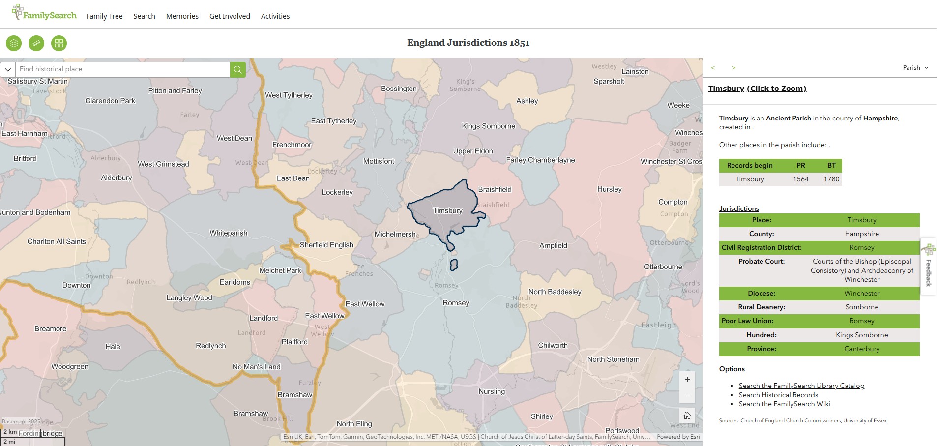
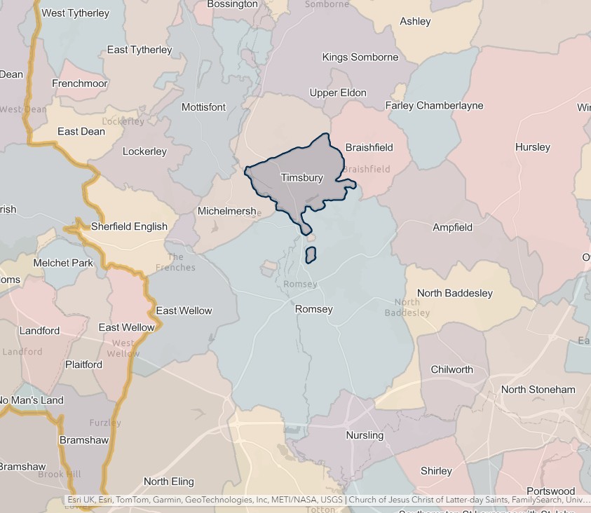
Southampton
England Jurisdictions 1851 - CRD Southampton
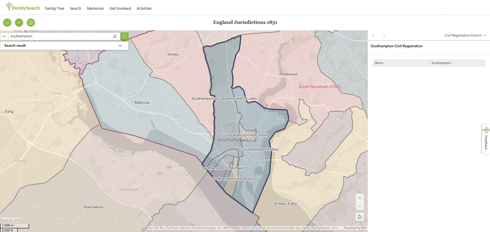
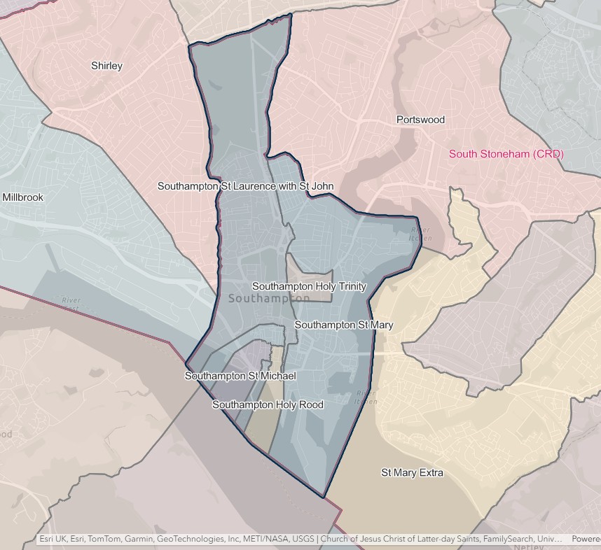
SOUTHAMPTON REGISTRATION DISTRICT
- Registration County : Hampshire.
- Created : 1.7.1837.
- Sub-districts : Eastleigh; Southampton; Southampton Eastern; Southampton Western
- GRO volumes : VII (1837–51); 2c (1852–1946); 6B (1946–74); 20 (1974–92).
- District number : 61 (1841–46); 105 (1847–69); 96 (1870–80); 97 (1881–1908); 99 (1909–46); 310 (1946–74); 500 (from 1974).
Table 1A: List of Places in Southampton Registration District (1837–1974)
|
Civil Parish |
County |
From |
To |
Comments |
|
All Saints |
1837 |
1912 |
Abolished 31.3.1912 and added to the parish of Southampton. |
|
|
Bitterne |
1924 |
1925 |
Abolished 1.4.1925 and added to the parish of Southampton. See also Table 2, note (b). |
|
|
Holy Rood |
1837 |
1912 |
Abolished 31.3.1912 and added to the parish of Southampton. |
|
|
Itchen |
1924 |
1925 |
Abolished 1.4.1925 and added to the parish of Southampton. See also Table 2, note (b). |
|
|
Portswood |
1909 |
1912 |
Abolished 31.3.1912 and added to the parish of Southampton. See also Table 2, note (a). |
|
|
Shirley |
1909 |
1912 |
Abolished 31.3.1912 and added to the parish of Southampton. See also Table 2, note (a). |
|
|
Southampton |
1912 |
1974 |
Created 31.3.1912 from the parishes of St. Mary, Shirley, Portswood, All Saints, St. Michael, Holy Rood, St. John, St. Lawrence. Abolished 1.4.1974 to become an unparished area. See also Table 2, notes (c), (d), (e) and (f). |
|
|
St. John |
1837 |
1912 |
Abolished 31.3.1912 and added to the parish of Southampton. |
|
|
St. Lawrence |
1837 |
1912 |
Abolished 31.3.1912 and added to the parish of Southampton. |
|
|
St. Mary |
1837 |
1912 |
Abolished 31.3.1912 and added to the parish of Southampton. |
|
|
St. Michael |
1837 |
1912 |
Abolished 31.3.1912 and added to the parish of Southampton. |
|
|
St. Nicholas |
1924 |
1925 |
Abolished 1.4.1925 and added to the parish of Southampton. See also Table 2, note (b). |
Table 1B: List of Places in Southampton Registration District (from 1974)
|
Civil Parish |
County |
From |
To |
Comments |
|
Bishopstoke |
1995 |
1997 |
Created 14.12.1995 out of the Eastleigh unparished area. See also Table 2, note (i). |
|
|
Botley |
1974 |
1997 |
See Table 2, notes (g) and (i). |
|
|
Bursledon |
1974 |
1997 |
See Table 2, notes (g) and (i). |
|
|
Eastleigh* |
1974 |
1997 |
Unparished area which until 1.4.1974 formed the parish of Eastleigh. See also Table 2, notes (g) and (i). |
|
|
Fair Oak |
1974 |
1983 |
Renamed 28.7.1983 to become the parish of Fair Oak & Horton Heath. See also Table 2, note (g). |
|
|
Fair Oak & Horton Heath |
1983 |
1997 |
Created 28.7.1983 by renaming the parish of Fair Oak. See also Table 2, note (i). |
|
|
Hamble |
1974 |
1992 |
Renamed 27.4.1992 to become the parish of Hamble-le-Rice. See also Table 2, note (g). |
|
|
Hamble-le-Rice |
1992 |
1997 |
Created 27.4.1992 by renaming the parish of Hamble. See also Table 2, note (i) |
|
|
Hedge End |
1974 |
1997 |
See Table 2, notes (g) and (i). |
|
|
Hound |
1974 |
1997 |
See Table 2, notes (g) and (i). |
|
|
Southampton |
1974 |
Unparished area which until 1.4.1974 formed the parish of Southampton. See also Table 2, note (h). |
||
|
West End |
1974 |
1997 |
See Table 2, notes (g) and (i). |
Table 2: Boundary Changes affecting Southampton Registration District
|
Date of Change |
Note |
Description of Change |
Population transferred |
|
1.7.1909 |
(a) |
Gained the parishes of Portswood and Shirley from South Stoneham registration district. |
43505 in 1901 |
|
1.4.1924 |
(b) |
Gained the parishes of Bitterne, Itchen and St. Nicholas, from South Stoneham registration district. |
31369 in 1921 |
|
1.4.1954 |
(c) |
Lost part of the parish of Southampton (which was added to the parish of Nursling & Rownhams on 1.4.1954) to Romsey & Stockbridge registration district. |
0 in 1951 |
|
(d) |
Gained parts of the parish of Southampton (which until 1.4.1954 formed parts of the parishes of Millbrook and Nursling & Rownhams) from Romsey & Stockbridge registration district. |
6430 in 1951 |
|
|
(e) |
Gained parts of the parish of Southampton (which until 1.4.1954 formed parts of the parishes of Hound and West End) from Winchester registration district. |
5048 in 1951 |
|
|
1.4.1967 |
(f) |
Gained part of the parish of Southampton (which until 1.4.1967 formed part of the parish of Nursling & Rownhams) from Romsey & Stockbridge registration district. |
204 in 1961 |
|
1.4.1974 |
(g) |
Gained the Eastleigh unparished area and the parishes of Botley, Bursledon, Fair Oak, Hamble, Hedge End, Hound and West End, from Winchester registration district. |
59766 in 1971 |
|
1.4.1978 |
(h) |
Gained part of the Southampton unparished area (which until 1.4.1978 formed parts of the parishes of Dibden, Marchwood and Totton & Eling) from New Forest registration district. |
0 in 1978 |
|
1.4.1997 |
(i) |
Lost the Eastleigh unparished area and the parishes of Bishopstoke, Botley, Bursledon, Fair Oak & Horton Heath, Hamble-le-Rice, Hedge End, Hound and West End, to Winchester registration district. |
101722 in 1991 |
The Parishes within the Civil Registration District as at 1851 (generally the same as the 1837 entries above)
All Saints
England Jurisdictions 1851 - All Saints
Extract from FamilySearch England Jurisdictions 1851. This link may not work if you don't have a subscription to FamilySearch
Then search for All Saints, Southampton. Use the Key to select which boundaries you wish to see
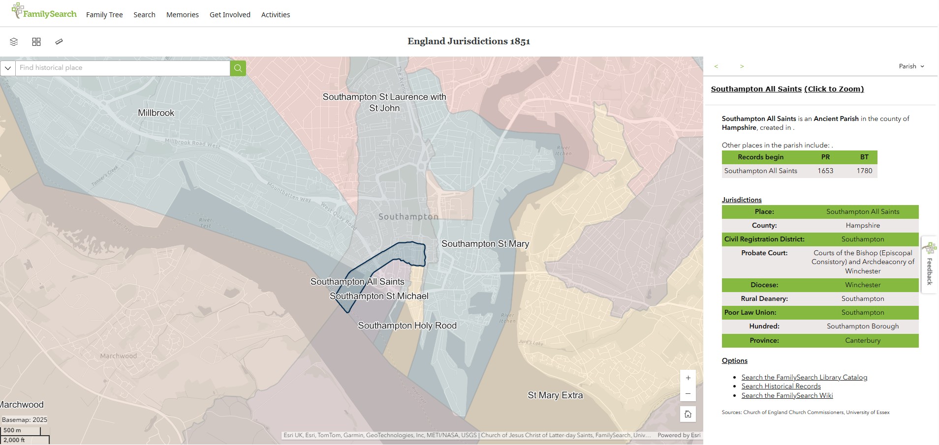
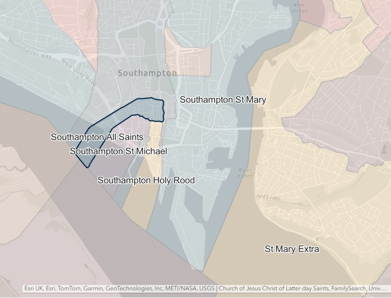
.
Holy Rood
England Jurisdictions 1851 - Holy Rood
Extract from FamilySearch England Jurisdictions 1851. This link may not work if you don't have a subscription to FamilySearch
Then search for Holy Rood, Southampton. Use the Key to select which boundaries you wish to see.
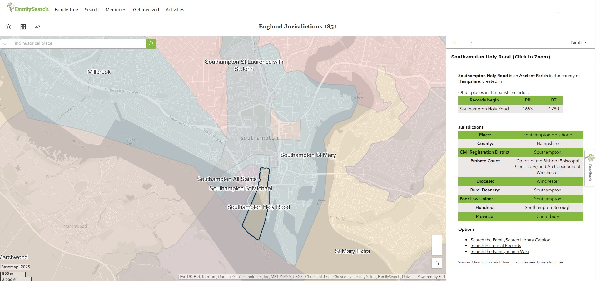
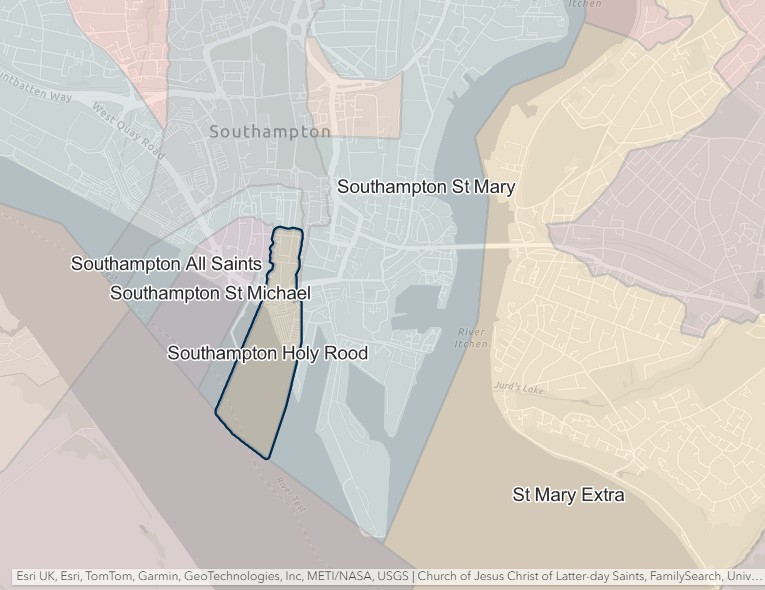
Holy Trinity
England Jurisdictions 1851 - Holy Trinity
Extract from FamilySearch England Jurisdictions 1851. This link may not work if you don't have a subscription to FamilySearch
Then search for Holy Trinity, Southampton. Use the Key to select which boundaries you wish to see.
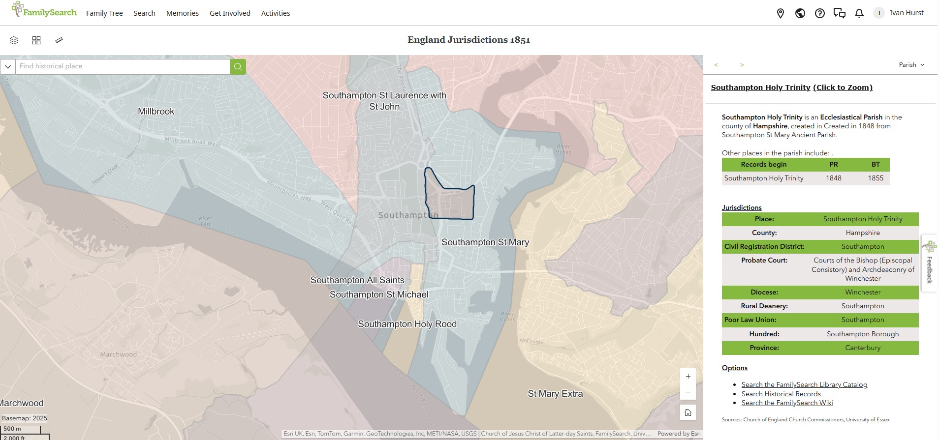
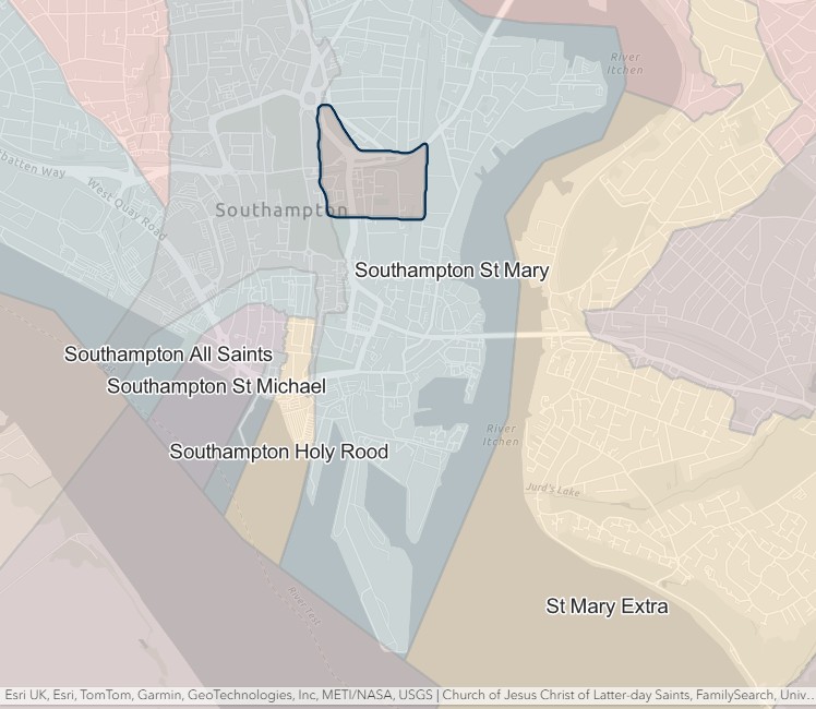
St John
England Jurisdictions 1851 - St John
Extract from FamilySearch England Jurisdictions 1851. This link may not work if you don't have a subscription to FamilySearch
Then search for St John, Southampton. Use the Key to select which boundaries you wish to see.
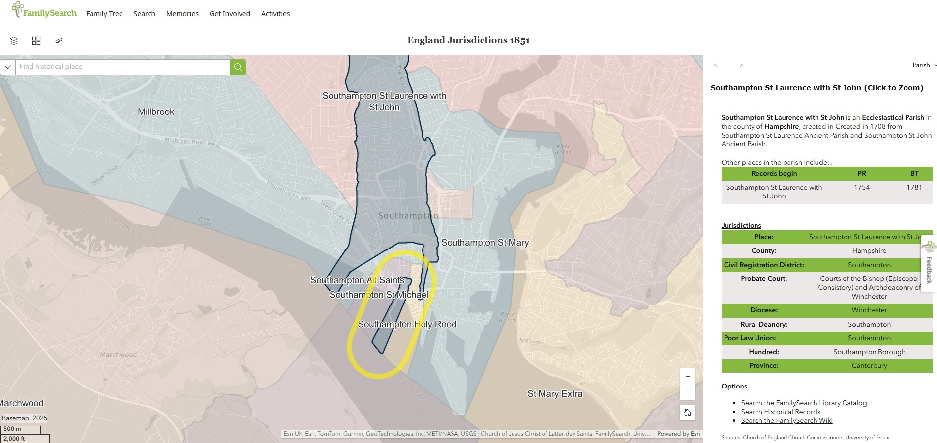
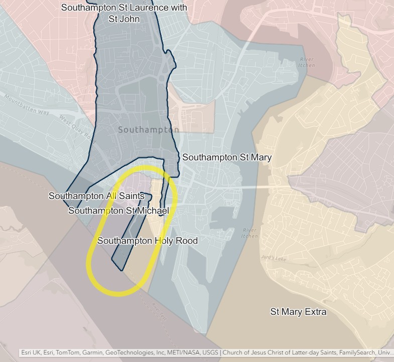
St Lawrence
England Jurisdictions 1851 - St Lawrence
Extract from FamilySearch England Jurisdictions 1851. This link may not work if you don't have a subscription to FamilySearch
Then search for St Lawrence, Southampton. Use the Key to select which boundaries you wish to see.
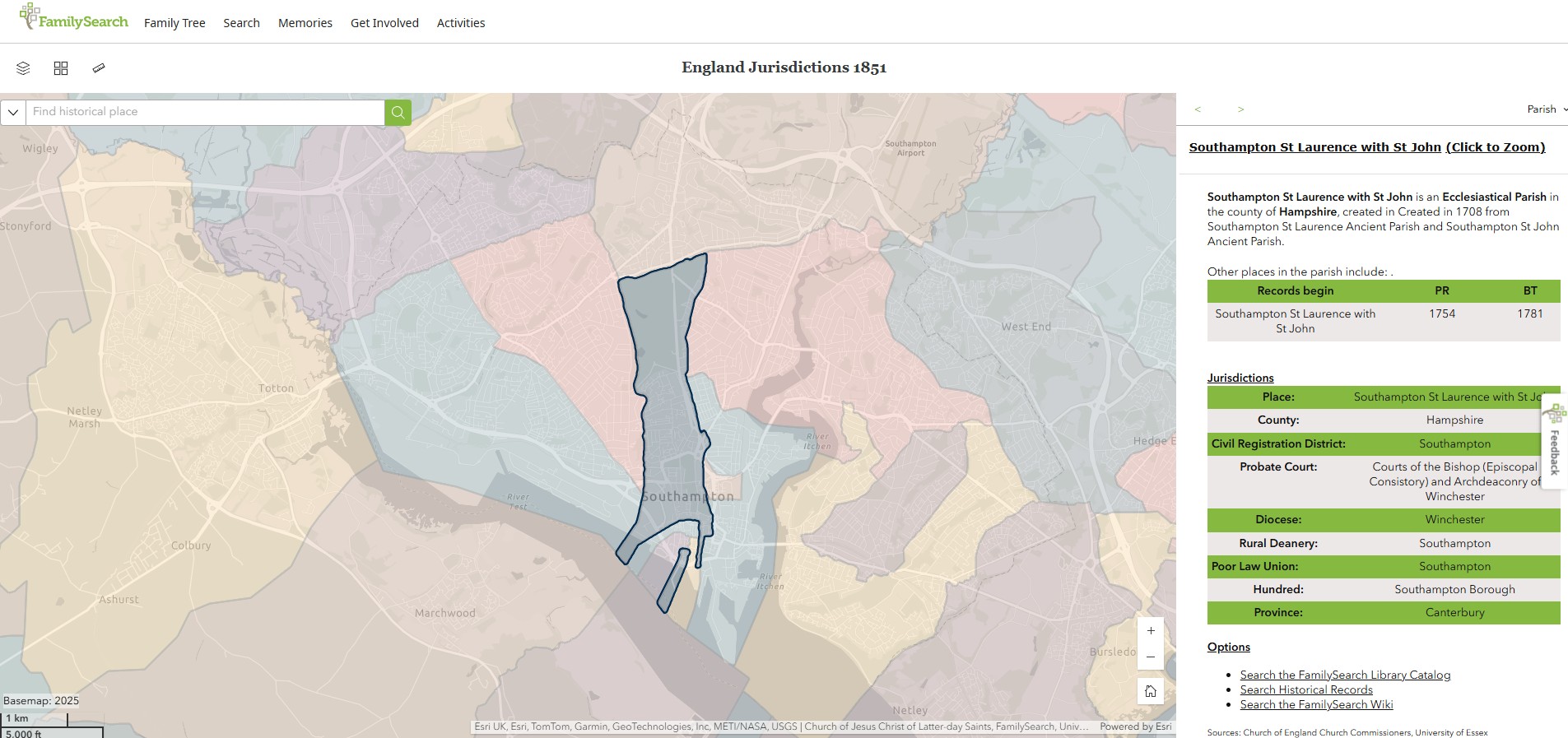
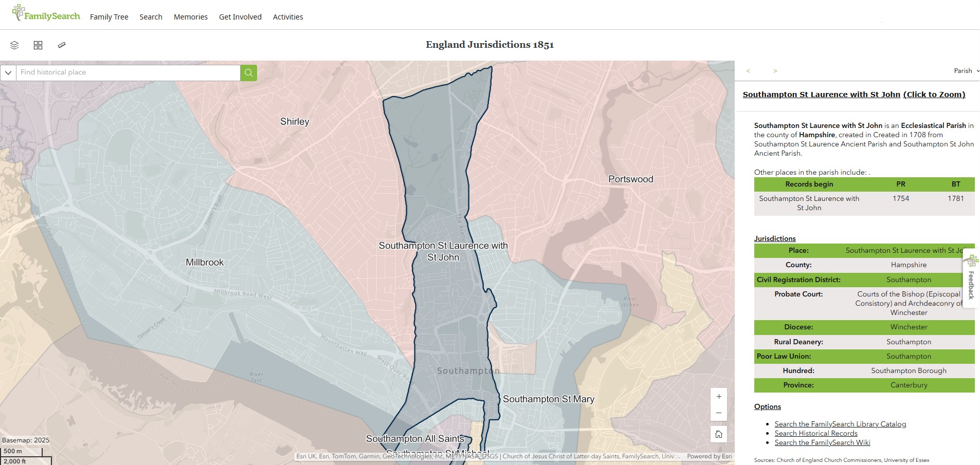
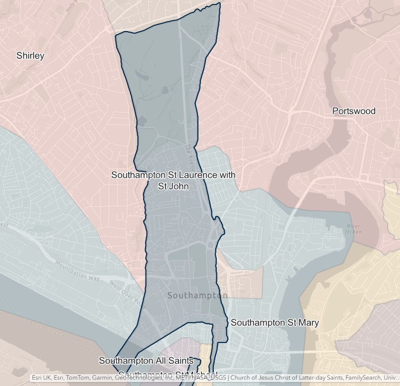
St Mary
England Jurisdictions 1851 - St Mary
Extract from FamilySearch England Jurisdictions 1851. This link may not work if you don't have a subscription to FamilySearch
Then search for St Mary, Southampton. Use the Key to select which boundaries you wish to see.
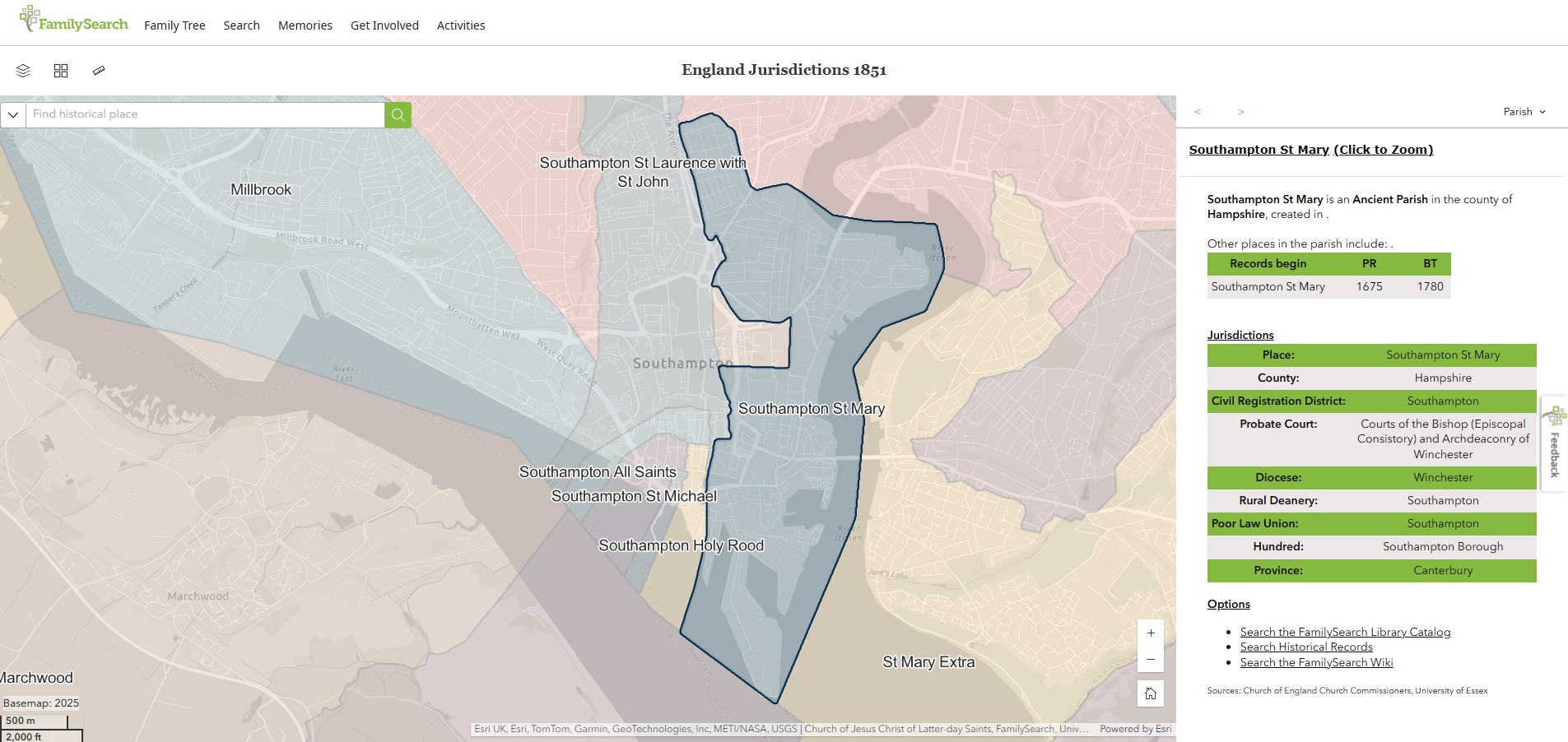
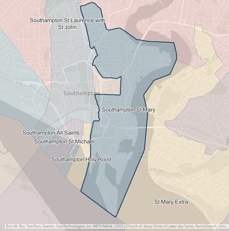
St Michael
England Jurisdictions 1851 - St Michael
Extract from FamilySearch England Jurisdictions 1851. This link may not work if you don't have a subscription to FamilySearch
Then search for St Michael, Southampton. Use the Key to select which boundaries you wish to see.
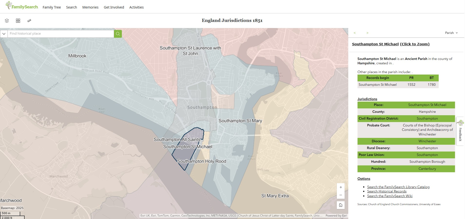
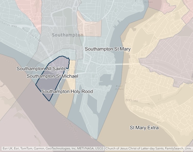
South Stoneham
England Jurisdictions 1851 - CRD South Stoneham
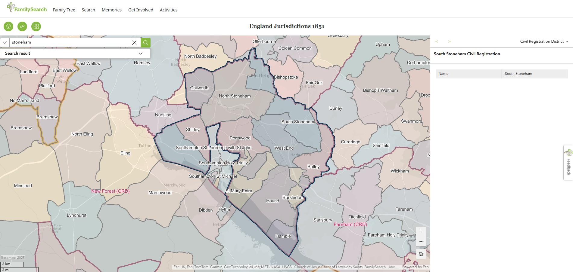
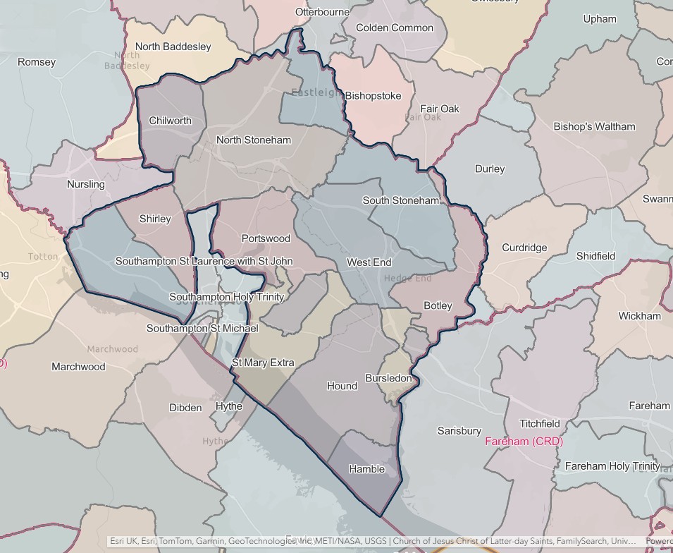
SOUTH STONEHAM REGISTRATION DISTRICT
- Registration County : Hampshire.
- Created : 1.7.1837.
- Abolished : 1.4.1927 (added to Eastleigh registration district).
- Sub-districts : Millbrook; St. Mary Extra; South Stoneham.
- GRO volumes : VII (1837–51); 2c (1852–1927).
- District number : 62a (1841–46); 106 (1847–69); 97 (1870–80); 98 (1881–1908); 100 (1909–27).
Table 1: List of Places in South Stoneham Registration District
|
Civil Parish |
County |
From |
To |
Comments |
|
Bitterne |
1894 |
1924 |
Created 1894 out of the parish of South Stoneham. See also Table 2, note (d). |
|
|
Botley |
1837 |
1927 |
See Table 2, notes (a) and (e). |
|
|
Bursledon |
1837 |
1927 |
See Table 2, note (e). |
|
|
Chilworth |
1837 |
1927 |
See Table 2, note (e). |
|
|
Eastleigh |
1894 |
1927 |
Created 26.3.1894 out of the parish of South Stoneham. See also Table 2, note (e). |
|
|
Hamble |
1837 |
1927 |
See Table 2, note (e). |
|
|
Hedge End |
1894 |
1927 |
Created 1894 out of the parishes of Botley and South Stoneham. See also Table 2, note (e). |
|
|
Hound |
1837 |
1927 |
See Table 2, note (e). |
|
|
Itchen |
1903 |
1924 |
Created 26.3.1903 from the parishes of St. Mary Extra and Sholing. See also Table 2, note (d). |
|
|
Millbrook |
1837 |
1927 |
See Table 2, note (e). |
|
|
North Stoneham |
1837 |
1927 |
See Table 2, notes (b) and (e). |
|
|
Portswood |
1894 |
1909 |
Created 1894 out of the part of the parish of South Stoneham in Southampton County Borough. See also Table 2, note (c). |
|
|
Shirley |
1894 |
1909 |
Created 1894 out of the part of the parish of Millbrook in Shirley & Freemantle Urban District. See also Table 2, note (c). |
|
|
Sholling |
1894 |
1903 |
Created 1894 out of the parish of Hound. Abolished 26.3.1903 and added to the parish of Itchen. |
|
|
South Stoneham |
1837 |
1920 |
Abolished 9.11.1920 and divided between the parishes of St. Nicholas and West End. See also Table 2, note (b). |
|
|
St. Mary Extra |
1837 |
1903 |
Abolished 26.3.1903 and added to the parish of Itchen. |
|
|
St. Nicholas |
1920 |
1924 |
Created 9.11.1920 out of the parishes of South Stoneham and North Stoneham. See also Table 2, note (d). |
|
|
West End |
1894 |
1927 |
Created 1894 out of the parish of South Stoneham. See also Table 2, note (e). |
Table 2: Boundary Changes affecting South Stoneham Registration District
|
Date of Change |
Note |
Description of Change |
Population transferred |
|
25.3.1884 |
(a) |
Gained part of the parish of Botley (which until 25.3.1884 formed a detached part of the parish of Droxford) from Droxford registration district. |
16 in 1891 |
|
1.11.1897 |
(b) |
Lost parts of the parishes of North Stoneham and South Stoneham (which became parts of the parish of Chandler's Ford on 1.10.1897) to Winchester registration district. |
219 in 1891 |
|
1.7.1909 |
(c) |
Lost the parishes of Portswood and Shirley to Southampton registration district. |
43505 in 1901 |
|
1.4.1924 |
(d) |
Lost the parishes of Bitterne, Itchen and St. Nicholas, to Southampton registration district. |
31369 in 1921 |
|
1.4.1927 (abolished) |
(e) |
Lost the parishes of Botley, Bursledon, Chilworth, Eastleigh, Hamble, Hedge End, Hound, Millbrook, North Stoneham and West End, to Eastleigh registration district |
25737 in 1921 |
The Parishes within the Civil Registration District as at 1851 (generally the same as the 1837 entries above)
Botley
England Jurisdictions 1851 - Botley
Extract from FamilySearch England Jurisdictions 1851. This link may not work if you don't have a subscription to FamilySearch
Then search for Botley. Use the Key to select which boundaries you wish to see.
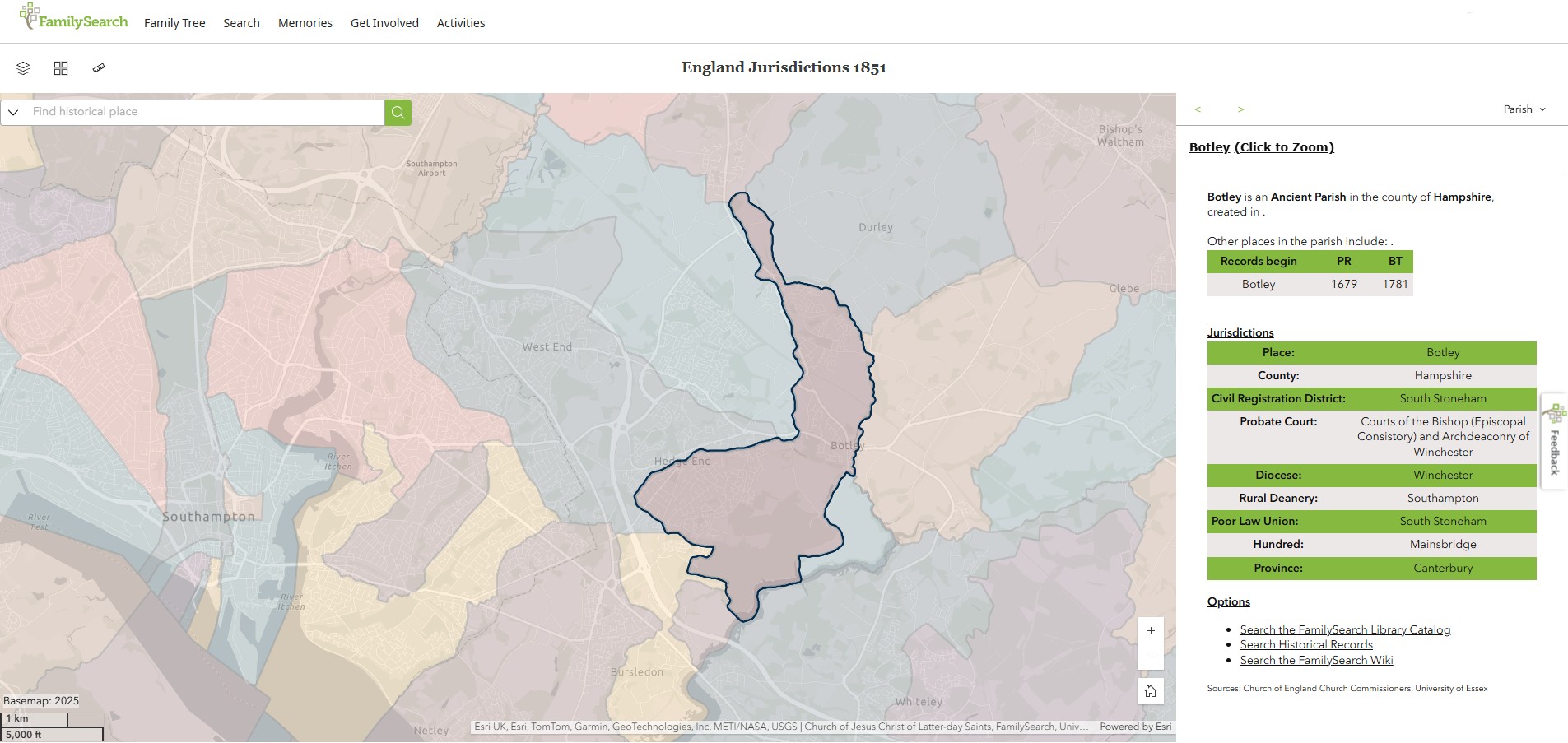
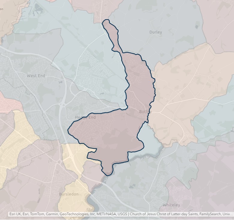
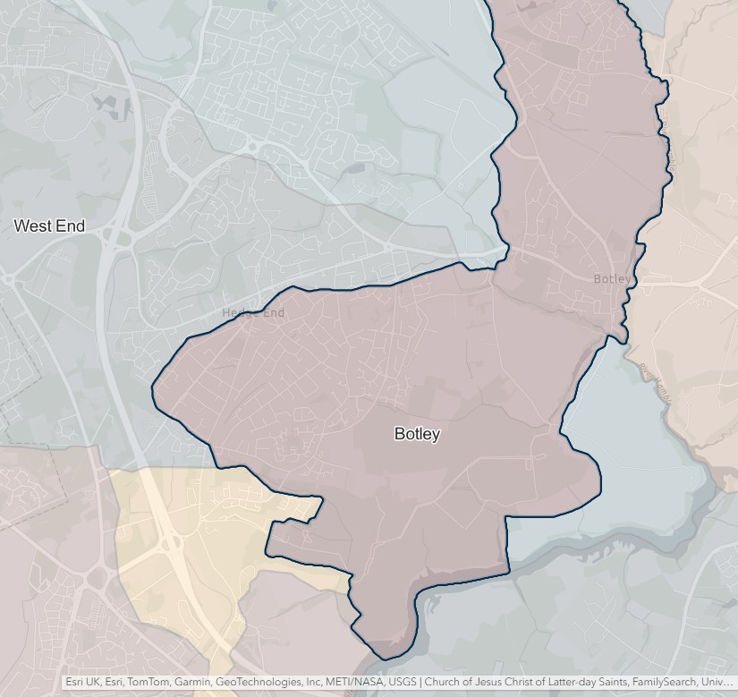
Bursledon
England Jurisdictions 1851 - Bursledon
Extract from FamilySearch England Jurisdictions 1851. This link may not work if you don't have a subscription to FamilySearch
Then search for Bursledon. Use the Key to select which boundaries you wish to see.
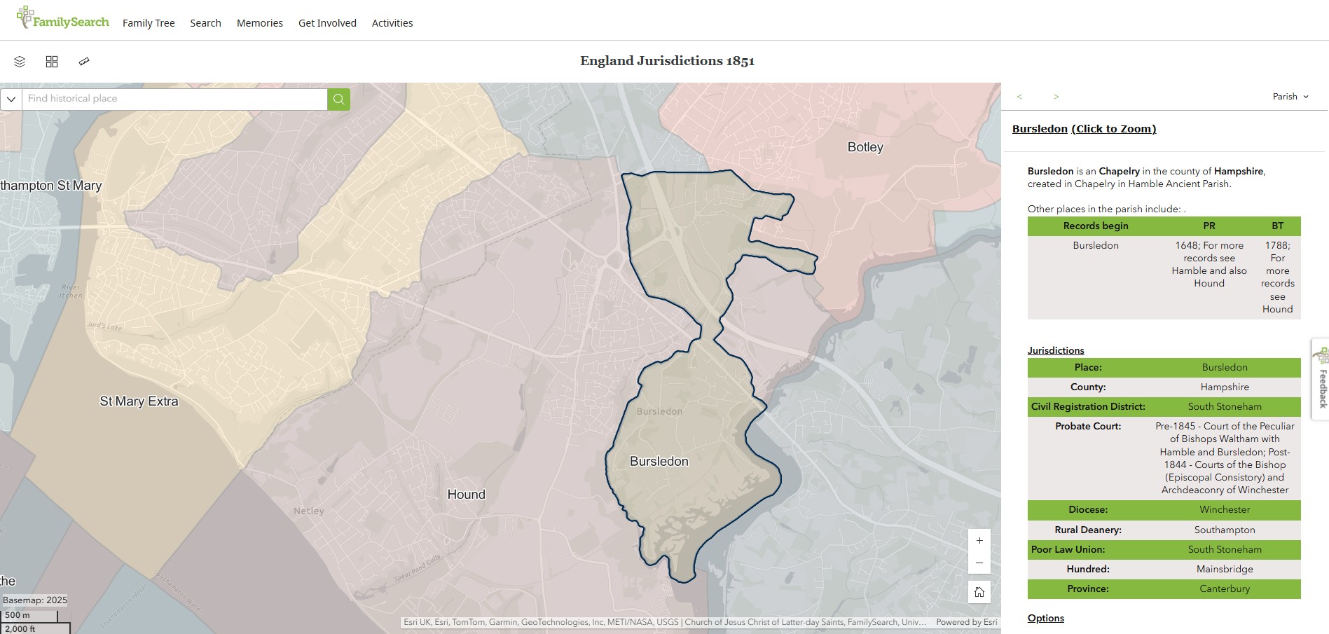
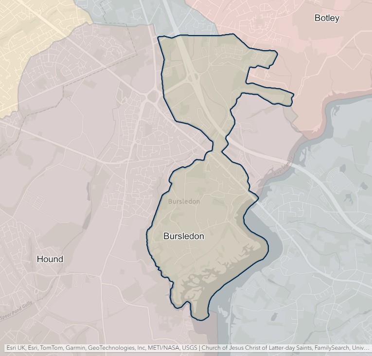
Chilworth
England Jurisdictions 1851 - Chilworth
Extract from FamilySearch England Jurisdictions 1851. This link may not work if you don't have a subscription to FamilySearch
Then search for Chilworth. Use the Key to select which boundaries you wish to see.

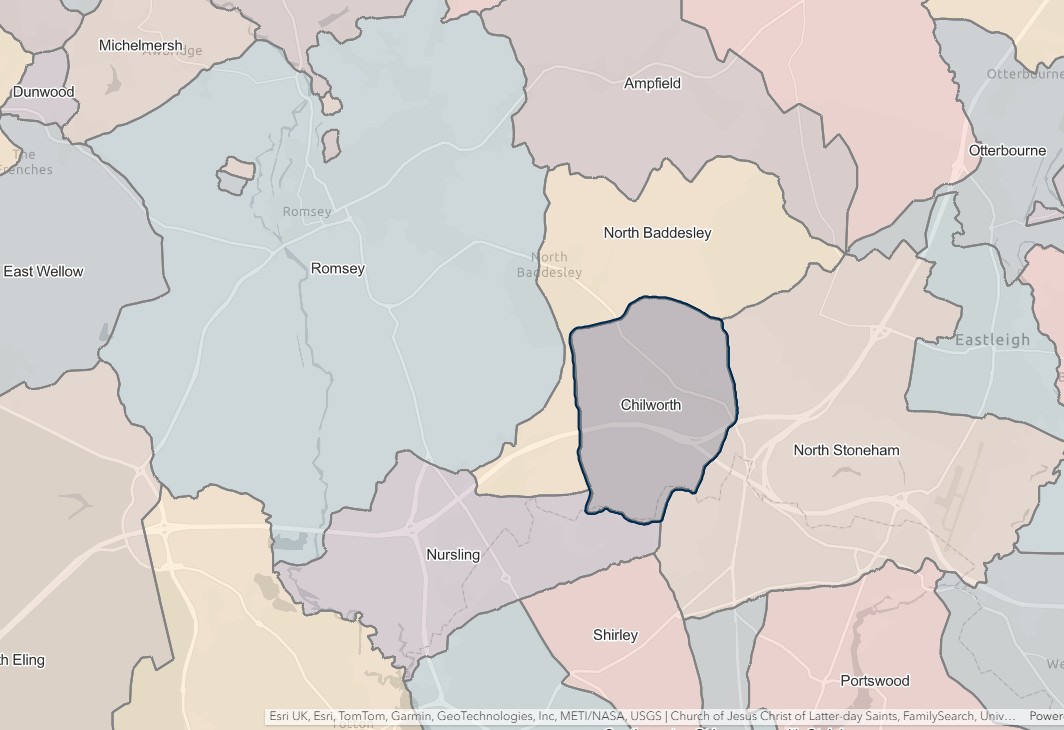
Hamble
England Jurisdictions 1851 - Hamble
Extract from FamilySearch England Jurisdictions 1851. This link may not work if you don't have a subscription to FamilySearch
Then search for Hamble. Use the Key to select which boundaries you wish to see.
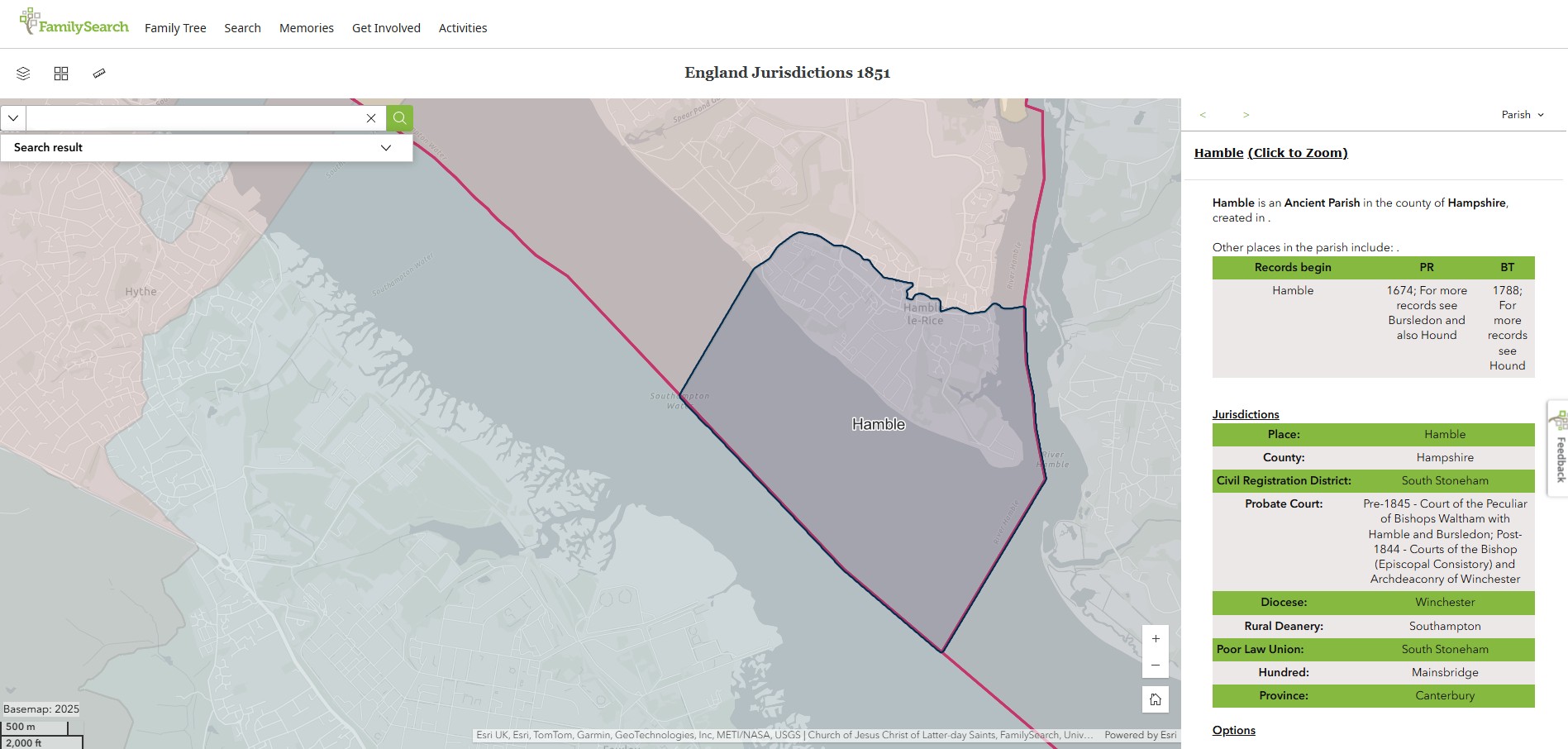
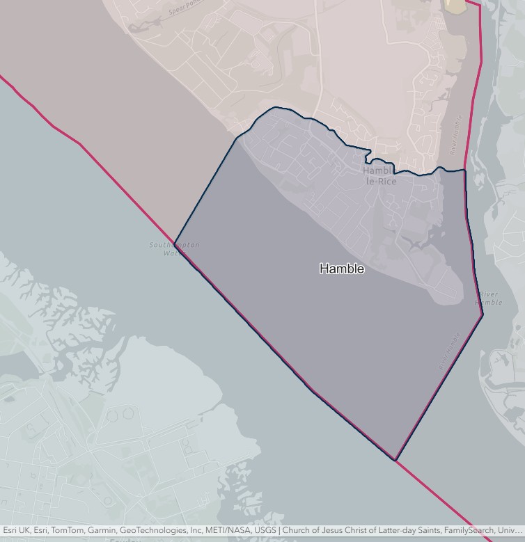
Hound
England Jurisdictions 1851 - Hound
Extract from FamilySearch England Jurisdictions 1851. This link may not work if you don't have a subscription to FamilySearch
Then search for Hound. Use the Key to select which boundaries you wish to see.
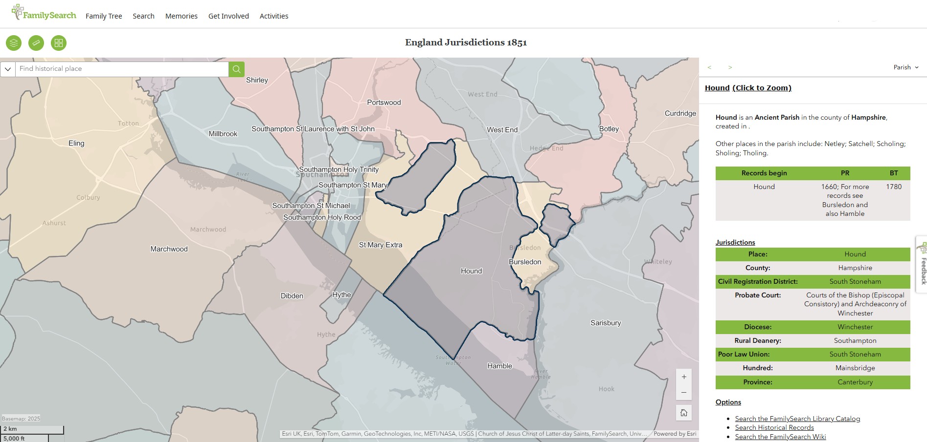
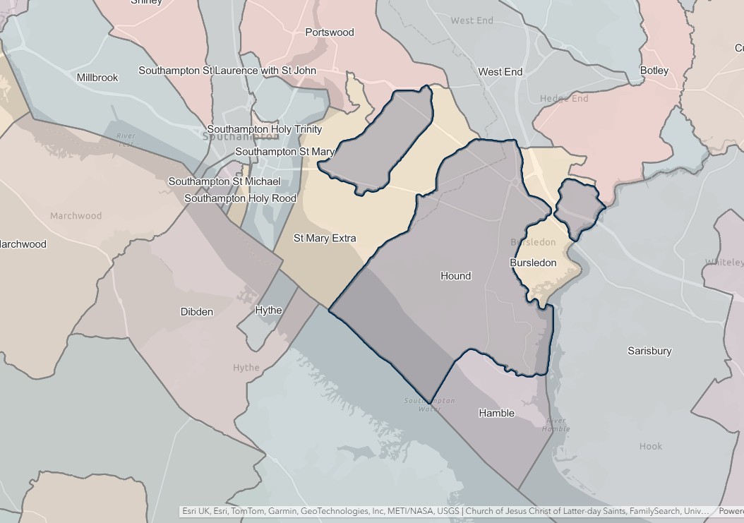
Millbrook
England Jurisdictions 1851 - Millbrook
Extract from FamilySearch England Jurisdictions 1851. This link may not work if you don't have a subscription to FamilySearch
Then search for Millbrook. Use the Key to select which boundaries you wish to see.
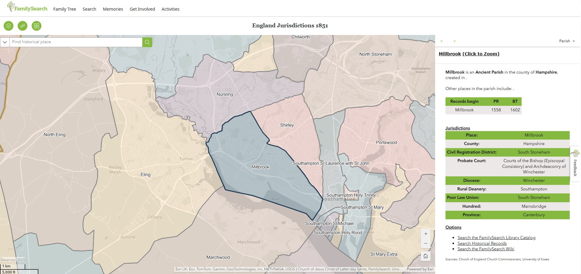

North Stoneham
England Jurisdictions 1851 - North Stoneham
Extract from FamilySearch England Jurisdictions 1851. This link may not work if you don't have a subscription to FamilySearch
Then search for North Stoneham. Use the Key to select which boundaries you wish to see.
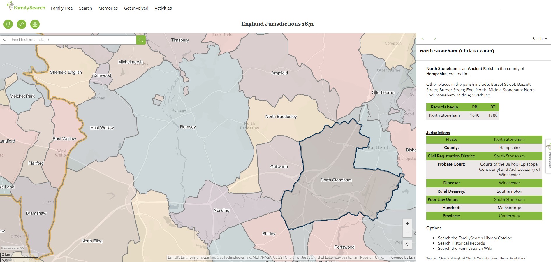
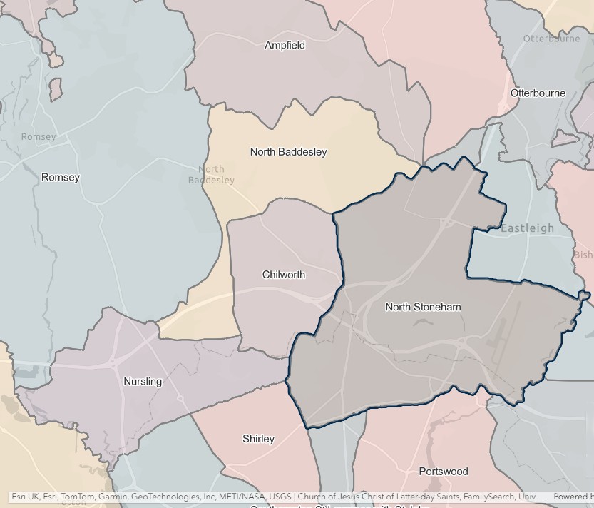
Portswood
England Jurisdictions 1851 - Portswood
Extract from FamilySearch England Jurisdictions 1851. This link may not work if you don't have a subscription to FamilySearch
Then search for Portswood. Use the Key to select which boundaries you wish to see.
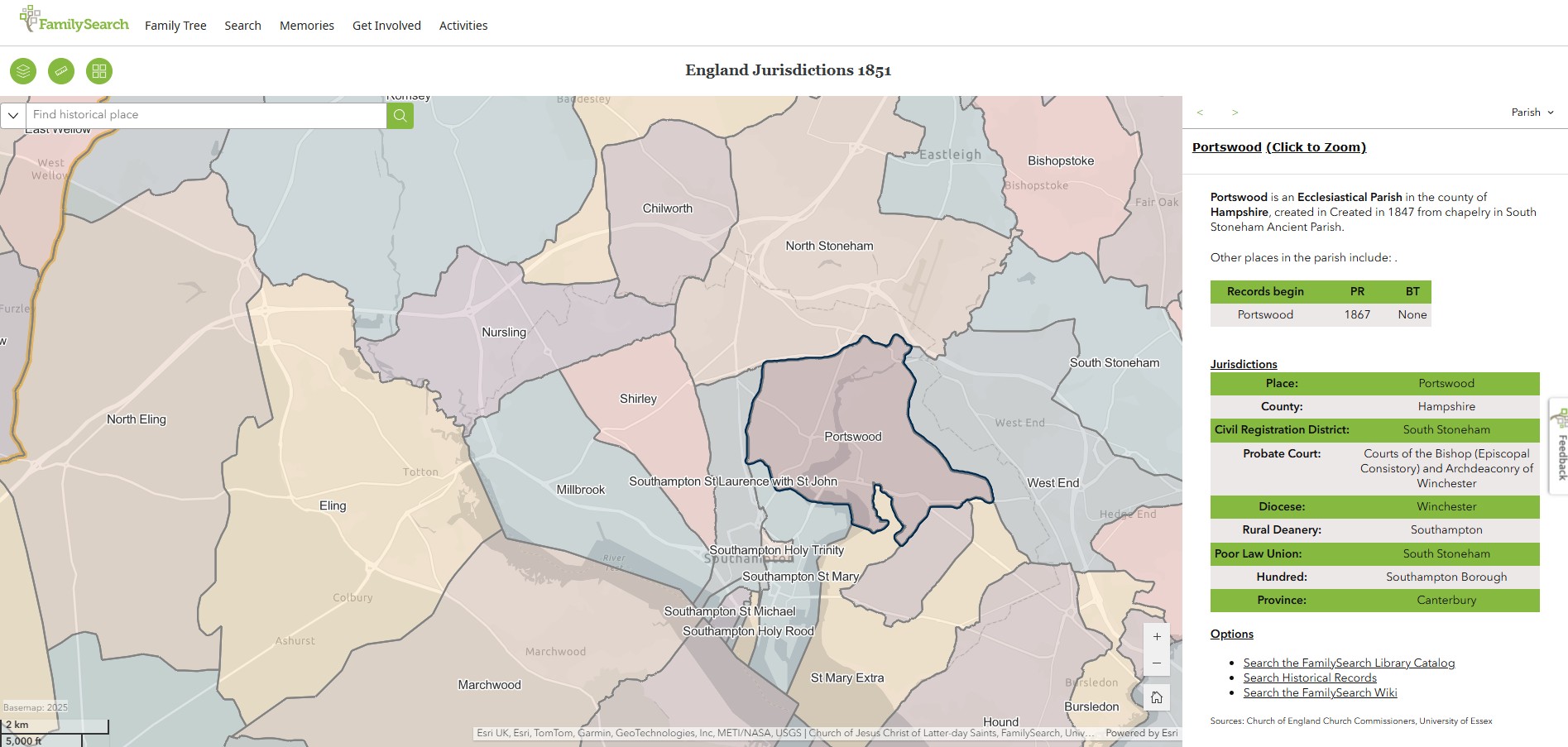
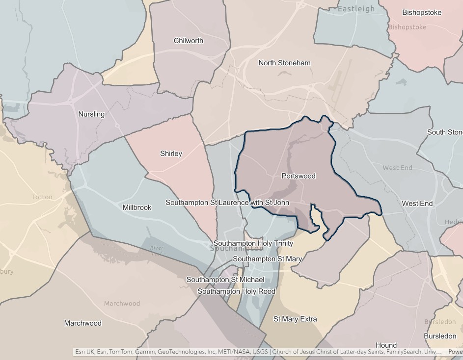
Shirley
England Jurisdictions 1851 - Shirley
Extract from FamilySearch England Jurisdictions 1851. This link may not work if you don't have a subscription to FamilySearch
Then search for Shirley. Use the Key to select which boundaries you wish to see.
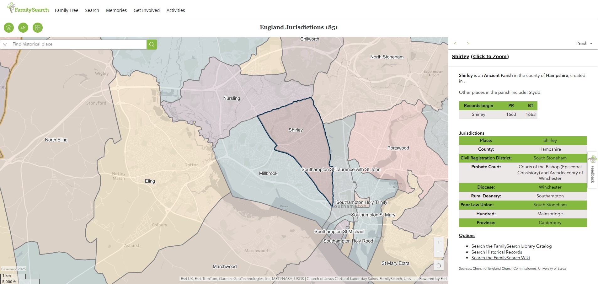
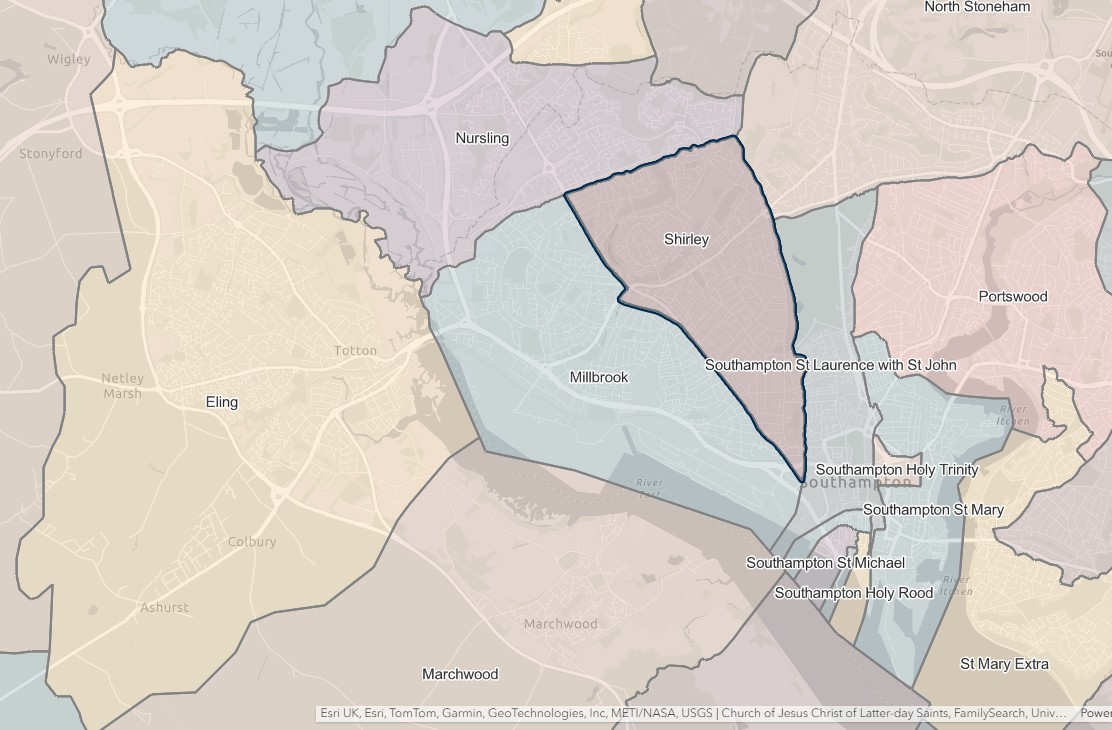
South Stoneham
England Jurisdictions 1851 - South Stoneham
Extract from FamilySearch England Jurisdictions 1851. This link may not work if you don't have a subscription to FamilySearch
Then search for South Sotneham. Use the Key to select which boundaries you wish to see.
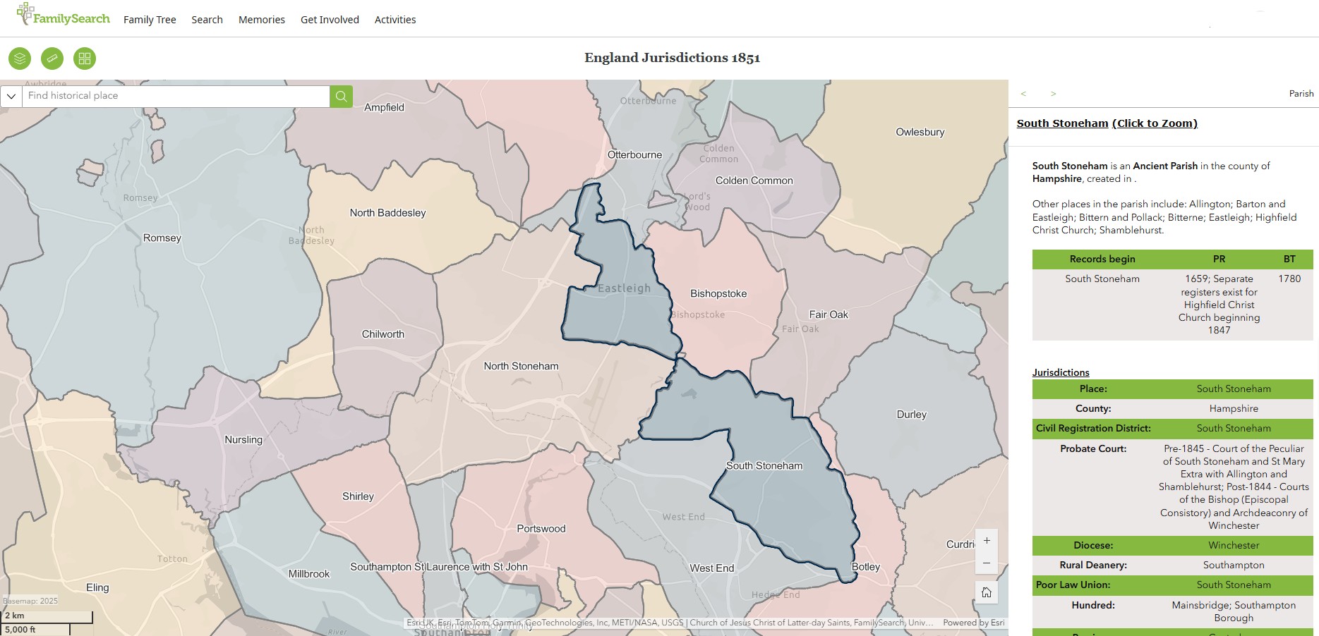
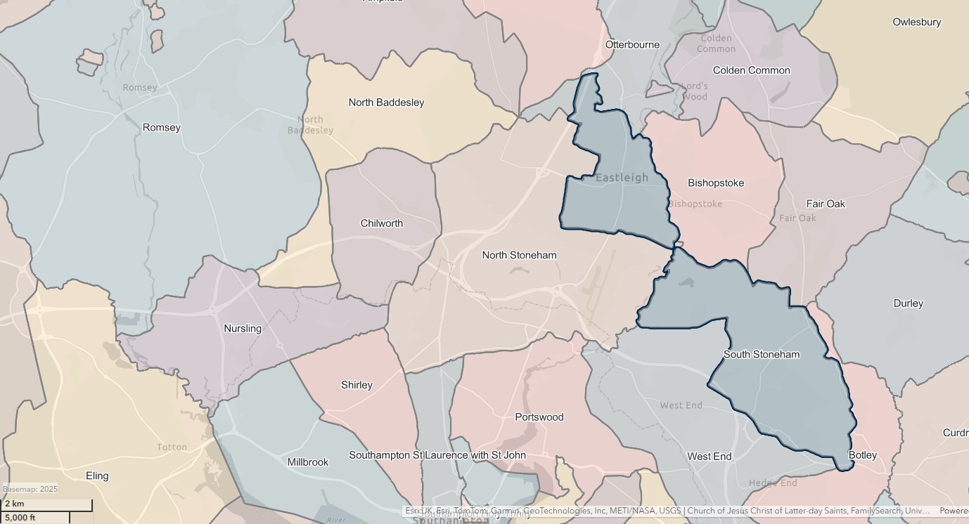
St Mary Extra
England Jurisdictions 1851 - St Mary Extra
Extract from FamilySearch England Jurisdictions 1851. This link may not work if you don't have a subscription to FamilySearch
Then search for St Mary Extra. Use the Key to select which boundaries you wish to see.
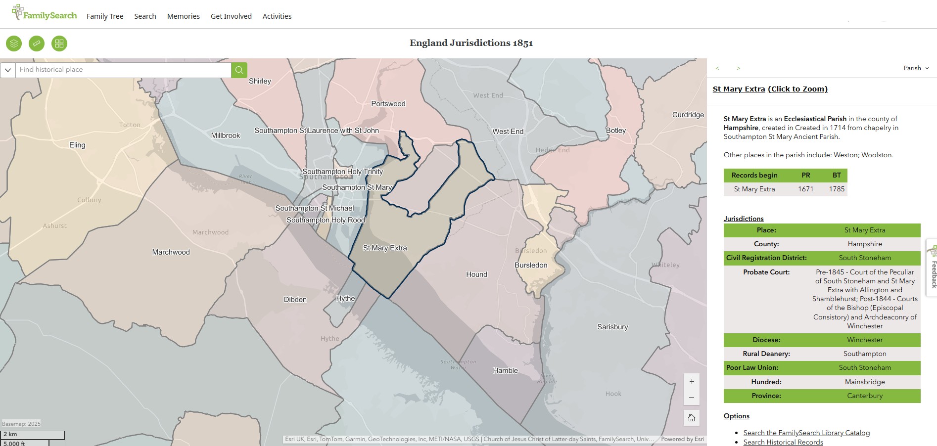
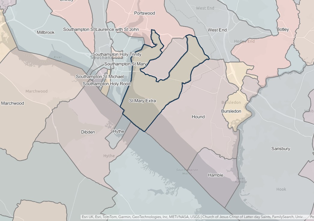
West End
England Jurisdictions 1851 - West End
Extract from FamilySearch England Jurisdictions 1851. This link may not work if you don't have a subscription to FamilySearch
Then search for West End. Use the Key to select which boundaries you wish to see.

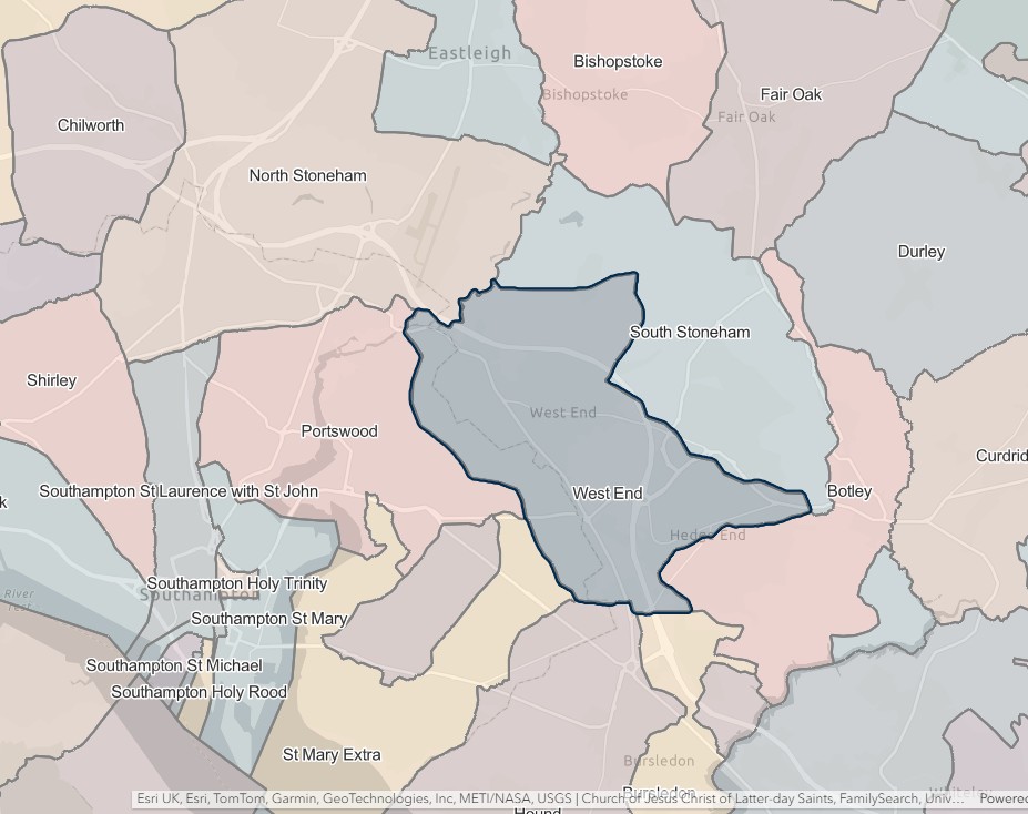
Stockbridge
England Jurisdictions 1851 - CRD Stockbridge
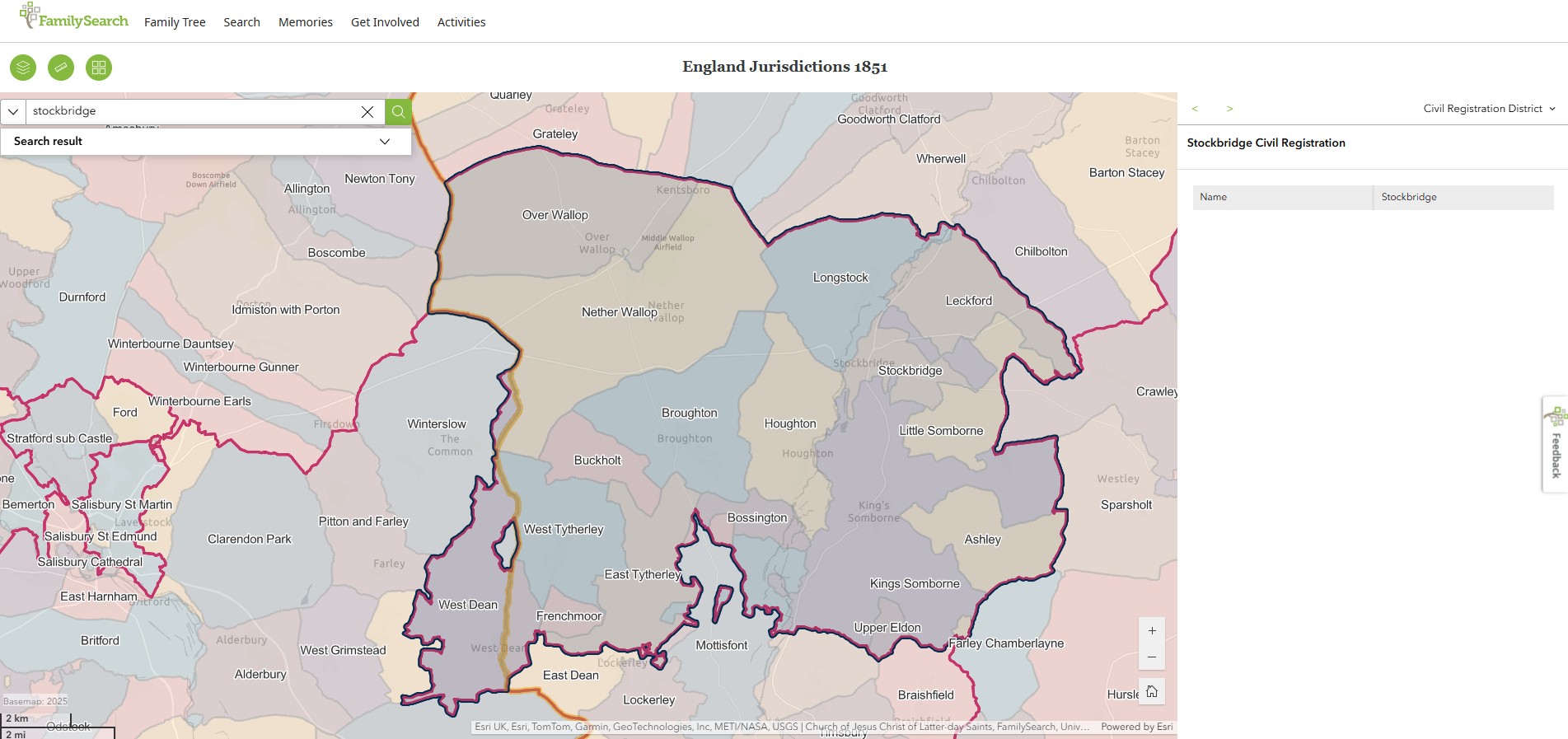
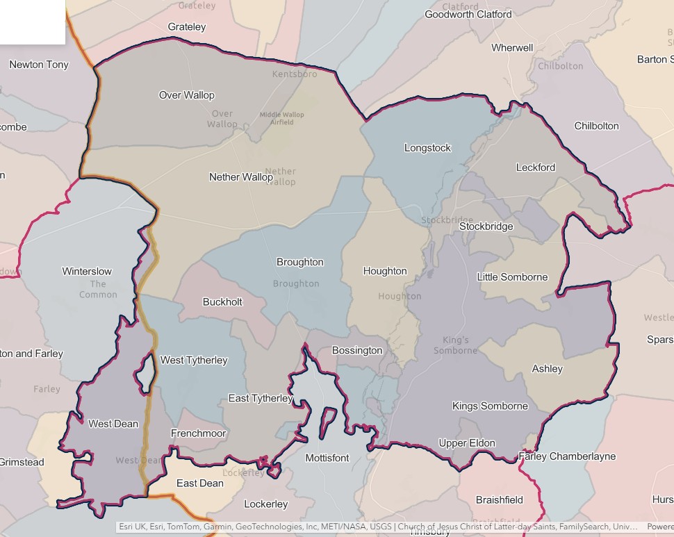
STOCKBRIDGE REGISTRATION DISTRICT
- Registration County : Hampshire.
- Created : 1.7.1837.
- Abolished : 1.10.1932 (added to Romsey & Stockbridge registration district).
- Sub-districts : Broughton; Stockbridge
- GRO volumes : VII (1837–51); 2c (1852–1932).
- District number : 63a (1841–46); 108 (1847–69); 99 (1870–80); 100 (1881–1908); 102 (1909–32).
Table 1: List of Places in Stockbridge Registration District
|
Civil Parish |
County |
From |
To |
Comments |
|
Ashley |
1837 |
1932 |
See Table 2, note (d). |
|
|
Bossington |
1837 |
1932 |
See Table 2, note (d). |
|
|
Broughton |
1837 |
1932 |
See Table 2, notes (a) and (d). |
|
|
Buckholt |
1837 |
1932 |
See Table 2, note (d). |
|
|
Crown Farm |
1837 |
1883 |
Abolished 25.3.1883 and divided between the parishes of Bossington and East Tytherley. |
|
|
East Tytherley |
1837 |
1932 |
See Table 2, notes (c) and (d). |
|
|
Frenchmoor |
1837 |
1932 |
See Table 2, note (d). |
|
|
Houghton |
1837 |
1932 |
See Table 2, note (d). |
|
|
King's Somborne |
1837 |
1932 |
See Table 2, note (d). |
|
|
Leckford |
1837 |
1932 |
See Table 2, note (d). |
|
|
Little Somborne |
1837 |
1932 |
See Table 2, note (d). |
|
|
Longstock |
1837 |
1932 |
See Table 2, note (d). |
|
|
Nether Wallop |
1837 |
1932 |
See Table 2, note (d). |
|
|
Over Wallop |
1837 |
1932 |
See Table 2, note (d). |
|
|
Stockbridge |
1837 |
1932 |
See Table 2, note (d). |
|
|
Upper Eldon |
1837 |
1932 |
Abolished 1.4.1932 and added to the parish of King's Somborne. |
|
|
West Dean |
1837 |
1883 |
On 25.3.1883 the part in Hampshire became part of the parish of West Tytherley, so that thereafter West Dean was entirely in Wiltshire. See also Table 2, note (b). |
|
|
1837 |
1883 |
|||
|
West Tytherley |
1837 |
1932 |
See Table 2, note (d). |
Table 2: Boundary Changes affecting Stockbridge Registration District
|
Date of Change |
Note |
Description of Change |
Population transferred |
|
25.3.1883 |
(a) |
Lost a detached part of the parish of Broughton (which was added to the parish of Mottisfont on 25.3.1883) to Romsey registration district. |
18 in 1891 |
|
1.1.1884 |
(b) |
Lost the parish of West Dean to Alderbury registration district. |
227 in 1881 |
|
24.3.1888 |
(c) |
Gained part of the parish of East Tytherley (which until 24.3.1888 formed a detached part of the parish of Lockerley) from Romsey registration district. |
0 in 1891 |
|
1.10.1932 (abolished) |
(d) |
Lost the parishes of Ashley, Bossington, Broughton, Buckholt, East Tytherley, Frenchmoor, Houghton, King's Somborne, Leckford, Little Somborne, Longstock, Nether Wallop, Over Wallop, Stockbridge and West Tytherley, to Romsey & Stockbridge registration district. |
6210 in 1931 |
The Parishes within the Civil Registration District as at 1851 (generally the same as the 1837 entries above)
Ashely
Bossington
England Jurisdictions 1851 - Chilworth
Extract from FamilySearch England Jurisdictions 1851. This link may not work if you don't have a subscription to FamilySearch
Then search for Chilworth. Use the Key to select which boundaries you wish to see.
Broughton
Buckholt
Crown Farm
England Jurisdictions 1851 - Chilworth
Extract from FamilySearch England Jurisdictions 1851. This link may not work if you don't have a subscription to FamilySearch
Then search for Chilworth. Use the Key to select which boundaries you wish to see.
East Tytherley
Frenchmoor
Houghton
England Jurisdictions 1851 - Chilworth
Extract from FamilySearch England Jurisdictions 1851. This link may not work if you don't have a subscription to FamilySearch
Then search for Chilworth. Use the Key to select which boundaries you wish to see.
King's Somborne
Leckford
Little Sombourne
Longstock
England Jurisdictions 1851 - Chilworth
Extract from FamilySearch England Jurisdictions 1851. This link may not work if you don't have a subscription to FamilySearch
Then search for Chilworth. Use the Key to select which boundaries you wish to see.
Nether Wallop
England Jurisdictions 1851 - Chilworth
Extract from FamilySearch England Jurisdictions 1851. This link may not work if you don't have a subscription to FamilySearch
Then search for Chilworth. Use the Key to select which boundaries you wish to see.
Over Wallop
England Jurisdictions 1851 - Chilworth
Extract from FamilySearch England Jurisdictions 1851. This link may not work if you don't have a subscription to FamilySearch
Then search for Chilworth. Use the Key to select which boundaries you wish to see.
Stockbridge
Upper Eldon
England Jurisdictions 1851 - Chilworth
Extract from FamilySearch England Jurisdictions 1851. This link may not work if you don't have a subscription to FamilySearch
Then search for Chilworth. Use the Key to select which boundaries you wish to see.
West Dean
England Jurisdictions 1851 - West Dean
Extract from FamilySearch England Jurisdictions 1851. This link may not work if you don't have a subscription to FamilySearch
Then search for West Dean, Wiltshire. Use the Key to select which boundaries you wish to see.
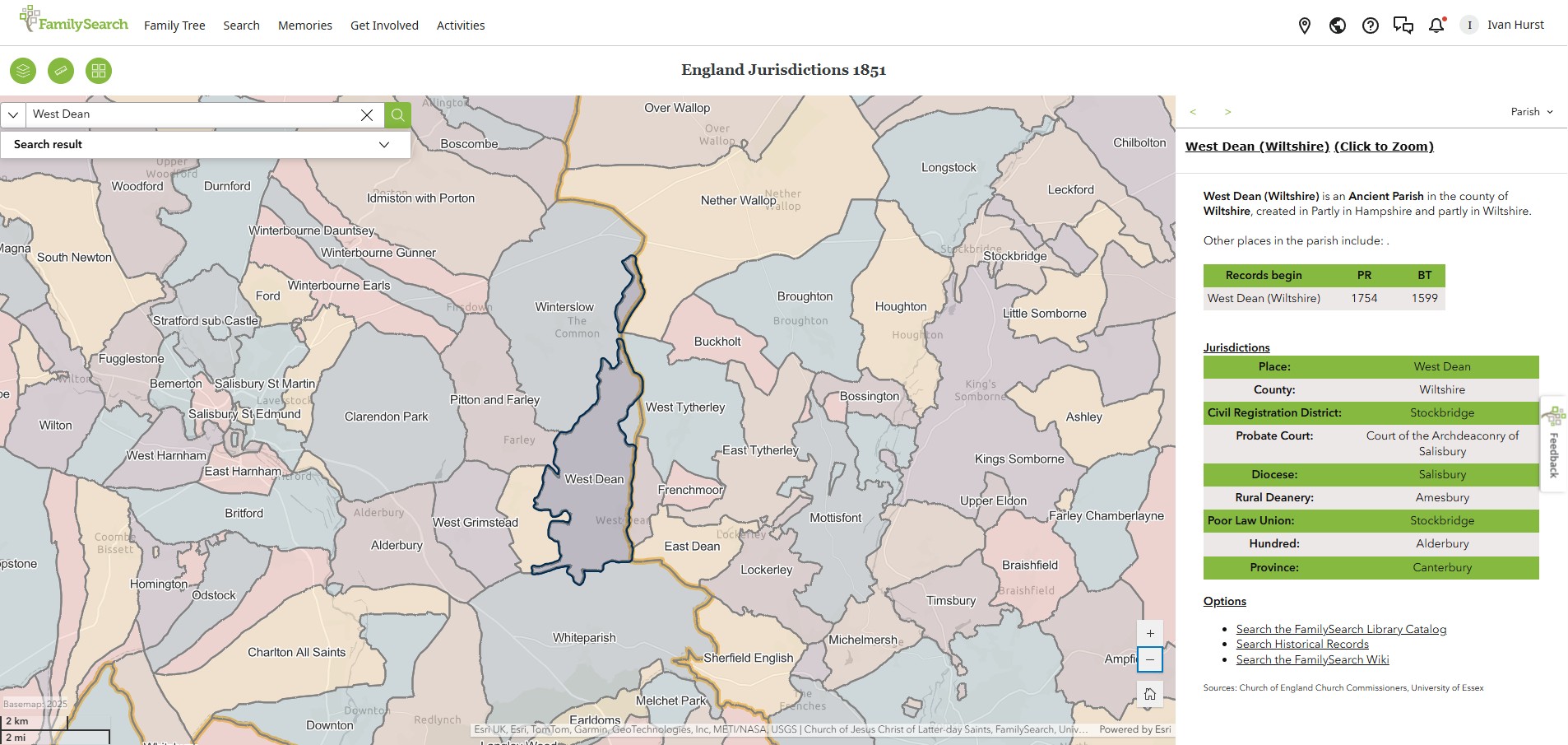
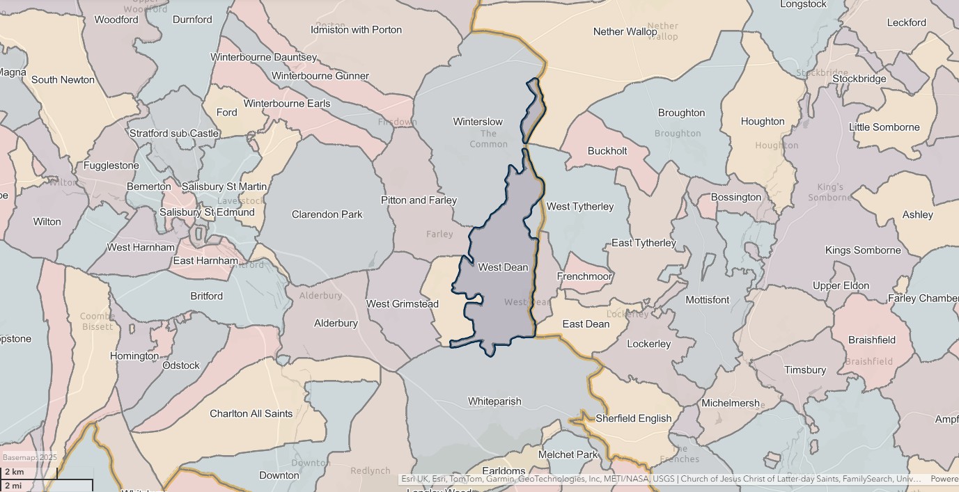
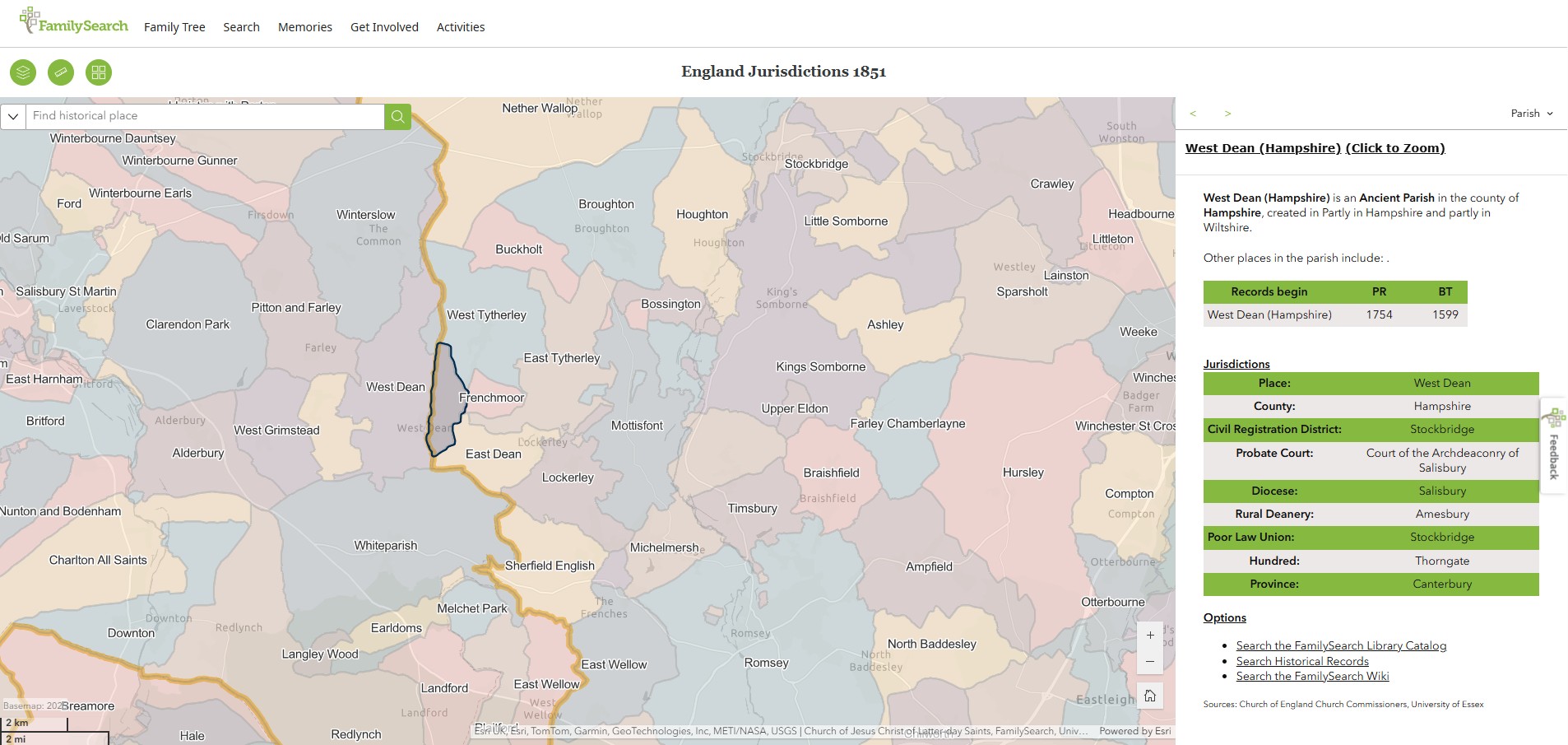
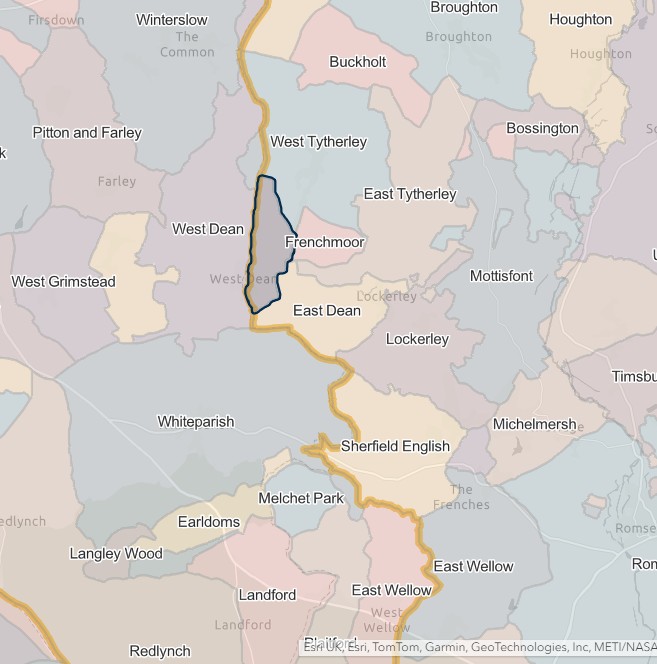
West Tytherley
Whitchurch
WHITCHURCH REGISTRATION DISTRICT
- Registration County : Hampshire.
- Created : 1.7.1837 (originally "Whitchurch & Overton").
- Abolished : 1.10.1932 (divided between Kingsclere & Whitchurch and Basingstoke registration districts).
- Sub-districts : Whitchurch.
- GRO volumes : VII (1837–51); 2c (1852–1932).
- District number : 63c (1841–46); 117 (1847–69); 108 (1870–80); 109 (1881–1908); 111 (1909–32).
Table 1: List of Places in Whitchurch Registration District
|
Civil Parish |
County |
From |
To |
Comments |
|
Ashe |
1837 |
1932 |
Abolished 1.4.1932 and divided between the parishes of Overton and Steventon. See also Table 2, note (a). |
|
|
Freefolk Manor |
1837 |
1932 |
Abolished 1.4.1932 and added to the parish of Laverstoke. |
|
|
Hurstbourne Priors |
1837 |
1932 |
See Table 2, note (b). |
|
|
Laverstoke |
1837 |
1932 |
See Table 2, note (b). |
|
|
Overton |
1837 |
1932 |
See Table 2, note (b). |
|
|
St. Mary Bourne |
1837 |
1932 |
See Table 2, note (b). |
|
|
Steventon |
1932 |
1932 |
That part which until 1.4.1932 formed part of the parish of Ashe. See also Table 2, note (a). |
|
|
Tufton |
1837 |
1932 |
Abolished 1.4.1932 and added to the parish of Hurstbourne Priors. |
|
|
Whitchurch |
1837 |
1932 |
See Table 2, note (b). |
Table 2: Boundary Changes affecting Whitchurch Registration District
|
Date of Change |
Note |
Description of Change |
Population transferred |
|
1.10.1932 (abolished) |
(a) |
Lost the part in the parish of Steventon (which until 1.4.1932 formed part of the parish of Ashe) to Basingstoke registration district. |
24 in 1931 |
|
(b) |
Lost the parishes of Hurstbourne Priors, Laverstoke, Overton, St. Mary Bourne and Whitchurch, to Kingsclere & Whitchurch registration district. |
6423 in 1931 |
The Parishes within the Civil Registration District as at 1851 (generally the same as the 1837 entries above)
Ashe
Freefolk Manor
Hurstbourne Priors
England Jurisdictions 1851 - Hurstbourne Priors
Extract from FamilySearch England Jurisdictions 1851. This link may not work if you don't have a subscription to FamilySearch
Then search for Hurstbourne Priors. Use the Key to select which boundaries you wish to see.
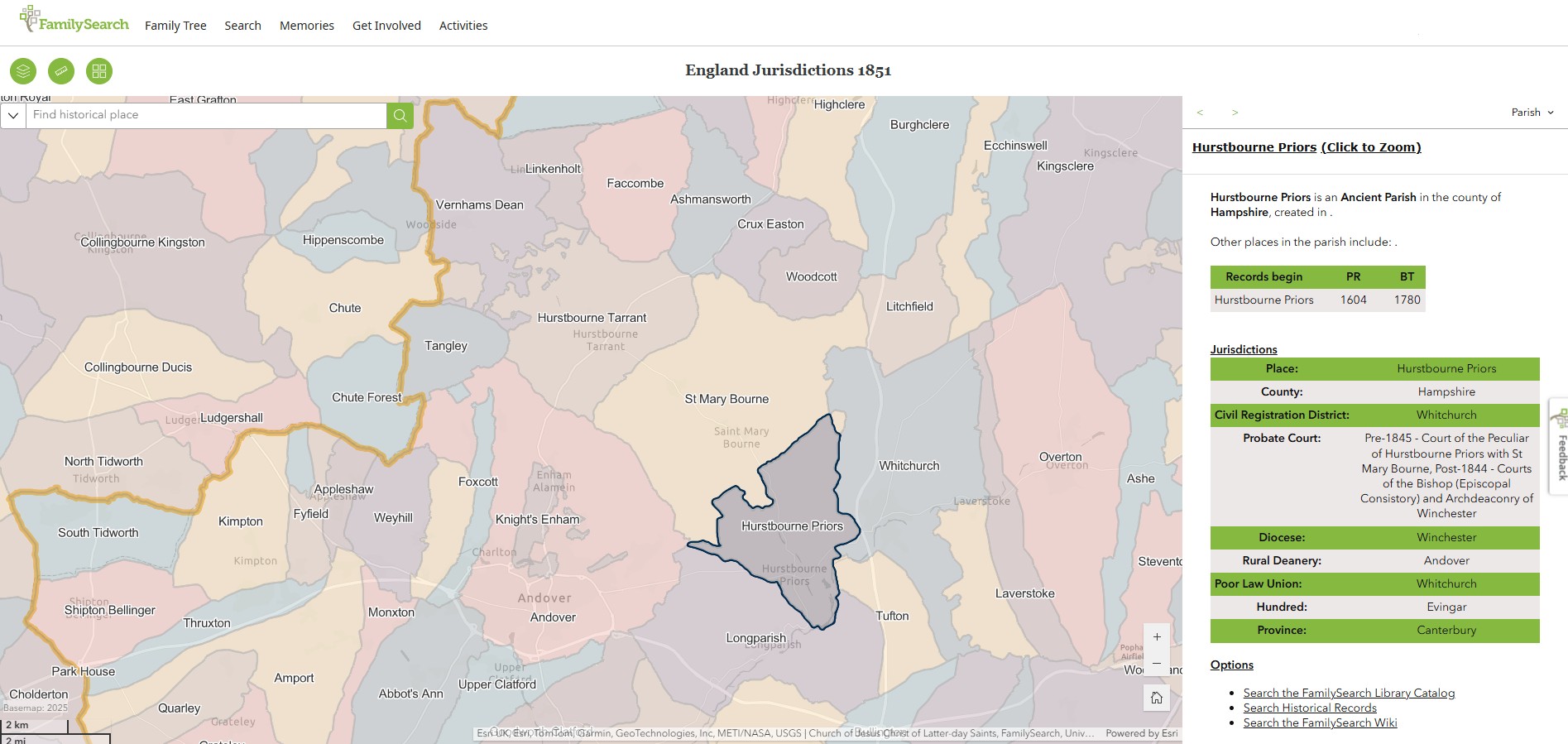
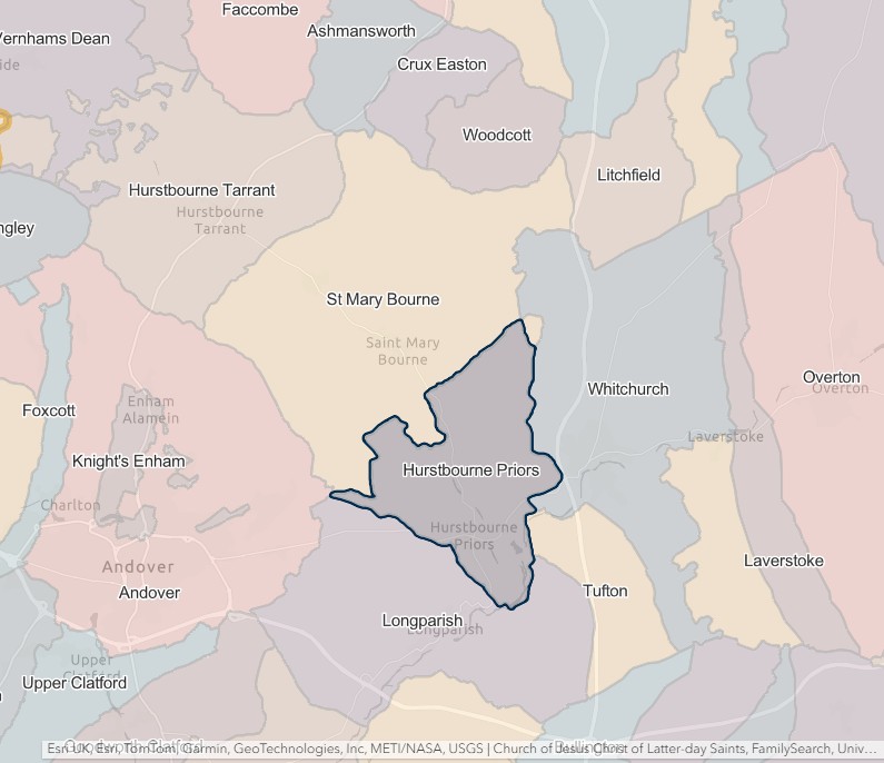
Laverstoke
Overton
St. Mary Bourne
Tufton
Whitchurch
Winchester
WINCHESTER REGISTRATION DISTRICT
- Registration County : Hampshire.
- Created : 1.7.1837 (originally "Winchester & Hursley").
- Abolished : 1.4.2008 (added to Hampshire registration district).
- Sub-districts : Eastleigh; Hursley; Micheldever; The Worthys; Twyford; Winchester; Winchester Rural
- GRO volumes : VII (1837–51); 2c (1852–1946); 6B (1946–74); 20 (1974–92).
- District number : 64 (1841–46); 109 (1847–69); 100 (1870–80); 101 (1881–1908); 103 (1909–46); 311 (1946–74); 502 (1974–2008).
Table 1: List of Places in Winchester Registration District
|
Civil Parish |
County |
From |
To |
Comments |
|
Abbotts Barton |
1894 |
1985 |
Created 1894 out of the rural part of the parish of St. Bartholomew Hyde. Abolished 1.4.1985 and added to the parish of Headbourne Worthy. |
|
|
Ampfield |
1894 |
1932 |
Created 1894 out of the parish of Hursley. See also Table 2, note (i). |
|
|
Avington |
1837 |
1932 |
Abolished 1.4.1932 and added to the parish of Itchen Valley. See also Table 2, note (b). |
|
|
Badger Farm |
1985 |
2008 |
Created 1.4.1985 out of the Winchester unparished area and the parishes of Compton and Olivers Battery. See also Table 2, note (m). |
|
|
Beauworth |
1932 |
2008 |
See Table 2, notes (f) and (m). |
|
|
Bighton |
1932 |
2008 |
See Table 2, notes (f) and (m). |
|
|
Bishop's Sutton |
1932 |
2008 |
See Table 2, notes (f) and (m). |
|
|
Bishopstoke |
1837 |
1927 |
See Table 2, note (e). |
|
|
Bishopstoke |
1997 |
2008 |
See Table 2, notes (l) and (m). |
|
|
Botley |
1932 |
1974 |
See Table 2, notes (h) and (k). |
|
|
Botley |
1997 |
2008 |
See Table 2, notes (l) and (m). |
|
|
Bramdean |
1932 |
2002 |
Renamed 1.7.2002 to become the parish of Bramdean & Hinton Ampnet. See also Table 2, note (f). |
|
|
Bramdean & Hinton Ampner |
2002 |
2008 |
Created 1.7.2002 by renaming the parish of Bramdean. See also Table 2, note (m). |
|
|
Bursledon |
1932 |
1974 |
See Table 2, notes (h) and (k). |
|
|
Bursledon |
1997 |
2008 |
See Table 2, notes (l) and (m). |
|
|
Chandler's Ford |
1897 |
1932 |
Created 1.10.1897 out of the parishes of Ampfield, North Stoneham, Otterbourne, North Baddesley and South Stoneham. Abolished 1.4.1932 and divided between the parishes of Eastleigh and North Baddesley. See also Table 2, note (c). |
|
|
Cheriton |
1932 |
2008 |
See Table 2, notes (f) and (m). |
|
|
Chilcomb |
1837 |
1894 |
Abolished 1894 to become the separate parishes of Chilcomb Within and Chilcomb Without. |
|
|
Chilcomb |
1932 |
2008 |
Created 1.4.1932 out of the parish of Chilcomb Without. See also Table 2, note (m). |
|
|
Chilcomb Within |
1894 |
1902 |
Created 1894 from the part of the parish of Chilcomb in Winchester Municipal Borough. Abolished 26.3.1902 and added to the parish of Winchester. |
|
|
Chilcomb Without |
1894 |
1932 |
Created 1894 from the rural part of the parish of Chilcomb. Abolished 1.4.1932 and divided between the parishes of Chilcomb and Winchester. |
|
|
Colden Common |
1932 |
2008 |
Created 1.4.1932 out of the parishes of Twyford and Owslebury. See also Table 2, note (m). |
|
|
Compton |
1837 |
1985 |
Abolished 1.4.1985 and divided between the parishes of Badger Farm and Compton & Shawford. |
|
|
Compton & Shawford |
1985 |
2008 |
Created 1.4.1985 out of the parish of Compton. See also Table 2, note (m). |
|
|
Crawley |
1837 |
2008 |
See Table 2, note (m). |
|
|
East Stratton |
1837 |
1932 |
Abolished 1.4.1932 and added to the parish of Mitcheldever. |
|
|
Eastleigh |
1932 |
1974 |
Abolished 1.4.1974 to become an unparished area. See also Table 2, notes (h) and (k). |
|
|
Eastleigh* |
1997 |
2008 |
Unparished area. See also Table 2, notes (l) and (m). |
|
|
Easton |
1837 |
1932 |
Abolished 1.4.1932 and added to the parish of Itchen Valley. |
|
|
Fair Oak |
1894 |
1974 |
Created 1894 out of the parish of Bishopstoke. See also Table 2, note (k). |
|
|
Fair Oak & Horton Heath |
1997 |
2008 |
See Table 2, notes (l) and (m). |
|
|
Farley Chamberlayne |
1838 |
1932 |
Abolished 1.4.1932 and added to the parish of Hursley. See also Table 2, note (a). |
|
|
Hamble |
1932 |
1974 |
See Table 2, notes (h) and (k). |
|
|
Hamble-le-Rice |
1997 |
2008 |
See Table 2, notes (l) and (m). |
|
|
Headbourne Worthy |
1837 |
2008 |
See Table 2, note (m). |
|
|
Hedge End |
1932 |
1974 |
See Table 2, notes (h) and (k). |
|
|
Hedge End |
1997 |
2008 |
See Table 2, notes (l) and (m). |
|
|
Hound |
1932 |
1974 |
See Table 2, notes (h), (j) and (k). |
|
|
Hound |
1997 |
2008 |
See Table 2, notes (l) and (m). |
|
|
Hunton |
1837 |
1932 |
Abolished 1.4.1932 and added to the parish of Wonston. |
|
|
Hursley |
1838 |
2008 |
See Table 2, notes (a) and (m). |
|
|
Itchen Abbas |
1837 |
1932 |
Abolished 1.4.1932 and added to the parish of Itchen Valley. |
|
|
Itchen Stoke & Ovington |
1932 |
2008 |
See Table 2, notes (f) and (m). |
|
|
Itchen Valley |
1932 |
2008 |
Created 1.4.1932 out of the parishes of Easton, Martyr Worthy, Itchen Abbas and Avington. See also Table 2, note (m). |
|
|
Kilmeston |
1932 |
2008 |
See Table 2, notes (f) and (m). |
|
|
King's Worthy |
1837 |
2008 |
See Table 2, note (m). |
|
|
Lainston |
1837 |
1932 |
Abolished 1.4.1932 and added to the parish of Sparisholt. |
|
|
Littleton |
1837 |
2008 |
Renamed 1.12.1987 to become the parish of Littleton & Harestock. |
|
|
Littleton & Harestock |
1987 |
2008 |
Created 1.12.1987 by renaming the parish of Littleton. See also Table 2, note (m). |
|
|
Martyr Worthy |
1837 |
1932 |
Abolished 1.4.1932 and added to the parish of Itchen Valley. |
|
|
Micheldever |
1837 |
2008 |
See Table 2, note (m). |
|
|
Milland |
1837 |
1902 |
Abolished 26.3.1902 and added to the parish of Winchester. |
|
|
Morestead |
1837 |
1932 |
Abolished 1.4.1932 and added to the parish of Owslebury. |
|
|
New Alresford |
1932 |
2008 |
See Table 2, notes (f) and (m). |
|
|
North Baddesley |
1838 |
1932 |
See Table 2, notes (a) and (i). |
|
|
Northington |
1932 |
2008 |
See Table 2, notes (f) and (m). |
|
|
Old Alresford |
1932 |
2008 |
See Table 2, notes (f) and (m). |
|
|
Olivers Battery |
1956 |
2008 |
Created 1.10.1956 out of the parish of Compton. See also Table 2, note (m). |
|
|
Otterbourne |
1838 |
2008 |
See Table 2, notes (a) and (m). |
|
|
Owslebury |
1837 |
2008 |
See Table 2, notes (g) and (m). |
|
|
Rownhams |
1897 |
1897 |
That part which until 1.10.1897 formed part of the parish of North Baddesley. See also Table 2, note (d). |
|
|
South Wonston |
1985 |
2008 |
Created 1.4.1985 out of the parishes of Headbourne Worthy, King's Worthy and Wonston. See also Table 2, note (m). |
|
|
Sparsholt |
1837 |
2008 |
See Table 2, note (m). |
|
|
St. Bartholomew Hyde |
1837 |
1902 |
Abolished 26.3.1902 and added to the parish of Winchester. |
|
|
St. Faith |
1837 |
1894 |
Abolished 1894 to become the separate parishes of St. Faith Within and St. Faith Without. |
|
|
St. Faith Within |
1894 |
1902 |
Created 1894 out of the part of the parish of St. Faith in Winchester Municipal Borough. Abolished 26.3.1902 and added to the parish of Winchester. |
|
|
St. Faith Without |
1894 |
1900 |
Created 1894 from the rural part of the parish of St. Faith. Abolished 9.11.1900 and divided between the parishes of St. Faith Within and Compton. |
|
|
St. John |
1837 |
1902 |
Abolished 26.3.1902 and added to the parish of Winchester. |
|
|
St. Lawrence |
1837 |
1902 |
Abolished 26.3.1902 and added to the parish of Winchester. |
|
|
St. Mary Kalendar |
1837 |
1902 |
Abolished 26.3.1902 and added to the parish of Winchester. |
|
|
St. Maurice |
1837 |
1902 |
Abolished 26.3.1902 and added to the parish of Winchester. |
|
|
St. Michael |
1837 |
1902 |
Abolished 26.3.1902 and added to the parish of Winchester. |
|
|
St. Peter Cheesehill |
1837 |
1902 |
Abolished 26.3.1902 and added to the parish of Winchester. |
|
|
St. Peter Colebrook |
1837 |
1902 |
Abolished 26.3.1902 and added to the parish of Winchester. |
|
|
St. Swithin |
1837 |
1902 |
Abolished 26.3.1902 and added to the parish of Winchester. |
|
|
St. Thomas |
1837 |
1902 |
Abolished 26.3.1902 and added to the parish of Winchester. |
|
|
Stoke Charity |
1837 |
1932 |
Abolished 1.4.1932 and added to the parish of Wonston. |
|
|
Stoke Park |
1899 |
1932 |
Created 1.4.1899 out of the parish of Bishopstoke. Abolished 1.4.1932 and divided between the parishes of Eastleigh and Fair Oak. |
|
|
Tichborne |
1932 |
2008 |
See Table 2, notes (f) and (m). |
|
|
Twyford |
1837 |
2008 |
See Table 2, note (m). |
|
|
Upham |
1932 |
1932 |
That part which until 1.4.1932 formed part of the parish of Owslebury. See also Table 2, note (g). |
|
|
Weeke |
1837 |
1894 |
Abolished 1894 to become the separate parishes of Weeke Within and Weeke Without. |
|
|
Weeke Within |
1894 |
1902 |
Created 1894 from the part of the parish of Weeke in Winchester Municipal Borough. Abolished 26.3.1902 and added to the parish of Winchester. |
|
|
Weeke Without |
1894 |
1932 |
Created 1894 from the rural part of the parish of Weeke. Abolished 1.4.1932 and divided between the parishes of Winchester and Hursley. |
|
|
West End |
1932 |
1974 |
See Table 2, notes (h), (j) and (k). |
|
|
West End |
1997 |
2008 |
See Table 2, notes (l) and (m). |
|
|
Winchester |
1902 |
1974 |
Created 26.3.1902 from the parishes of St. Thomas, St. Faith Within, Weeke Within, St. Bartholomew, Hyde, St. Maurice, St. John, St. Michael, St. Mary Kalender, Chilcomb Within, St. Peter, Cheesehill, St. Peter, Colebrook, Milland, St. Lawrence, St. Swithin and Winnall. Abolished 1.4.1974 to become an unparished area. |
|
|
Winchester* |
1974 |
2008 |
Unparished area which until 1.4.1974 formed the parish of Winchester. See also Table 2, note (m). |
|
|
Winnall |
1837 |
1902 |
Abolished 26.3.1902 and added to the parish of Winchester. |
|
|
Wonston |
1837 |
2008 |
See Table 2, note (m). |
Table 2: Boundary Changes affecting Winchester Registration District
|
Date of Change |
Note |
Description of Change |
Population transferred |
|
27.1.1838 |
(a) |
Gained the parishes of Farley Chamberlayne, Hursley, North Baddesley and Otterbourne, from Hursley registration district. |
2592 in 1841 |
|
24.3.1889 |
(b) |
Gained part of the parish of Avington (which until 24.3.1889 formed a detached part of the parish of Itchen Stoke) from Alresford registration district. |
24 in 1891 |
|
1.11.1897 |
(c) |
Gained parts of the parish of Chandler's Ford (which until 1.10.1897 formed parts of the parishes of North Stoneham and South Stoneham) from South Stoneham registration district. |
219 in 1891 |
|
1.12.1897 |
(d) |
Lost the part in the parish of Rownhams (which until 1.10.1897 formed part of the parish of North Baddesley) to Romsey registration district. |
140 in 1891 |
|
1.4.1927 |
(e) |
Lost the parish of Bishopstoke to Eastleigh registration district |
2224 in 1921 |
|
1.10.1932 |
(f) |
Gained the parishes of Beauworth, Bighton, Bishop's Sutton, Bramdean, Cheriton, Itchen Stoke & Ovington, Kilmeston, New Alresford, Northington, Old Alresford and Tichborne, from Alresford registration district. |
5155 in 1931 |
|
(g) |
Lost the part in the parish of Upham (which until 1.4.1932 formed part of the parish of Owslebury) to Droxford registration district. |
21 in 1931 |
|
|
(h) |
Gained the parishes of Botley, Bursledon, Eastleigh, Hamble, Hedge End, Hound and West End from Eastleigh registration district. |
31151 in 1931 |
|
|
(i) |
Lost the parishes of Ampfield and North Baddesley to Romsey & Stockbridge registration district. |
1157 in 1931 |
|
|
1.4.1954 |
(j) |
Lost parts of the parishes of Hound and West End (which became parts of the parish of Southampton on 1.4.1954) to Southampton registration district. |
5048 in 1951 |
|
1.4.1974 |
(k) |
Lost the parishes of Botley, Bursledon, Eastleigh, Fair Oak, Hamble, Hedge End, Hound and West End, to Southampton registration district. |
59766 in 1971 |
|
1.4.1997 |
(l) |
Gained the Eastleigh unparished area and the parishes of Bishopstoke, Botley, Bursledon, Fair Oak & Horton Heath, Hamble-le-Rice, Hedge End, Hound and West End, from Southampton registration district. |
101722 in 1991 |
|
1.4.2008 (abolished) |
(m) |
Lost the Eastleigh and Winchester unparished areas and the parishes of Badger Farm, Beauworth, Bighton, Bishop's Sutton, Bishopstoke, Botley, Bramdean & Hinton Ampner, Bursledon, Cheriton, Chilcomb, Colden Common, Compton & Shawford, Crawley, Fair Oak & Horton Heath, Hamble-le-Rice, Headbourne Worthy, Hedge End, Hound, Hursley, Itchen Stoke & Ovington, Itchen Valley, Kilmiston, King's Worthy, Littleton & Harestock, Micheldever, New Alresford, Northington, Old Alresford, Olivers Battery, Otterbourne, Owslebury, South Wonston, Sparsholt, Tichborne, Twyford, West End and Wonston, to Hampshire registration district. |
188684 in 2001 |
The Parishes within the Civil Registration District as at 1851 (generally the same as the 1837 entries above)
Avington
Bishopstoke
Chilcomb
Compton
Crawley
East Stratton
Easton
Farley Chamberlayne
Headbourne Worthy
Hunton
Itchen Abbas
King's Worthy
Lainston
Littleton
Martyr Worthy
Micheldever
Milland
Morestead
Owslebury
Sparsholt
St Bartholomew Hyde
St Faith
St John
St Lawrence
St Mary Kalendar
St Maurice
St Michael
St Peter Cheesehill
St Peter Colebrook
St Swithin
St Thomas
Stoke Charity
Twyford
Weeke
Winnall
Wonston
Wiltshire
Wiltshire
South Central England, Civil Registration Districts in Wiltshire
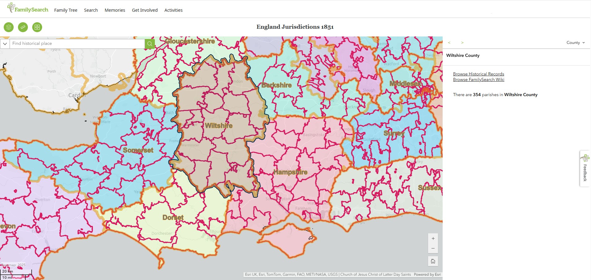
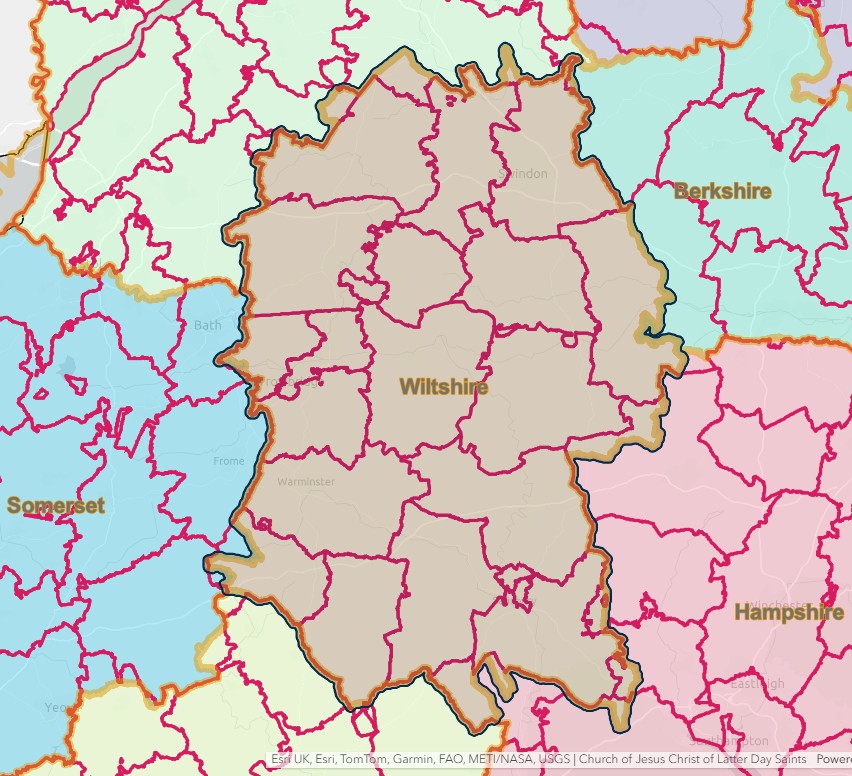
From another source, a list of Civil Registration Districts in text.
REGISTRATION DISTRICTS IN WILTSHIRE
The list below shows the civil registration districts in Wiltshire between 1837 and 1974. The same districts were used to compile the census returns for the years 1851 to 1921.
For the purposes of these pages, "Wiltshire" refers to:
- the ancient county of Wiltshire (1837–89)
- the administrative county of Wilts (1889–1974)
- the non-metropolitan county of Wiltshire (from 1974), with the unitary authority of Swindon (from 1997).
Click on a district name to see the places and dates covered, or see the Index of Place Names for the whole of England and Wales.
|
Registration District |
Registration County |
From |
To |
Comments |
|
Wiltshire |
1837 |
1895 |
Renamed 1.6.1895 to become Salisbury registration district. |
|
|
Wiltshire |
1837 |
1936 |
Abolished 1.4.1936 and added to Salisbury district. |
|
|
1837 |
1880 |
Partly in Wiltshire until 1.4.1880. |
||
|
Wiltshire |
1837 |
1936 |
Abolished 1.4.1936 and added to Trowbridge registration district. |
|
|
Wiltshire |
1837 |
1936 |
Abolished 1.4.1936 and added to Chippenham registration district. |
|
|
Wiltshire |
1938 |
2008 |
Abolished 1.4.2008 and added to Wiltshire registration district. |
|
|
1837 |
1897 |
Partly in Wiltshire until 30.9.1897. |
||
|
Wiltshire |
1837 |
1936 |
Abolished 1.4.1936 and added to Swindon registration district. |
|
|
Wiltshire |
1837 |
1998 |
Abolished 1.10.1998 and added to Devizes & Marlborough registration district. |
|
|
Wiltshire |
1998 |
2008 |
Created 1.10.1998 from Devizes and Marlborough registration districts. Abolished 1.4.2008 and added to Wiltshire registration district. |
|
|
1837 |
1844 |
Partly in Wiltshire until 20.10.1844. |
||
|
1837 |
1881 |
Partly in Wiltshire until 20.12.1881. |
||
|
1837 |
1895 |
Partly in Wiltshire until 30.9.1895. |
||
|
Wiltshire |
1837 |
1899 |
Abolished 1.5.1899 to become Swindon registration district. |
|
|
1837 |
1936 |
Partly in Wiltshire until 1.4.1936. |
||
|
Wiltshire |
1837 |
1936 |
Abolished 1.4.1936 and added to Chippenham registration district. |
|
|
Wiltshire |
1837 |
1998 |
Abolished 1.10.1998 and added to Devizes & Marlborough registration district. |
|
|
Wiltshire |
1837 |
1936 |
Abolished 1.4.1936 and divided between Trowbridge and Devizes registration districts. |
|
|
Wiltshire |
1837 |
1977 |
Abolished 1.1.1978 and added to Salisbury registration district. |
|
|
1837 |
1895 |
Partly in Wiltshire until 30.9.1895. |
||
|
Wiltshire |
1837 |
1936 |
Abolished 1.4.1936 and added to Devizes registration district. |
|
|
1837 |
1895 |
Partly in Wiltshire until 30.9.1895. |
||
|
Wiltshire |
1837 |
1869 |
Abolished 21.5.1869 and added to Alderbury registration district. |
|
|
Wiltshire |
1895 |
2008 |
Created 1.6.1895 by renaming Alderbury registration district. Abolished 1.4.2008 and added to Wiltshire registration district. |
|
|
1837 |
1883 |
Partly in Wiltshire until 25.3.1883. |
||
|
Wiltshire |
1899 |
Created 1.5.1899 by renaming Highworth registration district. |
||
|
1837 |
1930 |
Partly in Wiltshire until 31.3.1930. |
||
|
Wiltshire |
1837 |
1936 |
Abolished 1.4.1936 and added to Mere registration district. |
|
|
Wiltshire |
1837 |
1936 |
Created 1.4.1936 out of Melksham and Bradford on Avon registration districts. Abolished 1.4.2008 and added to Wiltshire registration district. |
|
|
Wiltshire |
1837 |
2008 |
Abolished 1.4.2008 and added to Wiltshire registration district. |
|
|
Wiltshire |
1837 |
1936 |
Abolished 1.4.1936 and added to Warminster registration district. |
|
|
Wiltshire |
1837 |
1936 |
Abolished 1.4.1936 and divided between Salisbury and Warminster registration districts. |
|
|
Wiltshire |
2008 |
Created 1.4.2008 from Chippenham, Devizes & Marlborough, Salisbury, Trowbridge and Warminster registration districts. |
||
|
1837 |
1844 |
Partly in Wiltshire until 20.10.1844. |
Alderbury
England Jurisdictions 1851 - CRD Alderbury
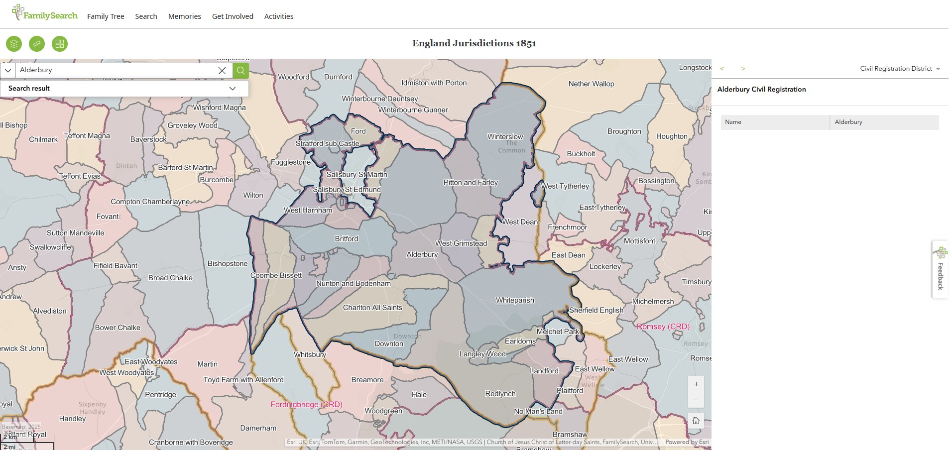
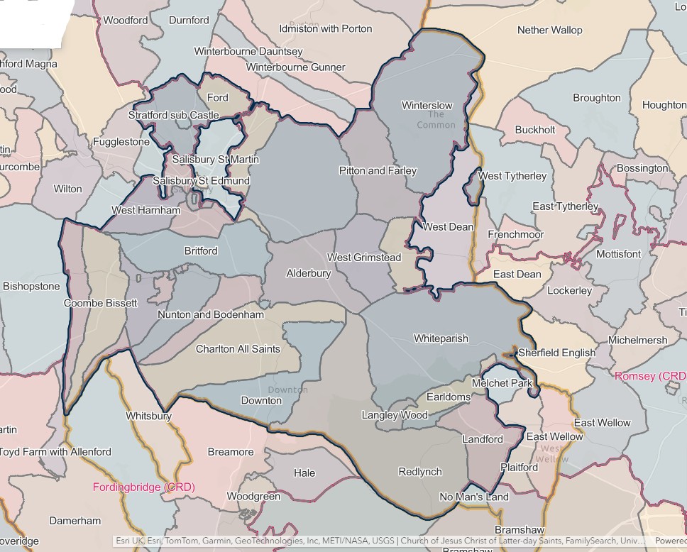
Spare
Spare
Dorset
Dorset
South Central England, Civil Registration Districts in Dorset
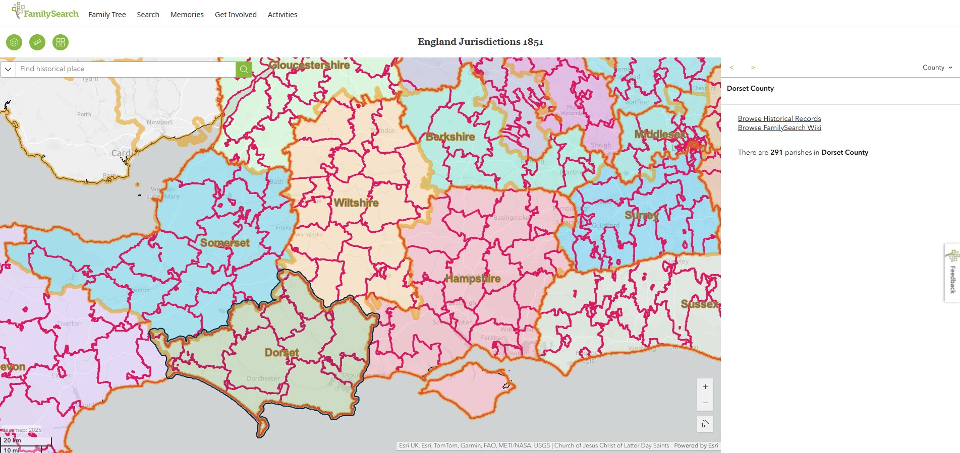
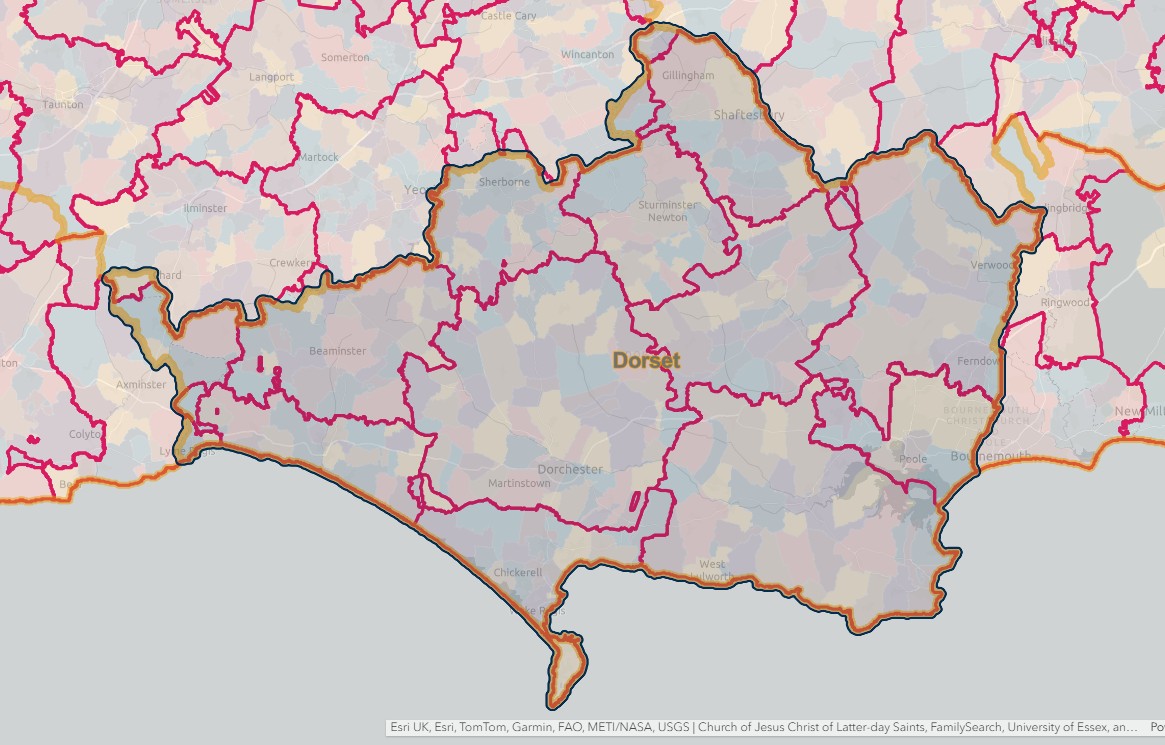
From another source, a list of Civil Registration Districts in text.
REGISTRATION DISTRICTS IN DORSET
The list below shows the civil registration districts in Dorset (sometimes known as "Dorsetshire") since 1837. The same districts were used to compile the census returns for the years 1851 to 1921.
For the purposes of these pages, "Dorset" refers to:
- the ancient county of Dorset (1837–89), including the county of the town of Poole
- the administrative county of Dorset (1889–1974)
- the non-metropolitan county of Dorset (1974–2019)
- the unitary authorities of Bournemouth (1997–2019), Poole (1997–2019), Dorset (from 2019) and Bournemouth, Christchurch and Poole (from 2019).
Click on a district name in the table below to see the places and dates covered, or see the Index of Place Names for the whole of England and Wales.
|
Registration District |
Registration County |
From |
To |
Comments |
|
1837 |
1936 |
Partly in Dorset until 1.7.1936. |
||
|
Dorset |
1837 |
1937 |
Abolished 1.4.1937 and added to Bridport registration district. |
|
|
Dorset |
1837 |
1956 |
Abolished 1.7.1956 and added to Poole registration district. |
|
|
Dorset |
1974 |
2019 |
Transferred from Hampshire on 1.4.1974. Abolished 1.4.2019 and added to Bournemouth, Christchurch & Poole registration district. |
|
|
Dorset |
2019 |
Created 1.4.2019 out of Bournemouth, Dorset and Poole registration districts. |
||
|
Dorset |
1837 |
1997 |
Renamed 1.4.1997 to become West Dorset registration district. |
|
|
Dorset |
1837 |
1838 |
Abolished 15.1.1838 and added to Dorchester registration district. |
|
|
1837 |
1895 |
Partly in Dorset until 30.9.1895. |
||
|
Dorset |
1837 |
1949 |
Abolished 1.7.1949 and added to Weymouth registration district. |
|
|
Dorset |
2005 |
Created 17.10.2005 from East Dorset, North Dorset and South & West Dorset registration districts. |
||
|
Dorset |
1997 |
2005 |
Created 1.4.1997 out of Bournemouth and Poole registration districts. Abolished 17.10.2005 and added to Dorset registration district. |
|
|
1837 |
1896 |
Partly in Dorset until 1.11.1896 |
||
|
Dorset |
1974 |
2005 |
Created 1.4.1974 out of Poole and Sturminster registration districts. Abolished 17.10.2005 and added to Dorset registration district. |
|
|
Dorset |
1837 |
2019 |
Abolished 1.4.2019 and added to Bournemouth, Christchurch & Poole registration district. |
|
|
Dorset |
1837 |
1937 |
Abolished 1.4.1937 and added to Sturminster registration district. |
|
|
Dorset |
1837 |
1937 |
Abolished 1.4.1937 and added to Sturminster registration district. |
|
|
Dorset |
1997 |
2001 |
Created 1.4.1997 out of Weymouth and Poole registration districts. Abolished 1.10.2001 and added to South & West Dorset registration district. |
|
|
Dorset |
2001 |
2005 |
Created 1.10.2001 from South Dorset and West Dorset registration districts. Abolished 17.10.2005 and added to Dorset registration district. |
|
|
Dorset |
1837 |
1974 |
Abolished 1.4.1974 and added to North Dorset registration district. |
|
|
Dorset |
1837 |
1937 |
Abolished 1.4.1937 and added to Poole registration district. |
|
|
Dorset |
1997 |
2001 |
Created 1.4.1997 by renaming Bridport registration district. Abolished 1.10.2001 and added to South & West Dorset registration district. |
|
|
Dorset |
1837 |
1997 |
Abolished 1.4.1997 and added to South Dorset registration district. |
|
|
Dorset |
1837 |
1937 |
Abolished 1.4.1937 and added to Blandford registration district. |
|
|
1837 |
1895 |
Partly in Dorset until 1.6.1895. |
Spare
Spare
Spare
