The Parish of Nursling
A Study of the Parish of Nursling in the County of Hampshire, or sometime known as the County of Southamptonshire.
I refer you to the Millbrook One Place Study in the first instance. That has a lot of the background information which would be repetitive if just repeated here.
For an extensive description of the parish follow the link to British History Online.
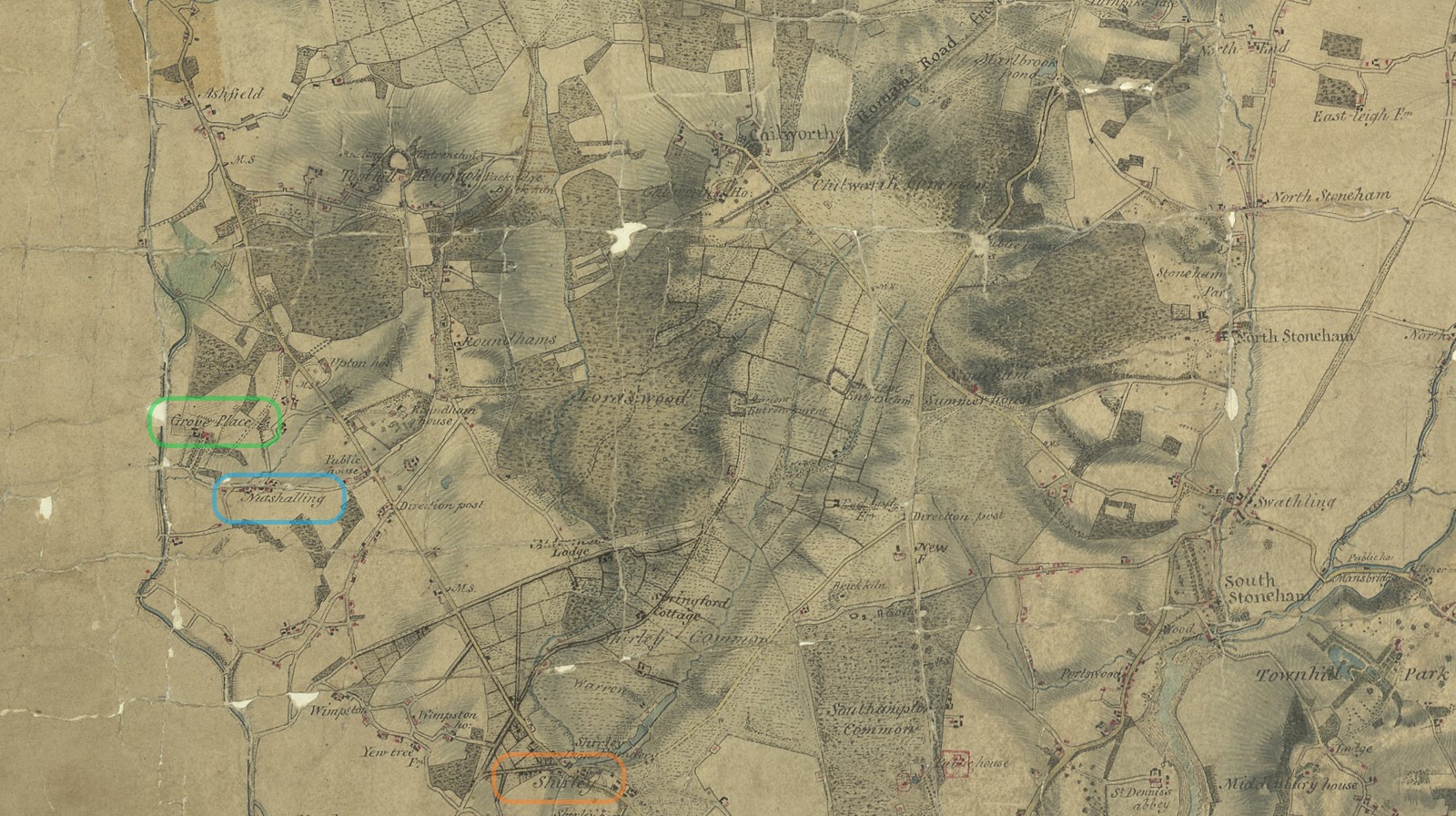
Nursling has also been called Nutshalling as can be seen in the Ordnance Survey drawing held at the British Library. Nutshalling is circled in blue. The nearby Grove Place is circled in green, the seat of Sir Charles Mills. Shirley, in the adjacent parish of Millbrook is circled in orange.
Before delving deeper, some information about the Ordnance Survey drawing held at the British Library. The British Library has also made the drawing available on Wikimedia The surveyor was: Crocker, Edmund - Medium: Pen and ink on paper - Date: 1806.
British Library notes;
This drawing was completed in 1806. The detail with which it records the road network is greater than in previous maps - testimony to the Ordnance Survey's urgency and military intent. The Roman road from Winchester to Old Sarum is marked running from the top left of the map, with smaller sections of the road shown in the Chilworth area. The origin and terminus of these roads are also noted. A line with a circle at each end leads from the margins of the map to Morstead. This line was used to plot locations and landmarks. Several "Ancient Entrenchments" are marked, notably an iron-age hillfort near Winchester called St. Catherine's Hill. The fort is indicated by concentric rings of dark, cross-hatched strokes ('hachures'). Week Turnpike Gate is marked on the road between Week and Winchester.
The recording of a dog kennel above Little Sombourne and bathing houses on the coast between Southampton and Redbridge reveal the meticulousness of the Survey, and perhaps too the interests of the draughtsman.
The map below is an extract of the map referred to in the British Library notes.
Not circled, but the following can also be seen on this map extract. Lordswood, Roundhams {Rownhams}, and Toothill, with the Telegraph. Together with a few named houses, Springford Cottage, Aldermore Lodge, Roundham House, Upton House, and Chilworth House,

This is the same Drawing referred to above but zooming to Grove Place and Nutshalling.
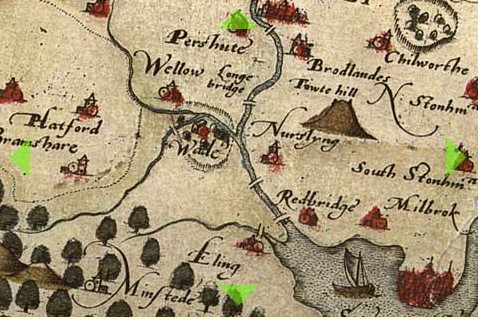
We are getting ahead of ourselves. Below we jump further back in time, to maps between 1575 and 1788. Nursling, or a variation of spelling of same, is shown on all the maps, despite how very small the village was.
 |
 |
| Saxton 1575 | Norden 1595 |
 |
 |
| Norden 1607 | Speed 1611 |
 |
 |
| Morden 1695 | Kitchen 1751 |
 |
|
| Harrison 1788 | |
| The names and dates refer to the originator of the map and date. | |
| Click the link to go to the Old Hampshire Mapped website for more information. | |
| See how much the skill of mapping has changed over time. | |
We also need to look at some old large scale maps, also from the Old Hampshire Mapped website.
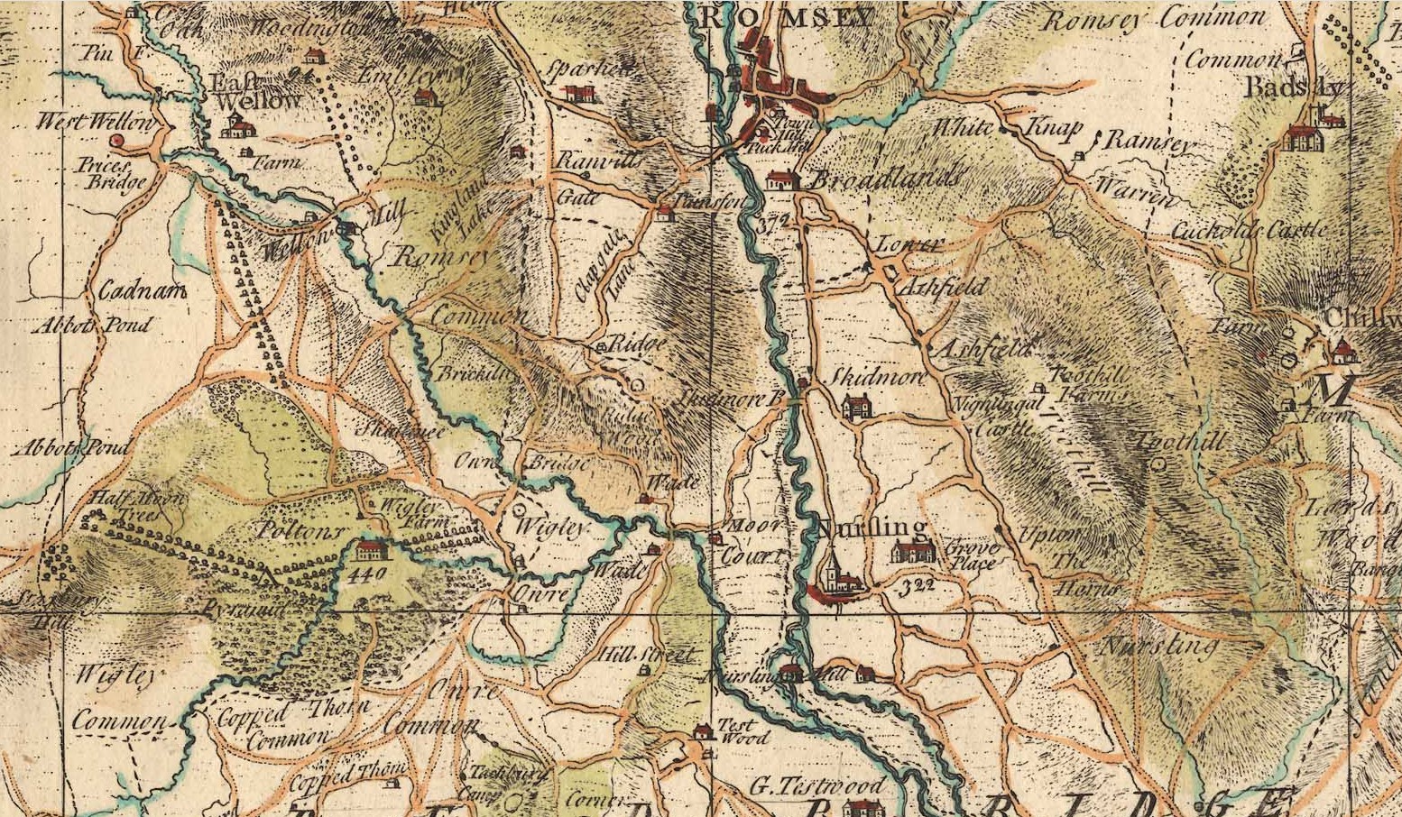
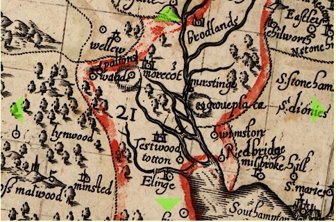
An extract of Taylor's Hampshire 1759. At 1759 this is not dissimilar to the period of interest of the article about John and Mary Mabey of Nursling. Grove Place is annotated 322.
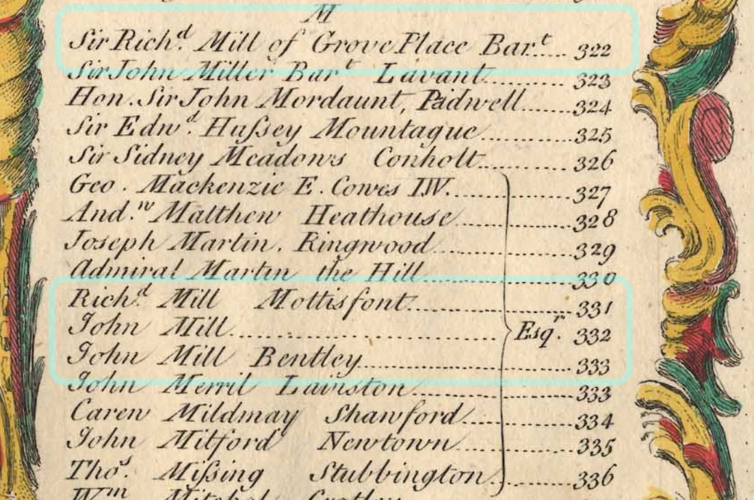
The Mill family were prominent in the area for a long time.
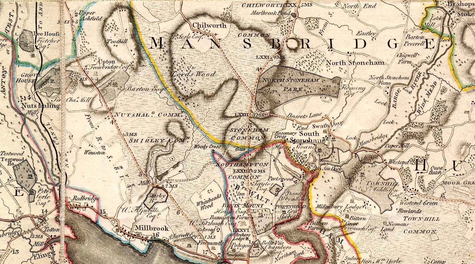
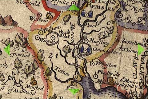
An extract from Milne's Hampshire 1791. This map has names of prominent people added as well as places
| Named people on Map | Residence | Link |
|---|---|---|
| J Jarrett Esq | Freemantle House | http://sotonopedia.wikidot.com/page-browse:freemantle-house |
| W. F. Grenville Esq | Shirley House | http://sotonopedia.wikidot.com/page-browse:shirley-house |
| Sir Charles Mill | Grove House / Place | http://sotonopedia.wikidot.com/page-browse:grove-place |
| Peter Serle Esq | Testwood House | http://sotonopedia.wikidot.com/page-browse:testwood-house |
| Barton Esq | Rownhams House | http://sotonopedia.wikidot.com/page-browse:rownhams-and-rownhams-house |
| Trowbridge Esq | Upton House | https://www.british-history.ac.uk/vch/hants/vol3/pp433-439 |
| Fletcher Esq | Lee House | http://research.hgt.org.uk/item/lee-house/ |
Nutshalling / Nursling Common and Shirley Common is shown on this map. On later maps Shirley Common is much smaller, and in the area of Whiteheads Wood.
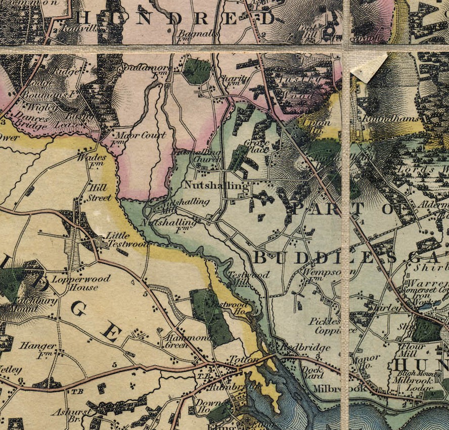
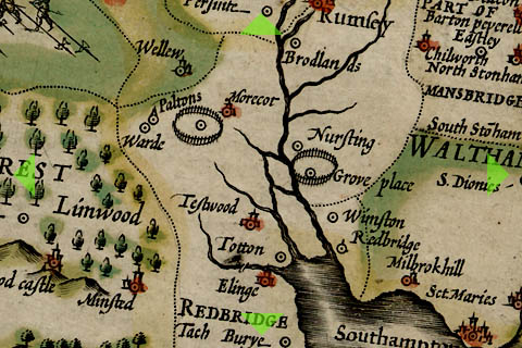
An extract of Greenwood's Hampshire 1826 with Nutshalling and Grove Place clearly shown.
The Parish
The maps so far show the village of Nursling or Nutshalling but not the extent of the parish.
NURSLING, or Nutshalling, a parish, in the union of Romsey, hundred of Buddlesgate, Romsey and S. divisions of the county of Southampton, 5 miles (N. W.) from Southampton. There is a place of worship for Wesleyans.
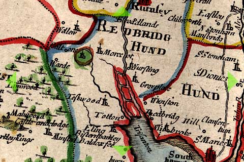
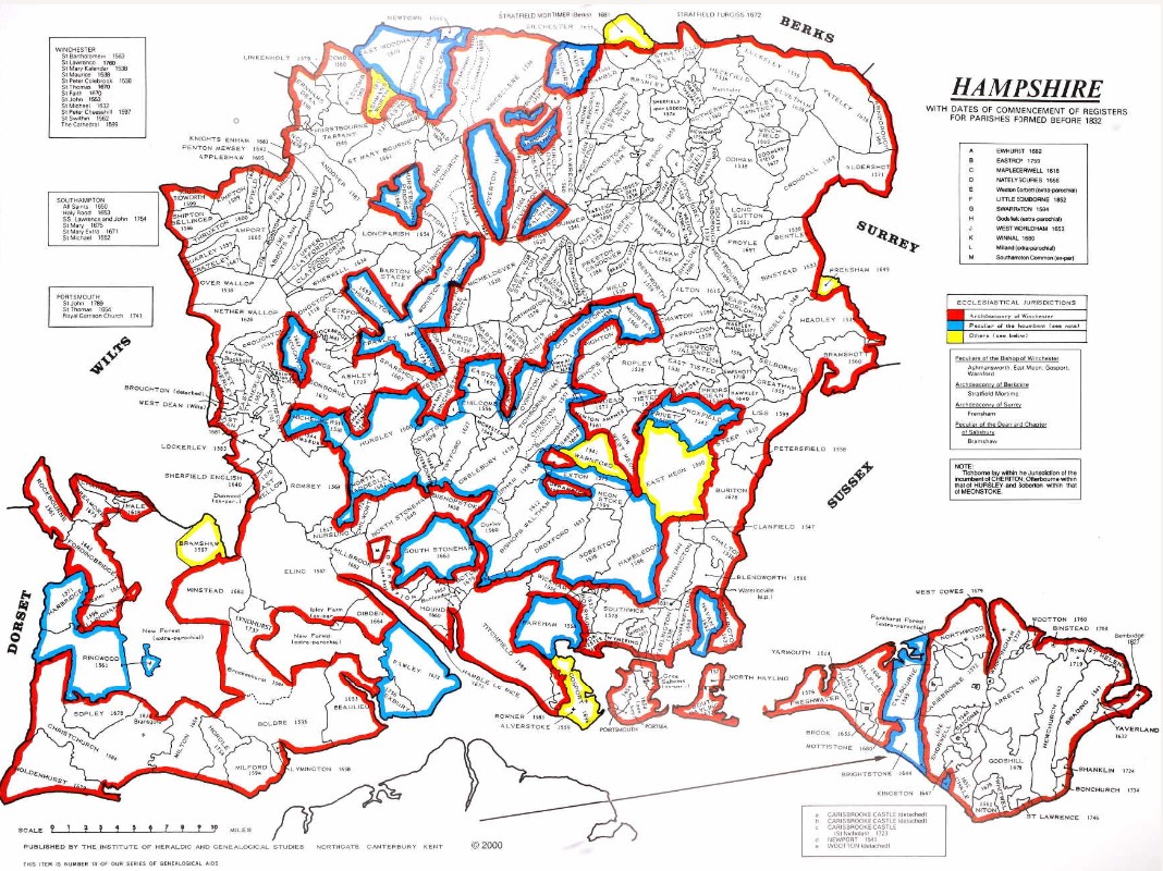
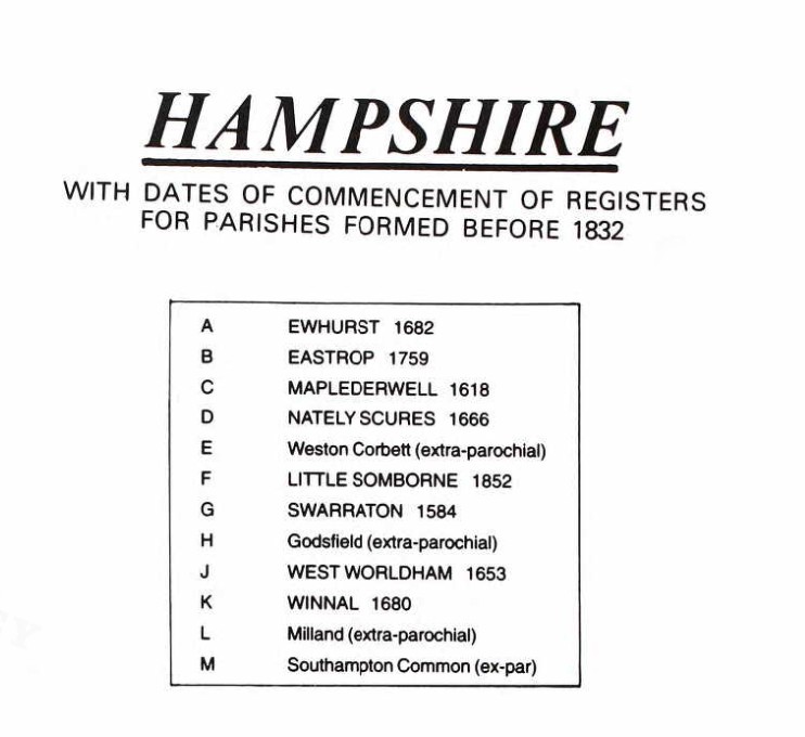
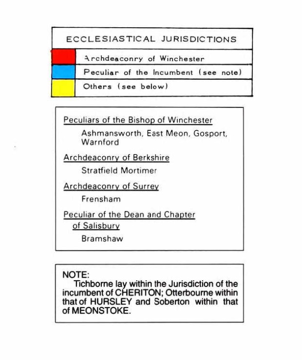
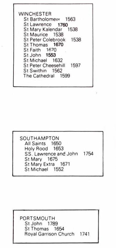
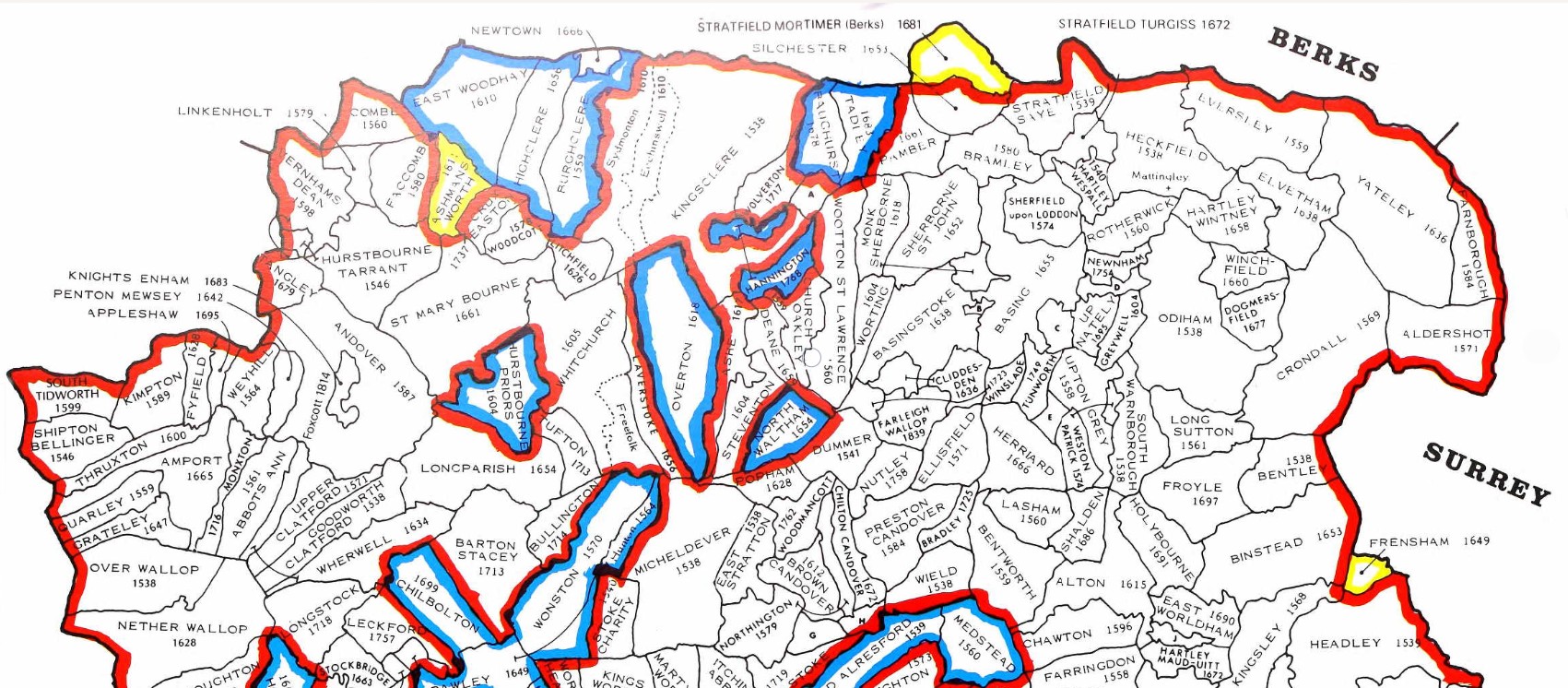
County map of Parishes - Hampshire
Extract from Great Britain, Atlas and Index of Parish Registers, from Ancestry
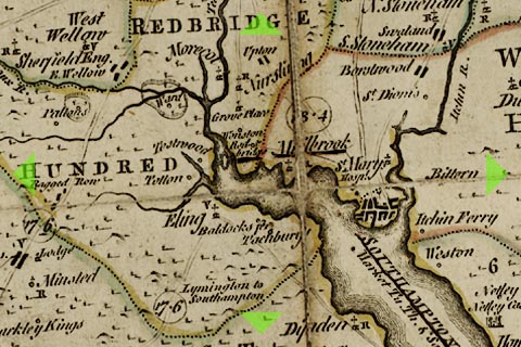
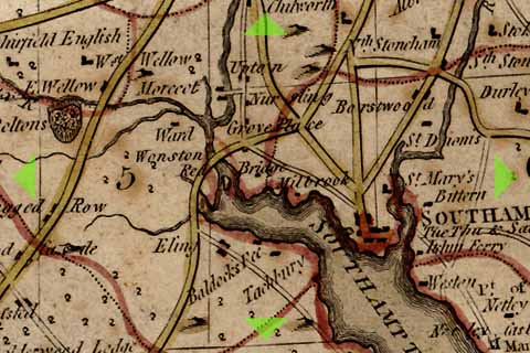
Same map but in more detail
The same map but zoomed in and split into four parts for ease of use.
There is a vertical overlap on each segment to try to avoid the difficulty of interpreting the information, reading at the joints.
At one time this was done with mouse rollover, but that no longer consistently works on all browsers, so back to static.
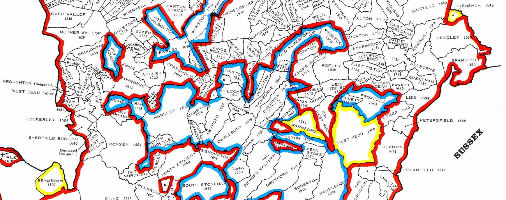
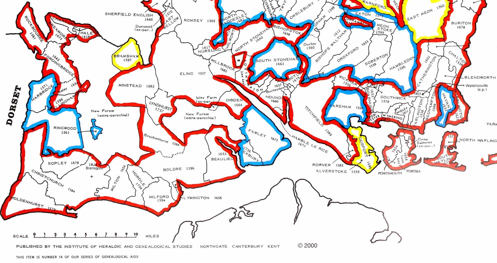
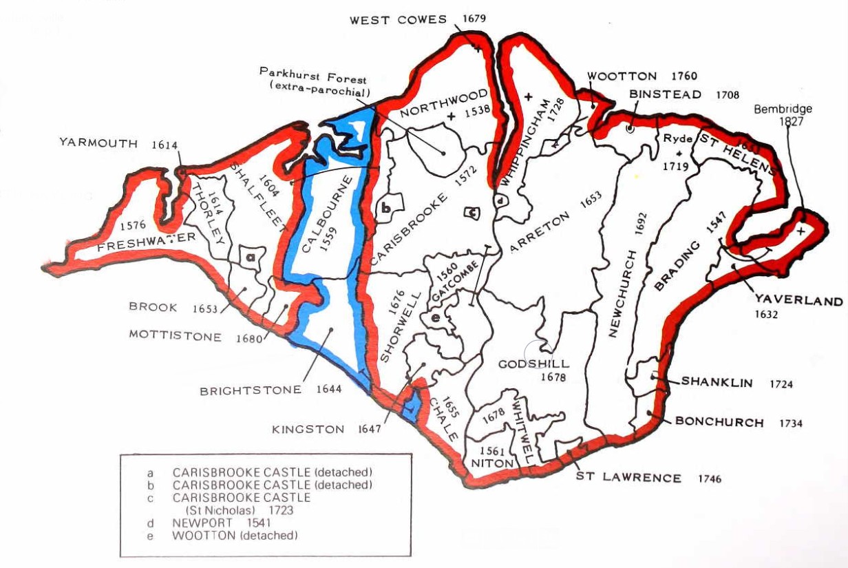
The County of Hampshire Parishes.
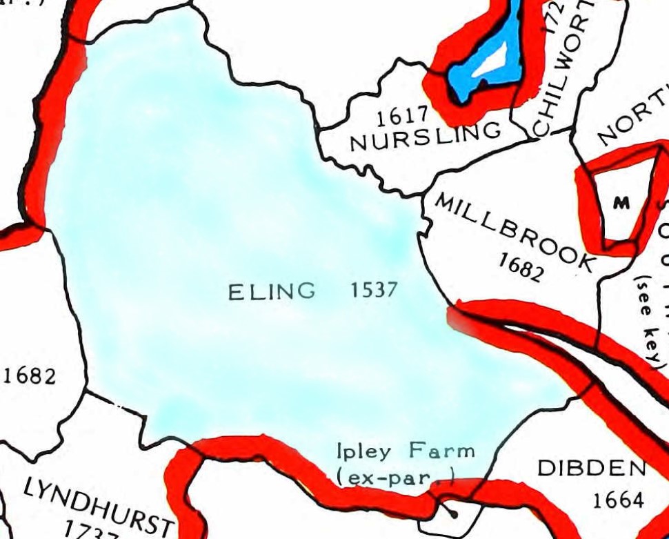
Zooming into the parish of Eling for this map, with a wash of light blue. Adjacent parishes to the North include Millbrook and Nursling. The dates indicate the early parish records.
An extract of Family Search English Jurisdictions 1851. Search for Nursling, to get the map below.
A similar map but for the parish of North Baddesley, which includes Rownhams.
Rownhams was formerly a chapelry in the parishes of Nursling, Romsey and North Baddesley, on 1 October 1897 became a separate civil parish, on 1 April 1932 the parish was abolished to form "Nursling and Rownhams". In 1931 the parish had a population of 540.
St John’s Church in Rownhams was constructed in the 1850’s having been financed by Oliver Colt who lived in Rownhams House.
From Kelly's "Directory of Hampshire and the Isle of Wight (1911)"
ROWNHAMS is an ecclesiastical parish formed in 1856 from the parishes of Romsey Extra, Nursling and North Baddesley, and into a civil parish by Local Government Board Order No 36648, dated Oct 1st, 1897; it is 1½ miles north from Nursling station on the Southampton and Salisbury line of the London and South Western railway, 4 west-by-north-west from Southampton and 3½ south-east from Romsey, in the New Forest division of the county, hundred of Buddlesgate, union of Romsey, county court district of Romsey, rural deanery of Romsey and archdeaconry and diocese of Winchester, overlooking the valley of the Test, and bounded on the side by the road from Southampton to Romsey. The church of St. John the Evangelist is an edifice of stone in the Decorated style, consisting of chancel, nave, transepts, vestry, south porch and a tower with spire containing one bell and tubular chimes, hung in 1889 to the memory of the Rev. Robert Francis Wilson M.A. vicar here 1863-1888: in the chancel is a brass to William Oliver Colt, founder of this church, died April 9th. 1853, and Jane, his widow, by whom the work was completed about 1856, who died September 5th. 1875: the church was consecrated October 25th. 1856: all the windows are stained: the reredos is of alabaster, gilt and colored (sic): there are 220 sittings. The register dates from the year 1856. The living is a vicarage, net yearly value £190, with residence and 3 acres of glebe, in the gift of the Bishop of Winchester, and held since 1891 by the Rev. George Mead M.A. of St. John's College, Oxford. The vicarage house is of red brick in the Elizabethan still, and was erected by the late Mrs. Colt, of Rownhams Park. Rownhams House, the property and residence of Lord Abinger J.P. is a mansion of brick, situated in a park of 40 acres. The chief landowners are Wilfred W. Ashley esq. M.P., J.P. of Broadlands, Romsey, Mrs Vaudry-Barker-Mill, of Langley Manor, Tankerville Chamberlayne esq. of Cranbury Park, who is lord of the manor, and John E.A. Willis Fleming esq. of Chilworth Manor. The chief crops are barley, wheat and oats. The soil is clay, sand and gravel; subsoil, clay. The area is 1985 acres of land and 4 of water; rateable value , £3428; the population in 1901 was 498 in the civil and 481 in the ecclesiastical parish"
An Ordnance Survey, OS 6" Old Map from the National Library Of Scotland. The link will take you to a similar map, with the marker at St Boniface Church Nursling. The Map is made up from the following sheets;-
Hampshire & Isle of Wight Sheet LVII.SW
Revised: 1895, Published: 1897
Hampshire & Isle of Wight Sheet LVI.SE
Revised: 1895, Published: 1897
Hampshire & Isle of Wight Sheet LXV.NW
Revised: 1895 to 1896, Published: 1898
Hampshire & Isle of Wight Sheet LXIV.NE
Revised: 1895 to 1896, Published: 1897
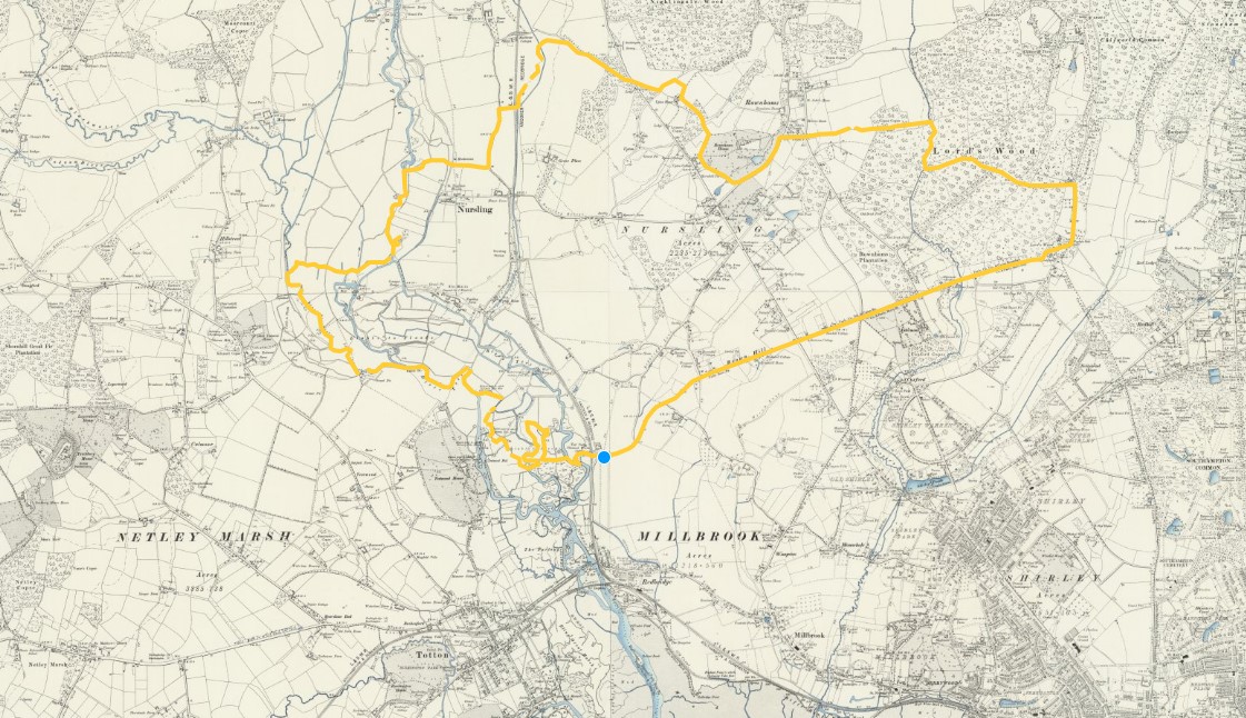
Unfortunately, if you follow the link, the yellow line will not be there. I drew that onto the digital map using one of the tools. Zooming in a long way I followed the boundary markers, hoping they were the parish boundary.
You could also follow the doted line on the map at the link, for the detailed position. It may not be exactly the same boundary as shown on the English Jurisdictions 1851 map, above. Not only is there a time difference but the may be a difference between civil and ecclesiastical boundaries.
To get you a little closer, I have made copies of the above, zoomed in and split North and South.
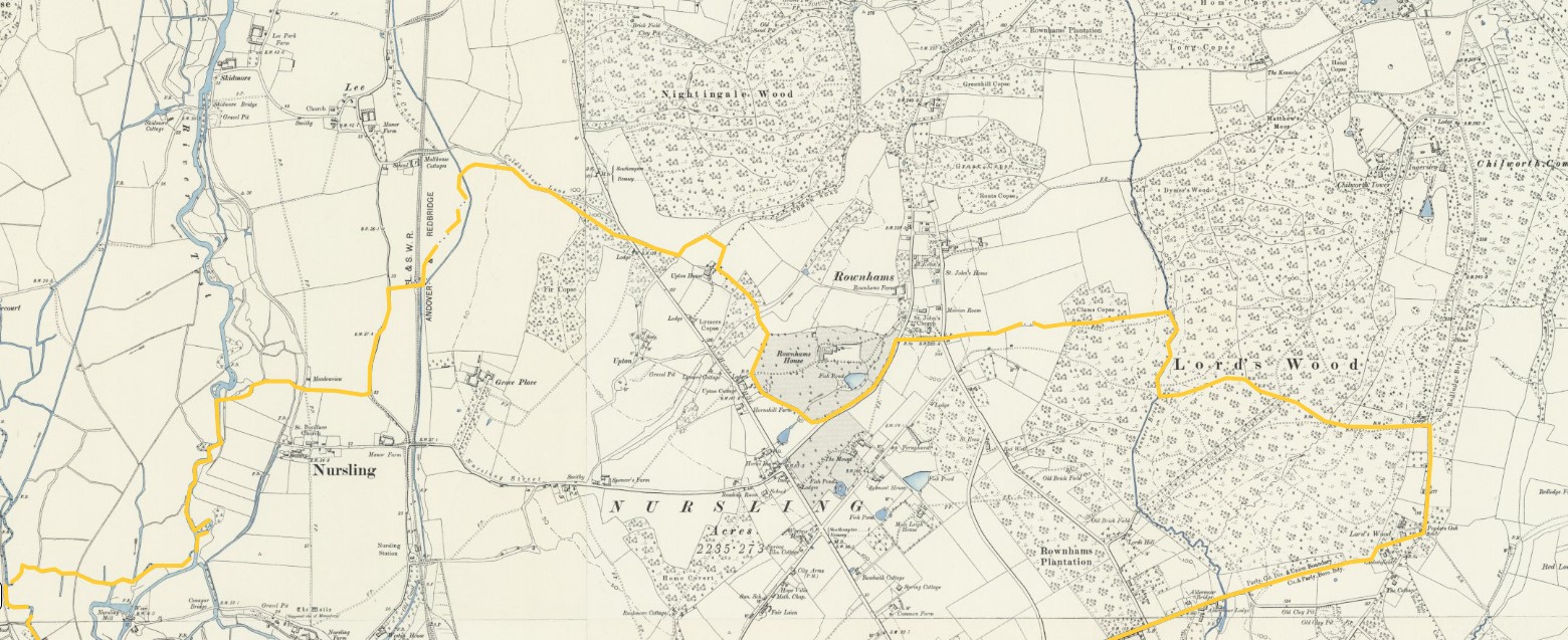
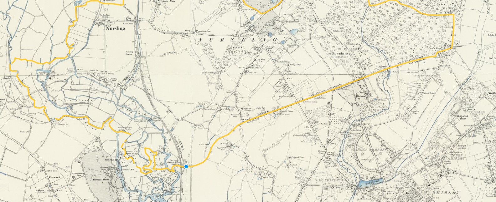
I have not tried to align the two sheets. There are some vary torturous routes for the boundary, especially near the river.
All of the above maps of the Parish are before the separation and creation of a separate Rownhams Parish from lands of Nursling, Romsey, and North Baddesley Parishes, on 1 October 1897.
However, Rownhams House and the village of Rownhams do appear to be outside of the boundary shown. It is possible that the imminent boundary change was know and incorporated onto the maps as part of the revision.
Some of the dotted lines I have followed are Poor Law Union boundaries and others are Civil Parishes. Looking further at the key, I don't think the maps show ecclesiastical boundaries, so at least that is one potential variation resolved.
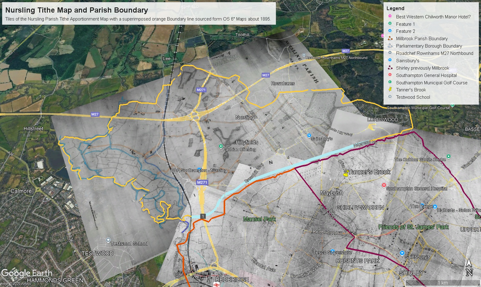
The above is a copy of a Google Earth image created by overlaying tiles of Nursling Parish Tithe Apportionment Map and the Boundary line created on the OS 6" maps above. Also shown is some of Millbrook Parish Tithe Apportionment Map. Although the lines and the edge of the Tithe Map do not align everywhere, there is a reasonable correlation. Apart for part of Lordswood, which appears to be missing. Although, on the original image it does go further into Lordswood, closer to the shape of the boundary. Something to rectify at a later date. The Tithe Apportionment is dated 19th Sept 1846. My conclusion therefore is that the orange line above is before the separation of part of the Parish for the creation of the Parish of Rownhams.
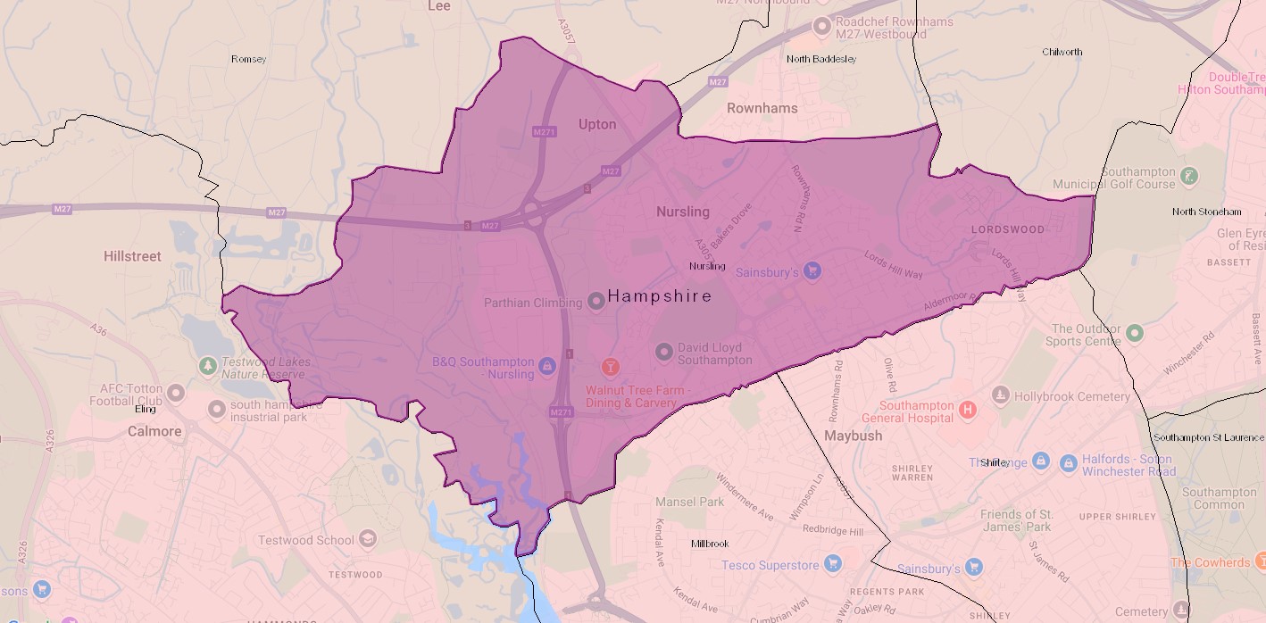
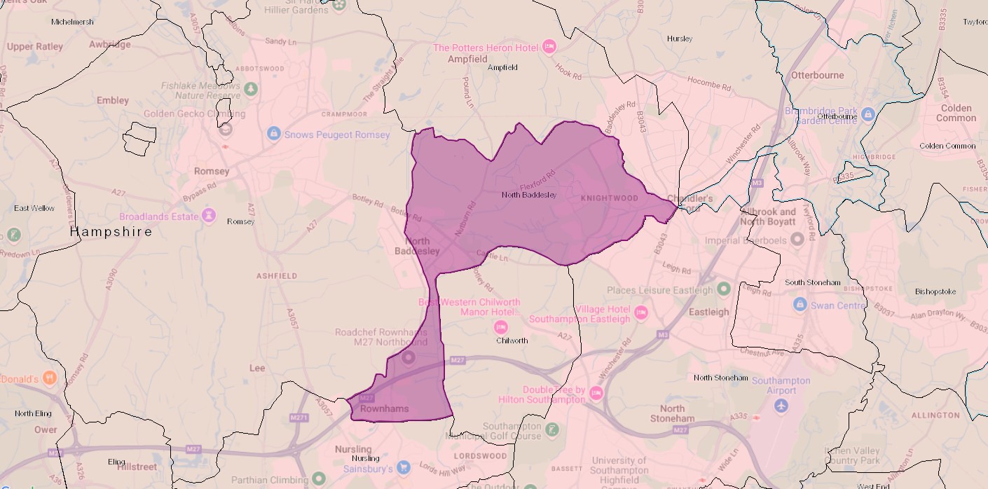
The above ESRI Church of England Parish map brings us up to date. Click on the map in the area of Nursling to bring up the boundary and information about the Parish. It does work here but it is easier to see if you first click on 'View larger map', which opens a new page. The statistics are fascinating. You can also click on one of the dots to bring up information about that. Click in different places to see different parts of the boundary, or adjacent parishes.