Fire Insurance Plans of London
Part of a collection at the British Library.
However, it always takes me a long time to find the sheet I want so this is going to be a collection of the Key sheets to aid that process.
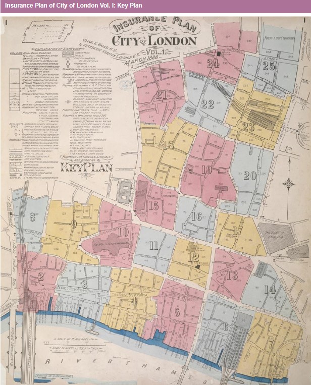
Insurance Plan of City of London Vol. I: Key Plan
Shelfmark: Maps 145.b.22.(.1)
Scale: Inches
Genre: Map
Map scale ratio: [1:480]. 40 ft = 1 inch. and [1:2400]. 200 ft = 1 inch.
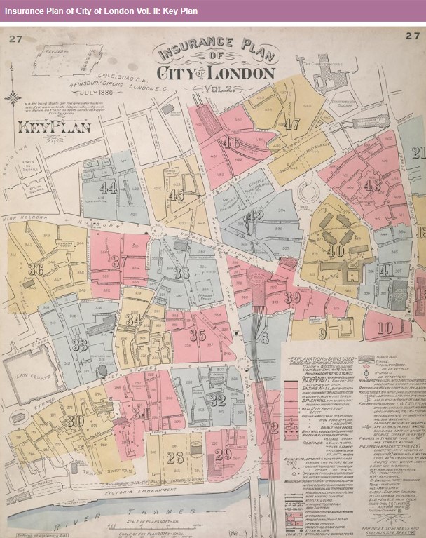
This "key plan" indicates coverage of the Goad 1886 series of fire insurance maps of London that were originally produced to aid insurance companies in assessing fire risks. The building footprints, their use (commercial, residential, educational, etc.), the number of floors and the height of the building, as well as construction materials (and thus risk of burning) and special fire hazards (chemicals, kilns, ovens) were documented in order to estimate premiums. Names of individual businesses, property lines, and addresses were also often recorded. Together these maps provide a rich historical shapshot of the commercial activity and urban landscape of towns and cities at the time. The British Library holds a comprehensive collection of fire insurance plans produced by the London-based firm Charles E. Goad Ltd. dating back to 1885. These plans were made for most important towns and cities of the British Isles at the scales of 1:480 (1 inch to 40 feet), as well as many foreign towns at 1:600 (1 inch to 50 feet).
Insurance Plan of City of London Vol. II: Key Plan
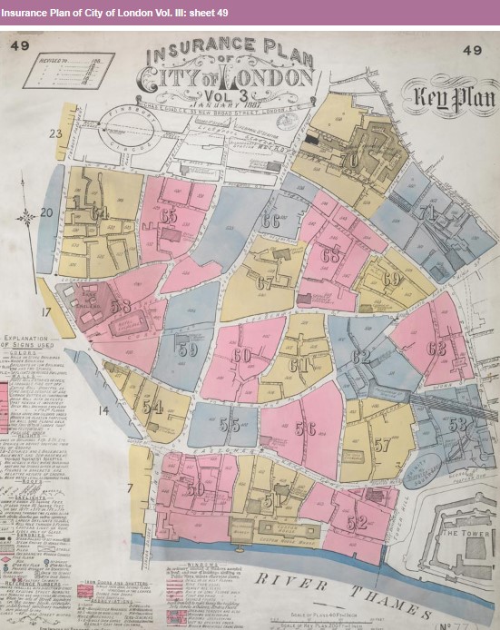
Next list should be Vol III, sheets found but not Key. However, although not listed as key, that is what sheet 49 is.
Insurance Plan of City of London Vol. III: sheet 49
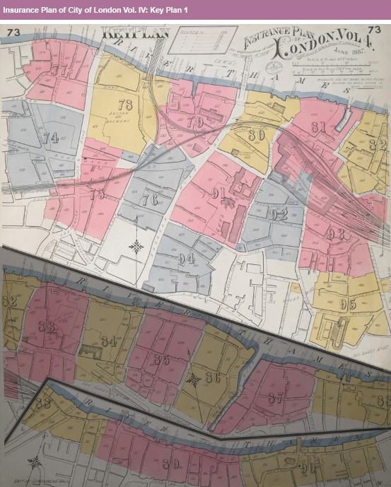
Insurance Plan of City of London Vol. IV: Key Plan 1
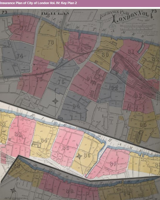
Insurance Plan of City of London Vol. IV: Key Plan 2
Next list
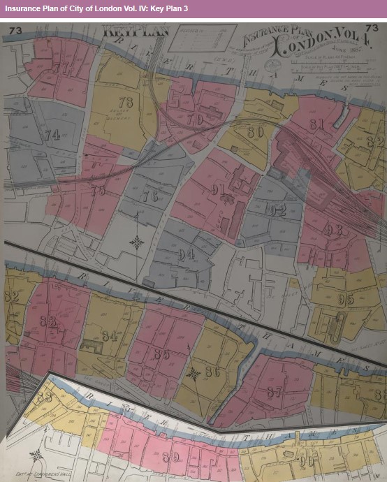
Insurance Plan of City of London Vol. IV: Key Plan 3
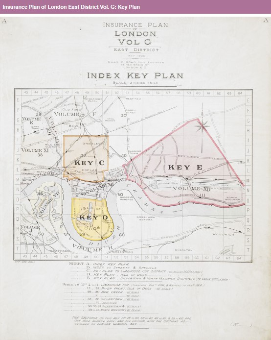
Insurance Plan of London East District Vol. G: Key Plan
Next list, East London South East District Vol H
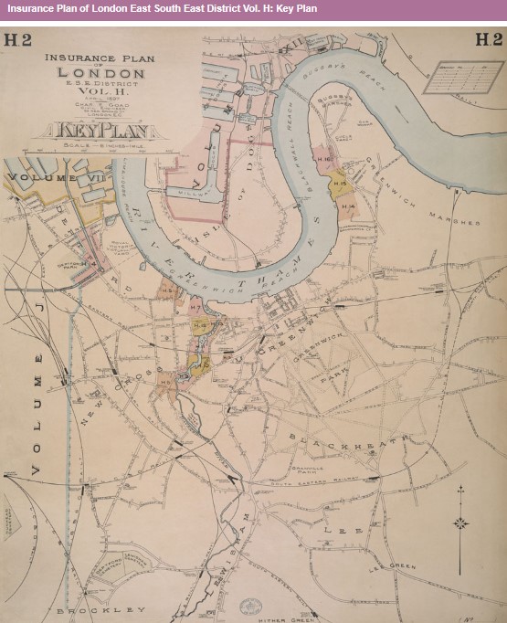
Insurance Plan of London East South East District Vol. H: Key Plan
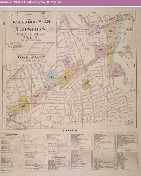
Insurance Plan of London East Vol. G: Key Plan
Next list, London North and North East Vol E.
Insurance Plan of London North & North-East District Vol. E: Key Plan

Next List, London North District Vol D.
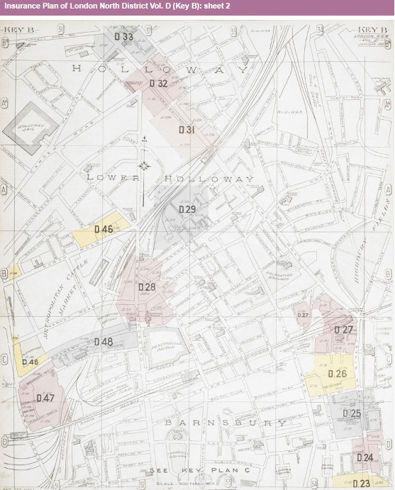
Insurance Plan of London North District Vol. D (Key B): sheet 2
Next List, London North District Vol D.
Insurance Plan of London North District Vol. D (Key C): sheet 3-1

Insurance Plan of London North District Vol. E: Key Plan

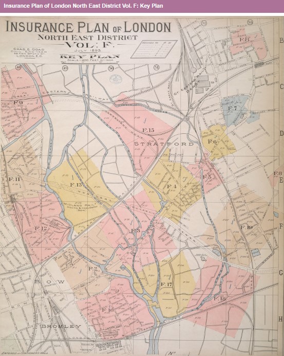
Next List, London North East Vol F
Insurance Plan of London North East District Vol. F: Key Plan
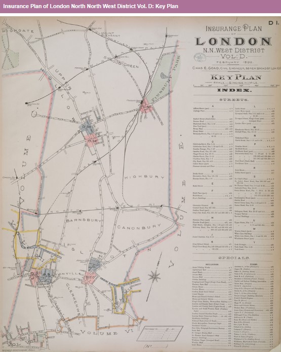
Next List, London North North West Vol D
Insurance Plan of London North North West District Vol. D: Key Plan
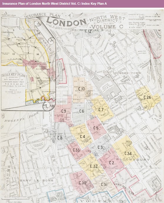
Next List, London North West Vol C.
Insurance Plan of London North West District Vol. C: Index Key Plan A
Next List, London North West Vol C.
Insurance Plan of London North West District Vol. C: Second Key Plan B

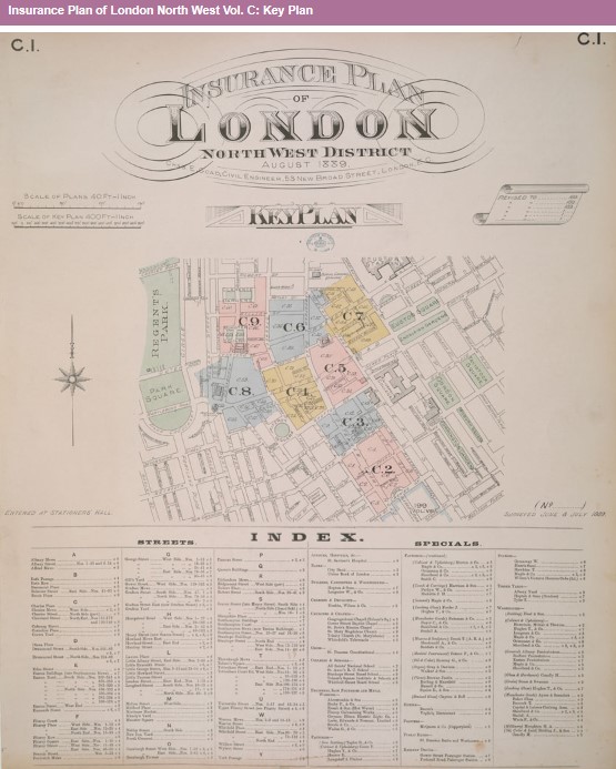
Next List, London North West Vol C.
Insurance Plan of London North West Vol. C: Key Plan
Next List for Key to J appears to be missing, so the list where J starts
Next List, London South West Vol K.
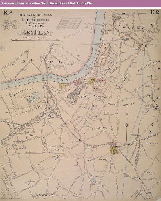
Insurance Plan of London South West District Vol. K: Key Plan
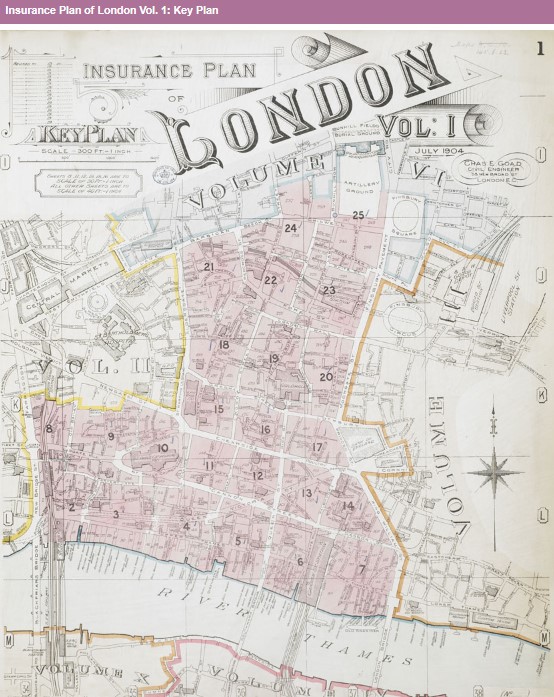
Insurance Plan of London Vol. 1: Key Plan
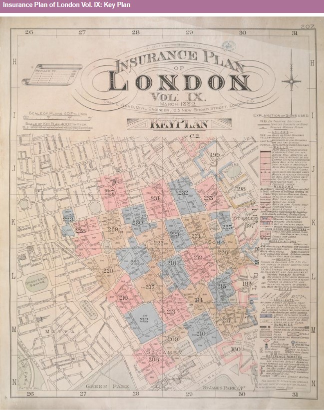
Insurance Plan of London Vol. IX: Key Plan
Insurance Plan of London Vol. V: Key Plan 1

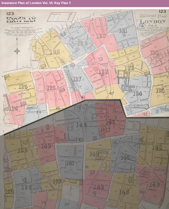
Insurance Plan of London Vol. VI: Key Plan 1
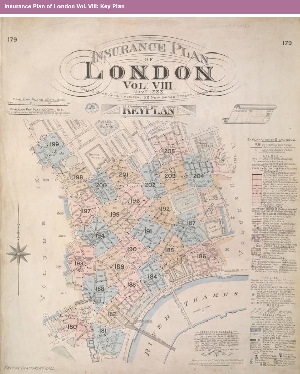
Insurance Plan of London Vol. VIII: Key Plan
Insurance Plan of London Vol. X: Key Plan
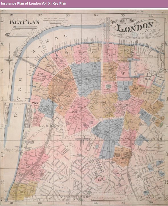
Link to Printable image did not work
Insurance Plan of London Vol. XI: Key Plan
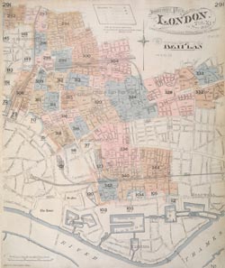
Link to Printable image did not work
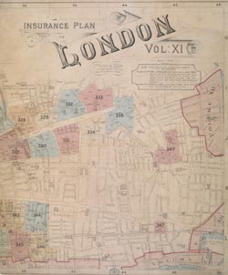
Insurance Plan of London Vol. XI: Key Plan
Link to details did not work for
- Insurance Plan of London Vol. XII Regent's Canal and Vicinity: Key Plan 1, and 2, and 3.
-
Insurance Plan of London Vol. XII: Key Plan 1, and 2, and 3, and 4
Link to Printable image did not work
The pages after this point are problematic.