Eling, Hampshire
Eling a small village and town, as well as a large parish on the banks of the River Test opposite Southampton, and adjacent to the New Forest, in the county of Hampshire, sometimes known as Southamptonshire, or County of Southampton.
Bronze Age 1500BC
A Bronze Age Settlement to the North of the Town was discovered when the Testwood Lakes were excavated. A jetty, bridge and dagger were all found dating from that period.
The town has a history back to before Bronze Age times. It is thought the name Eling probably derives from Edlas’s people, or Edlingas as it appeared in the Domesday Book.
Domesday Book 1066-1086
Eling was a settlement in Domesday Book, in the hundred of Redbridge and the county of Hampshire.
It had a recorded population of 69 households in 1086, putting it in the largest 20% of settlements recorded in Domesday.
![Domesday_-_Eling.jpeg]() Land of King William
Land of King William
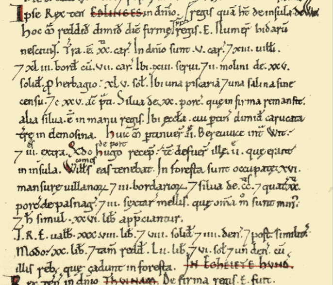 Land of King William
Households
- Households: 13 villagers. 43 smallholders. 13 slaves.
Land and resources
- Ploughland: 20 ploughlands. 5 lord's plough teams. 7 men's plough teams.
- Other resources: Meadow 125 acres. Woodland 20 swine render;in Forest. 2 mills, value 1 pound 5 shillings. 1 fishery. 1 salthouse. 1 church. 0.5 church lands.
Valuation
- Annual value to lord: 20 pounds in 1086; 38 pounds 8 shillings and 2 pence when acquired by the 1086 owner; 38 pounds 8 shillings and 2 pence in 1066.
Owners
- Tenant-in-chief in 1086: King William.
- Lord in 1086: King William.
- Lord in 1066: King Edward.
Other information
- Partially waste in 1086.
- Phillimore reference: Hampshire 1,27
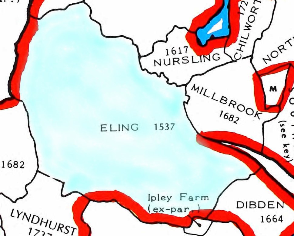
Eling Parish 1537
Original data;
Smith, Cecil R. Humphery. The Phillimore Atlas and Index of Parish Registers. Digitized images. Institute of Heraldic and Genealogical Studies, Canterbury, Kent, England. From Ancestry
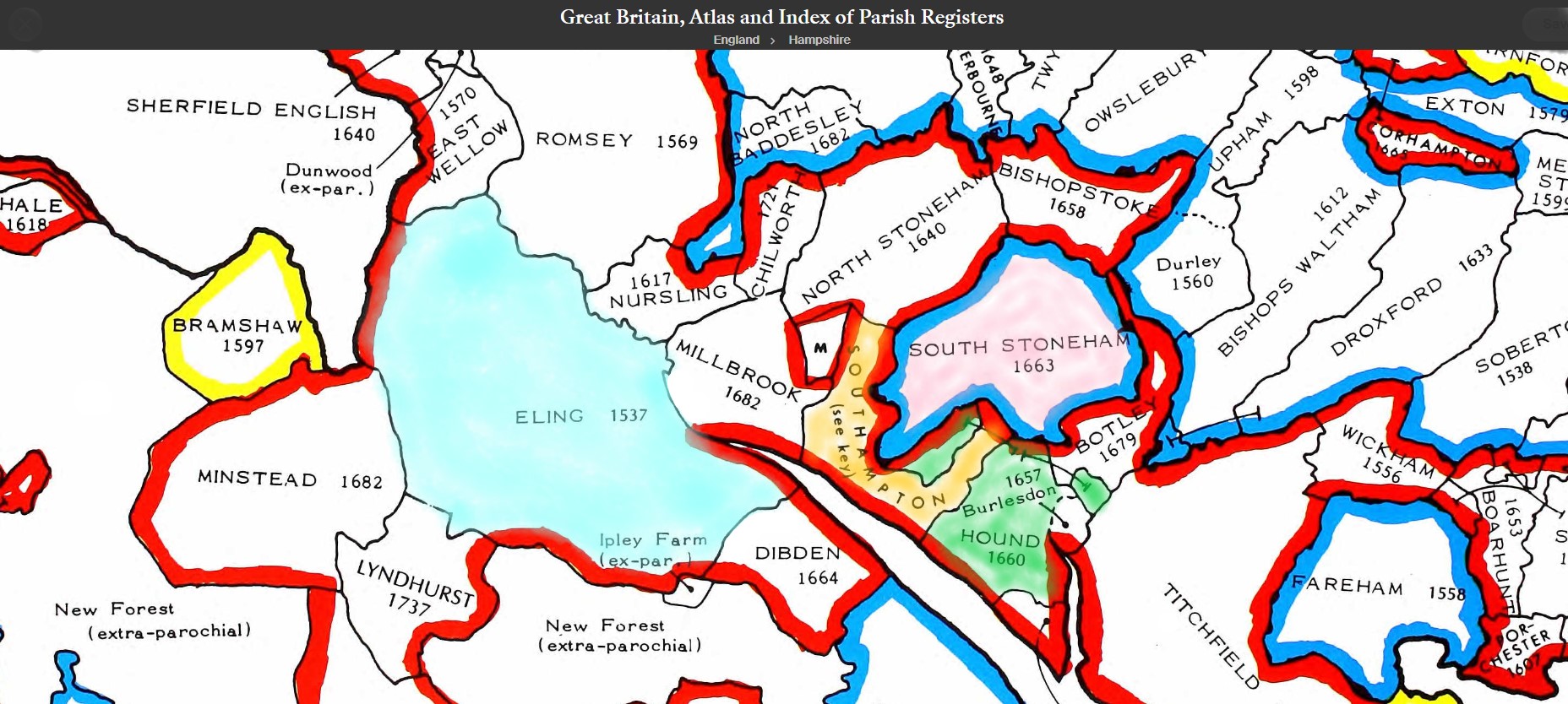
The above map is an extract of the The Phillimore Atlas and Index of Parish Registers for Hampshire. Of particular interest, the Parishes of Eling - 1537, Southampton, Hound 1660, and South Stonham 1663.
Southampton contains the following parishes;
- All Saints - 1650
- Holy Rood - 1653
- SS, Lawrence and John, sometimes written as St Lawrence and St John - 1754
- St Mary - 1675
- St Mary Extra - 1671 (Other side of the River Itchen)
- St Michael - 1552
- Southampton Common, marked as M, extra-parochial.
The dates are not when the parishes were formed but as it states by the County Title, the dates of the commencement of Registers of Parishes formed before 1832.
I think that may be expanded to dates of registers still in existence.
Old Hampshire Maps
The website for Old Hampshire Maps and Other Historic Resources is a most excellent source of information which I often refer to.
I normally click on the top left icon, Old Hampshire Mapped, but believe that the one next to it on the right is more extensive and gets to the same maps and more.
This section could be called an indulgence to my lifelong fascination with maps and travel. Maps can tell you so much more than just how to get from A to B. Maps over time add to so much more.
Generally, the maps refer to Eling the settlement as opposed to the much larger parish. Something in the history must have given Eling some significance.
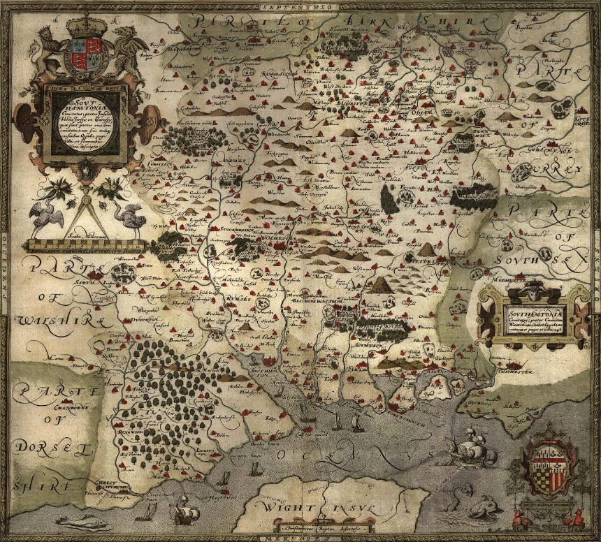
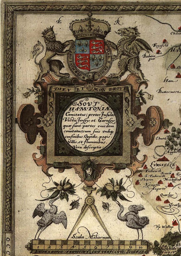
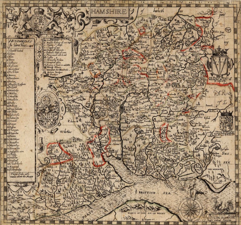
Saxton 1575
Saxton's map of Hampshire 1575
Extract from the Old Hampshire Mapped website about Saxton's map.
Map, hand coloured copper plate engraving, Southamtoniae, ie Hampshire, scale about 4 miles to 1 inch, engraved by Leonard Terwoort, Antwerp, Netherlands, published by Christopher Saxton, map maker, London? about 1575.
Published in the Atlas of England and Wales; it was usually issued in hand coloured form; measurements and notes made in the field were worked up later, with the help of earlier manuscript maps if available; Saxton almost certainly used the rudimentary triangulation techniques first described by the cartographer Frisius, Belgium, 1533.
Hills are drawn in profile to provide a general impression of the local topography, while named settlements are shown by a variety of symbols including a church with tower; rivers, coastline, some bridges, deer parks and woods are all included; the most obvious omission on Saxton's maps, to our eyes, are roads, which were not included on general county maps until the 1690s.
The map '... provides us with our first english example of accurate cartography': Colonel Close: 1930:: Hampshire Field Club.
Saxton's county maps were engraved by Ryther, Hogenberg, Reynolds, Terwoort and Scatter.
Direct link to Eling.(Settlement)
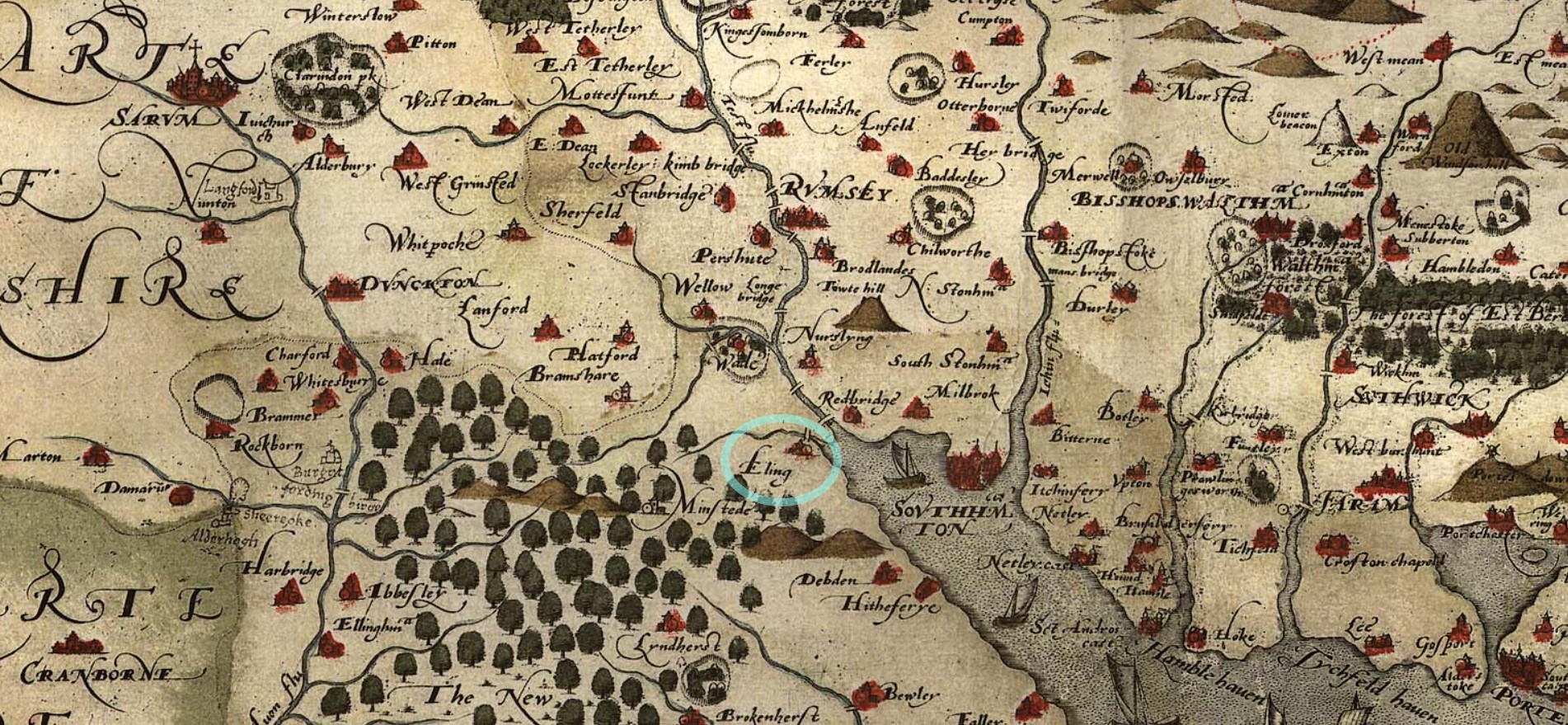
The ancient settlement of Eling circled in blue, to help locate it.
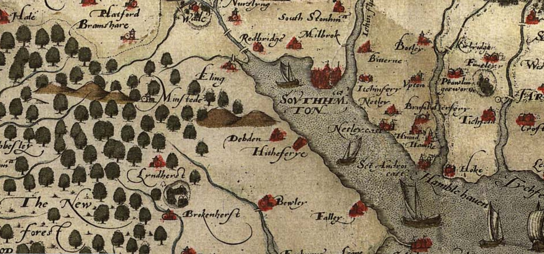
Zoomed in some more on the same map. Showing from the New Forest, Eling, Southampton, across to the Hamble.
Norden 1595
Norden's Hampshire 1595
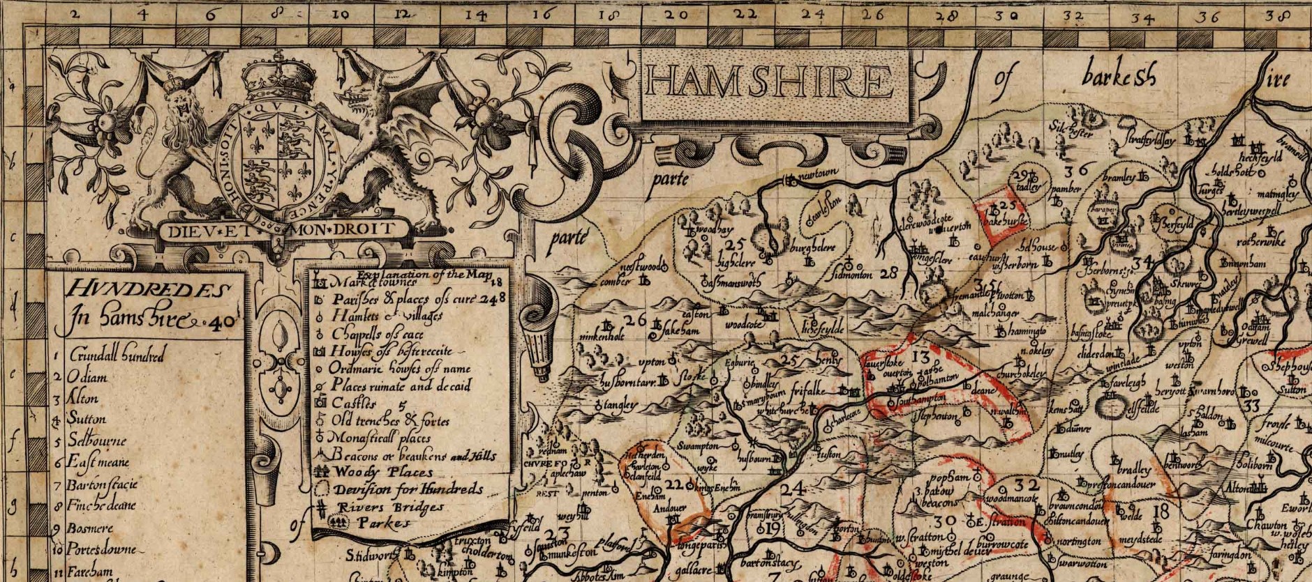
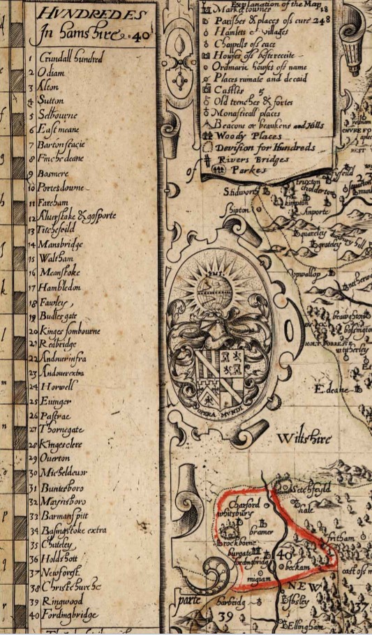
A map of Hampshire, including the Hundreds of the time. Remembering that a Hundred was an administrative area, part of and smaller than a County, and bigger than, and containing multiple Parishes.
The origin of the division of counties into hundreds is described by the Oxford English Dictionary (OED) as "exceedingly obscure". It may once have referred to an area of 100 hides; in early Anglo-Saxon England a hide was the amount of land farmed by and required to support a peasant family, but by the eleventh century in many areas it supported four families. Alternatively the hundred may have been an area originally settled by one "hundred" men at arms, or the area liable to provide one "hundred" men under arms.
Either way, a huge area of land for such a small population.
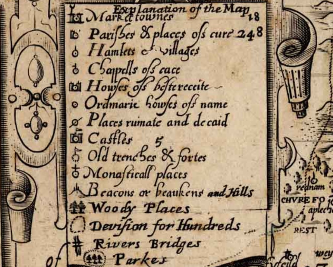
![Norden s Hampshire 1595 Hundreds and key]() Details
Details
 Details
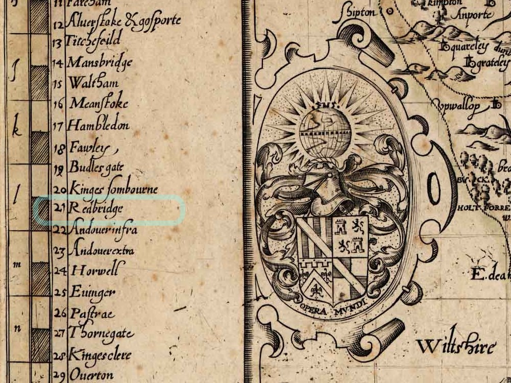
Eling is within the Hundred of Redbridge. Indicated on this map as 21. Fortunately, some of the hundreds have boundaries marked in red on this copy of the map, and 21 is one of them.
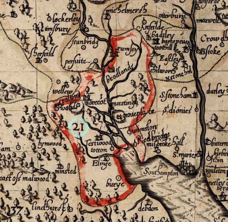
From this map it appears that the Hundred of Redbridge, at the time, extended North as far as Romsey, with its town and Abbey, including the Broadlands Estate, and South just past Elinge, on level with Lyndhurst. Note the spelling of Eling with an e at the end.
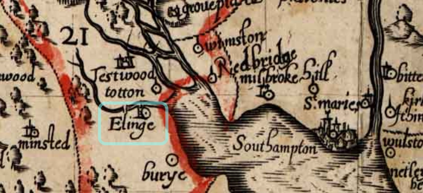
According to the Key or 'Explanation of the Map' the icon attributed to Elinge appears to be that of a Parish. This map is dated from 1595 and from elsewhere Parish Records commenced in 1537, which obviously predates the map.
Taylor's Hampshire 1759
Taylor's Hampshire 1759 - Section 33.
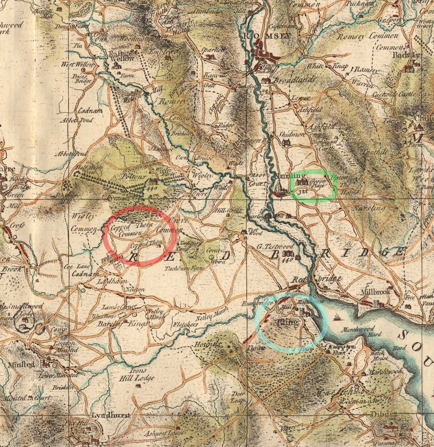
Circled in green, Grove Place, in Nursling, is not part of this story, but does get a mention elsewhere on this site. Eling, the settlement, circled in blue, is the centre of attention. Eling the parish, takes up a large portion of the map, and the Hundred of Redbridge takes up even more. Extending to Romsey
Copped Thorn Common and Copped Thorn are circled in red, and turn up later in our story, under a slightly changed name.
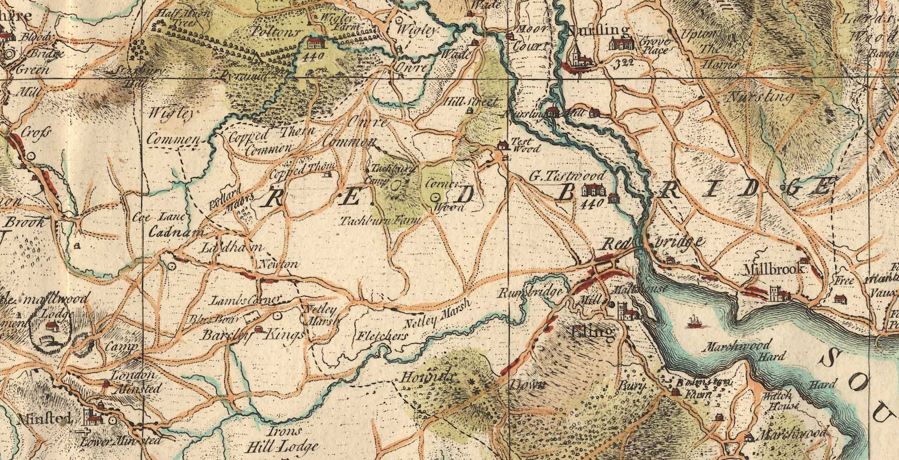
I will have to look up house 440 at Poltons. It is interesting that Great Testwood carries the same number. Poltons is now known as Paultons Park - Home of Peppa Pig World. How things change.
The estate can be traced back to 1086 where the ‘Paulet’ manor was in the possession of Glastonbury Abbey. The house became derelict and burned down in a great fire on 5 November 1963. Click the link to read about the Estate's History.
The above only looks at Section 33 of Taylor's Map of Hampshire. If you want to look at the whole map, which is very decorated, follow the link to the article Taylor's Map of Hampshire 1759 which opens in a new window.
Eling Parish Split in three 1837-1846
Ancient Parish of Eling
The Parish of Eling was divided, which is understandable, as it was a huge area, and would have had a growing population. Initially into, South to North, Marchwood, (1846), Ealing (Ancient) and North Eling (1837), .
The maps are from FamilySearch.
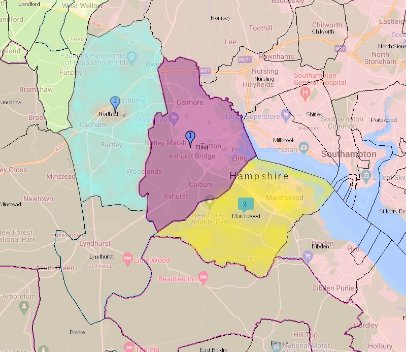
North Eling, blue wash, Eling, mouve, Marchwood, yellow.
Eling - re-sized
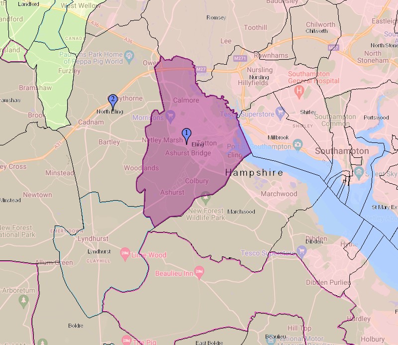
First the map with the revised size Eling parish as 1 and the newly formed North Eling as 2. Marchwood is also formed from the Ancient Parish of Ealing.
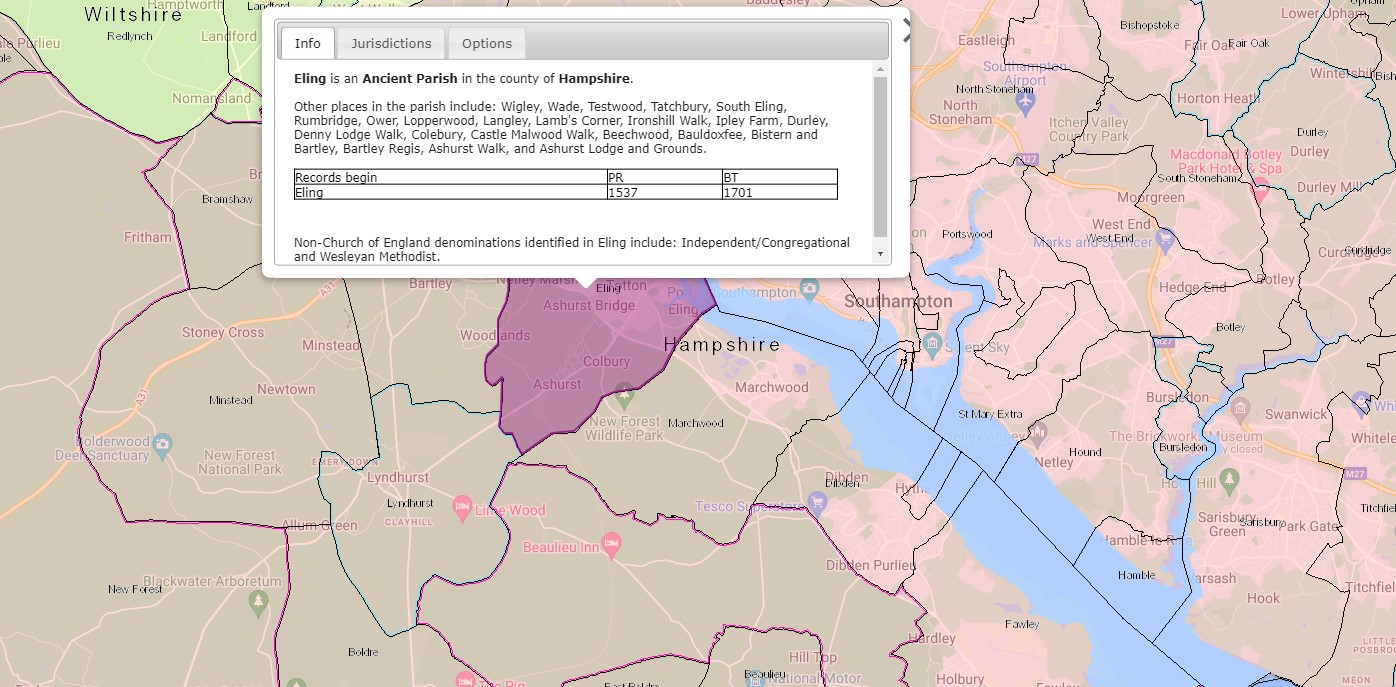
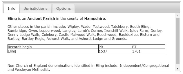
Eling is an Ancient Parish in the county of Hampshire
Other places include: Wigley, Wade, Testwood, Tatchbury, South Eling, Rumbridge, Ower, Lopperwood, Langley, Lamb's Corner, Ironshill Walk, Ipley Farm, Durley, Denny Lodge Walk, Colebury, Castle Malwood Walk, Beechwood, Bauldoxfee, Bistern and Bartley, Bartley Regis, Ashurst Walk, and Ashurst Lodge and Grounds.
Parish records begin in 1537 and Bishops Transcripts 1701.
Non-Church of England denominations identified in Eling include: Independent/Congregational and Wesleyan Methodist.
I have transcribed the image, which is clearly legible sat here, mainly to provide searchable text, but hopefully also to provide the information irrespective of the devise used to view this article.
North Eling
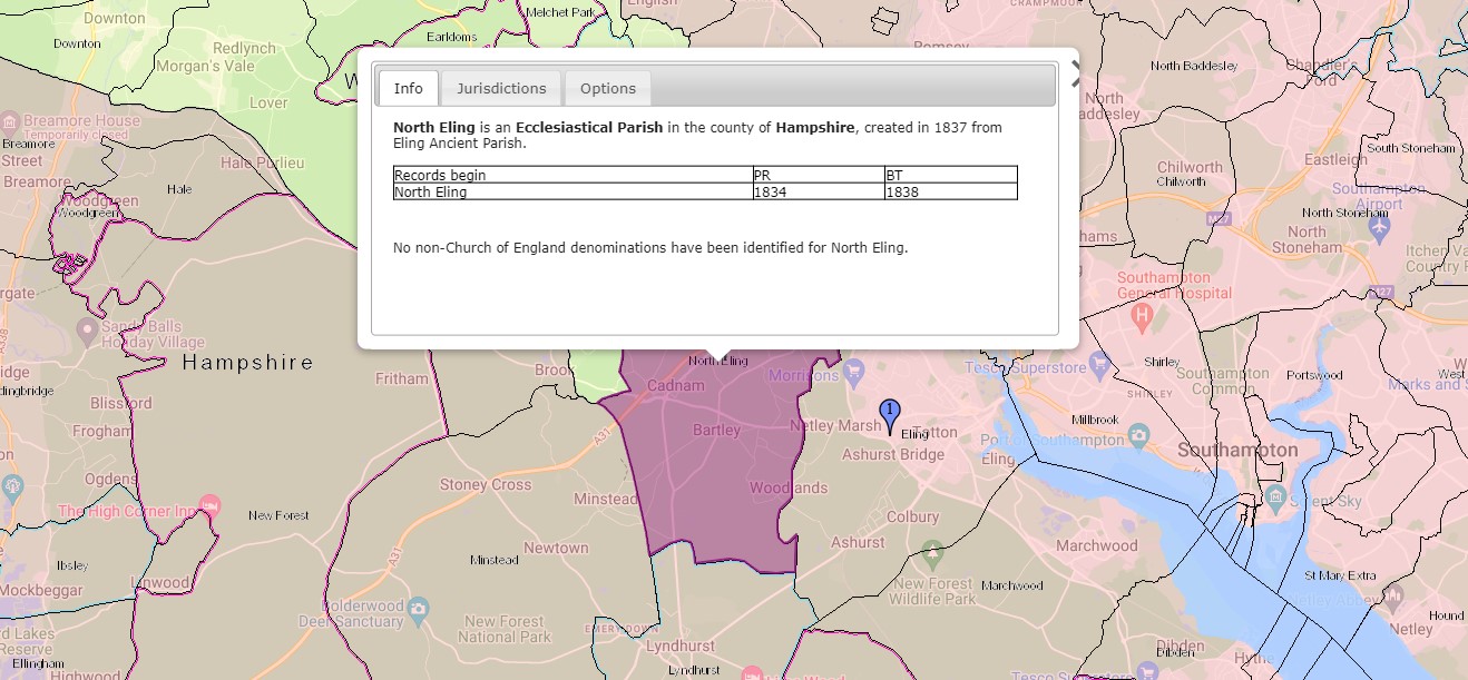
North Eling is an Ecclesiastical Parish in the county of Hampshire, created in 1837 from Eling Ancient Parish.
Parish records begin in 1834 and Bishops Transcripts 1838. Interesting that the Parish records commence before the creation of the parish. No non-Church of England denominations have been identified for North Eling.
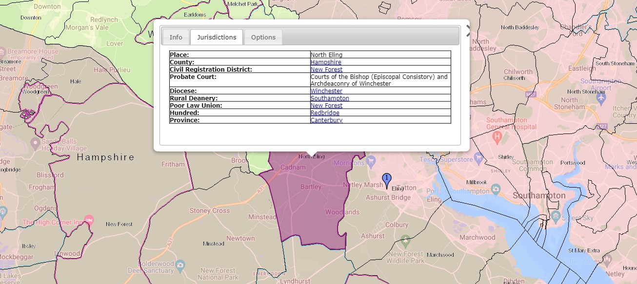
Jurisdictions;
- Place; North Eling
- County; Hampshire
- Civil Registration District; New Forest
- Probate Court; Courts of the Bishop (Episcopal Consistory) and Archdeaconry of Winchester.
- Diocese; Winchester
- Rural Deanery; Southampton
- Poor Law Union; New Forest
- Hundred; Redbridge
- Province; Canterbury
All the Jurisdictions apart from the place are the same for all three parishes.
Marchwood
Nine years after the division of the Ancient Parish of Eling to create North Eling, a further split to create the Parish of Marchwood.
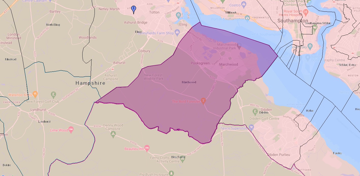
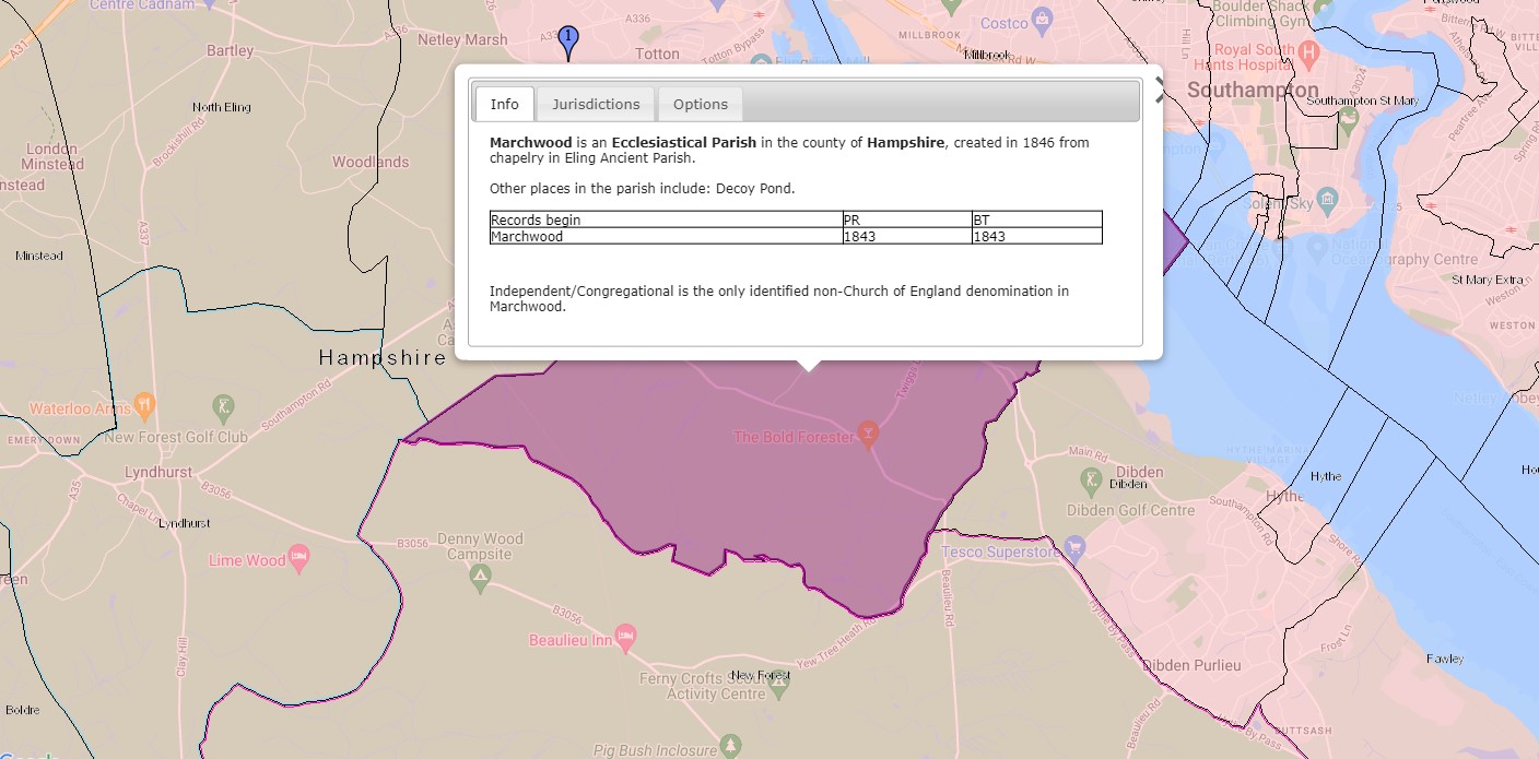
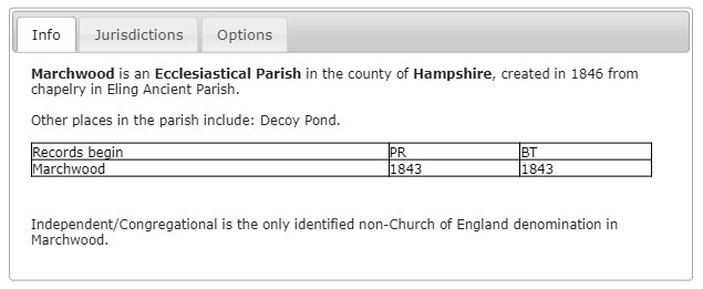
Marchwood is an Ecclesiastical Parish in the county of Hampshire, created in 1846 from chapelry in Ealing Ancient Parish.
Other places in the parish include: Decoy Pond.
Parish records begin in 1843 and Bishops Transcripts 1843. Interesting that the Parish records commence before the creation of the parish.
Independent/Congregational is the only identified non-Church of England denomination in Marchwood.
E
...
F
...