Frankia, West Frankia, and France
To make any sense of that we need to look at what was the Kingdom of France in the Middle Ages. How it moved from being a division of the large Frankish realm to effectively a collection of duchy and their lands, or sub-kingdoms, and slowly to a single kingdom, and on to the France we know today.
The Middle Ages or medieval period lasted approximately from the 5th to the late 15th centuries.
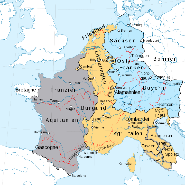 Partition of Francia after the Treaty of Verdun 843. Kingdom of Lothair I Kingdom of Louis the German Kingdom of Charles the Bald (Hatched area: Status undefined) <<>>By Furfur - This vector image includes elements that have been taken or adapted from this file: Fond de carte Tour de France-blank.svg (by Sémhur)., CC BY-SA 4.0, https://commons.wikimedia.org/w/index.php?curid=81211089During the Merovingian and Carolingian dynasties the Frankish realm was one large kingdom polity subdivided into several smaller kingdoms, often effectively independent. The geography and number of subkingdoms varied over time, but a basic split between eastern and western domains persisted. The eastern kingdom was initially called Austrasia, centred on the Rhine and Meuse, and expanding eastwards into central Europe. Following the Treaty of Verdun in 843, the Frankish Realm was divided into three separate kingdoms: West Francia, Middle Francia and East Francia. The Treaty of Verdun, signed on 10 August 843, was the first of the treaties that divided the Carolingian Empire into three kingdoms among the three surviving sons of Louis the Pious, who was the son of Charlemagne. The treaty, signed in Verdun-sur-Meuse, ended the three-year Carolingian Civil War.
In 870, Middle Francia was partitioned again, with most of its territory being divided among West and East Francia, which would hence form the nuclei of the future Kingdom of France and the Holy Roman Empire respectively, with West Francia (France) eventually retaining the choronym.
From the Middle Ages onward, French rulers believed their kingdoms had natural borders: the Pyrenees, the Alps and the Rhine. This was used as a pretext for an aggressive policy and repeated invasions. The belief, however, had little basis in reality for not all of these territories were part of the Kingdom and the authority of the King within his kingdom would be quite fluctuant. The lands that composed the Kingdom of France showed great geographical diversity; the northern and central parts enjoyed a temperate climate while the southern part was closer to the Mediterranean climate. While there were great differences between the northern and southern parts of the kingdom there were equally important differences depending on the distance of mountains: mainly the Alps, the Pyrenees and the Massif Central. France had important rivers that were used as waterways: the Loire, the Rhone, the Seine as well as the Garonne. These rivers were settled earlier than the rest and important cities were founded on their banks but they were separated by large forests, marsh, and other rough terrains.
Before the Romans conquered Gaul, the Gauls lived in villages organised in wider tribes. The Romans referred to the smallest of these groups as pagi and the widest ones as civitates. These pagi and civitates were often taken as a basis for the imperial administration and would survive up to the middle-ages when their capitals became centres of bishoprics. These religious provinces would survive until the French revolution. During the Roman Empire, southern Gaul was more heavily populated and because of this more episcopal sees were present there at first while in northern France they shrank greatly in size because of the barbarian invasions and became heavily fortified to resist the invaders.
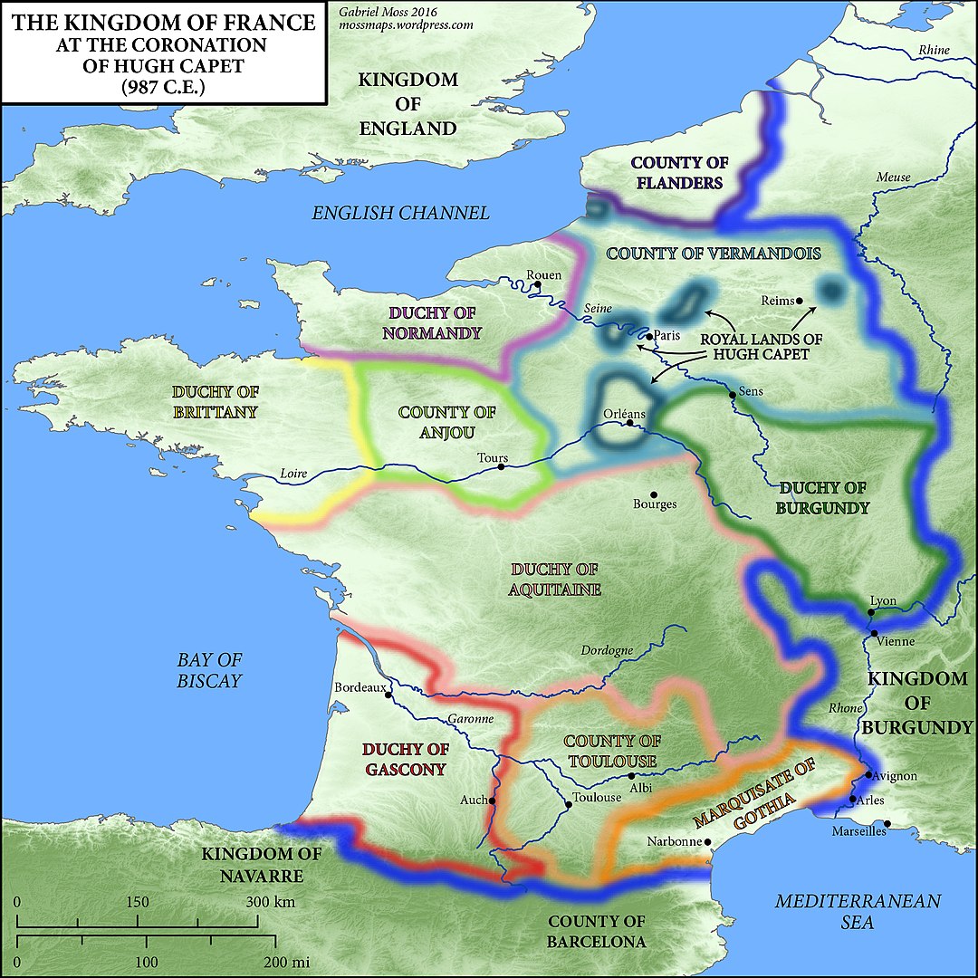
Discussion of the size of France in the Middle Ages is complicated by distinctions between lands personally held by the king (the "domaine royal") and lands held in homage by another lord. The notion of res publica inherited from the Roman province of Gaul was not fully maintained by the Frankish kingdom and the Carolingian Empire, and by the early years of the Direct Capetians, the French kingdom was more or less a fiction. The "domaine royal" of the Capetians was limited to the regions around Paris, Bourges and Sens. The great majority of French territory was part of Aquitaine, the Duchy of Normandy, the Duchy of Brittany, the Comté of Champagne, the Duchy of Burgundy, the County of Flanders and other territories (for a map, see Provinces of France). In principle, the lords of these lands owed homage to the French king for their possession, but in reality the king in Paris had little control over these lands, and this was to be confounded by the uniting of Normandy, Aquitaine and England under the Plantagenet dynasty in the 12th century.
The territorial conquests of Philip Augustus of France, at the time of his accession (1180) and at the time of his death (1223).
Philip II Augustus undertook a massive French expansion in the 13th century , but most of these acquisitions were lost both by the royal system of "apanage" (the giving of regions to members of the royal family to be administered) and through losses in the Hundred Years' War. Only in the 15th century would Charles VII and Louis XI gain control of most of modern-day France (except for Brittany, Navarre, and parts of eastern and northern France).